December 30 2012
|
Pictures of Old Margate added to the OS 1907 Map
|
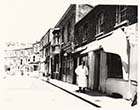
![Alexandra [Northdown] Road jnc with Bath Road | Margate History](../Pictures/Photos/Modern/Old Margate/Alexandra Road jnc with Bath Road-thumb.jpg) |
 |
 |
 |
|
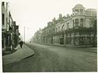
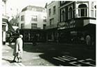
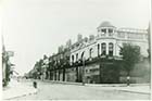
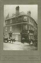
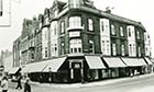
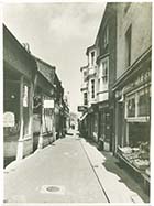
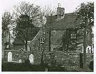
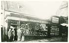
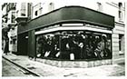
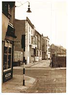
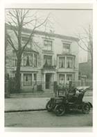
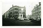
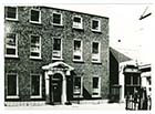
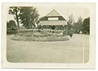
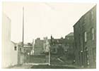
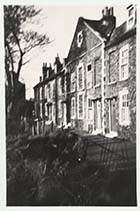
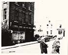
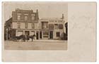
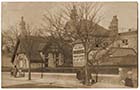
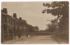
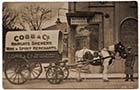
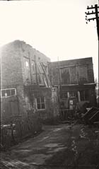
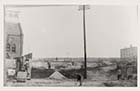
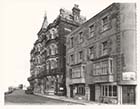
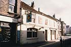
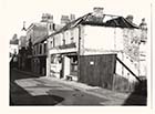
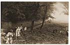
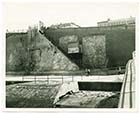
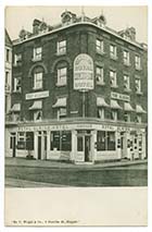
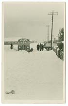
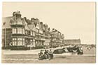
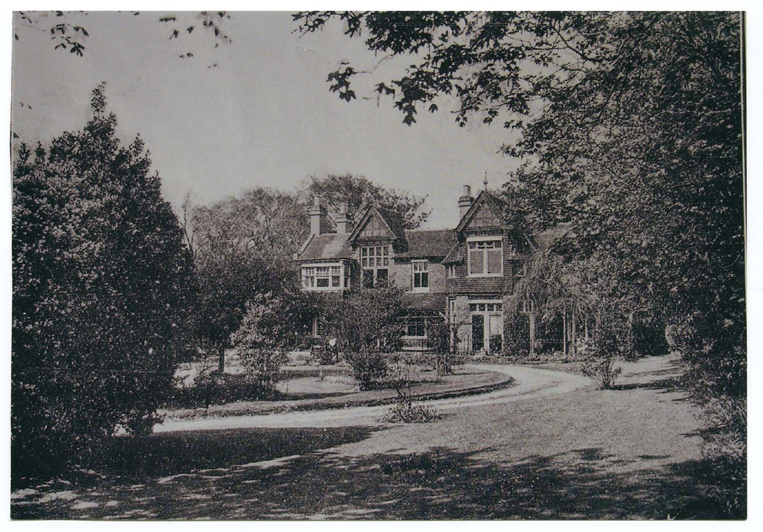
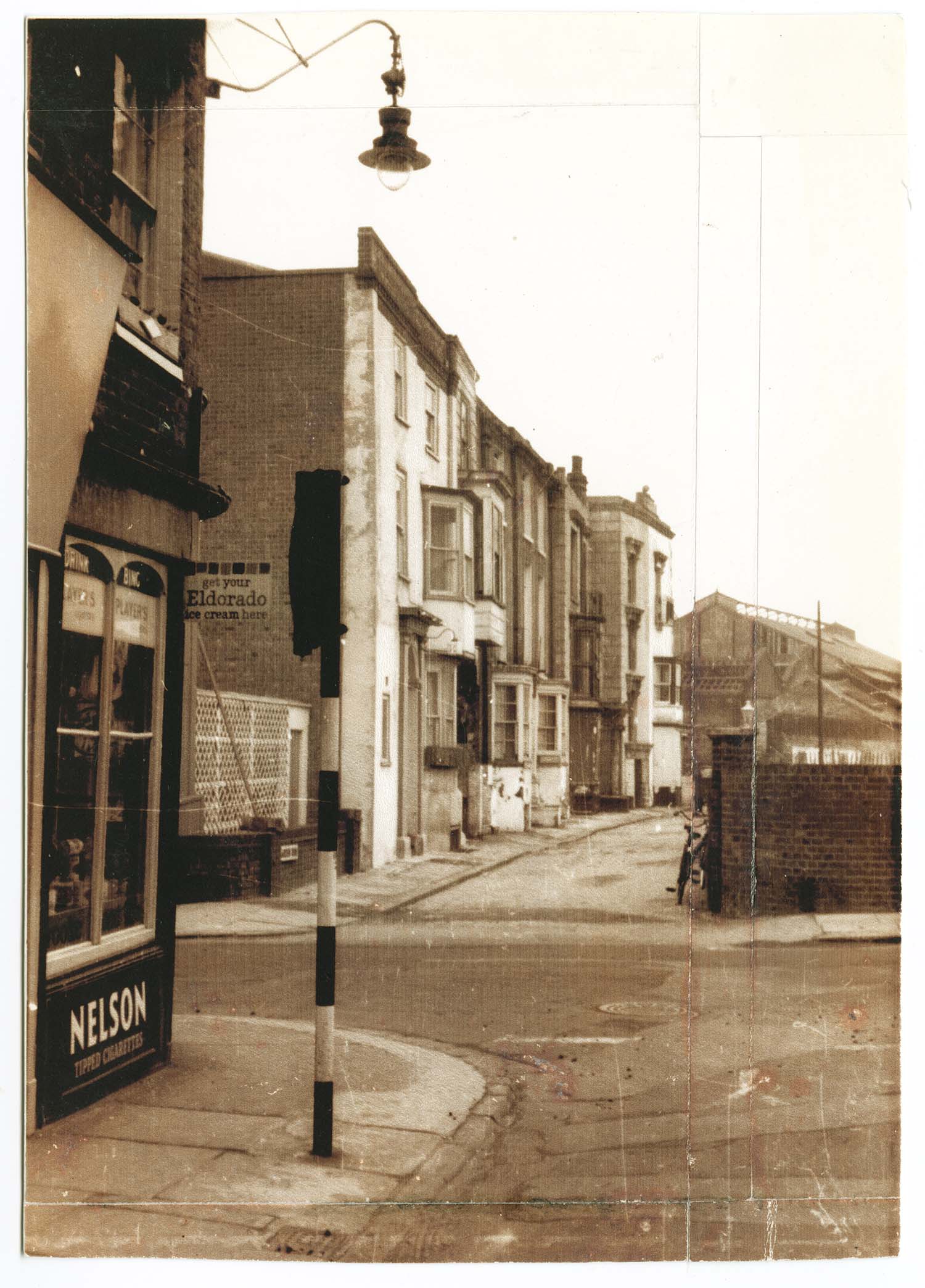
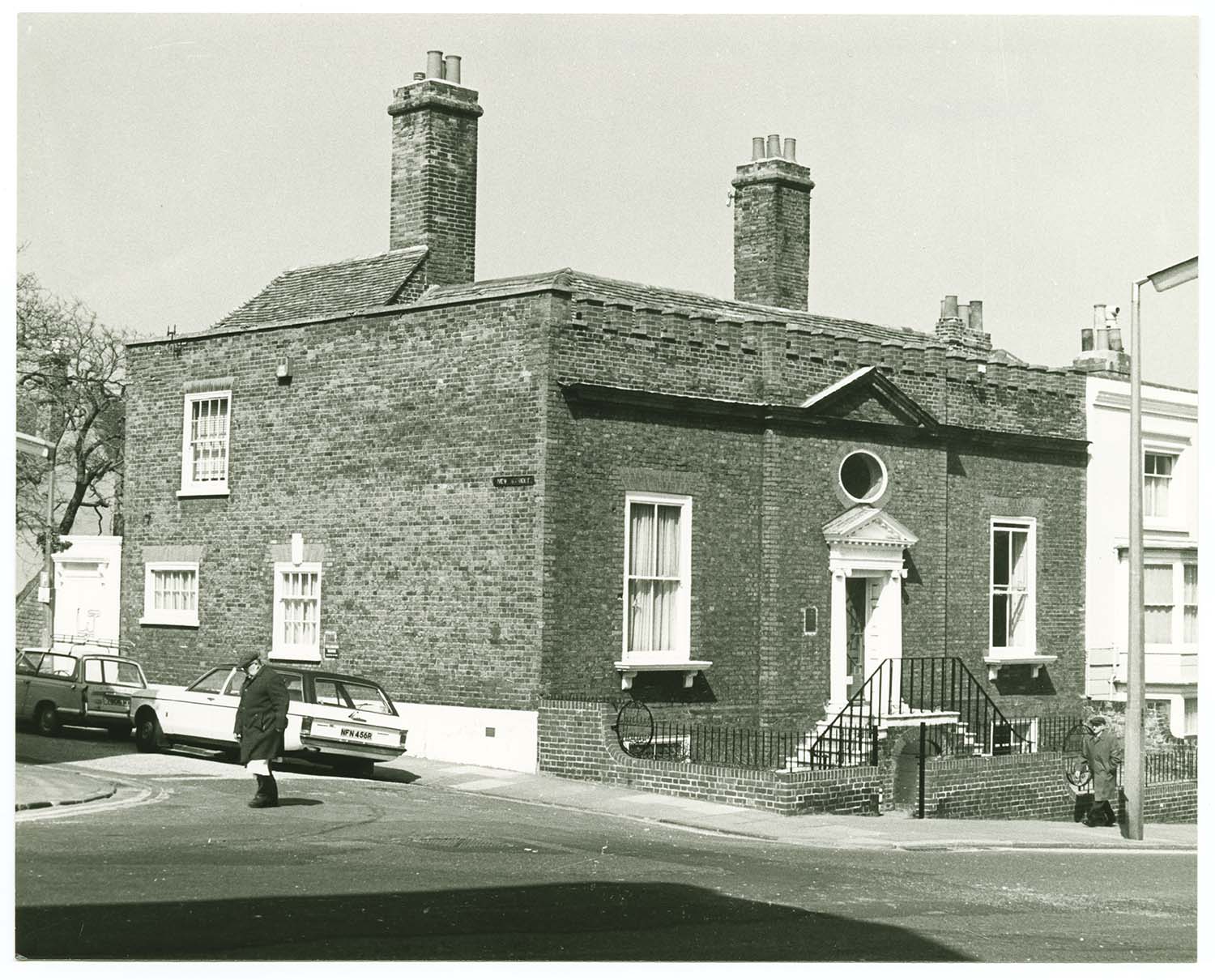
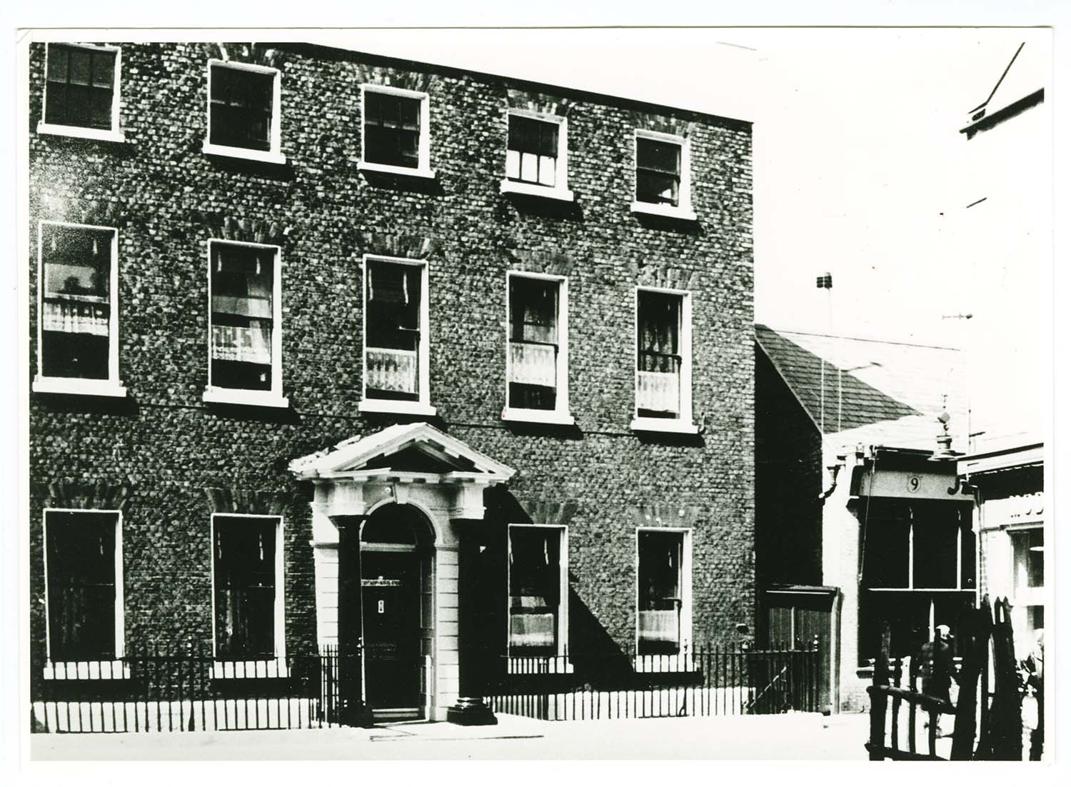
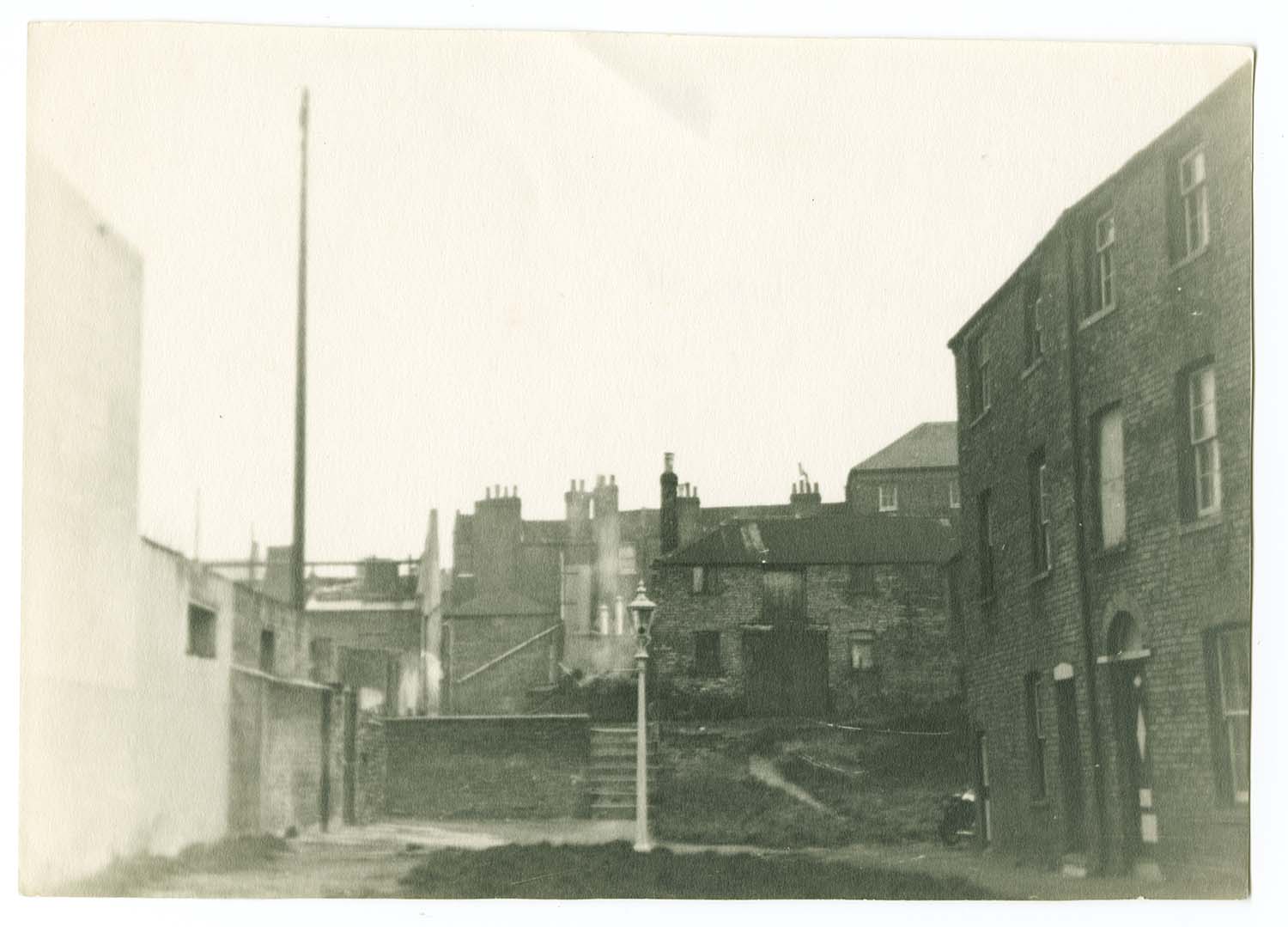
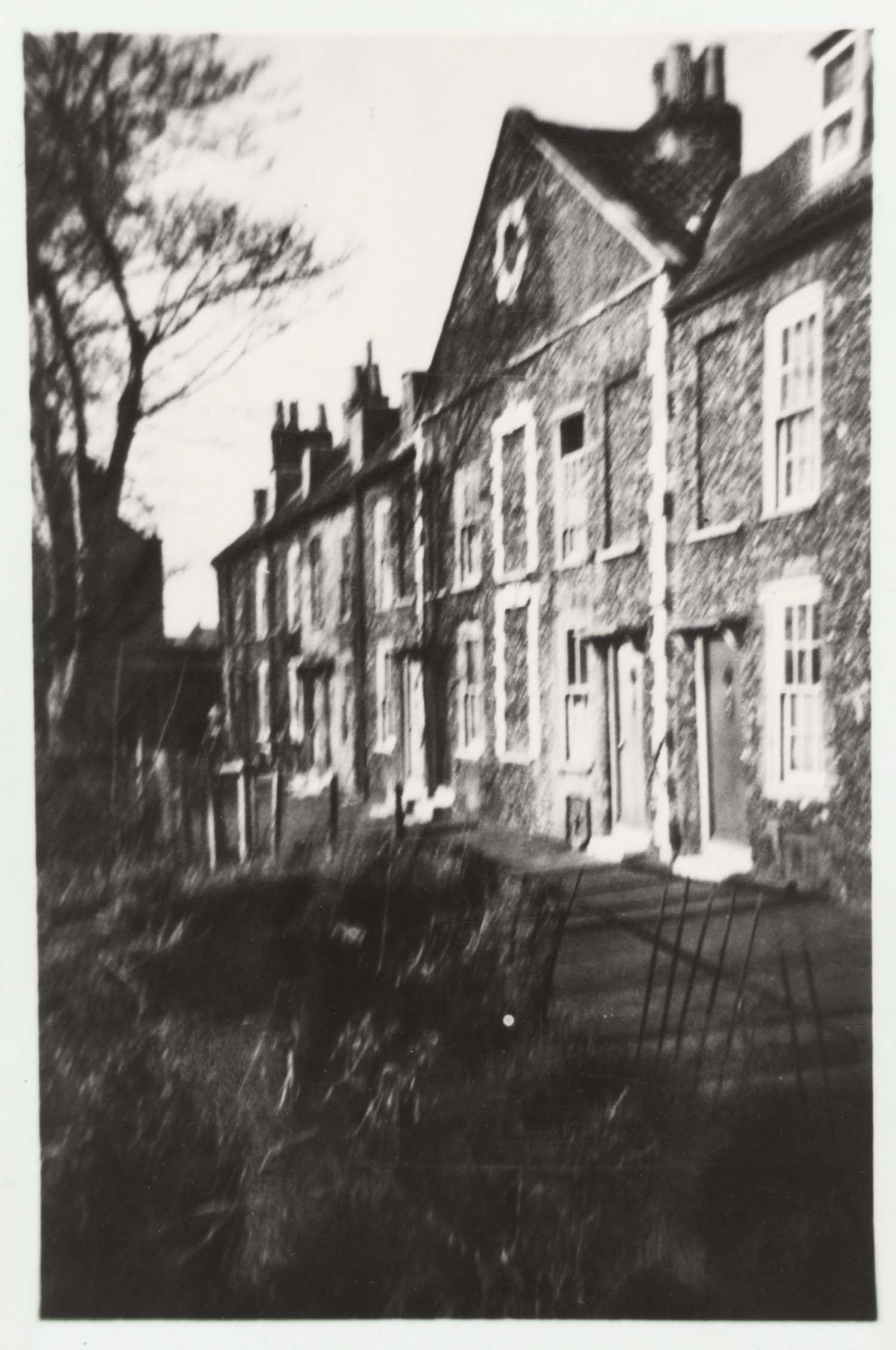
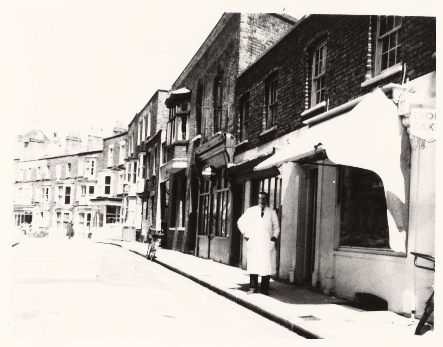
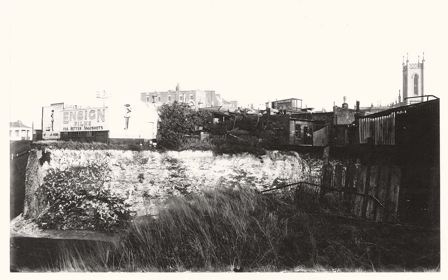
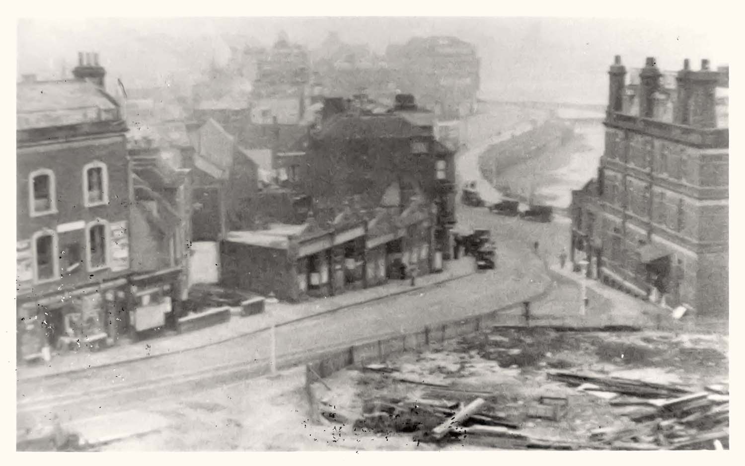
Alexandra [Northdown] Road jnc with Bath Road |
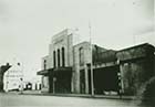
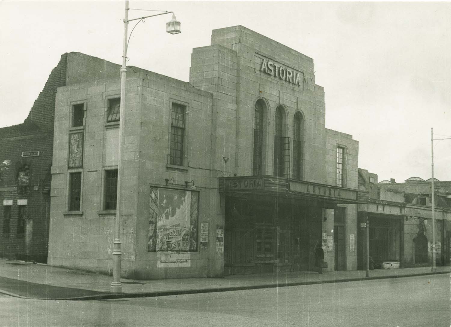
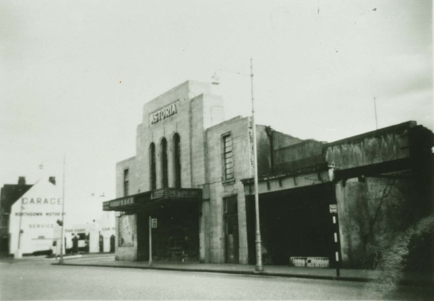
Northdown Road/Astoria Cinema |
Northdown Road/Astoria Cinema |
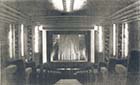
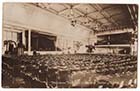
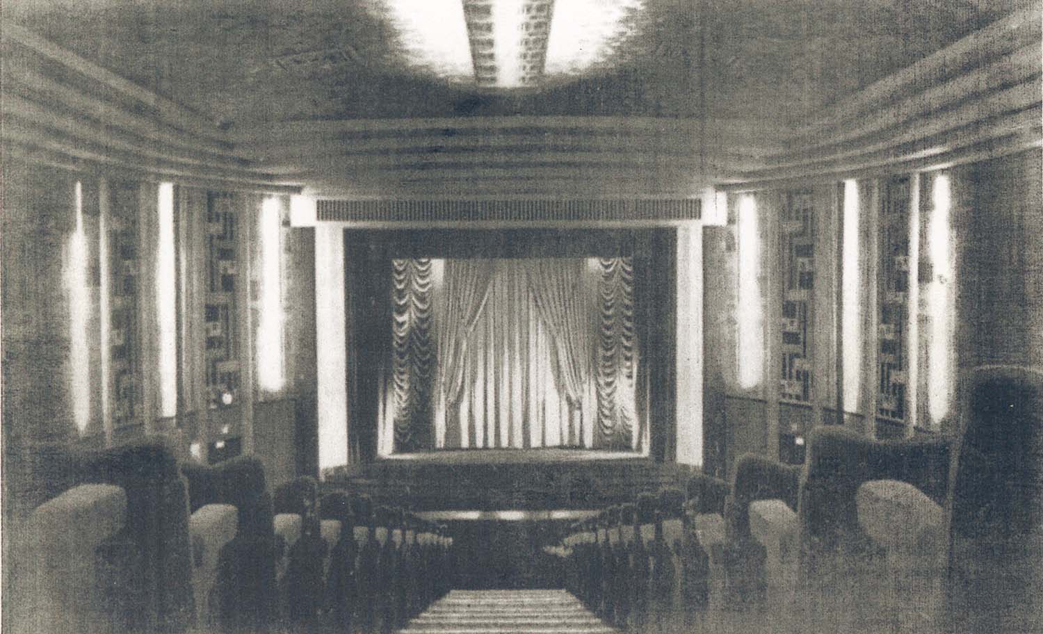
Northdown Road/Astoria Cinema auditorium |
 |
 |
 |
 |
|
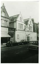
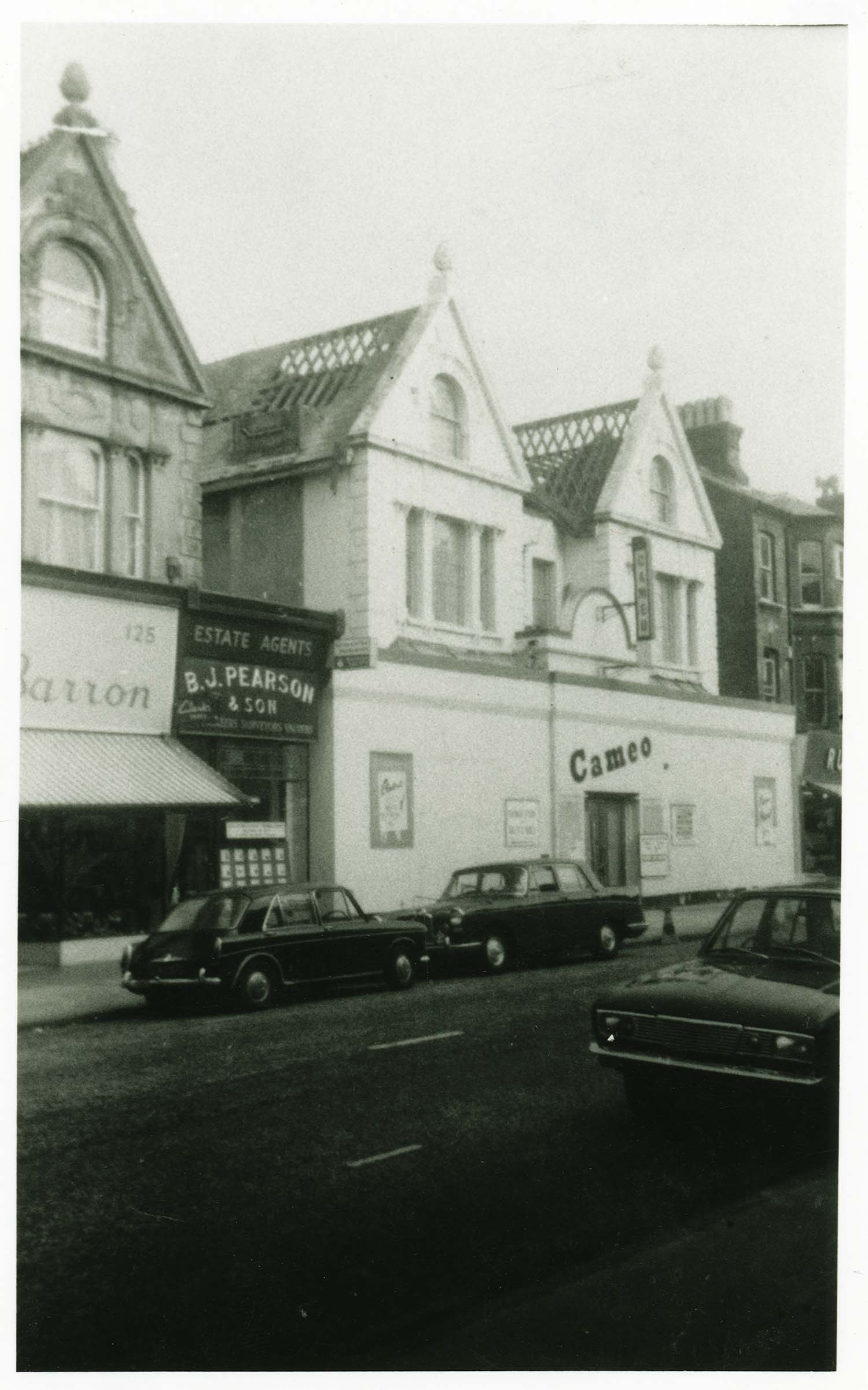
Northdown Road /Cameo Cinema demolition 1967 |
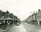
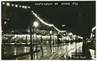
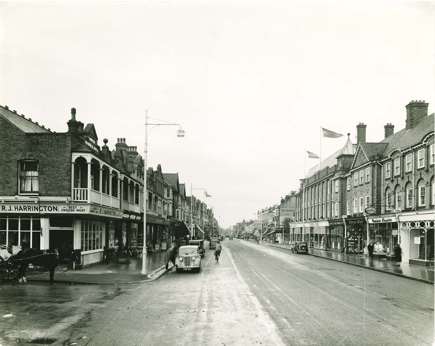
Northdown Road 1930s |
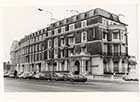
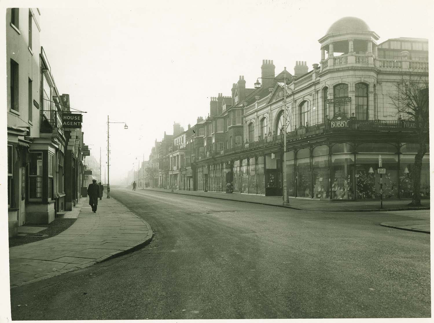
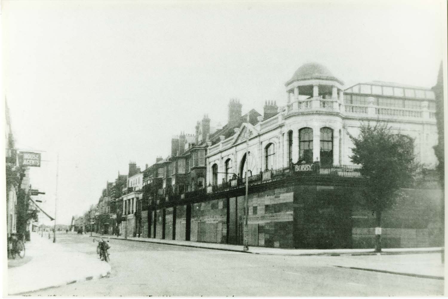
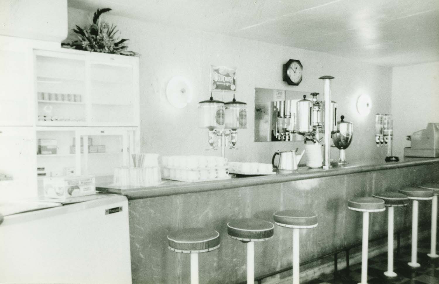
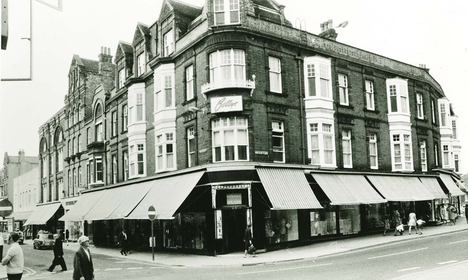
Northdown Road/Bobbys |
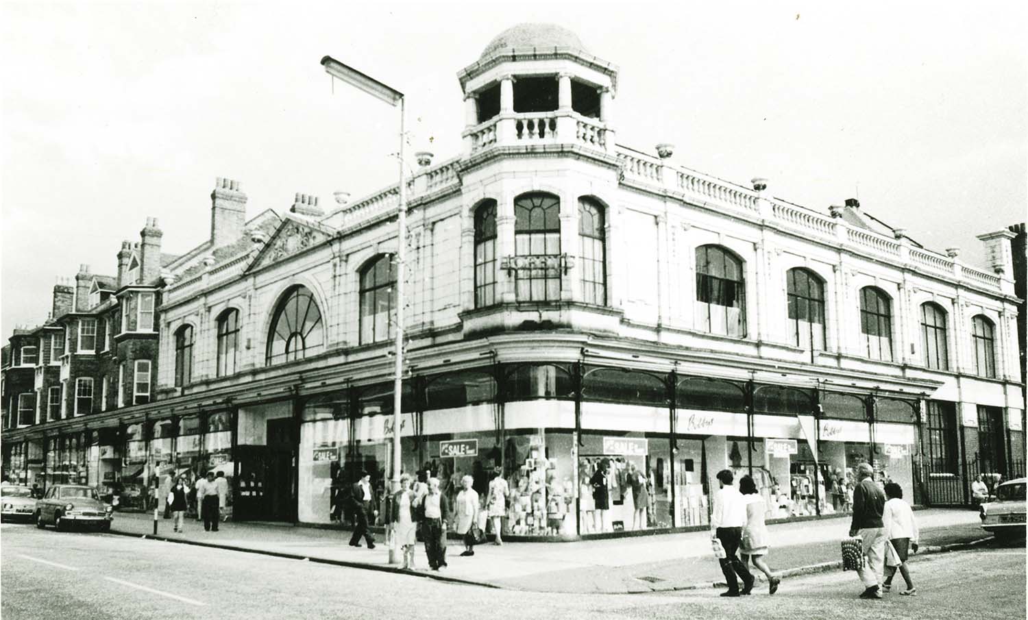
Northdown Road/Bobbys 1967 |
 |
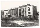
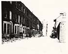
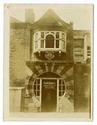
![Northumberland [Northdown] Road/Herbert Hills | Margate History](../Pictures/Photos/Modern/Old Margate/Northumberland Road Herbert Hills-thumb.jpg) |
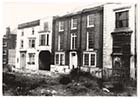
![Northumberland [Northdown] Road/Herbert Hills | Margate History](../Pictures/Photos/Modern/Old Margate/Northumberland Road Herbert Hills 2-thumb.jpg) |
 |
|
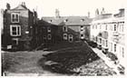
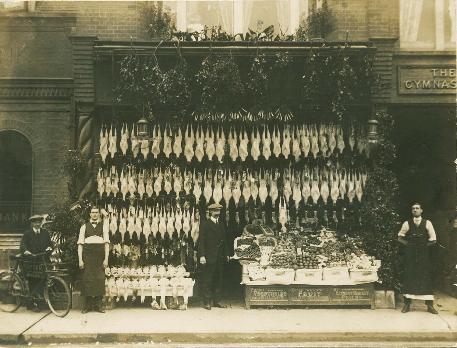
Northdown Road/Potters Bank Buildings Xmas 1913 |
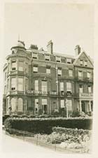
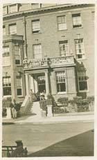
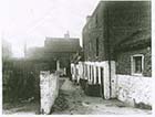
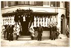
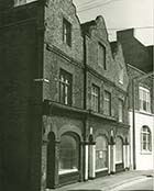
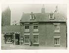
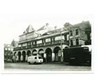
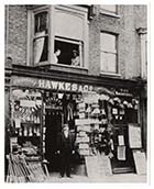
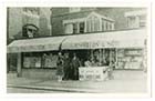
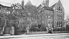
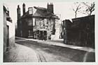
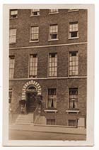
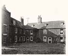
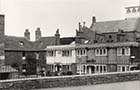
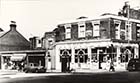
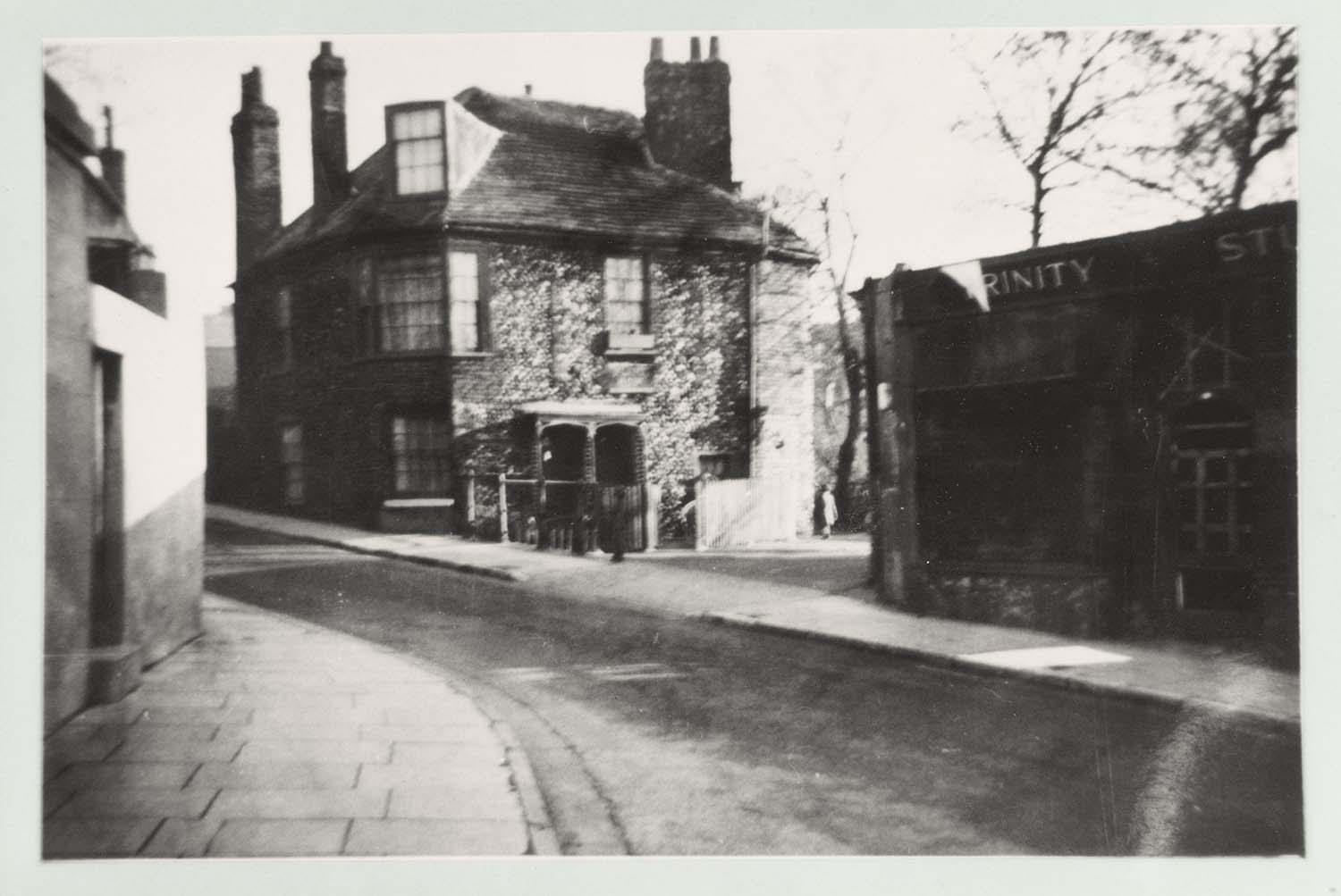
Northumberland [Northdown] Road/Herbert Hills |
Northumberland [Northdown] Road/Herbert Hills |
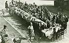
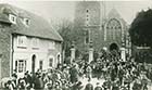
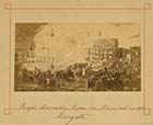
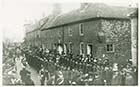
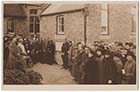
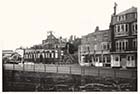
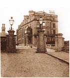
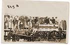
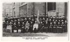
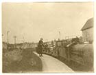
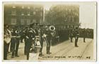
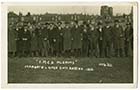
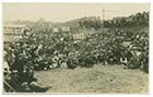
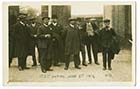
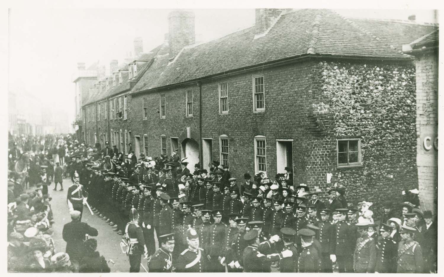
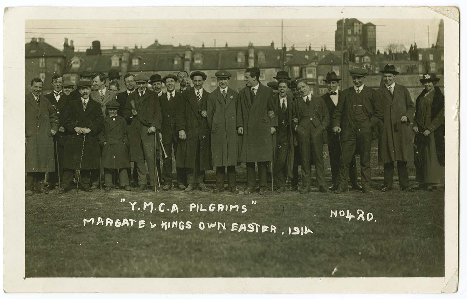
Parade/Mayor's Procession |
 |
 |
 |
 |
|
Queen street 1963 |
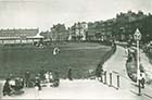
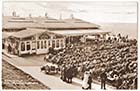
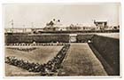
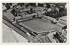
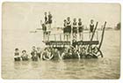
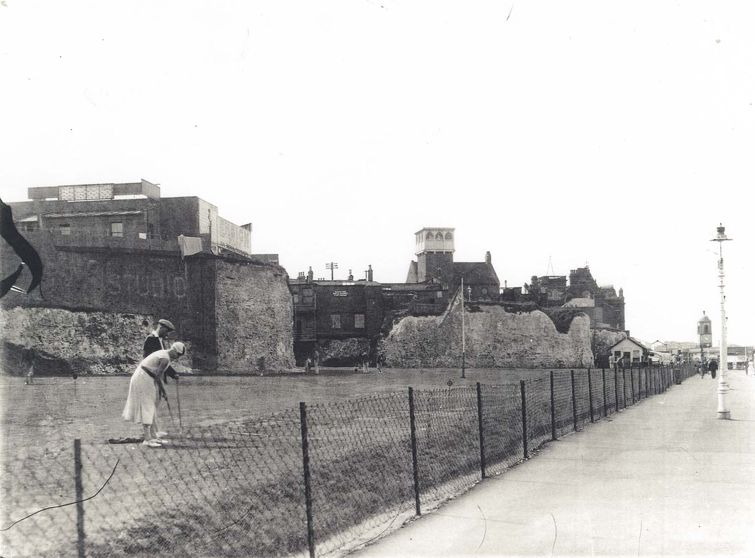
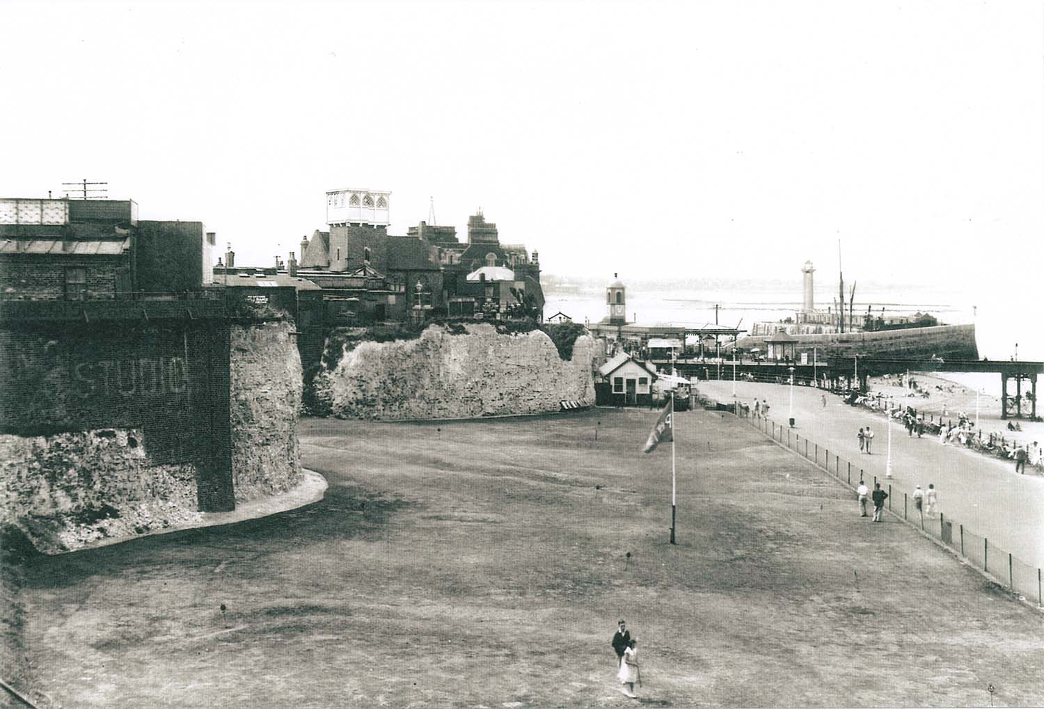
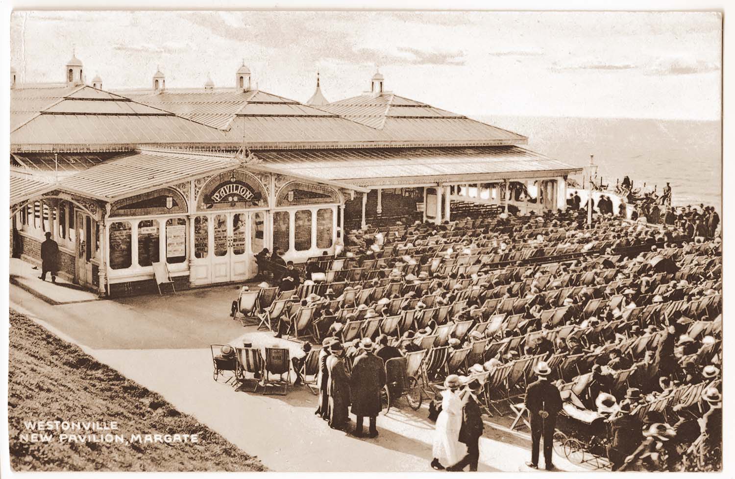
Rendezvous and putting-green |
Rendezvous and putting-green |
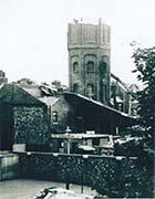
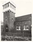
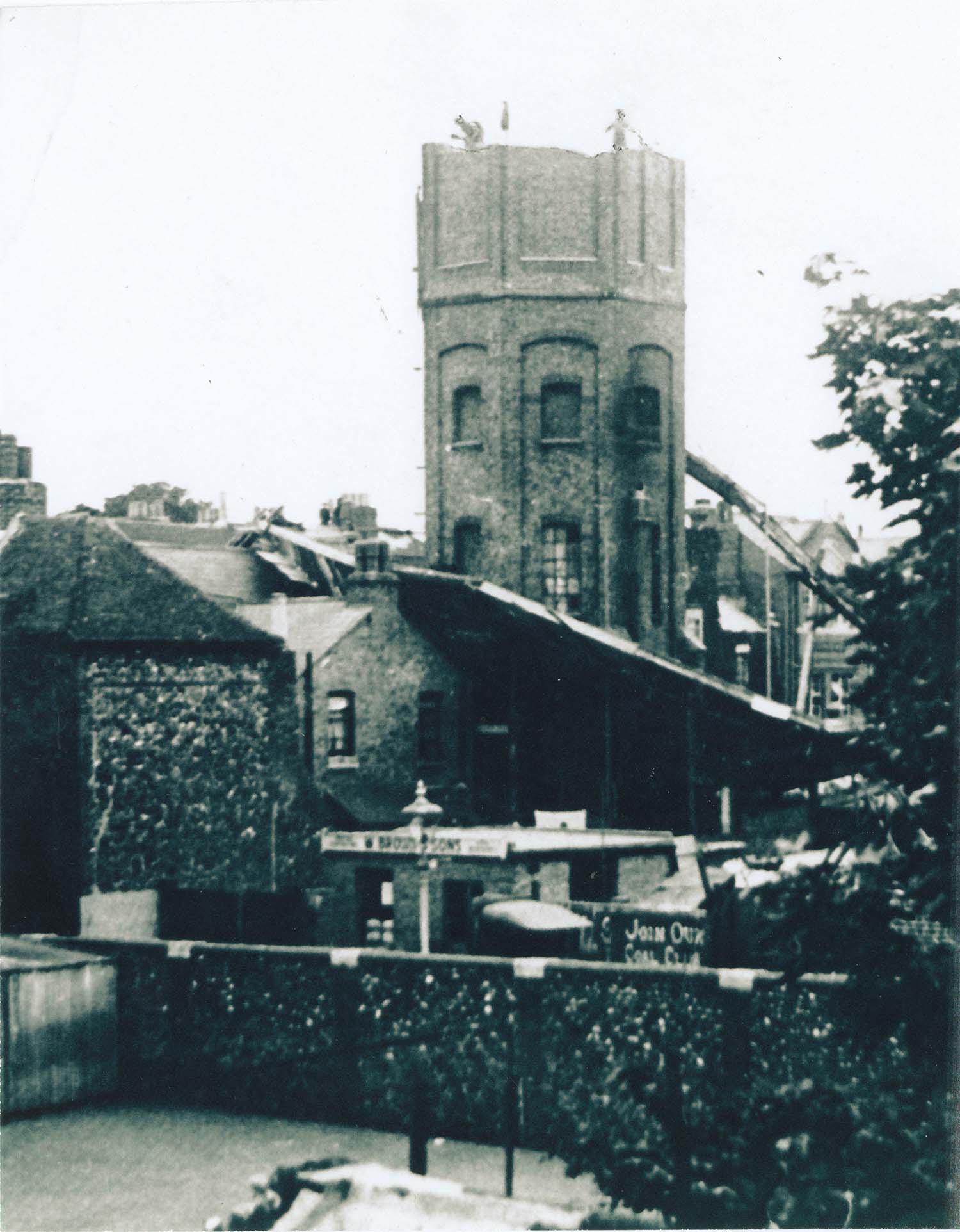
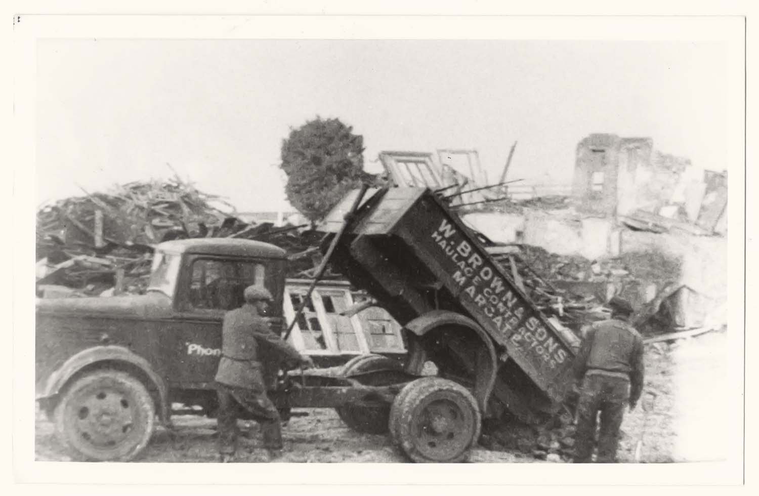
Victoria Road/Demolition of water tower |
 |
|
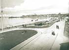
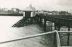
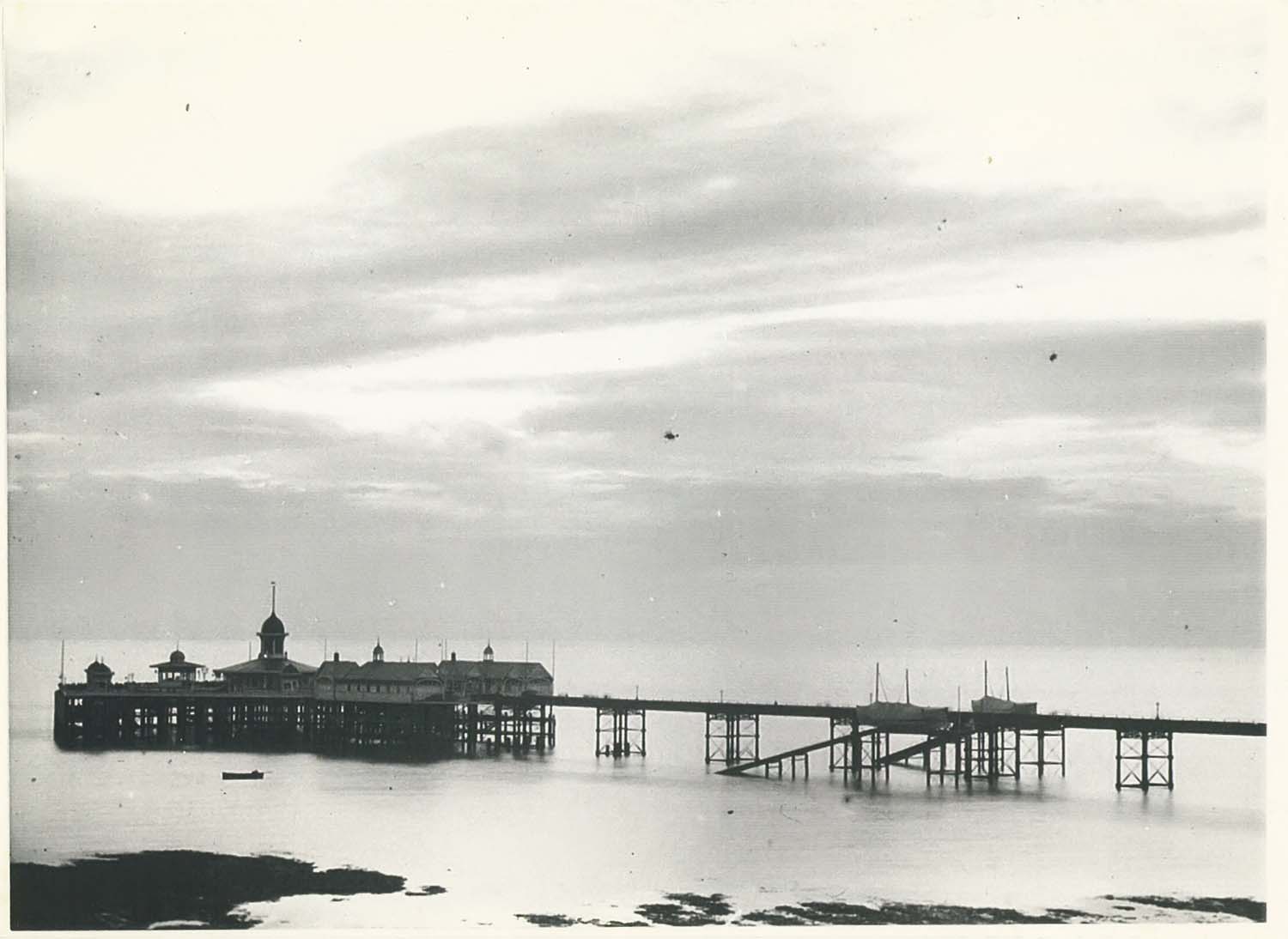
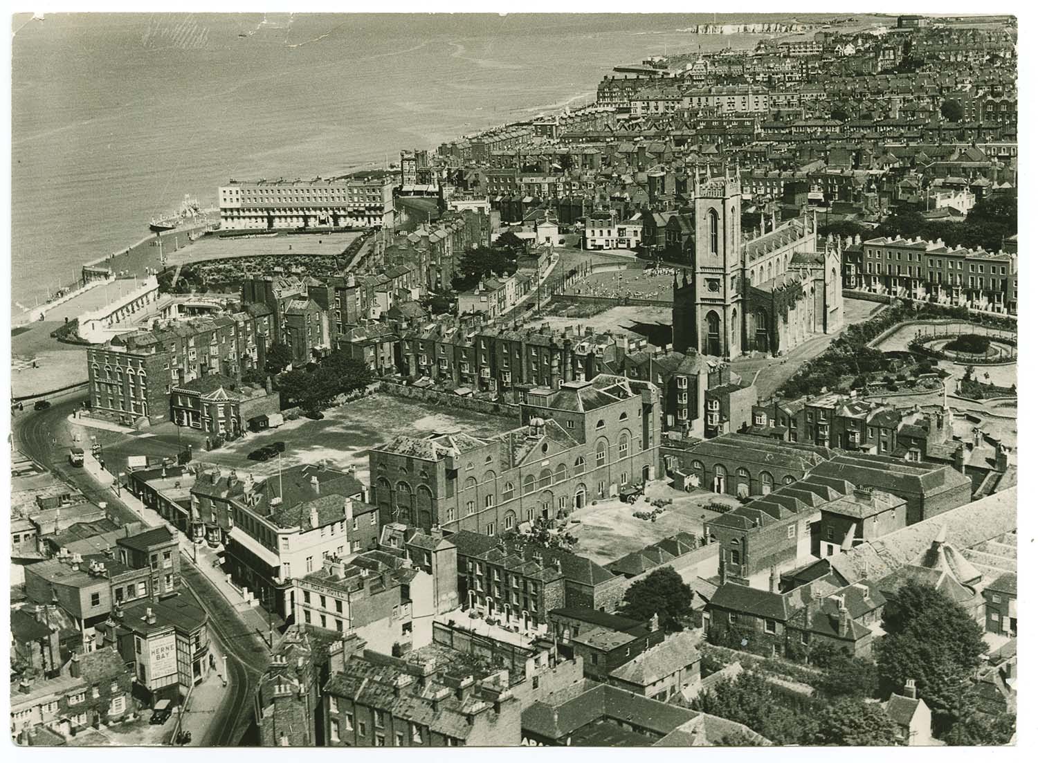
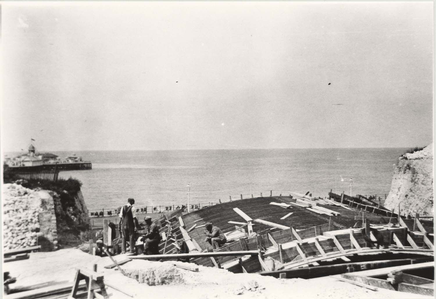
Jetty head from the sea |
December 23 2012
|
Pictures of Old Margate added to the OS 1907 and Tram Maps
|
 |
 |
 |
 |
|
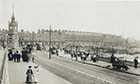
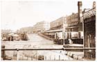
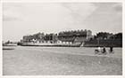
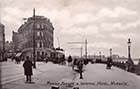
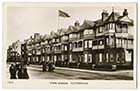
Marine Terrace |
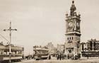
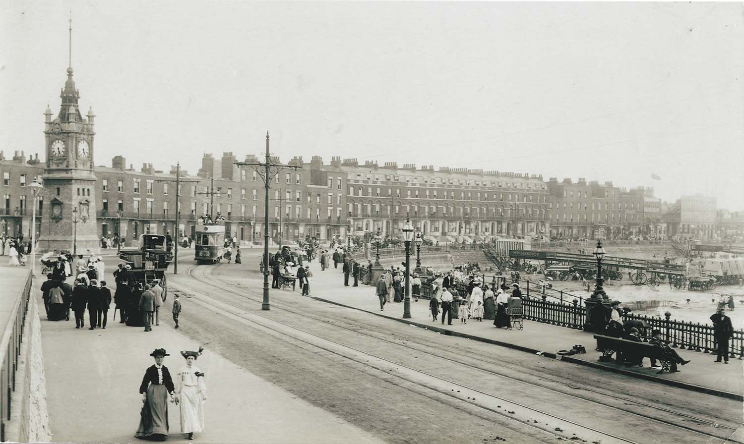
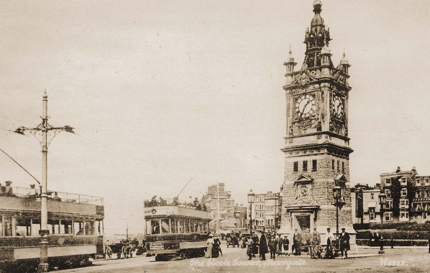
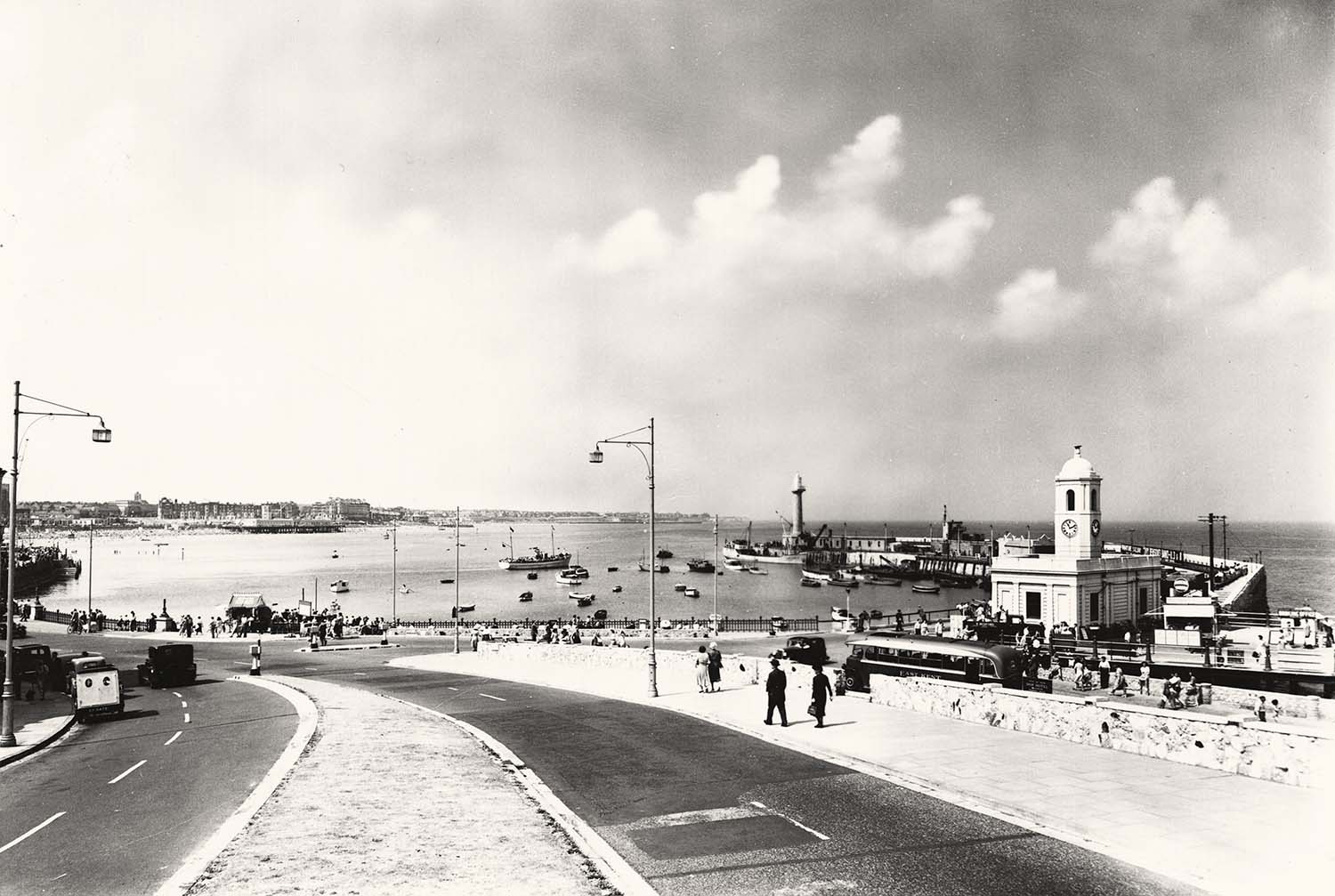
Marine Drive/Clocktower and tram |
Clock tower and two trams |
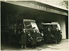
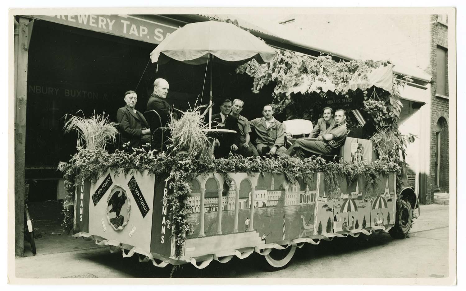
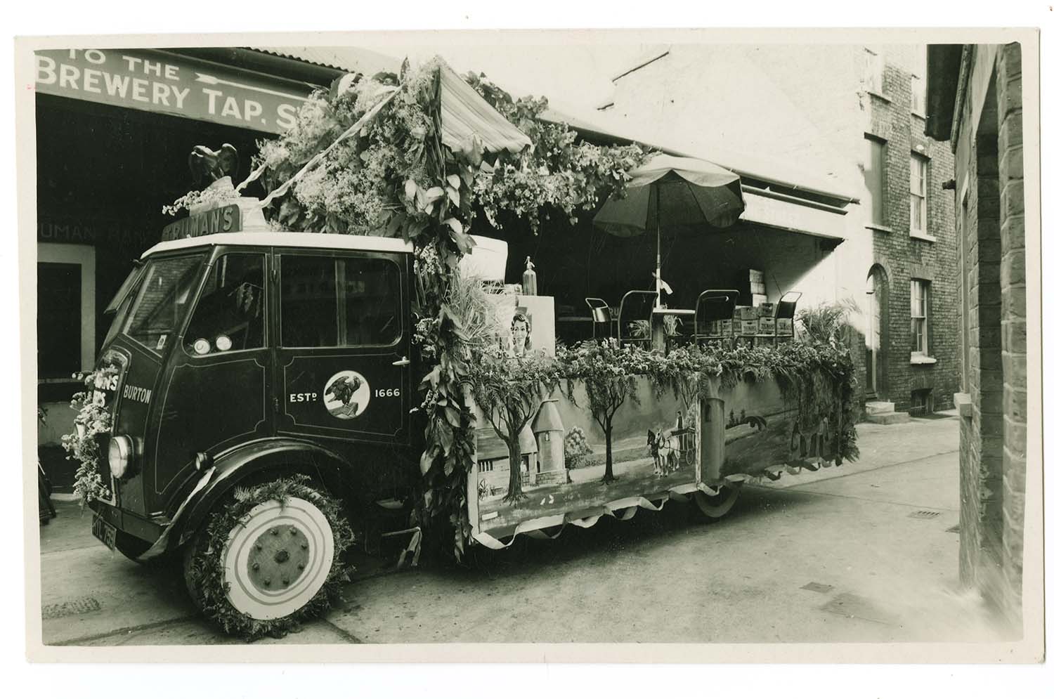
Mansion Street/Truman Depot |
 |
 |
 |
 |
|
Northdown Road/Bobbys closed for war |
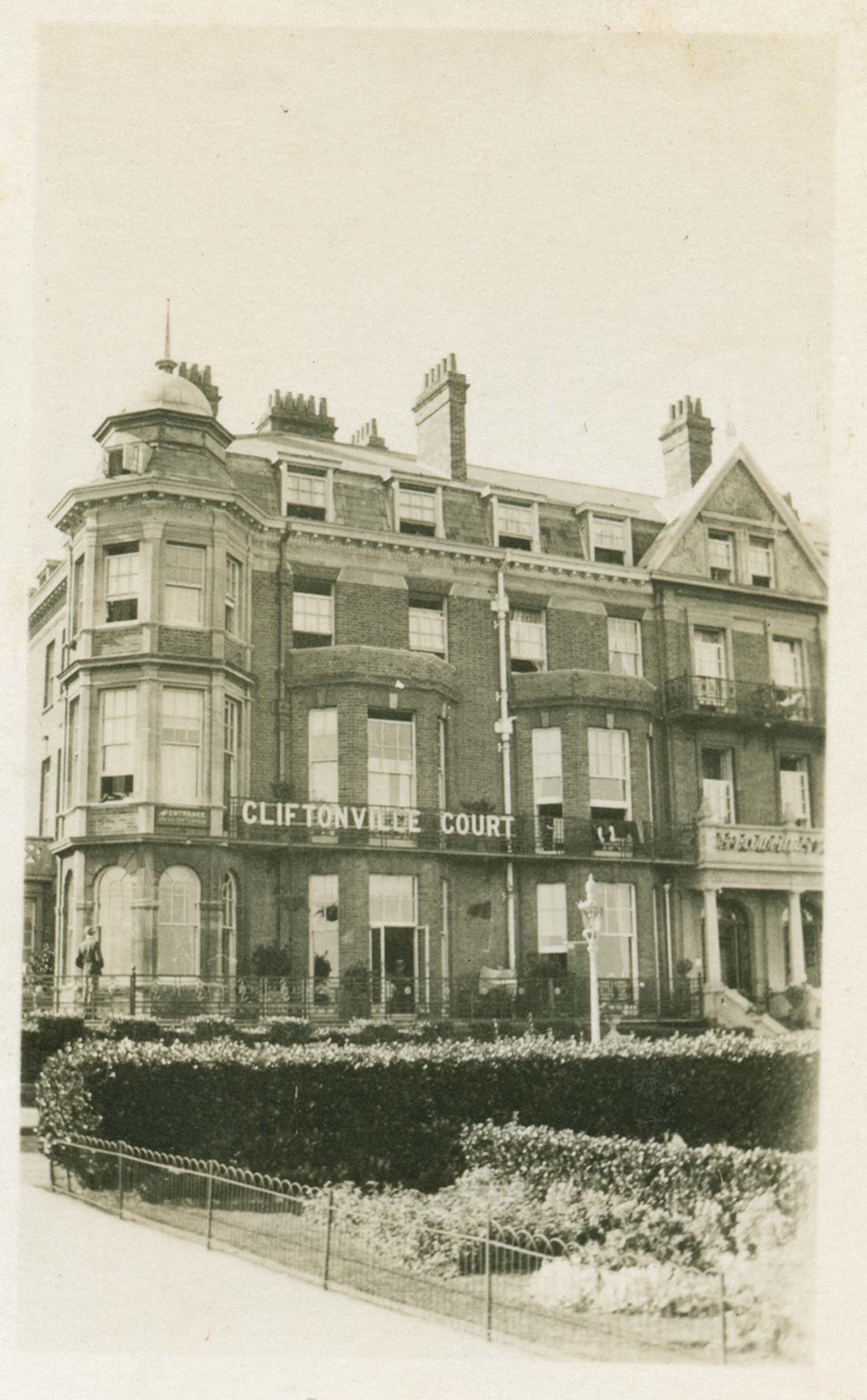
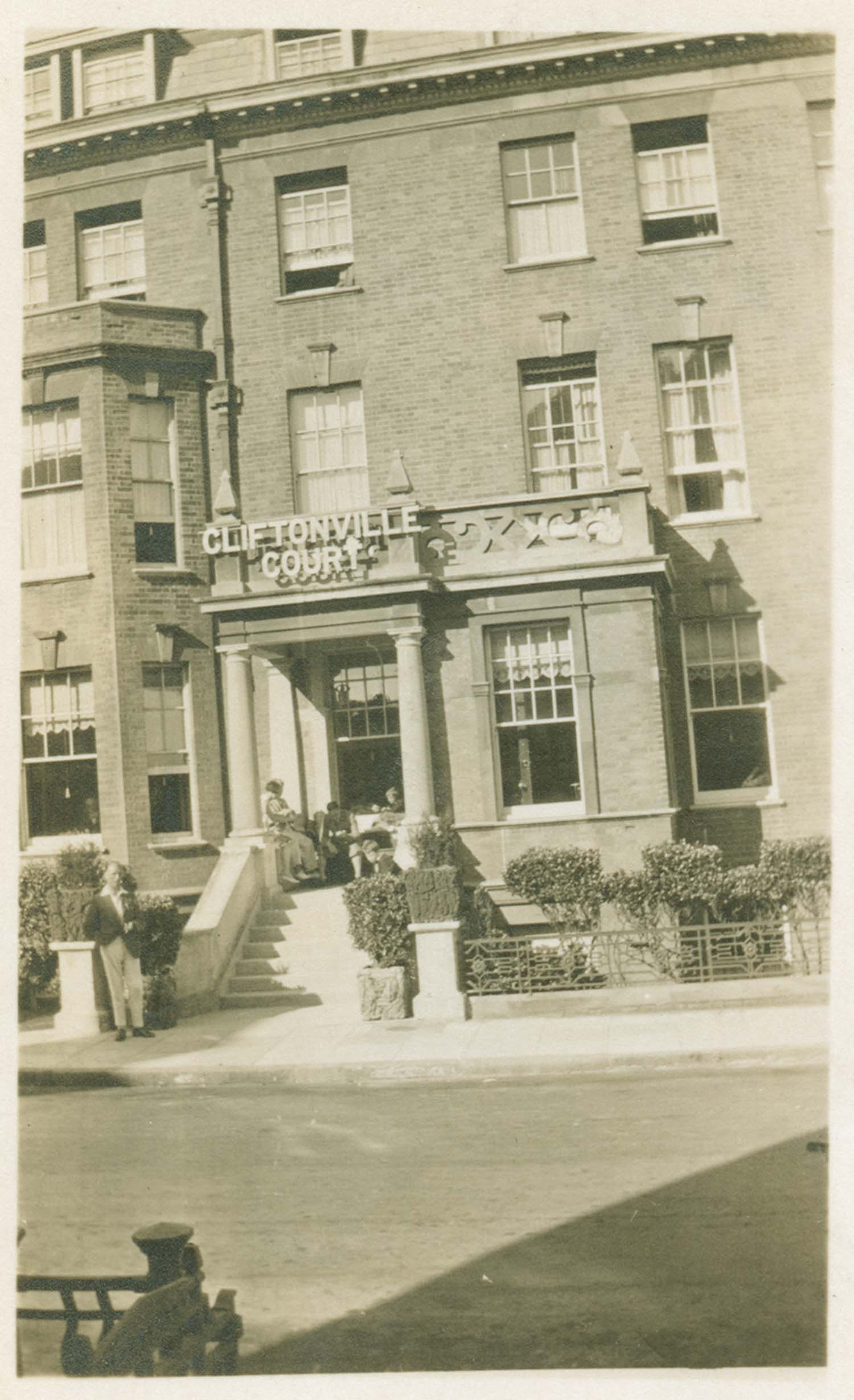
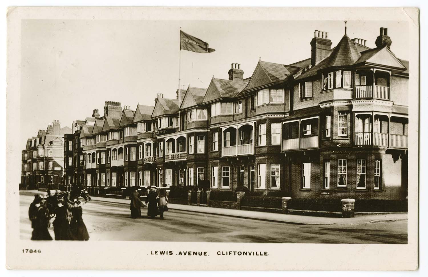
Lewis Avenue/Cliftonville Court |
Lewis Avenue/Cliftonville Court |
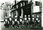
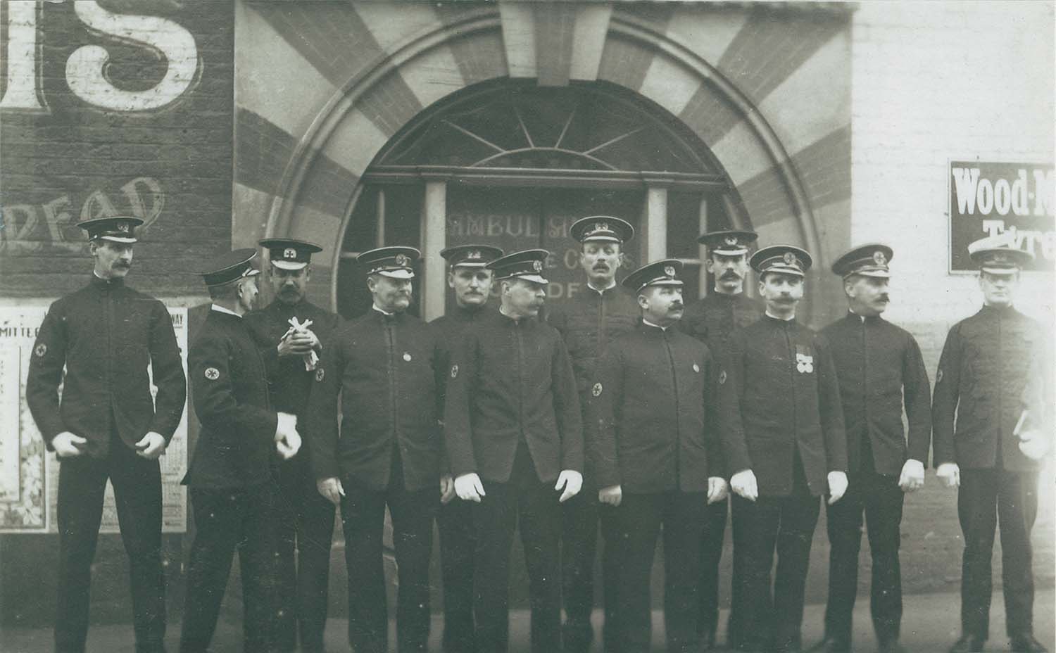
Fort Road/group at Ambulance station |
 |
 |
 |
 |
|
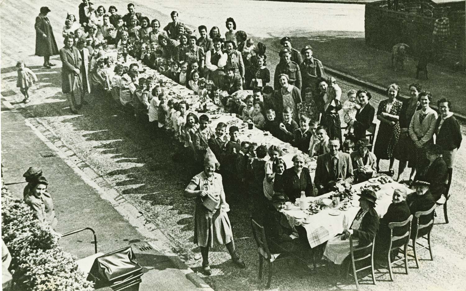
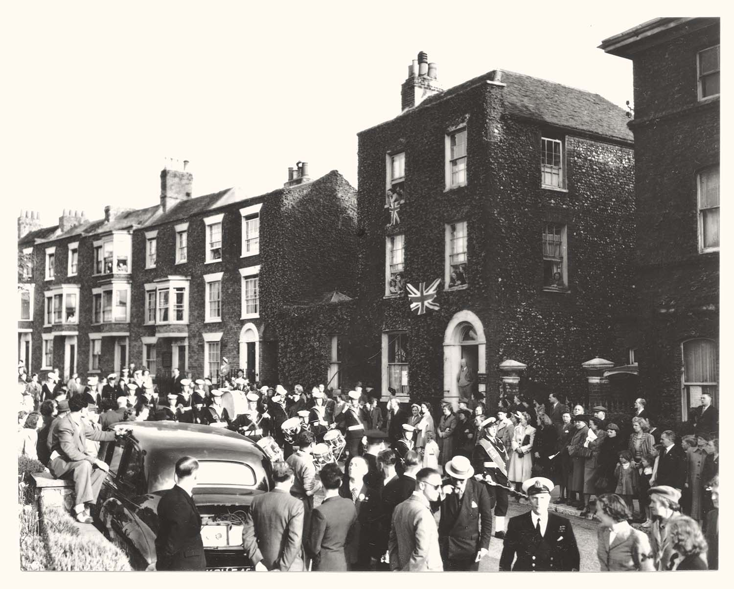
Hengist Avenue/VE day party |
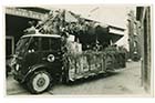
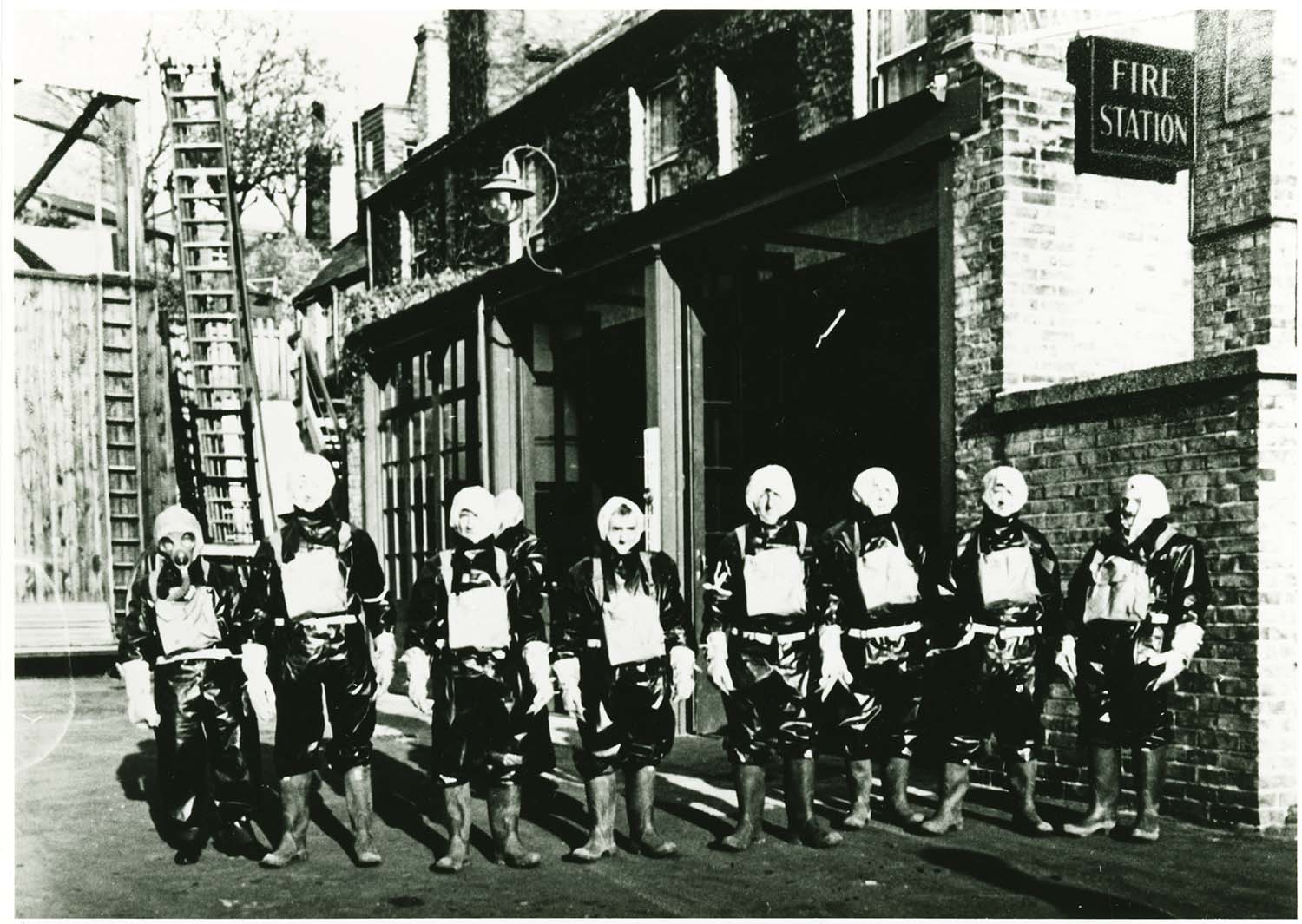
King street/Fire engine Station |
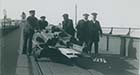
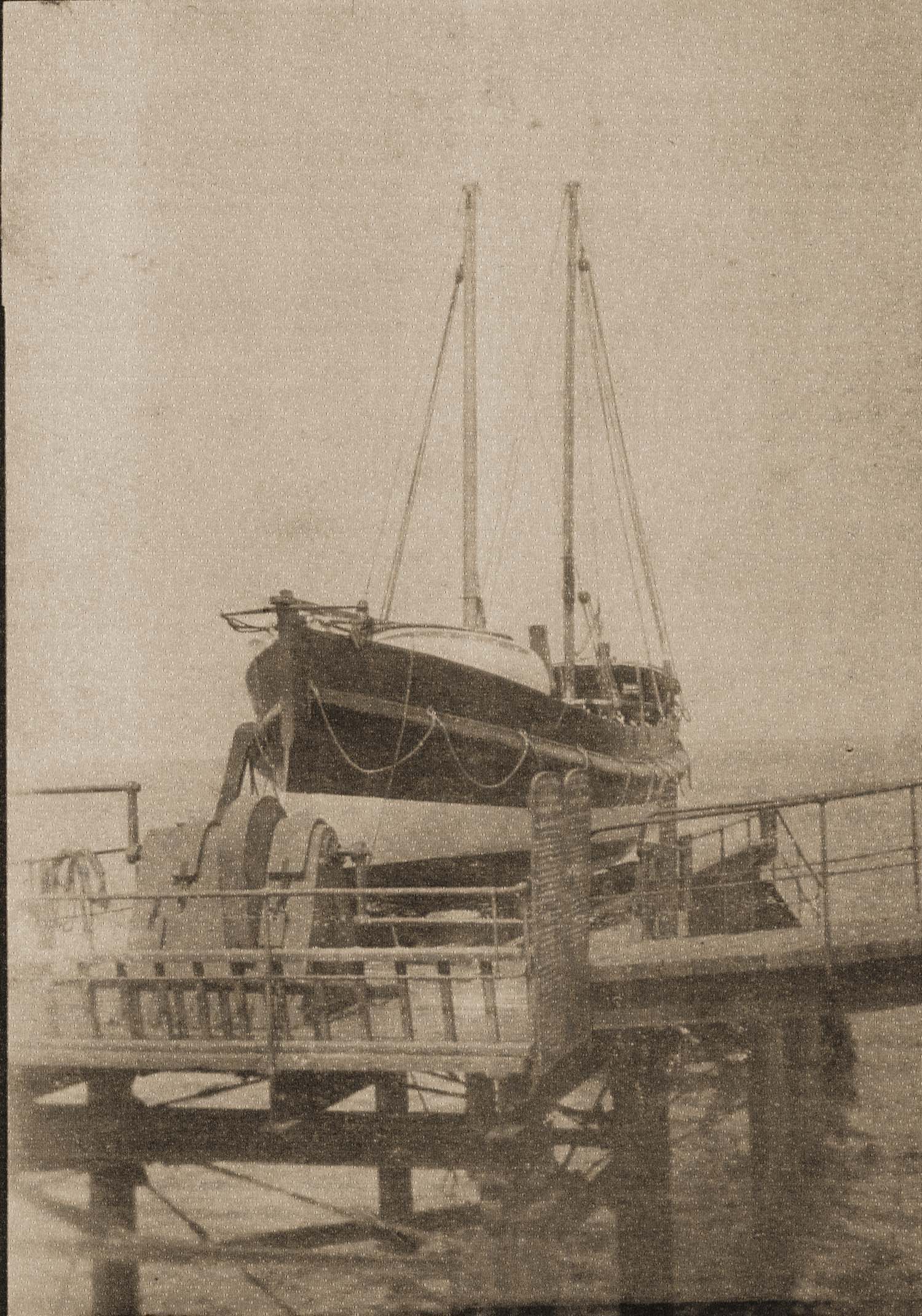
Lifeboat on slipway |
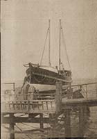
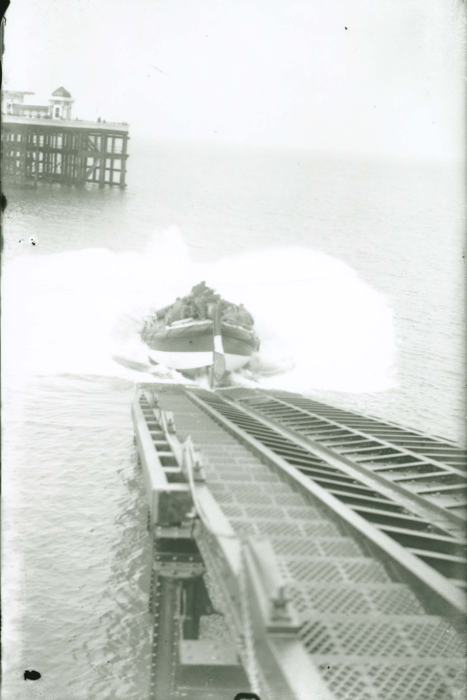
Launching Lord Southborough lifeboat |
 |
 |
 |
 |
|
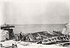
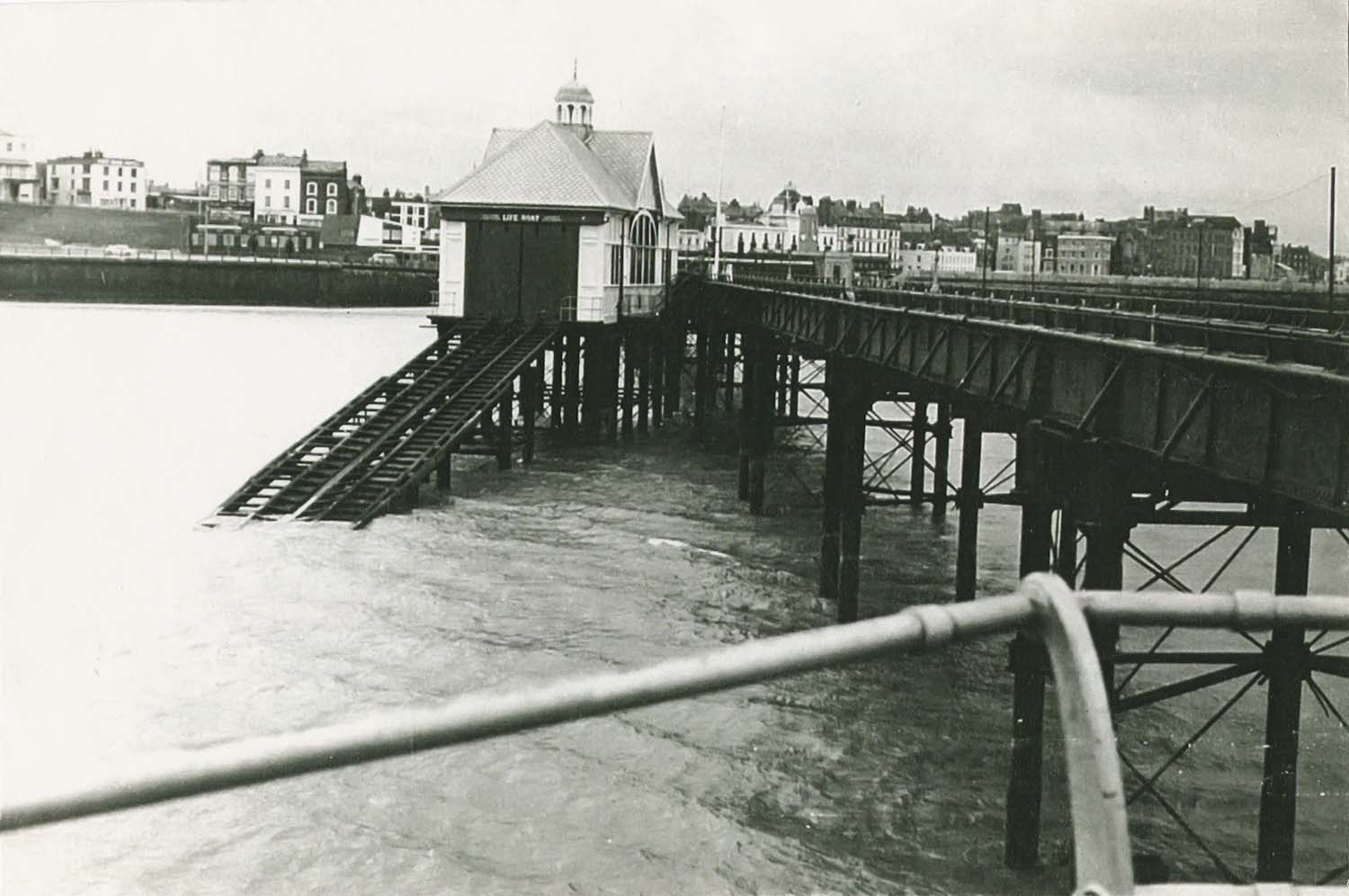
Jetty Lifeboat house and slipway |
Jetty and two lifeboat houses |
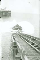
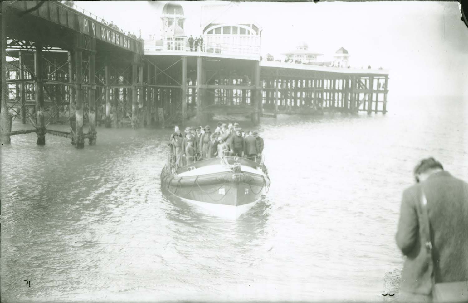
Jetty/lifeboat after launch |
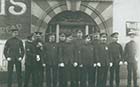
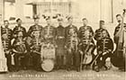
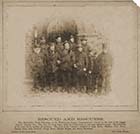
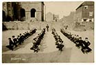
Jetty Band Royal Engineers 1906 |
December 21 2012
|
Pictures of Old Margate added to the OS 1907 Map
|
 |
 |
 |
 |
|
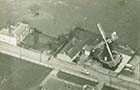
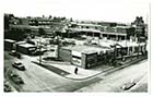
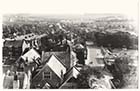
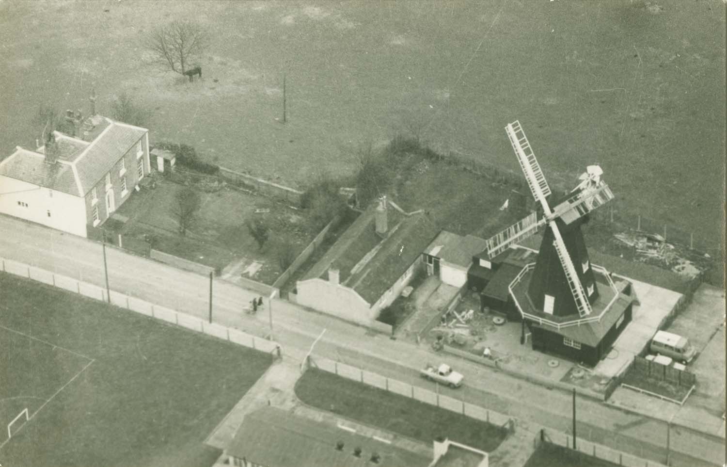
Drapers Mills aerial view |
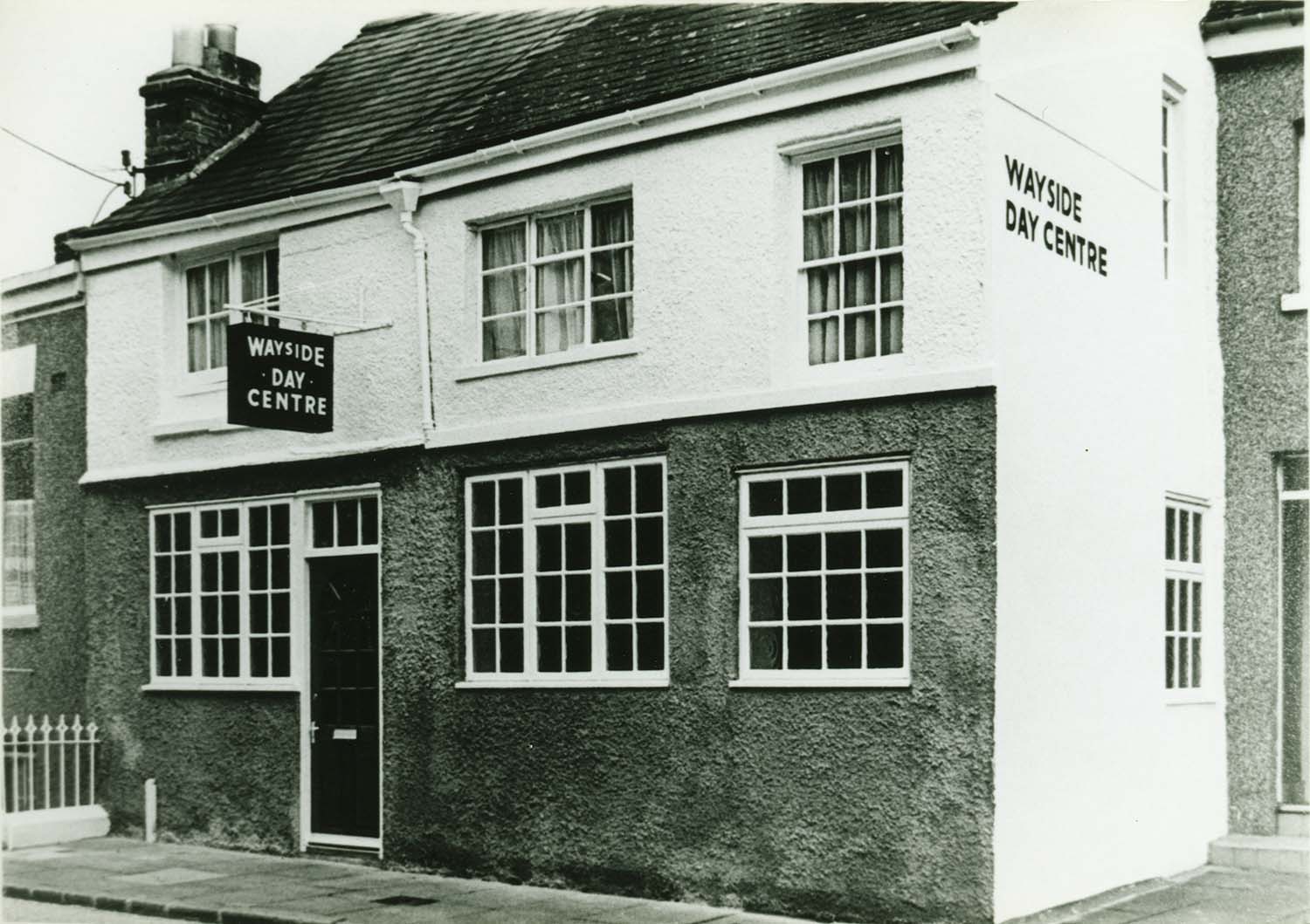
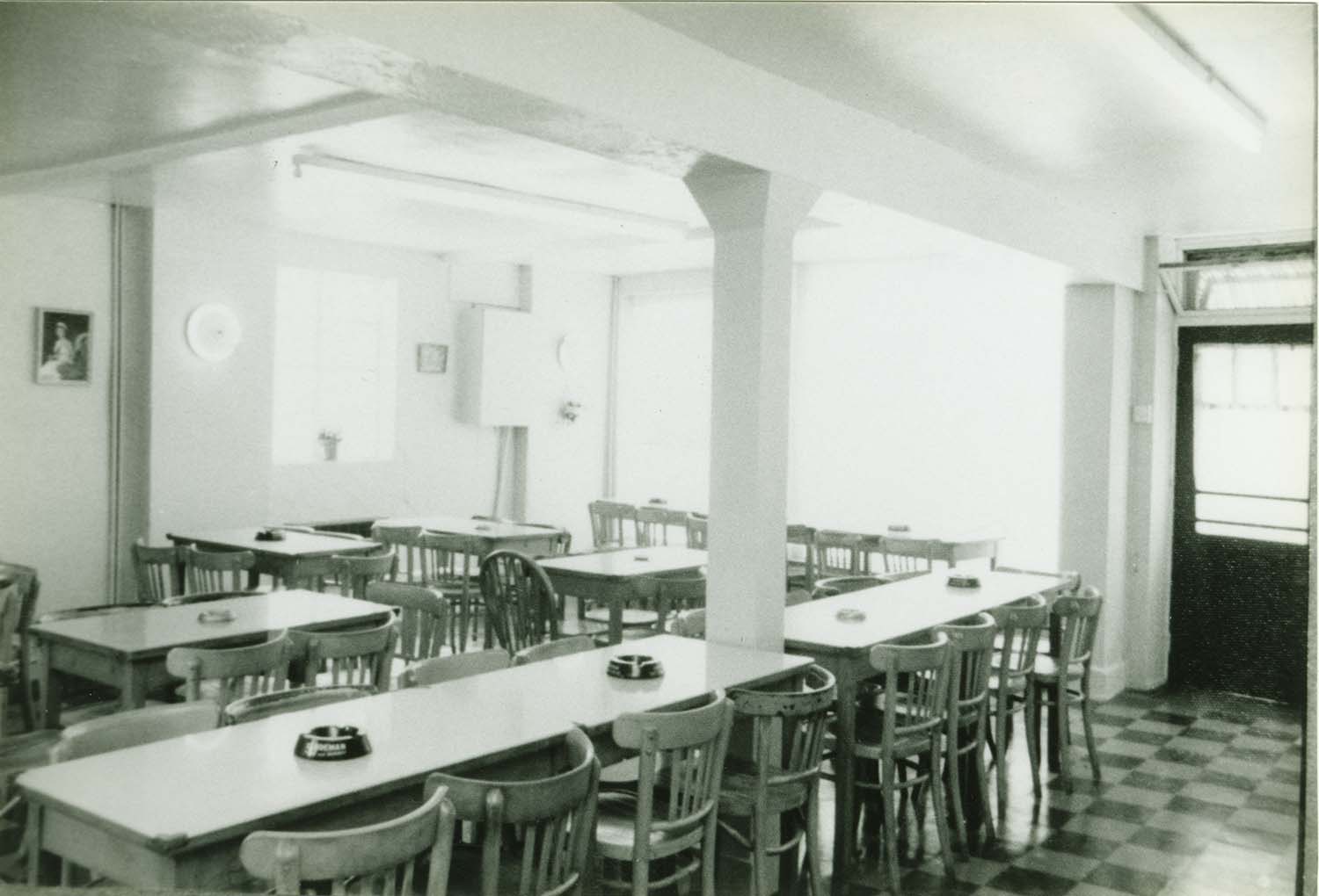
Eaton Rd 38-40 Wayside Day centre |
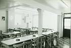
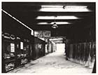
Eaton Rd Nos 38-40 Wayside Day centre interior |
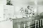
Eaton Rd Nos 38-40 Wayside Day centre interior |
 |
 |
 |
 |
|
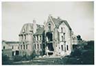
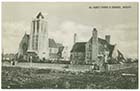
Ethelbert Crescent/demolished Cliftonville Hotel |
Ethelbert Crescent/demolished Cliftonville Hotel |
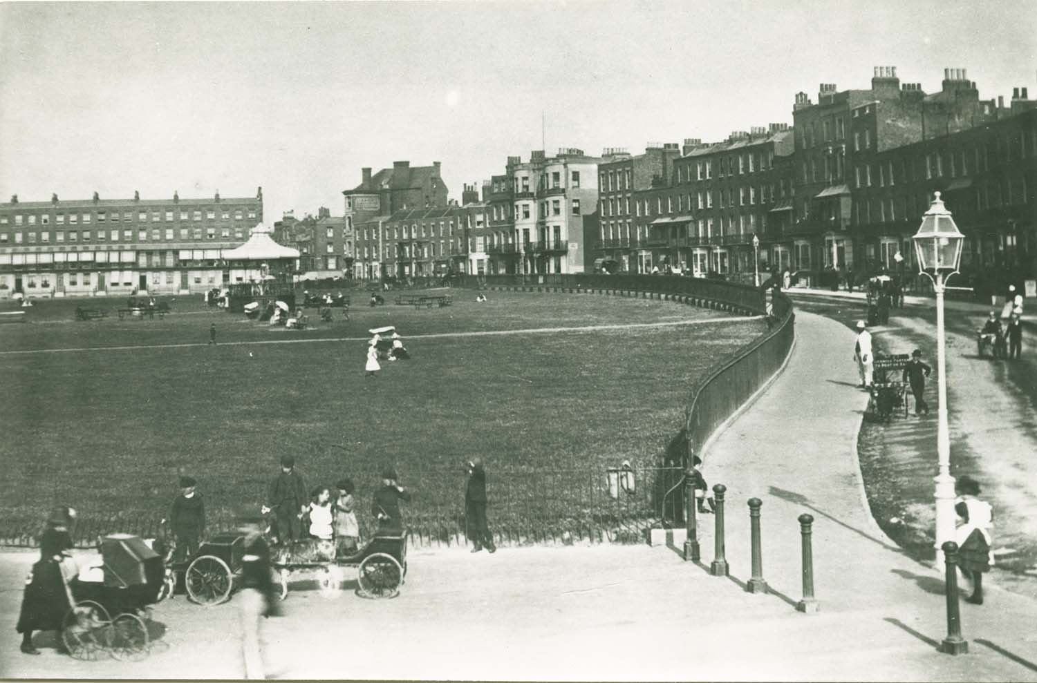
Fort Crescent/Fort Green |
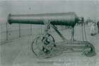
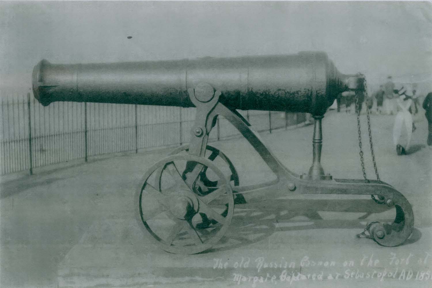
Fort Green/Old russian canon |
 |
 |
 |
 |
|
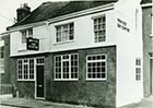
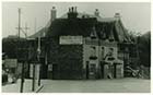
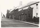
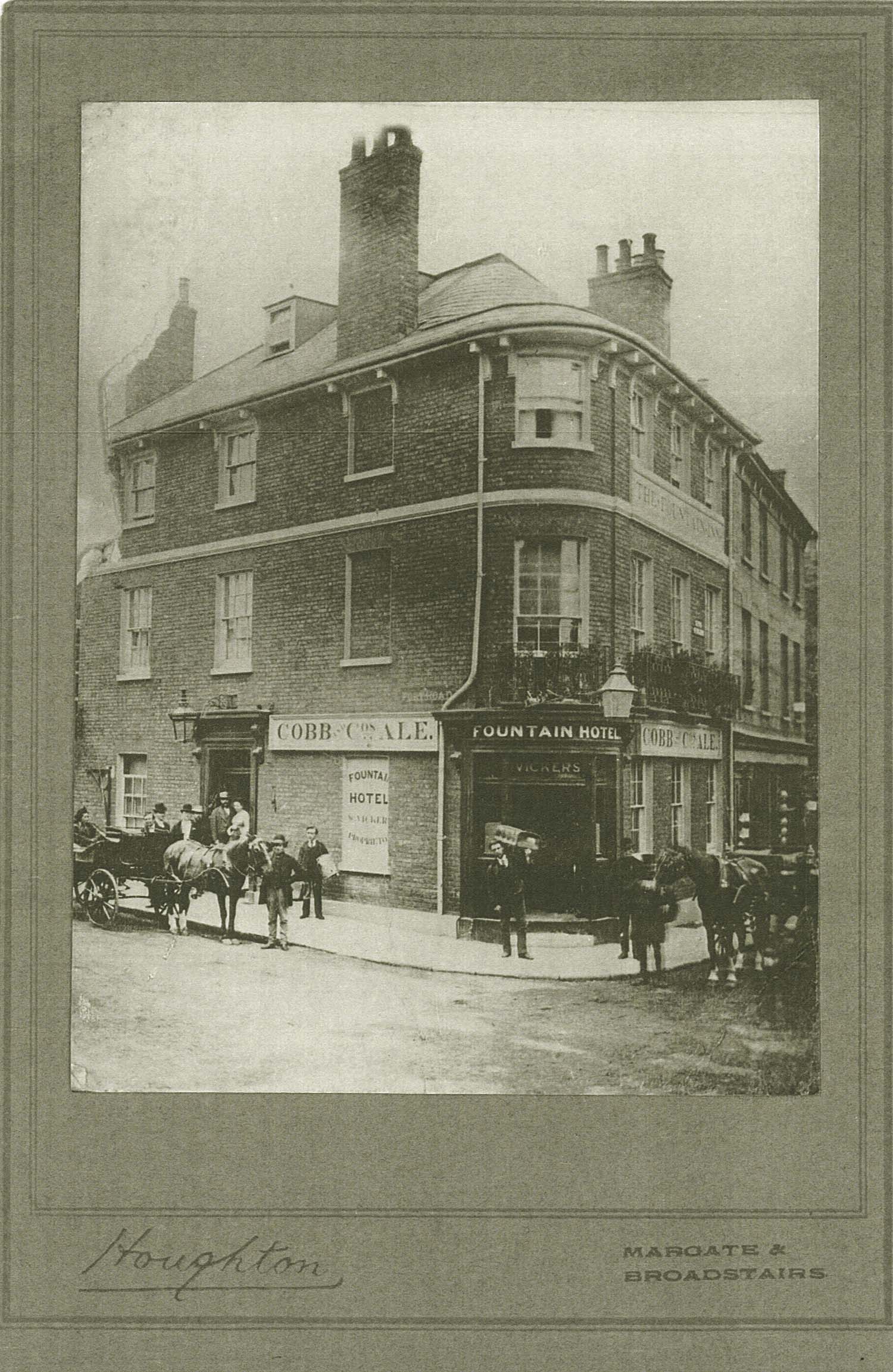
Fort Road/Fountain Inn |
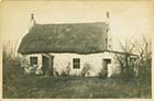
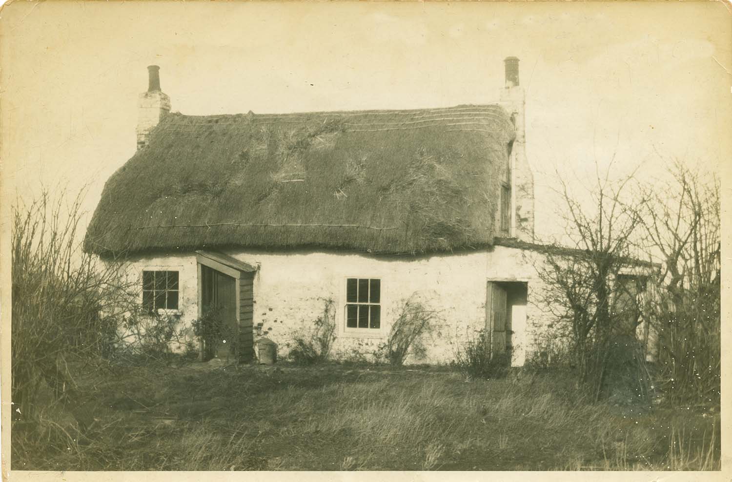
Garlinge/Crow Hill Road White Cottage 1930 |
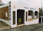
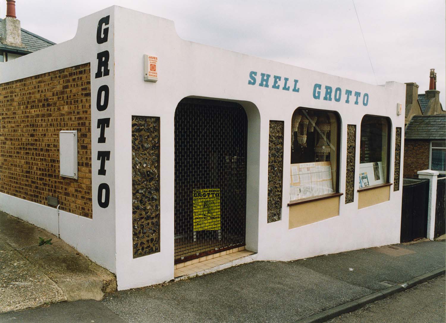
Grotto Hill/Shell Grotto |
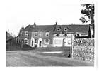
Garlinge/Dent de Lion |
 |
 |
 |
 |
|
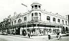
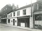
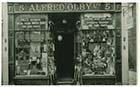
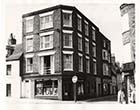
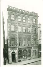
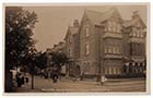
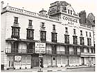
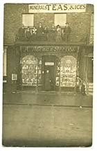
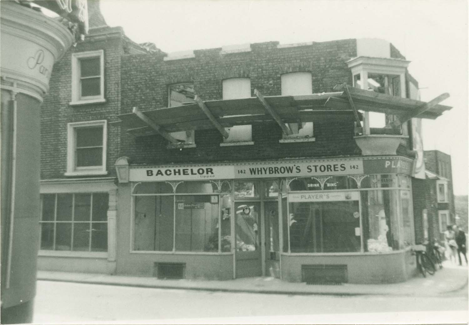
High Street/Bobbys Store |
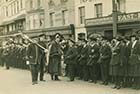
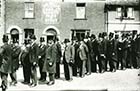
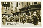
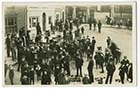
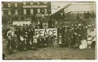
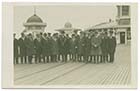
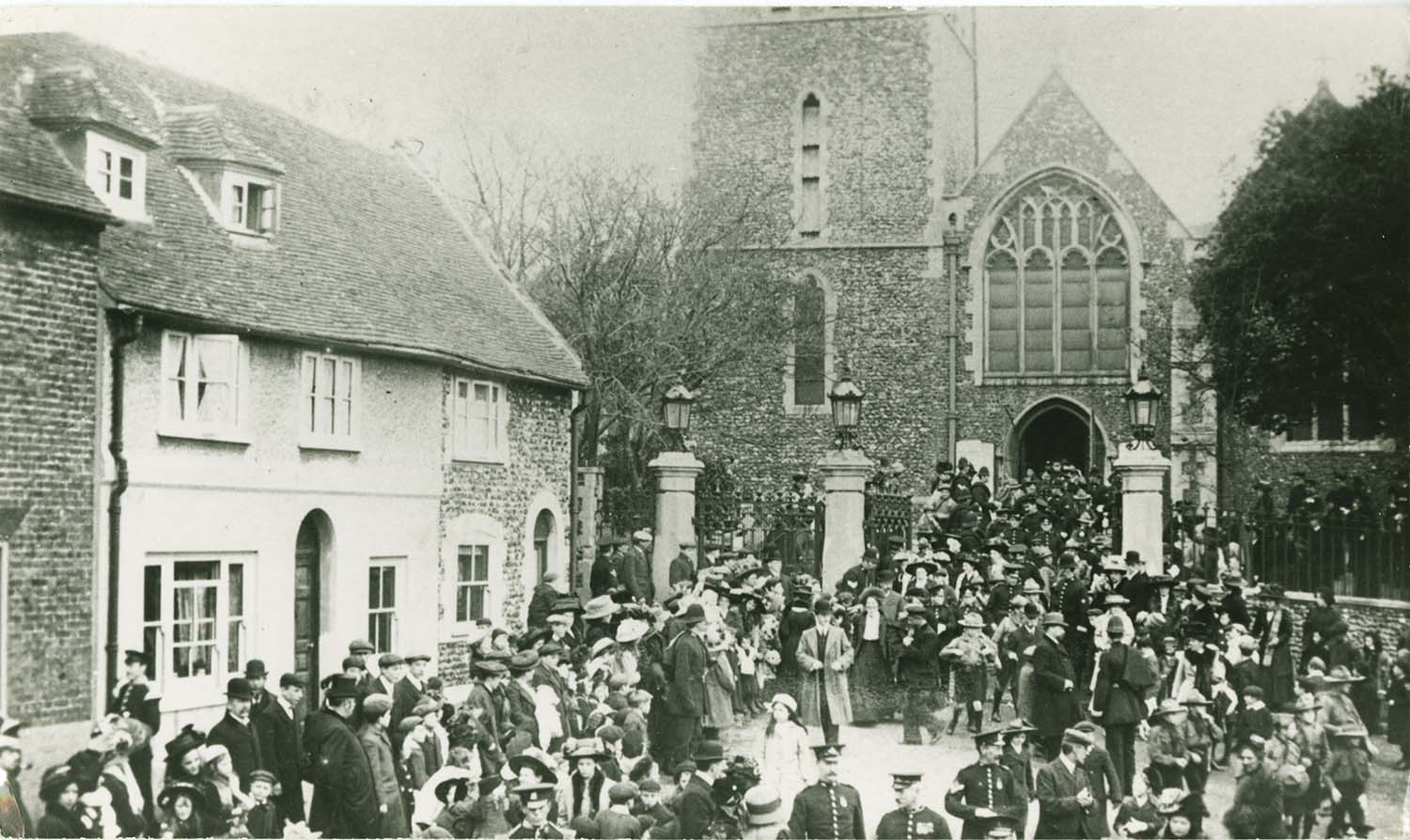
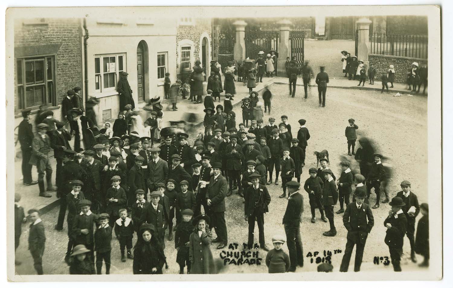
High Street/Church Parade |
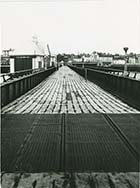
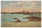
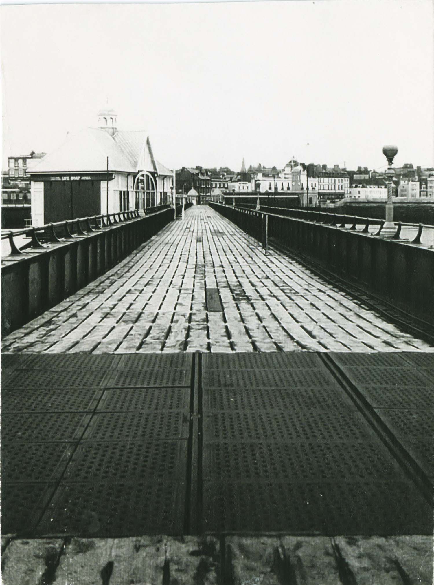
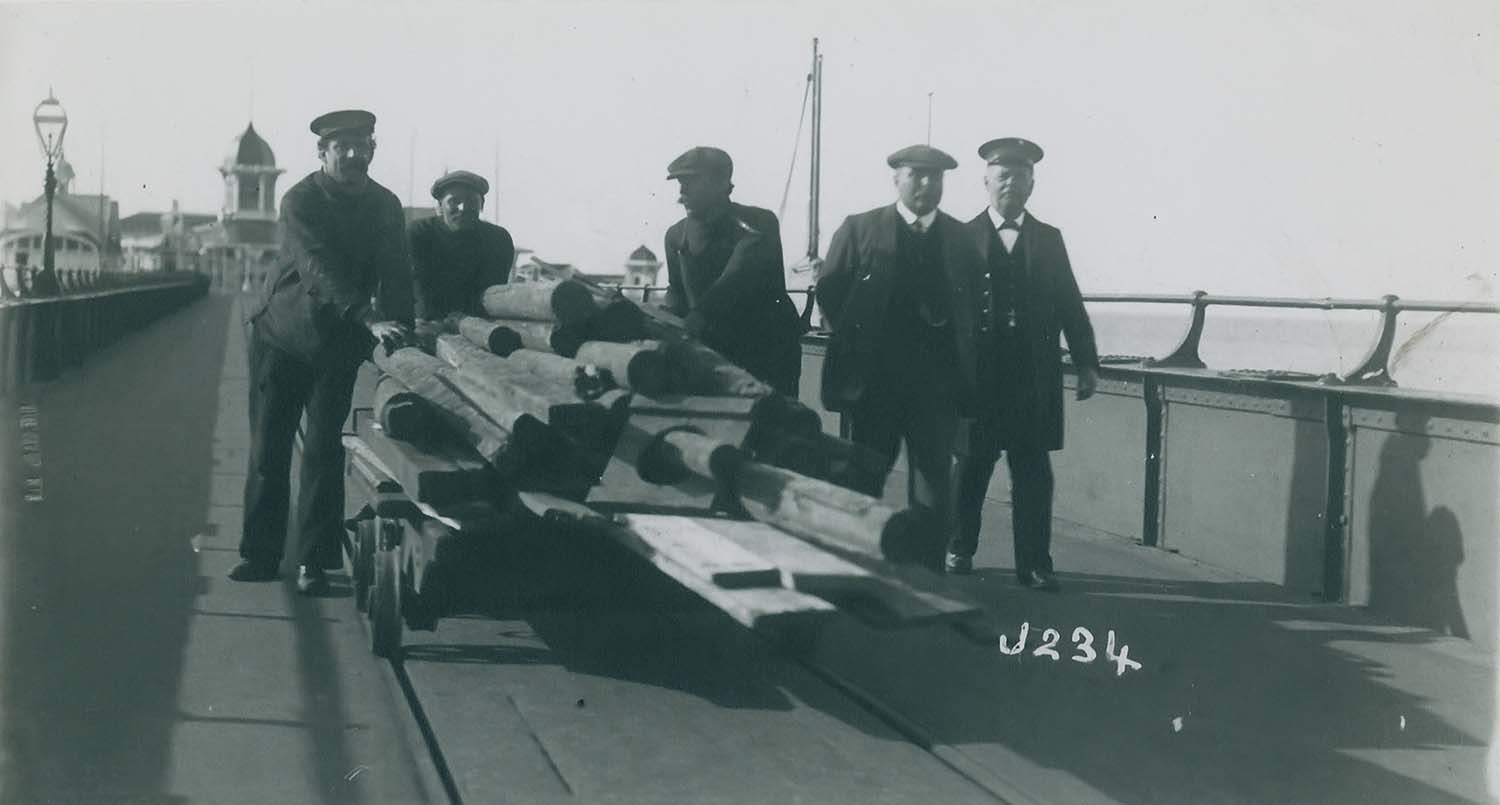
Jetty/showing decking |
Jetty/using the trolly |
December 11 2012
|
Pictures of Old Margate added to the OS 1907 Map
|
 |
 |
 |
 |
|
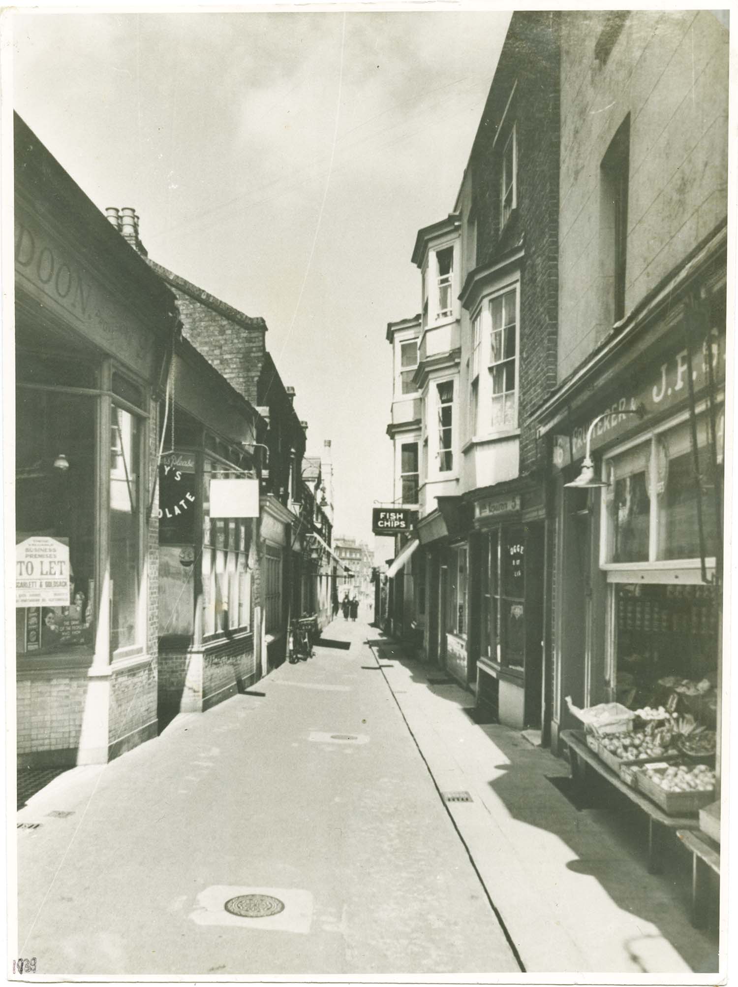
King Street/Cranbourne Alley 1939 |
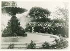
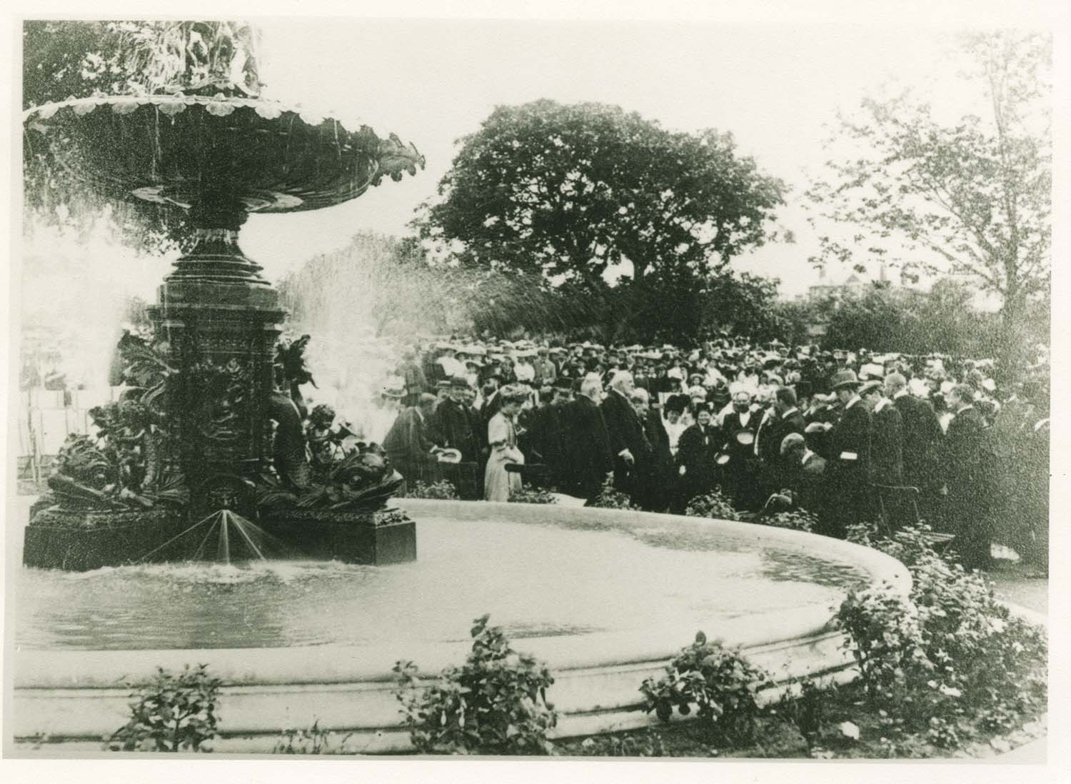
Dane Park/Inauguration of fountain 1907 |
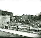
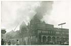
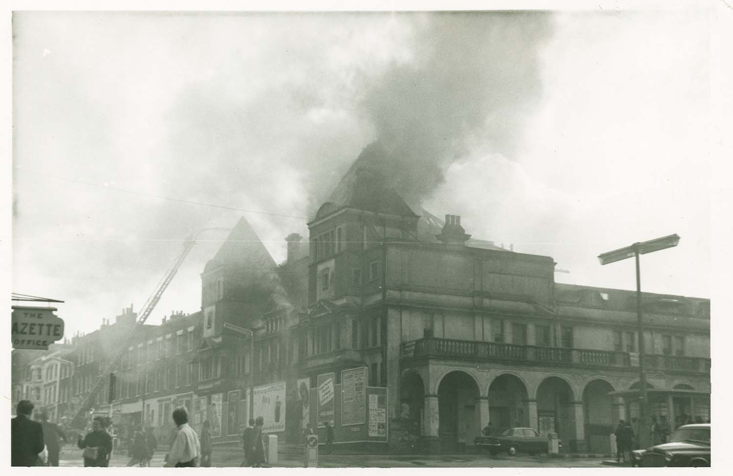
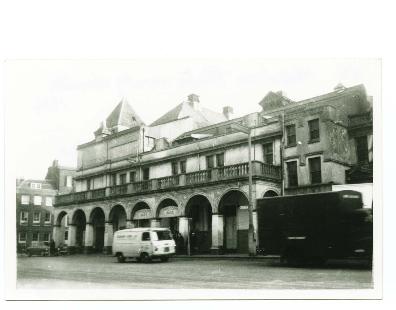
Cecil Square/Hippodrome fire |
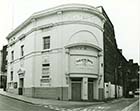
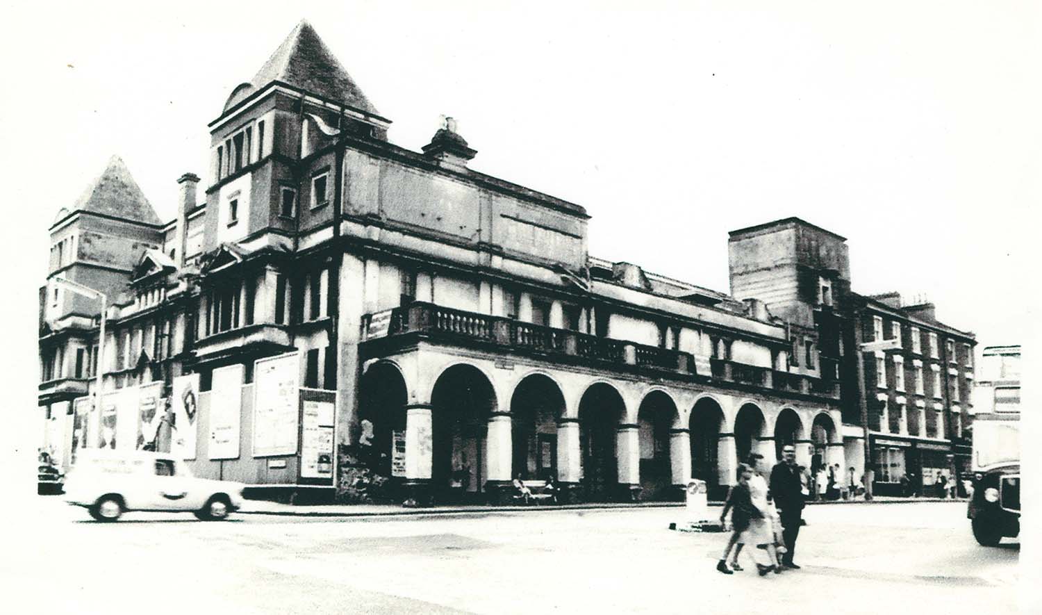
Cecil Square/Hippodrome 1967 |
 |
 |
 |
 |
|
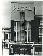
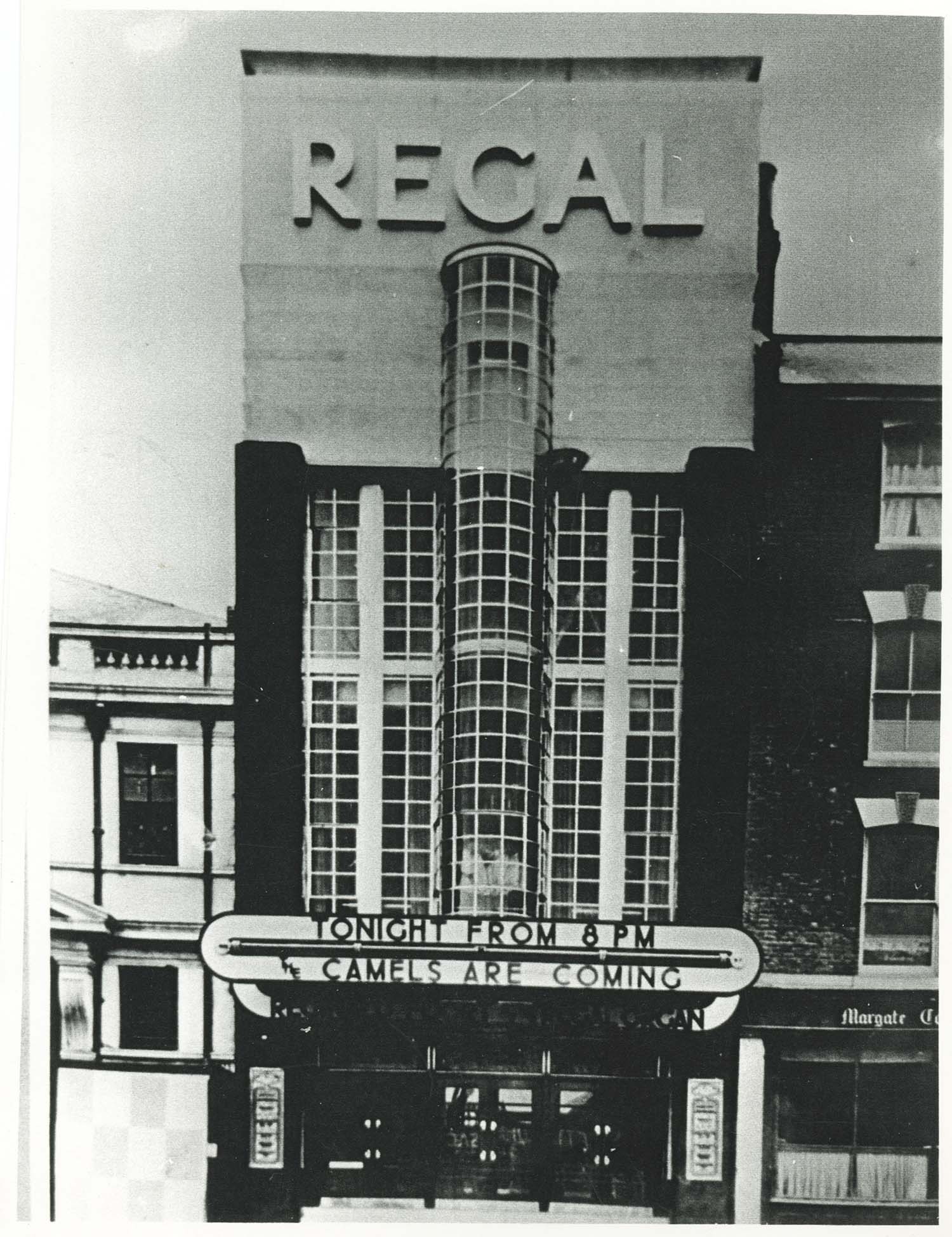
Cecil Square/Regal Cinema 1939 |
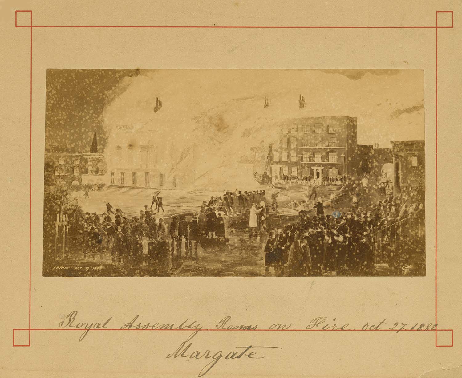
Cecil Square/Assembly Rooms on fire Oct 27 1882 |
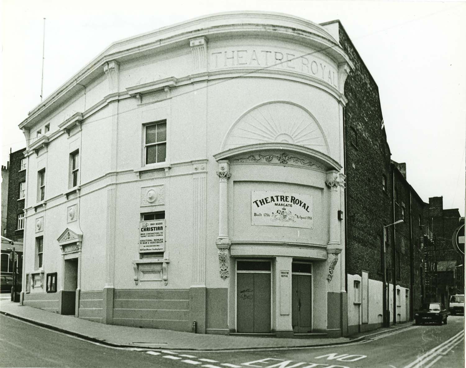
Addington Street/Theatre Royal |
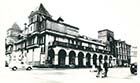
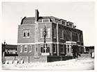
Aerial view/Margate College, Gas works, Cecil Square |
 |
 |
 |
 |
|
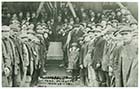
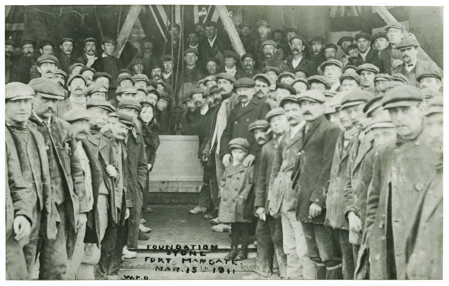
Winter Gardens/laying foundation stone 1911 |
Wheatleys Place from church yard ca 1926 |
Wheatleys Place off Victoria Road c1926 |
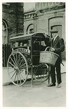
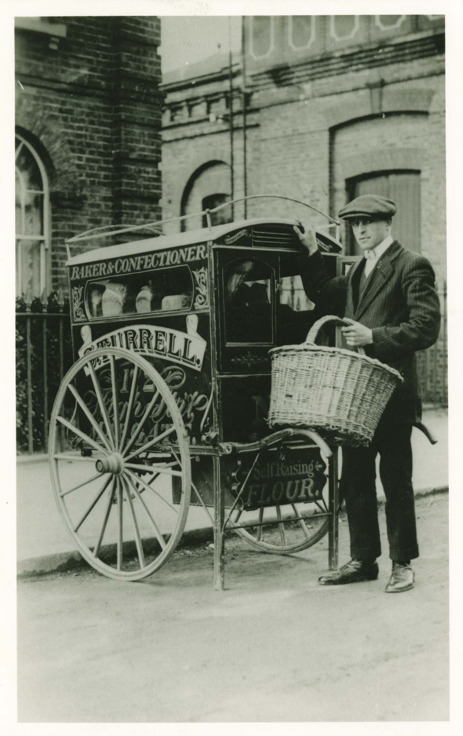
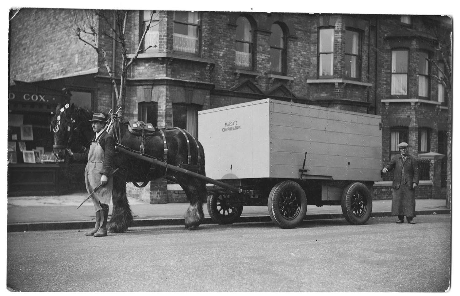
Victoria Road/Water tower and Turrell cart |
 |
 |
 |
 |
|
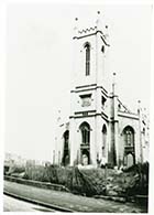
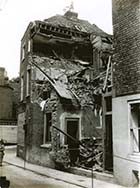
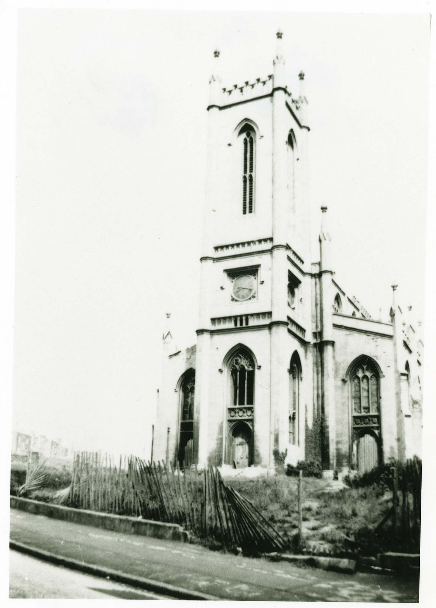
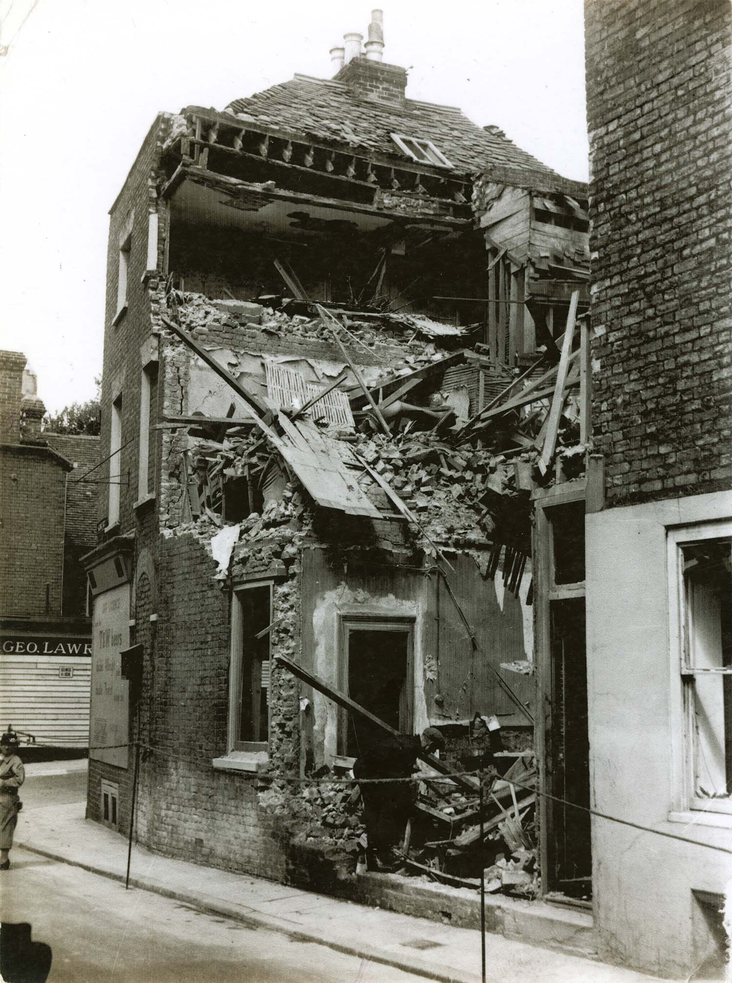
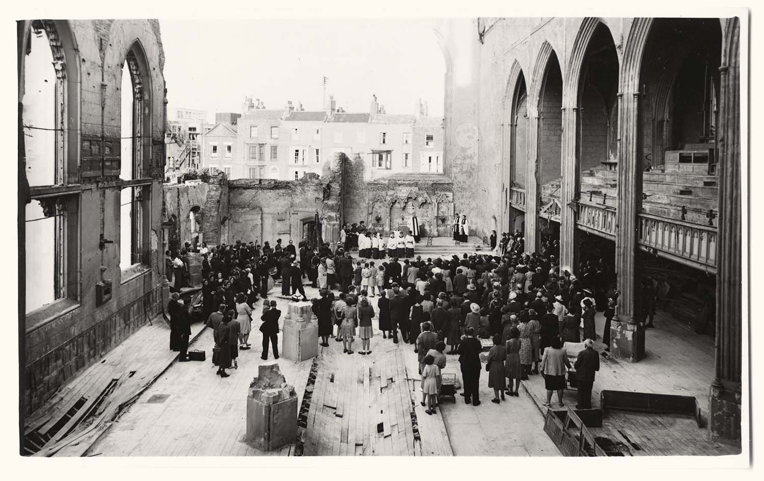
Trinity church after bomb damage |
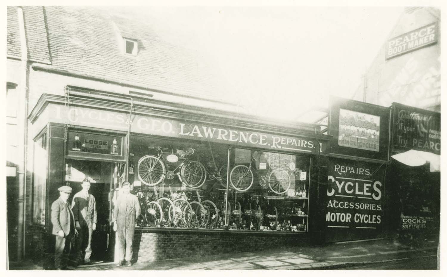
Trinity Hill/No 1 Lawrence Cycle Store 1925 |
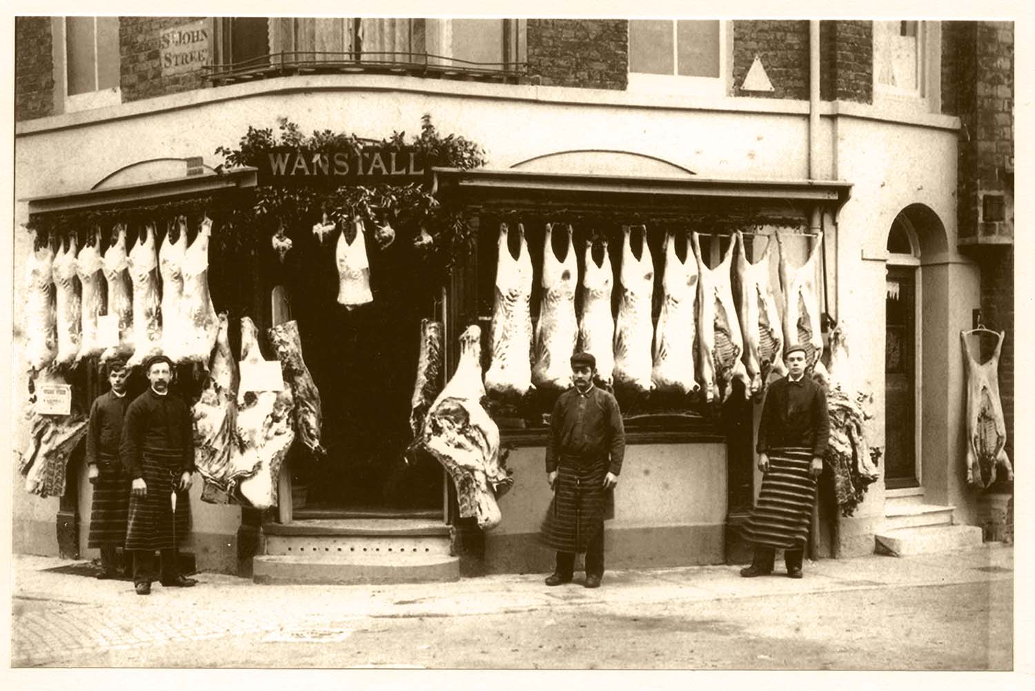
St Johns Street/ No 11 Wanstall |
High Street/Marine Terrace corner Wanstall No 82 |
 |
|
St Peters Road/Vicarage |
December 1 2012
|
Pictures of Old Margate added to the OS 1907 Map
|
 |
 |
 |
 |
|
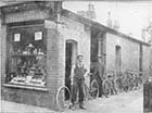
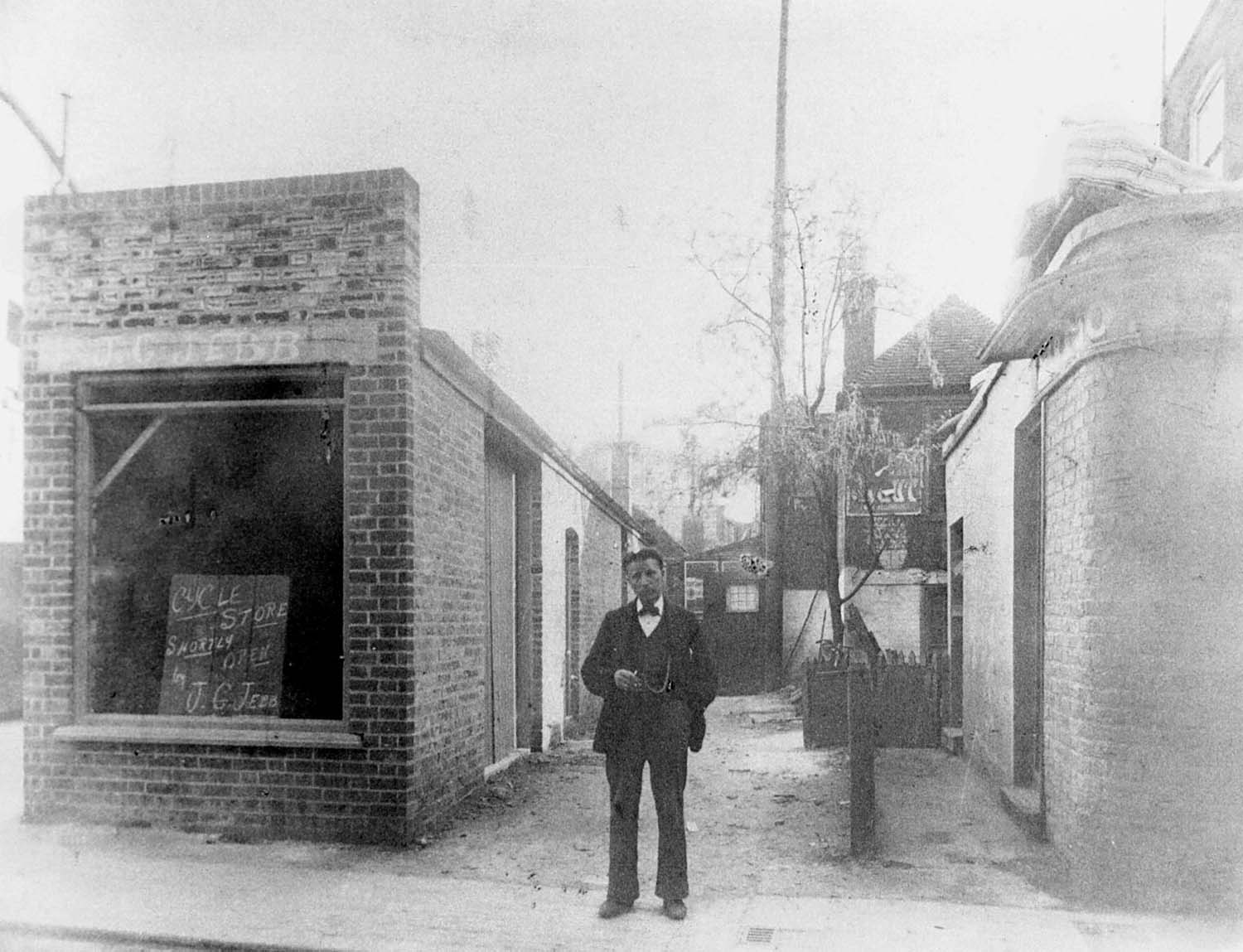
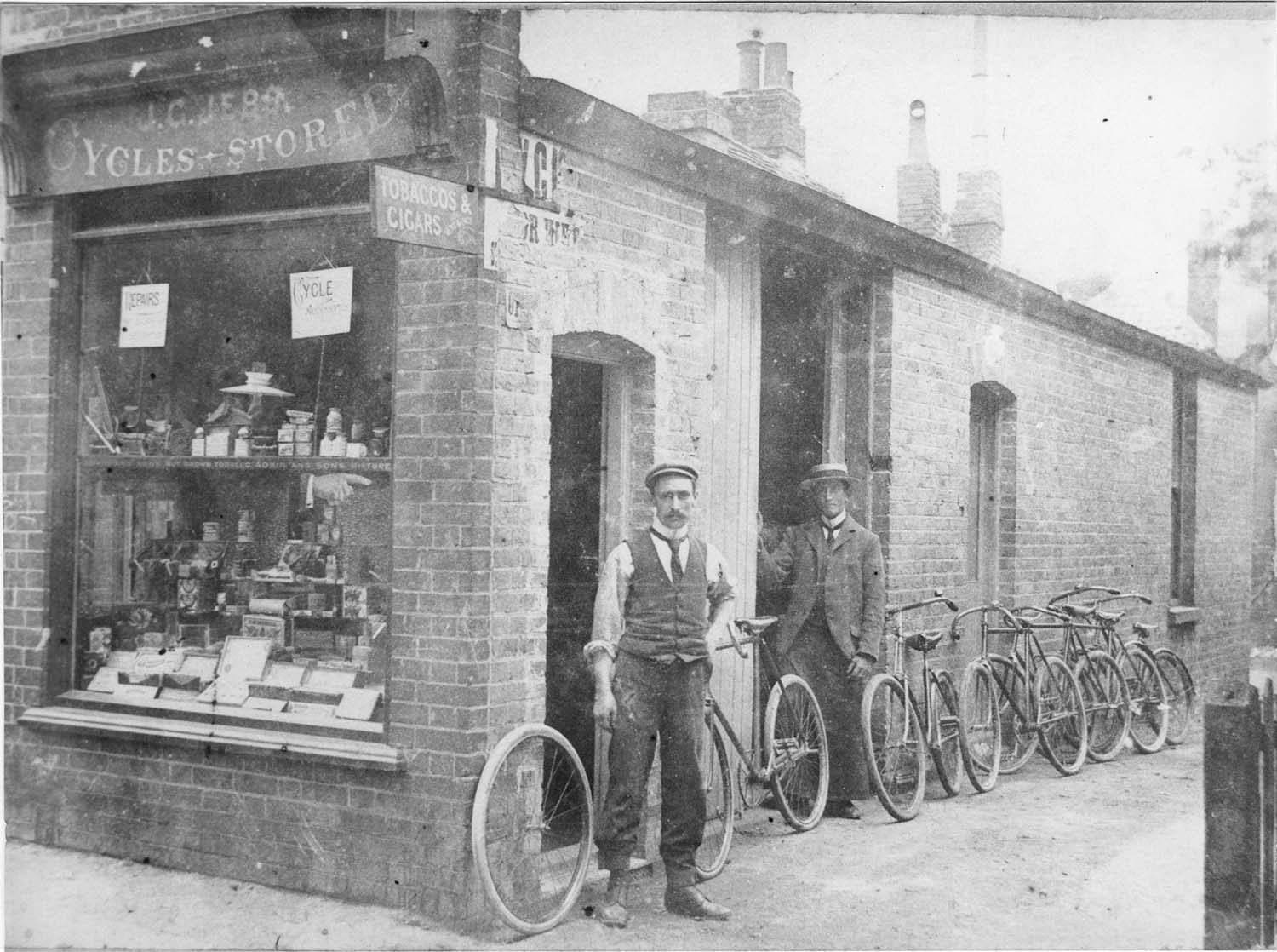
King Street/JG Jebb Cycle Store c 1905 |
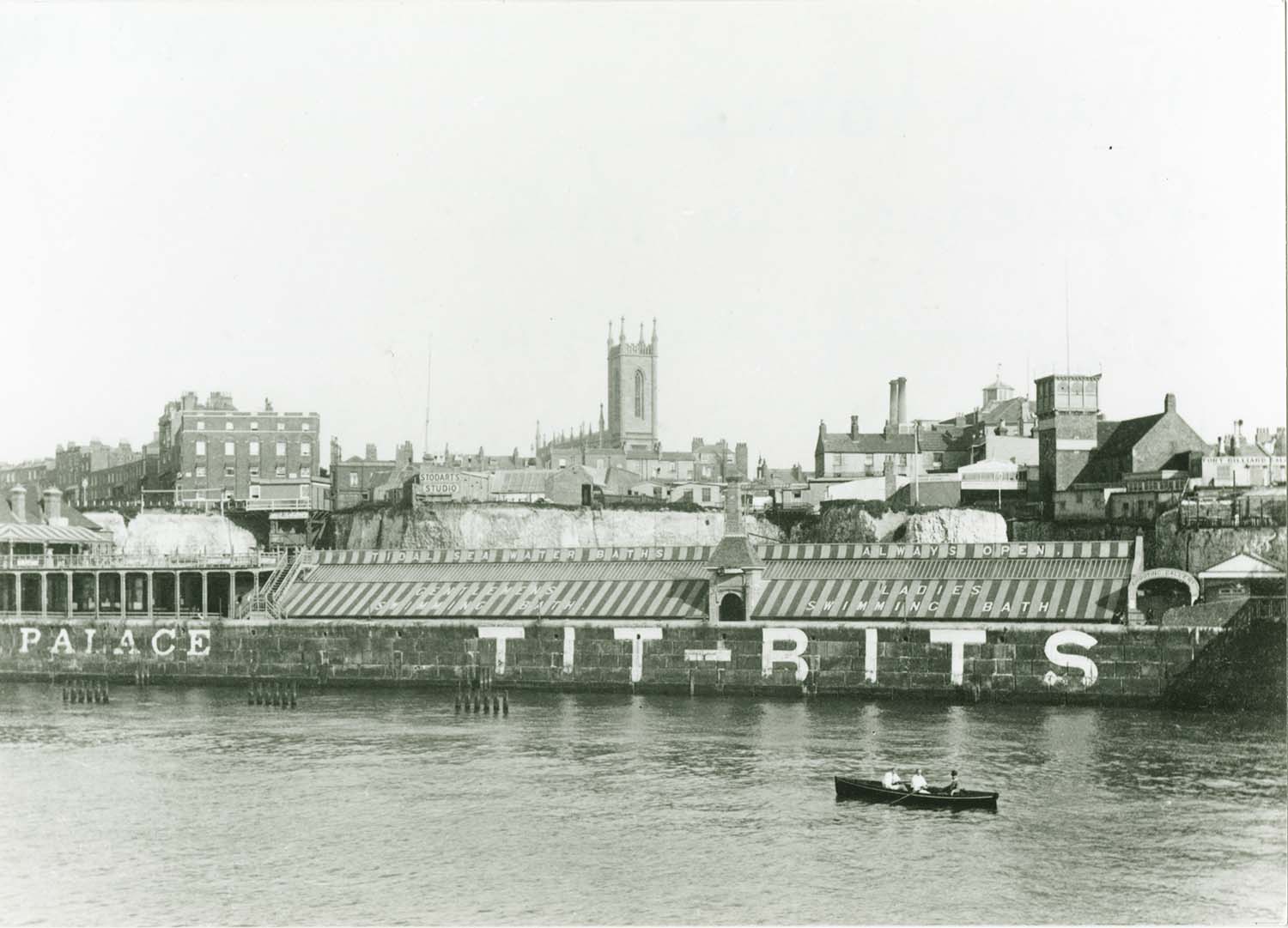
Marine Palace |
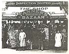
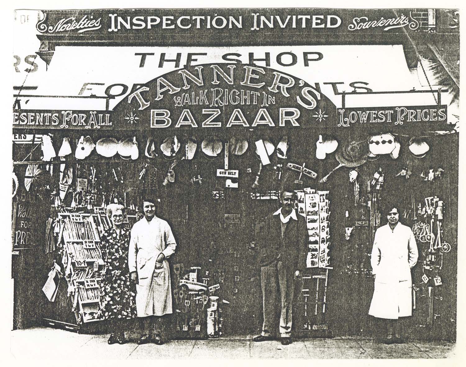
Marine Terrace/No 47 Tanners Bazaar |
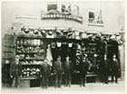
Market Place/No 14 J Clarks shop 1880 |
 |
 |
![Northdown [Northumberland] Road/No 32 and 32a Singer | Margate History](../Pictures/Photos/Modern/Old Margate/Northdown Road 32 and 32a Singer-thumb.jpg) |
![Northdown [Northumberland] Road/No 44 Whitehead | Margate History](../Pictures/Photos/Modern/Old Margate/Northdown Road 44 Whitehead-thumb.jpg) |
|
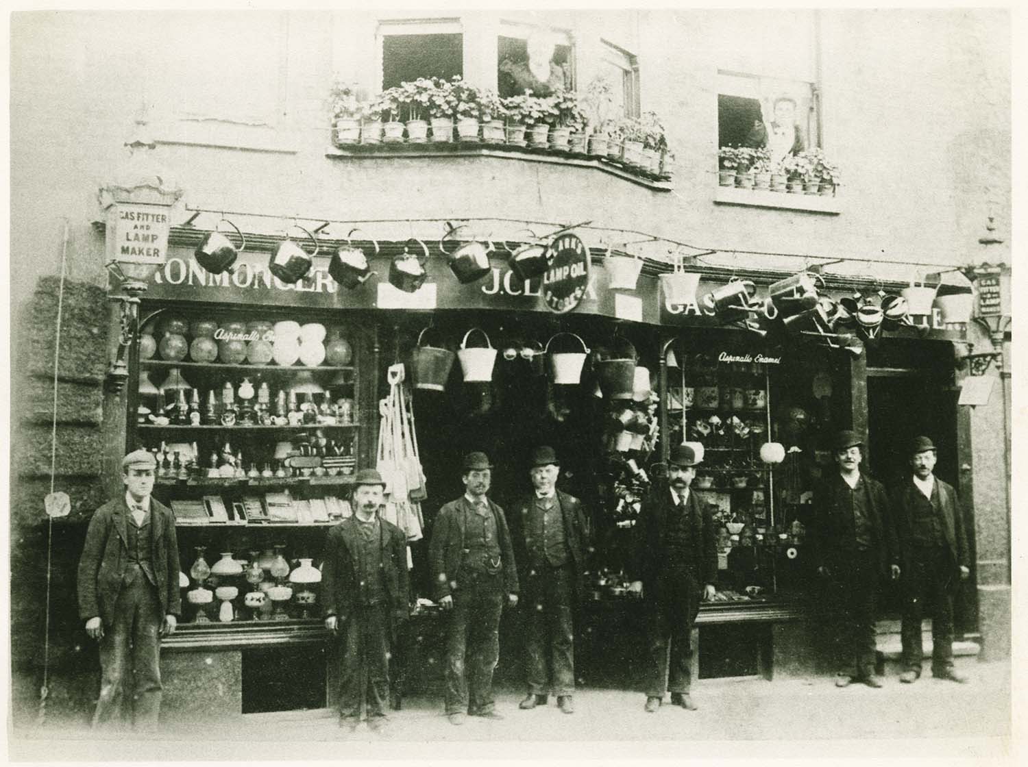
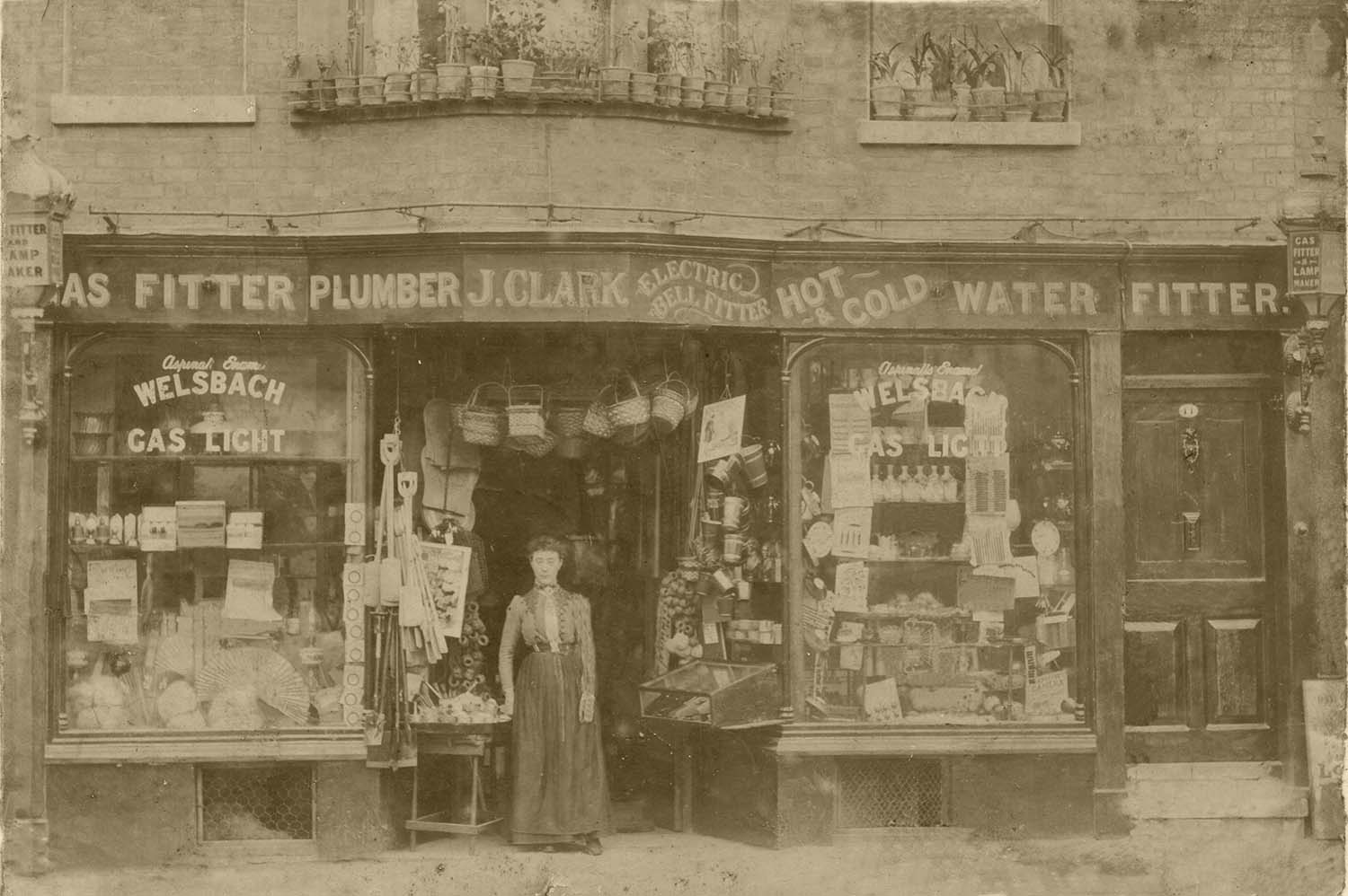
Market Place/No 14 J Clark |
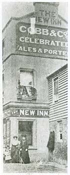
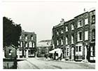
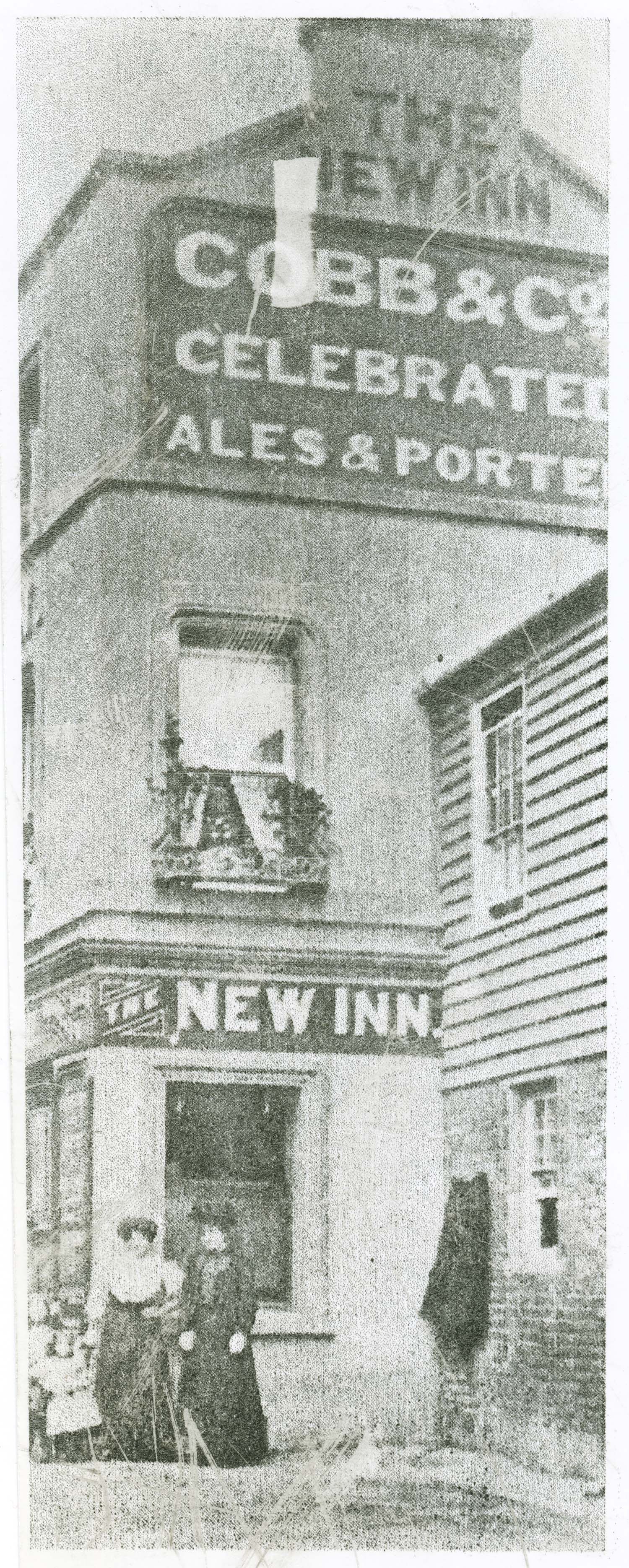
New Street/New Inn |
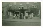
Northdown [Northumberland] Road/No 32 and 32a Singer |
Northdown [Northumberland] Road/No 44 Whitehead |
![Northdown [Alexandra] Road/No 88 Twyman shop | Margate History](../Pictures/Photos/Modern/Old Margate/Northdown Road 88 Twyman shop 1-thumb.jpg) |
![Northdown [Alexandra] Road/No 88 Twyman shop | Margate History](../Pictures/Photos/Modern/Old Margate/Northdown Road 88 Twyman shop 2-thumb.jpg) |
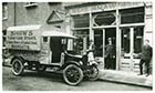
![Northdown [Alexandra] Road/No 88 Twyman van | Margate History](../Pictures/Photos/Modern/Old Margate/Northdown Road 88 Twyman van-thumb.jpg) |
 |
|
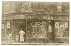
Northdown [Alexandra] Road/No 88 Twyman shop |
Northdown [Alexandra] Road/No 88 Twyman shop |
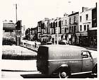
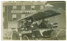
Northdown [Alexandra] Road/No 88 Twyman van |
Northdown Road/Harold Road junction |
 |
 |
 |
 |
|
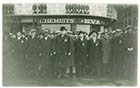
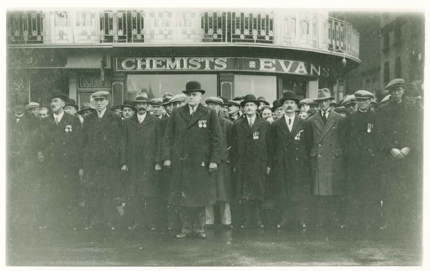
Parade and High Street corner/Evans Chemist |
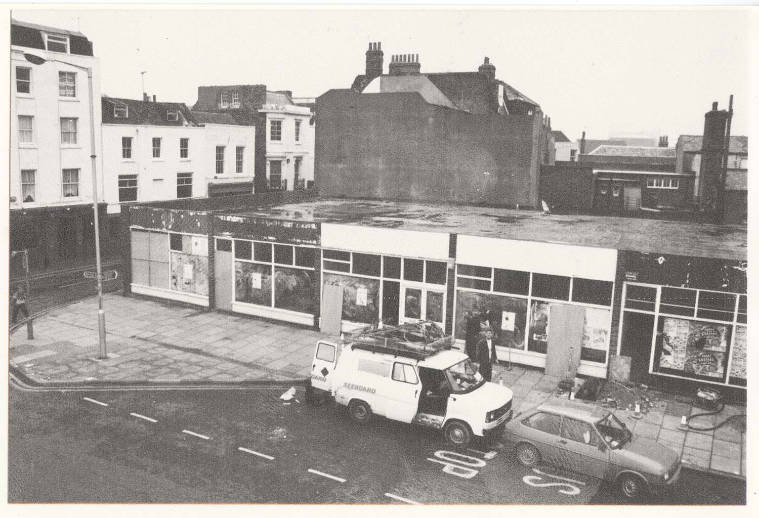
Parade/ site of old White Hart Hotel demolished |
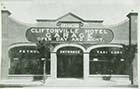
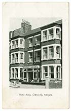
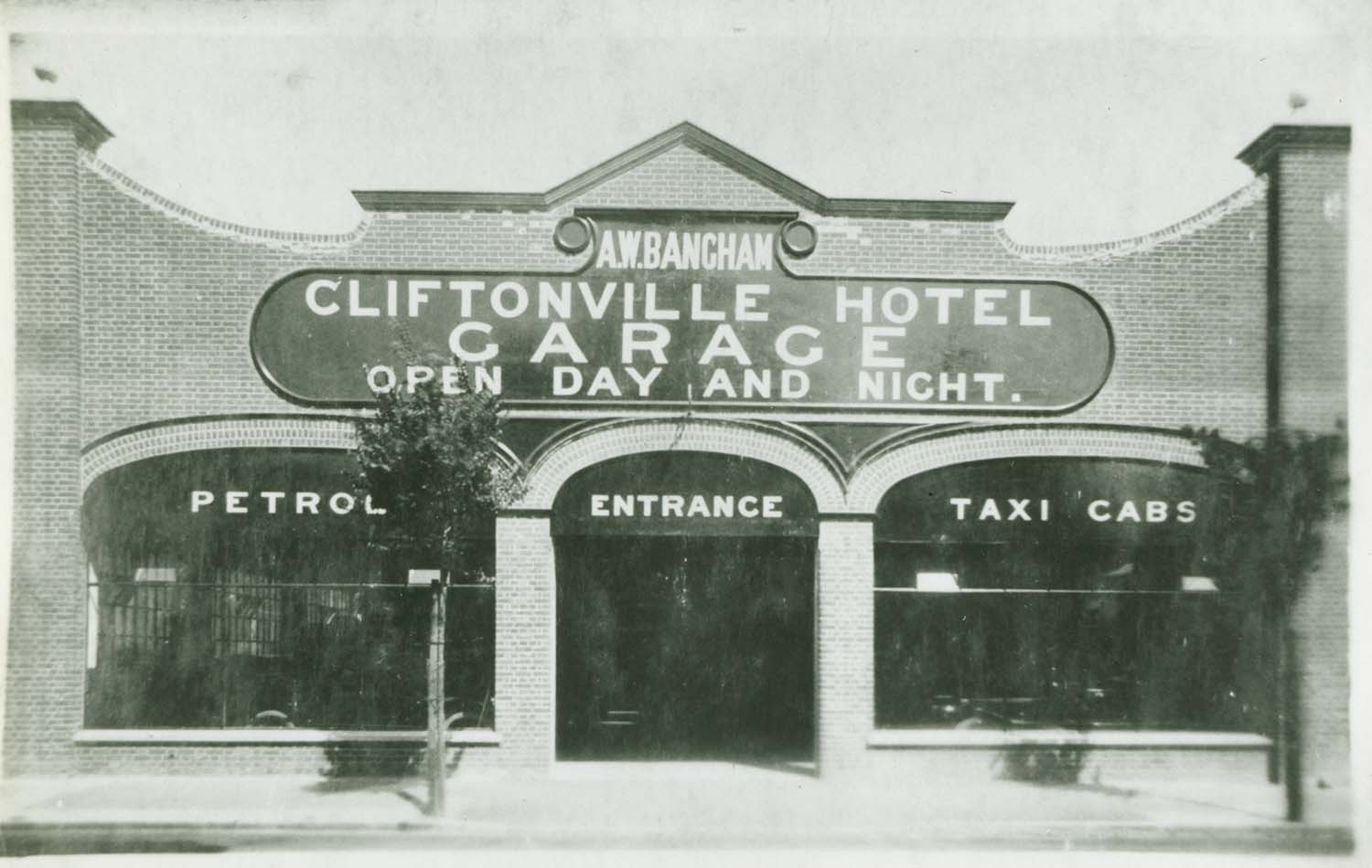
Percy Road/Cliftonville Hotel gargage |
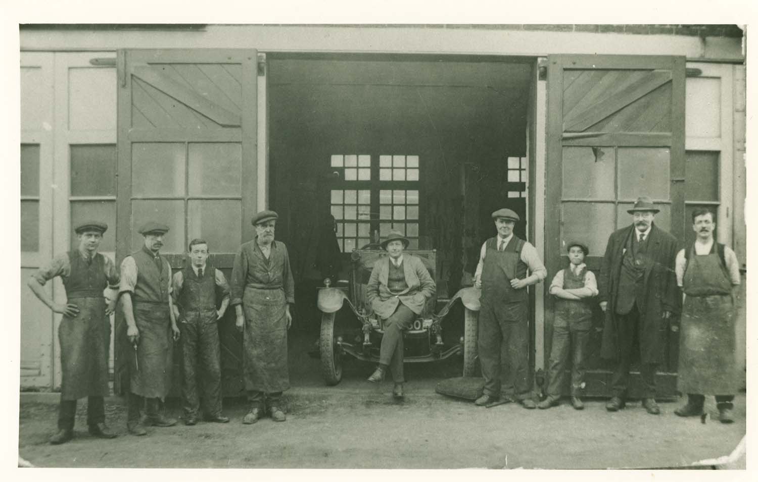
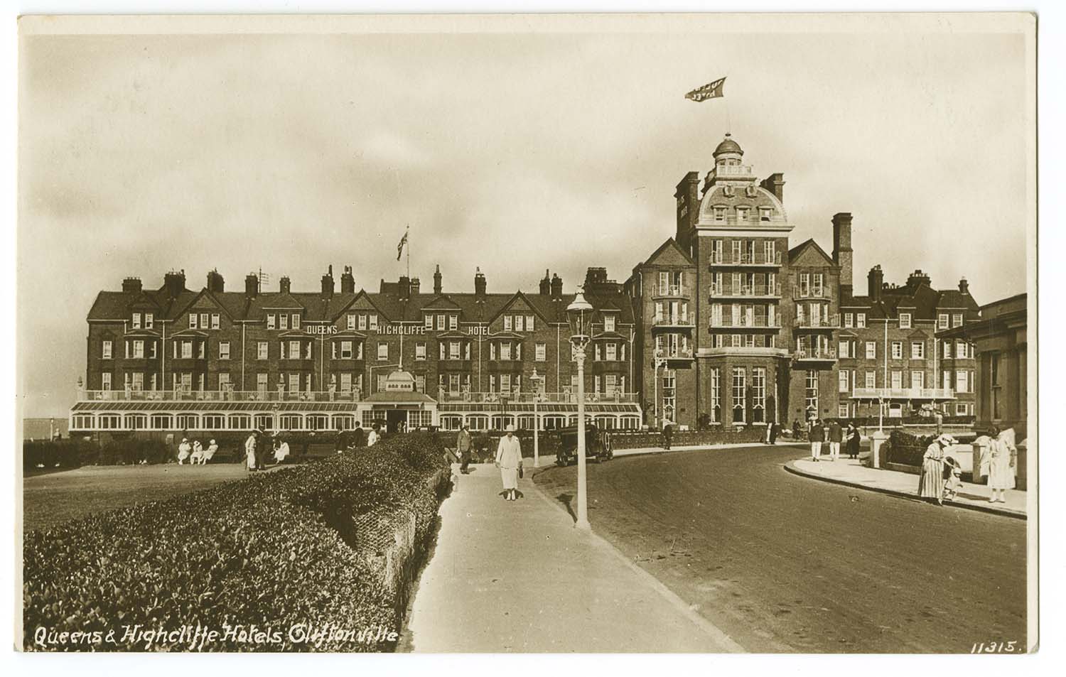
Queens Hotel garage |
November 25 2012
|
Pictures of Old Margate added to the OS 1873 and 1907 Maps
|
 |
 |
 |
 |
|
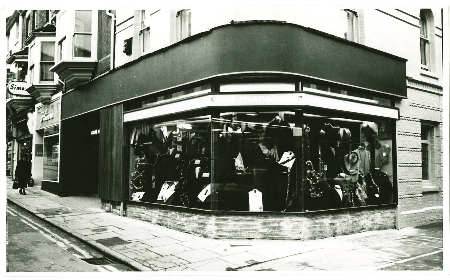
High Street/No 110 Cant Tailors/corner to Prince of Wales |
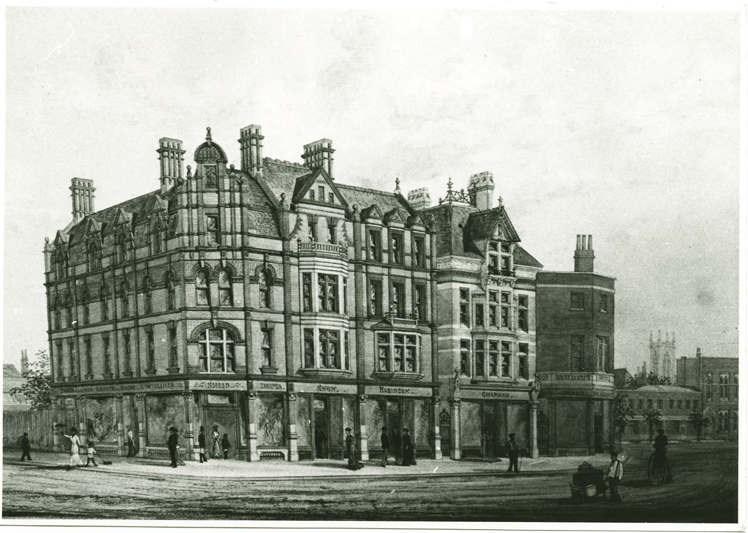
High street Queen Street corner/Mr Smeed c 1883 |
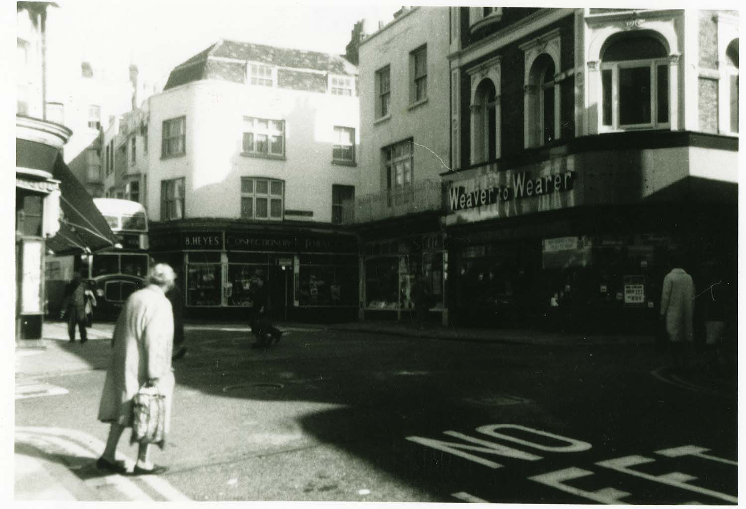
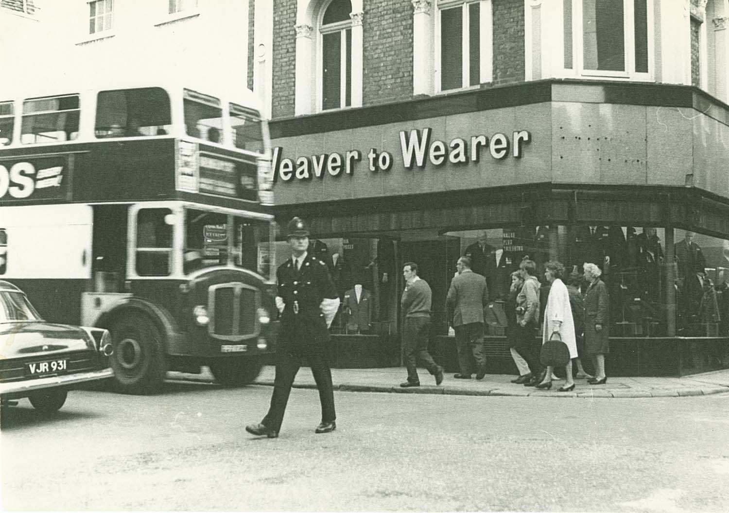
High street Queen street corner/Weaver to Wearer |
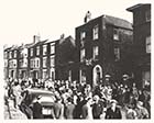
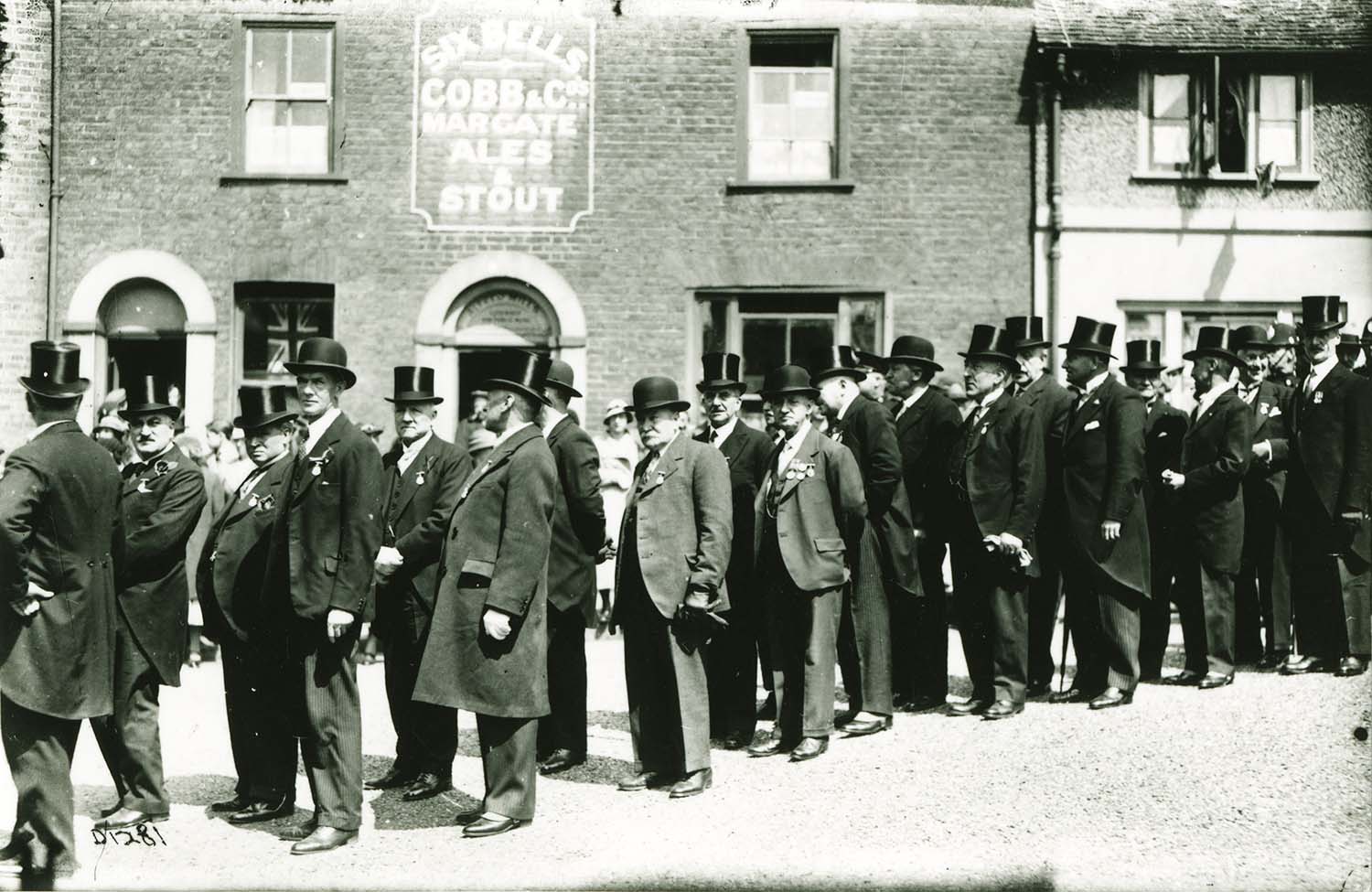
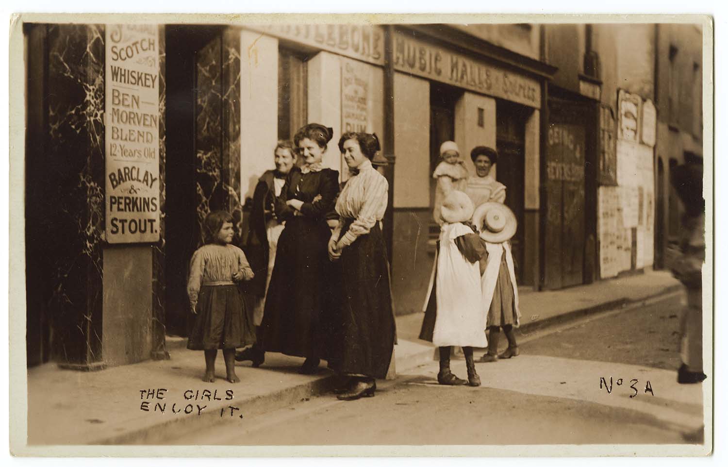
High Street/procession outside Six Bells |
 |
 |
 |
|
High street looking toward Hope and Anchor |
High Street/Royal Oak |
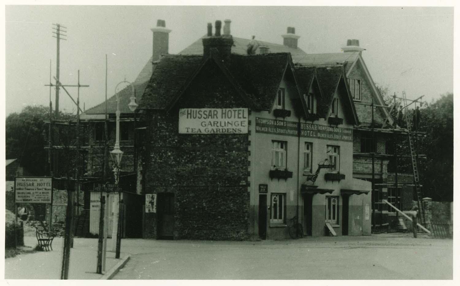
Hussar Hotel Garlinge |
 |
 |
 |
 |
|
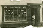
King street/ No 38 Packer |
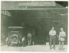
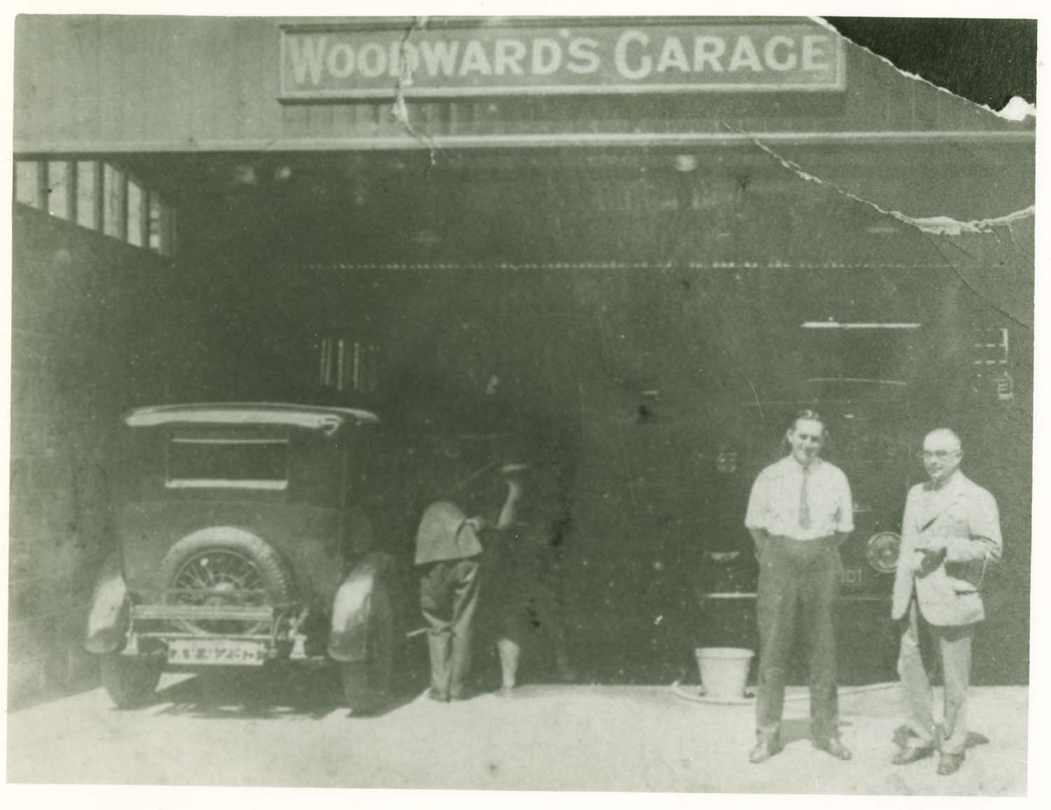
King Street/No 81 Woodward's Garage |
King Street/No 15 Harold Toby |
King Street/Jebbs Cycle Store ca 1905 |
 |
 |
 |
 |
|
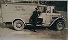
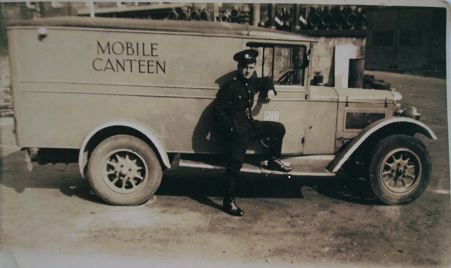
King street/Mobile Canteen 1942 |
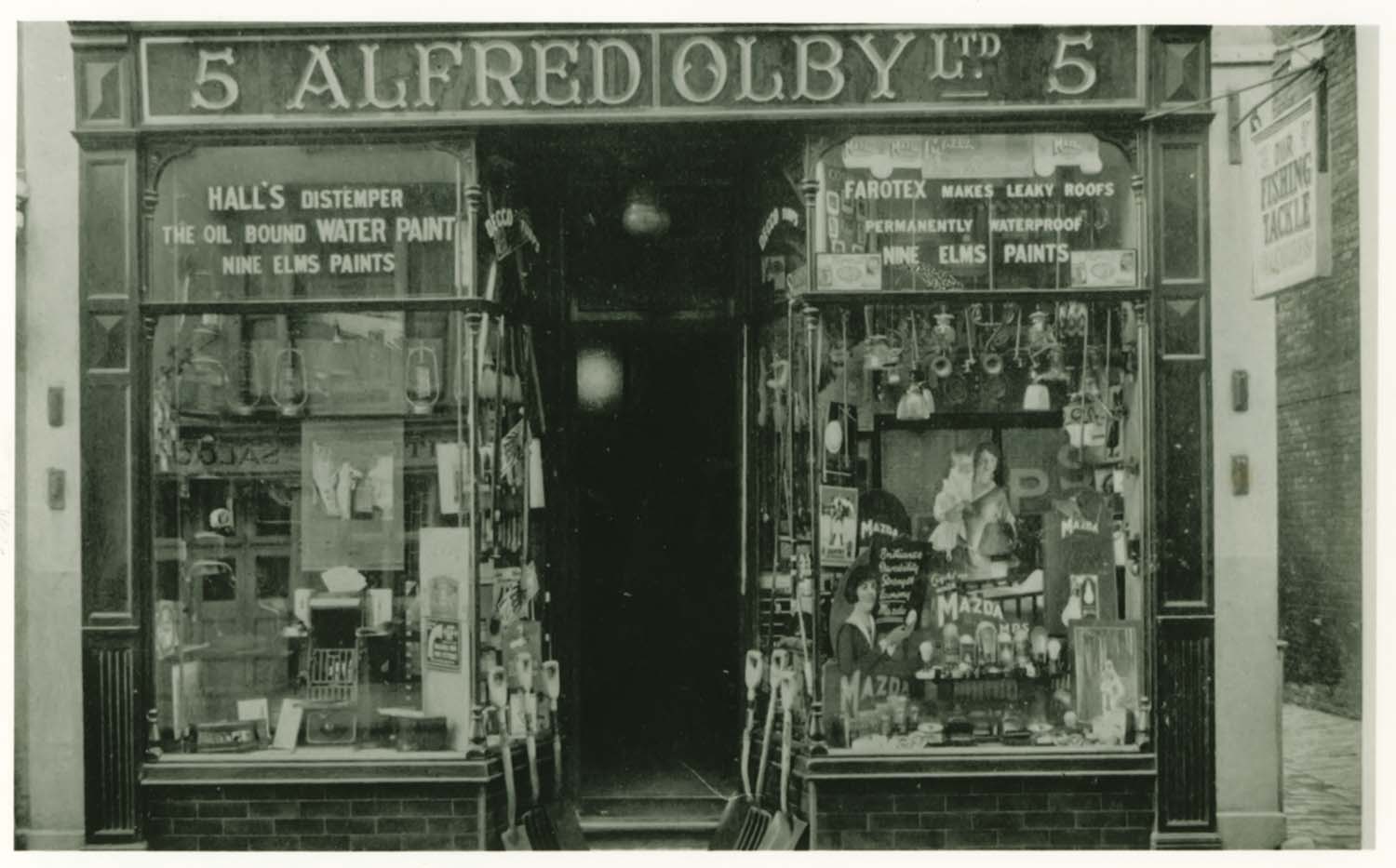
King Street/No 5 Alfred Olby |
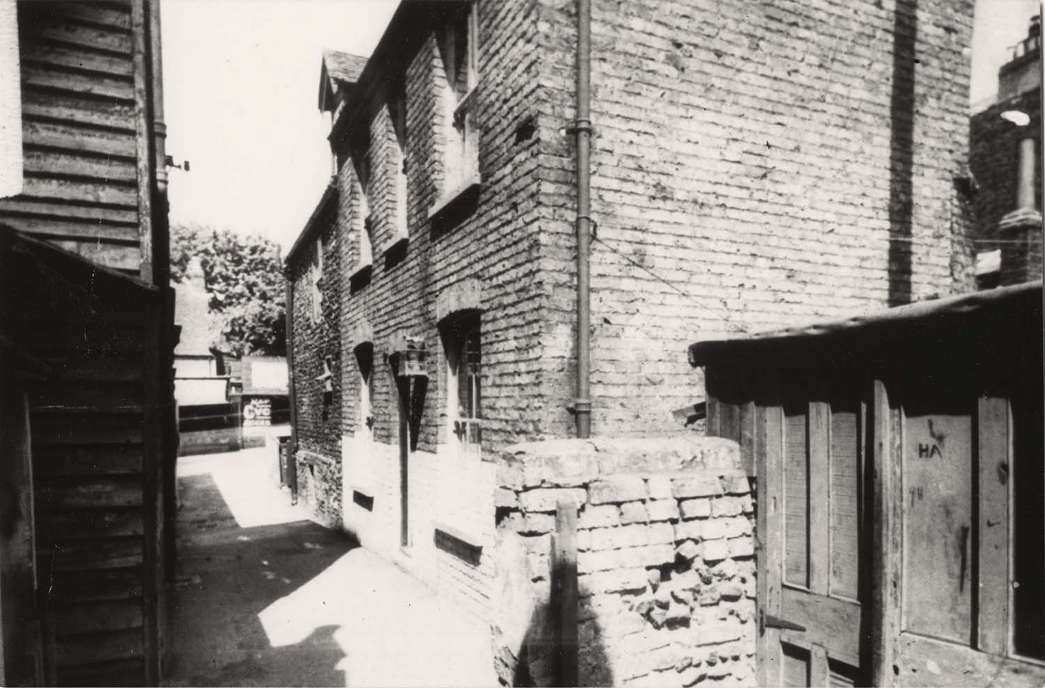
King street/demolished cottages next to Tudor House |
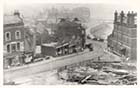
King street Trinity Hill corner/Bomb damage |
November 18 2012
|
I thank Brian Brookes Payne for permission to include many of his large collection of Margate Storm pictures
|
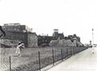
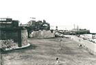
Storm of 1953
|
![King Street Floods [Payne Collection] | Margate History](../Pictures/Storms/Floods 1953/Payne 52 King Street-thumb.jpg) |
![Love Lane Floods [Payne Collection] | Margate History](../Pictures/Storms/Floods 1953/Payne 55 Storm Love Lane-thumb.jpg) |
![Hawley Street Floods [Payne Collection] | Margate History](../Pictures/Storms/Floods 1953/Payne 56 Hawley ST-thumb.jpg) |
![Marine Drive [Payne Collection] | Margate History](../Pictures/Storms/Floods 1953/Payne 54 Marine Drive Storm-thumb.jpg) |
|
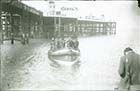
King Street Floods [Payne Collection] |
Love Lane Floods [Payne Collection] |
Hawley Street Floods [Payne Collection] |
Marine Drive [Payne Collection] |
![Rendezvous [Payne Collection] | Margate History](../Pictures/Storms/Floods 1953/Payne 53 Storm-thumb.jpg) |
![Bathing Stage [Payne Collection] | Margate History](../Pictures/Storms/Floods 1953/Payne 51 Bathing Stage-thumb.jpg) |
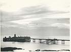
![Harbour after the storm [Payne Collection] | Margate History](../Pictures/Storms/Floods 1953/Payne 14-thumb.jpg) |
![Pier and Lighthouse [Payne Collection] | Margate History](../Pictures/Storms/Floods 1953/Payne 15-thumb.jpg) |
|
Rendezvous [Payne Collection] |
Bathing Stage [Payne Collection] |
Harbour after the storm [Payne Collection] |
Pier and Lighthouse [Payne Collection] |
![Damaged Lighthouse [Payne Collection] | Margate History](../Pictures/Storms/Floods 1953/Payne 17-thumb.jpg) |
![Damaged Lighthouse [Payne Collection] | Margate History](../Pictures/Storms/Floods 1953/Payne 18-thumb.jpg) |
![Damaged Lighthouse [Payne Collection] | Margate History](../Pictures/Storms/Floods 1953/Payne 19-thumb.jpg) |
![Lighthouse [Payne Collection] | Margate History](../Pictures/Storms/Floods 1953/Payne 16-thumb.jpg) |
|
Damaged Lighthouse [Payne Collection] |
Damaged Lighthouse [Payne Collection] |
Damaged Lighthouse [Payne Collection] |
Lighthouse after collapse [Payne Collection] |
![Damaged Pier [Payne Collection] | Margate History](../Pictures/Storms/Floods 1953/Payne 21-thumb.jpg) |
![Damaged Pier [Payne Collection] | Margate History](../Pictures/Storms/Floods 1953/Payne 22-thumb.jpg) |
![Damaged Pier [Payne Collection] | Margate History](../Pictures/Storms/Floods 1953/Payne 23-thumb.jpg) |
![Damaged Pier [Payne Collection] | Margate History](../Pictures/Storms/Floods 1953/Payne 24-thumb.jpg) |
|
Damaged Pier [Payne Collection] |
Damaged Pier [Payne Collection] |
Damaged Pier [Payne Collection] |
Damaged Pier [Payne Collection] |
![Damaged Pier [Payne Collection] | Margate History](../Pictures/Storms/Floods 1953/Payne 27-thumb.jpg) |
![Damaged Pier [Payne Collection] | Margate History](../Pictures/Storms/Floods 1953/Payne 28-thumb.jpg) |
![Damaged Pier [Payne Collection] | Margate History](../Pictures/Storms/Floods 1953/Payne 29-thumb.jpg) |
![Damaged Marine Drive [Payne Collection] | Margate History](../Pictures/Storms/Floods 1953/Payne 30-thumb.jpg) |
|
Damaged Pier [Payne Collection] |
Damaged Pier [Payne Collection] |
Damaged Pier [Payne Collection] |
Damaged Marine Drive [Payne Collection] |
![Damaged Jetty [Payne Collection] | Margate History](../Pictures/Storms/Floods 1953/Payne 31-thumb.jpg) |
![Damaged Jetty [Payne Collection] | Margate History](../Pictures/Storms/Floods 1953/Payne 32-thumb.jpg) |
![Damaged Jetty [Payne Collection] | Margate History](../Pictures/Storms/Floods 1953/Payne 33-thumb.jpg) |
![Damaged Jetty [Payne Collection] | Margate History](../Pictures/Storms/Floods 1953/Payne 34-thumb.jpg) |
|
Damaged Jetty [Payne Collection] |
Damaged Jetty [Payne Collection] |
Damaged Jetty [Payne Collection] |
Damaged Jetty [Payne Collection] |
![Damaged Jetty [Payne Collection] | Margate History](../Pictures/Storms/Floods 1953/Payne 35-thumb.jpg) |
![Damaged Jetty [Payne Collection] | Margate History](../Pictures/Storms/Floods 1953/Payne 36-thumb.jpg) |
![Damaged Jetty [Payne Collection] | Margate History](../Pictures/Storms/Floods 1953/Payne 37-thumb.jpg) |
![Damaged Jetty [Payne Collection] | Margate History](../Pictures/Storms/Floods 1953/Payne 38-thumb.jpg) |
|
Damaged Jetty [Payne Collection] |
Damaged Jetty [Payne Collection] |
Damaged Jetty [Payne Collection] |
Damaged Jetty [Payne Collection] |
![Damaged Jetty [Payne Collection] | Margate History](../Pictures/Storms/Floods 1953/Payne 39-thumb.jpg) |
![Damaged Jetty [Payne Collection] | Margate History](../Pictures/Storms/Floods 1953/Payne 40-thumb.jpg) |
![Damaged Jetty [Payne Collection] | Margate History](../Pictures/Storms/Floods 1953/Payne 41-thumb.jpg) |
![Damaged Jetty [Payne Collection] | Margate History](../Pictures/Storms/Floods 1953/Payne 42-thumb.jpg) |
|
Damaged Jetty [Payne Collection] |
Damaged Jetty [Payne Collection] |
Damaged Jetty [Payne Collection] |
Damaged Jetty [Payne Collection] |
![Damaged Jetty [Payne Collection] | Margate History](../Pictures/Storms/Floods 1953/Payne 43-thumb.jpg) |
![Damaged Jetty [Payne Collection] | Margate History](../Pictures/Storms/Floods 1953/Payne 44-thumb.jpg) |
![Damaged Jetty [Payne Collection] | Margate History](../Pictures/Storms/Floods 1953/Payne 45-thumb.jpg) |
![Damaged Jetty [Payne Collection] | Margate History](../Pictures/Storms/Floods 1953/Payne 46-thumb.jpg) |
|
Damaged Jetty [Payne Collection] |
Damaged Jetty [Payne Collection] |
Damaged Jetty [Payne Collection] |
Damaged Jetty [Payne Collection] |
![Damaged Jetty [Payne Collection] | Margate History](../Pictures/Storms/Floods 1953/Payne 47-thumb.jpg) |
![Damaged Jetty [Payne Collection] | Margate History](../Pictures/Storms/Floods 1953/Payne 48-thumb.jpg) |
![Damaged Jetty [Payne Collection] | Margate History](../Pictures/Storms/Floods 1953/Payne 49-thumb.jpg) |
![Damaged Jetty [Payne Collection] | Margate History](../Pictures/Storms/Floods 1953/Payne 50-thumb.jpg) |
|
Damaged Jetty [Payne Collection] |
Damaged Jetty [Payne Collection] |
Damaged Jetty [Payne Collection] |
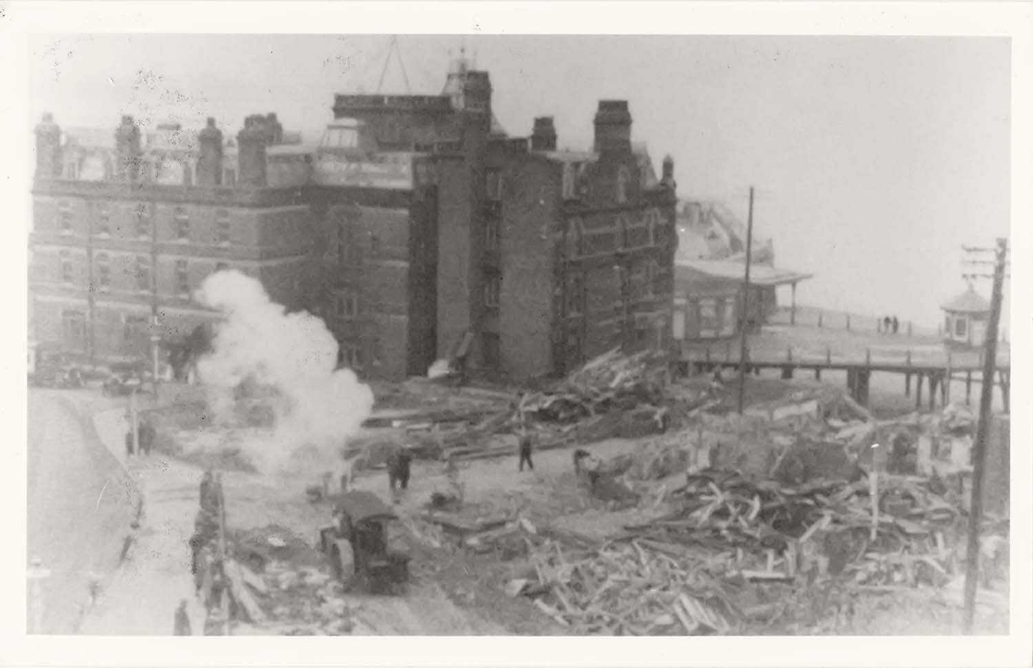
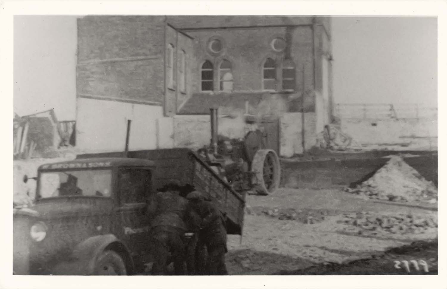
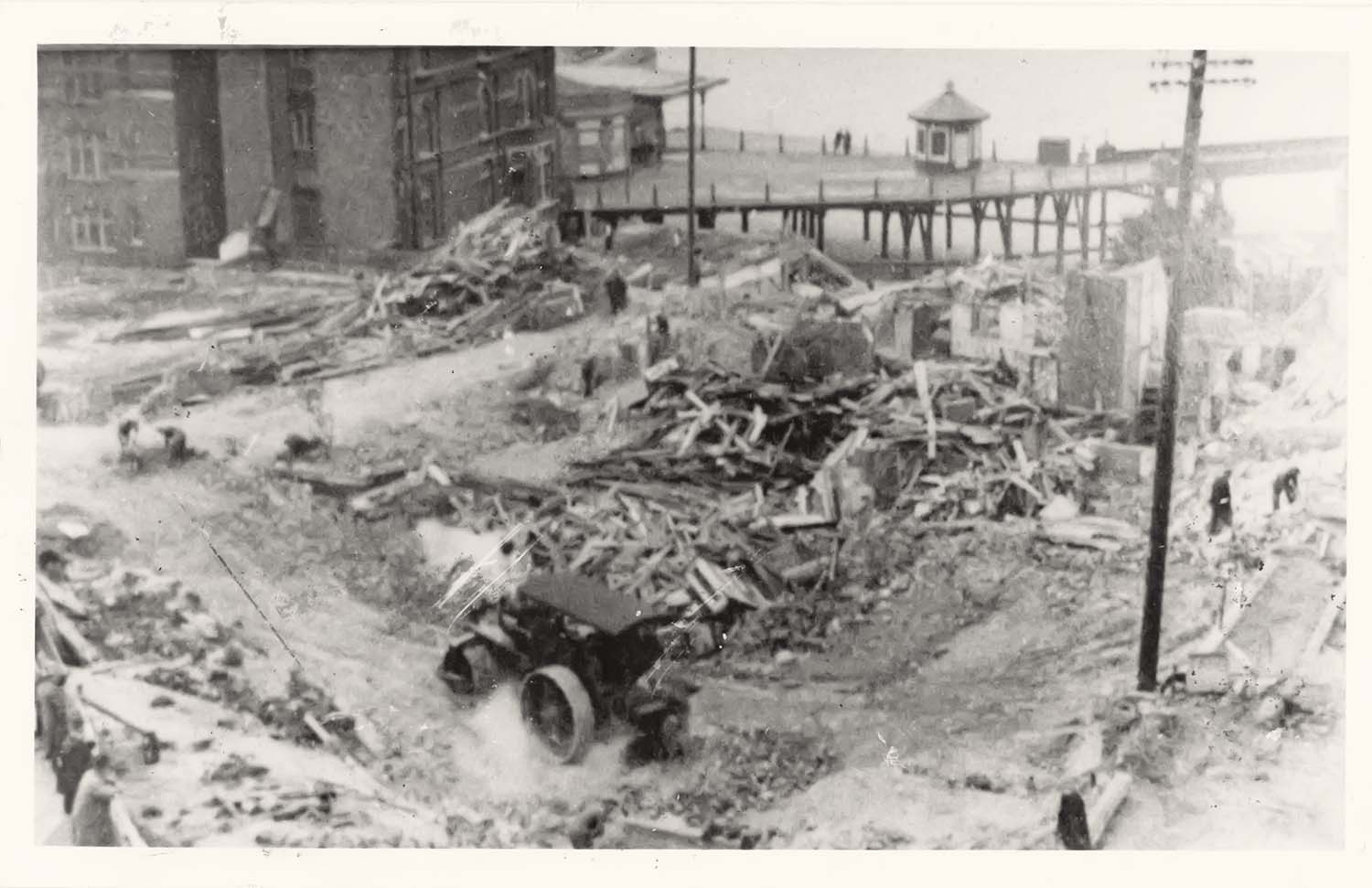
Damaged Jetty [Payne Collection] |
Frozen Sea 1963
|
![Frozen Sea [Payne Collection] | Margate History](../Pictures/Storms/Frozen Sea 1963/Payne 57-thumb.jpg) |
![Frozen Sea [Payne Collection] | Margate History](../Pictures/Storms/Frozen Sea 1963/Payne 58-thumb.jpg) |
![Frozen Sea [Payne Collection] | Margate History](../Pictures/Storms/Frozen Sea 1963/Payne 59-thumb.jpg) |
![Jetty [Payne Collection] | Margate History](../Pictures/Storms/Frozen Sea 1963/Payne 60-thumb.jpg) |
|
Frozen Sea [Payne Collection] |
Frozen Sea [Payne Collection] |
Frozen Sea [Payne Collection] |
Jetty [Payne Collection] |
![Jetty [Payne Collection] | Margate History](../Pictures/Storms/Frozen Sea 1963/Payne 61-thumb.jpg) |
![Harbour [Payne Collection] | Margate History](../Pictures/Storms/Frozen Sea 1963/Payne 63-thumb.jpg) |
![Swimming Pool [Payne Collection] | Margate History](../Pictures/Storms/Frozen Sea 1963/Payne 64-thumb.jpg) |
![Frozen Sea [Payne Collection] | Margate History](../Pictures/Storms/Frozen Sea 1963/Payne 65-thumb.jpg) |
|
Jetty [Payne Collection] |
Harbour [Payne Collection] |
Swimming Pool [Payne Collection] |
Frozen Sea [Payne Collection] |
![Frozen Sea [Payne Collection] | Margate History](../Pictures/Storms/Frozen Sea 1963/Payne 730-thumb.jpg) |
![Frozen Sea [Payne Collection] | Margate History](../Pictures/Storms/Frozen Sea 1963/Payne 731-thumb.jpg) |
![Frozen Sea [Payne Collection] | Margate History](../Pictures/Storms/Frozen Sea 1963/Payne 734-thumb.jpg) |
![Frozen Sea [Payne Collection] | Margate History](../Pictures/Storms/Frozen Sea 1963/Payne 736-thumb.jpg) |
|
Frozen Sea [Payne Collection] |
Frozen Sea [Payne Collection] |
Frozen Sea [Payne Collection] |
Frozen Sea [Payne Collection] |
![Frozen Sea [Payne Collection] | Margate History](../Pictures/Storms/Frozen Sea 1963/Payne 738-thumb.jpg) |
![Frozen Sea [Payne Collection] | Margate History](../Pictures/Storms/Frozen Sea 1963/Payne 739-thumb.jpg) |
![Frozen Sea [Payne Collection] | Margate History](../Pictures/Storms/Frozen Sea 1963/Payne 742-thumb.jpg) |
|
Frozen Sea [Payne Collection] |
Frozen Sea [Payne Collection] |
Frozen Sea [Payne Collection] |
Storm 1978
|
![Harbour [Payne Collection] | Margate History](../Pictures/Storms/Storm 1978/Payne 66-thumb.jpg) |
![Harbour [Payne Collection] | Margate History](../Pictures/Storms/Storm 1978/Payne 67-thumb.jpg) |
![Marine Terrace [Payne Collection] | Margate History](../Pictures/Storms/Storm 1978/Payne 68-thumb.jpg) |
![Jetty [Payne Collection] | Margate History](../Pictures/Storms/Storm 1978/Payne 69-thumb.jpg) |
|
Harbour [Payne Collection] |
Harbour [Payne Collection] |
Marine Terrace [Payne Collection] |
Jetty [Payne Collection] |
![Jetty [Payne Collection] | Margate History](../Pictures/Storms/Storm 1978/Payne 74-thumb.jpg) |
![Jetty [Payne Collection] | Margate History](../Pictures/Storms/Storm 1978/Payne 75-thumb.jpg) |
![Jetty [Payne Collection] | Margate History](../Pictures/Storms/Storm 1978/Payne 76-thumb.jpg) |
![Jetty [Payne Collection] | Margate History](../Pictures/Storms/Storm 1978/Payne 77-thumb.jpg) |
|
Jetty [Payne Collection] |
Jetty [Payne Collection] |
Jetty [Payne Collection] |
Jetty [Payne Collection] |
![Jetty [Payne Collection] | Margate History](../Pictures/Storms/Storm 1978/Payne 78-thumb.jpg) |
![Jetty [Payne Collection] | Margate History](../Pictures/Storms/Storm 1978/Payne 79-thumb.jpg) |
![Jetty [Payne Collection] | Margate History](../Pictures/Storms/Storm 1978/Payne 80-thumb.jpg) |
|
Jetty [Payne Collection] |
Jetty [Payne Collection] |
Jetty [Payne Collection] |
The end of the Jetty
|
![Jetty demolition [Payne Collection] | Margate History](../Pictures/Storms/End of Jetty 1998/Payne81-thumb.jpg) |
![Jetty demolition [Payne Collection] | Margate History](../Pictures/Storms/End of Jetty 1998/Payne82-thumb.jpg) |
![Jetty demolition [Payne Collection] | Margate History](../Pictures/Storms/End of Jetty 1998/Payne83-thumb.jpg) |
|
Jetty demolition [Payne Collection] |
Jetty demolition [Payne Collection] |
Jetty demolition [Payne Collection] |
November 4 2012
|
Pictures of Old Margate added to the OS 1907 Map
|
 |
|
 |
 |
|
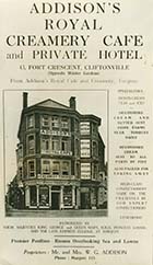
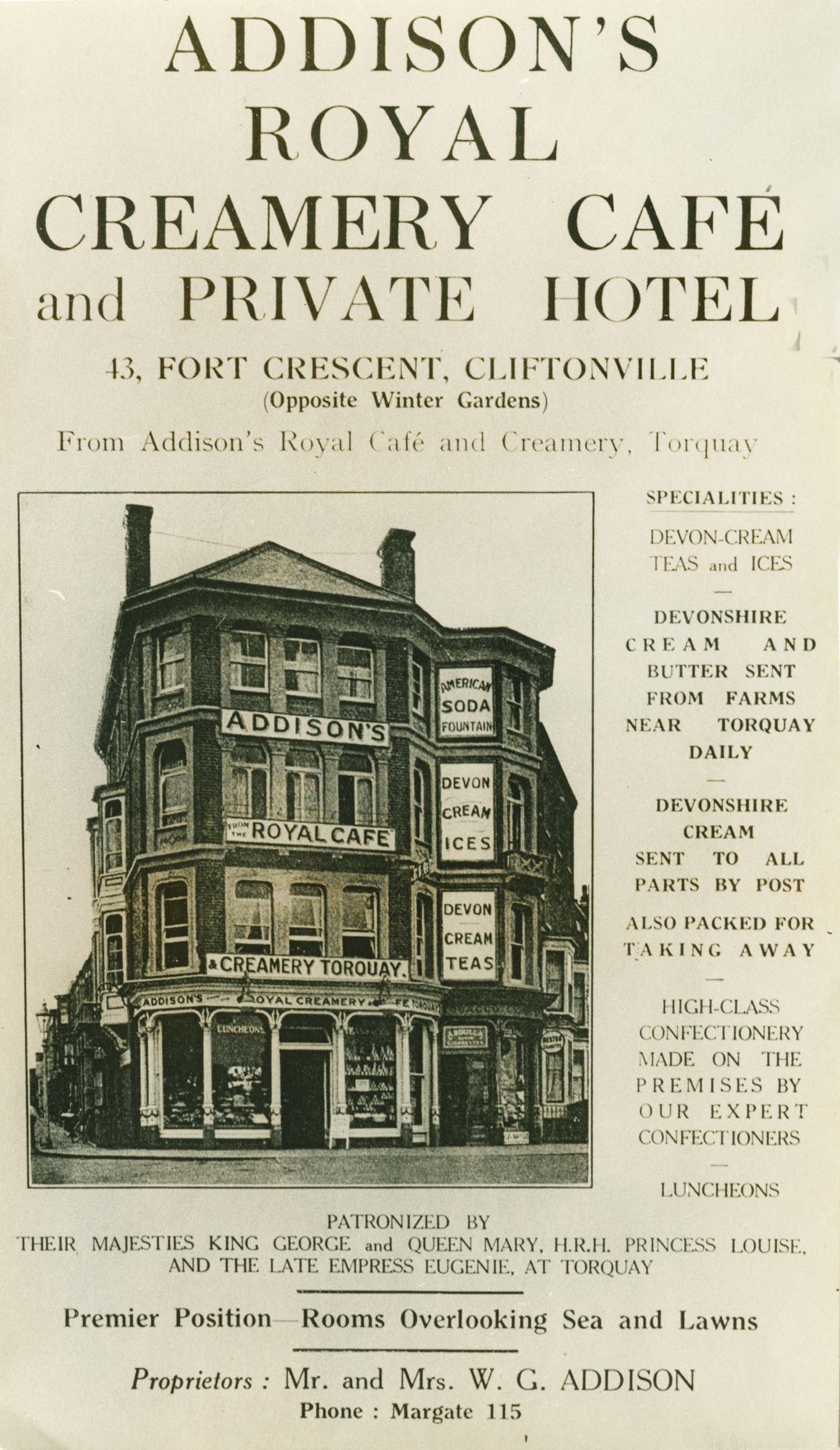
Fort Crescent/Addisons Cafe |
Fort Road/Fountain Inn [Houghton] |
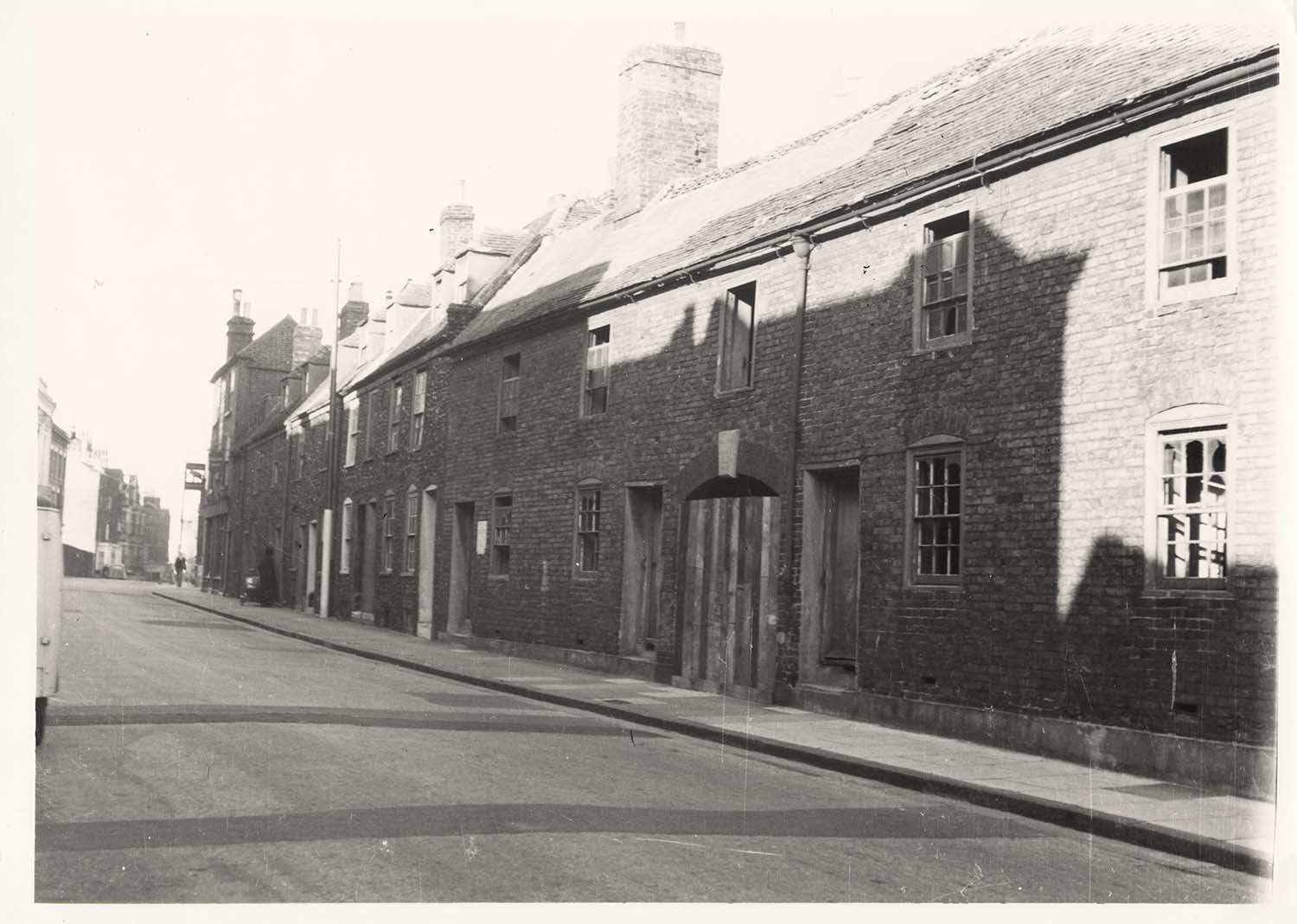
Garden Row |
Garden Row |
 |
 |
 |
 |
|
Garden Row |
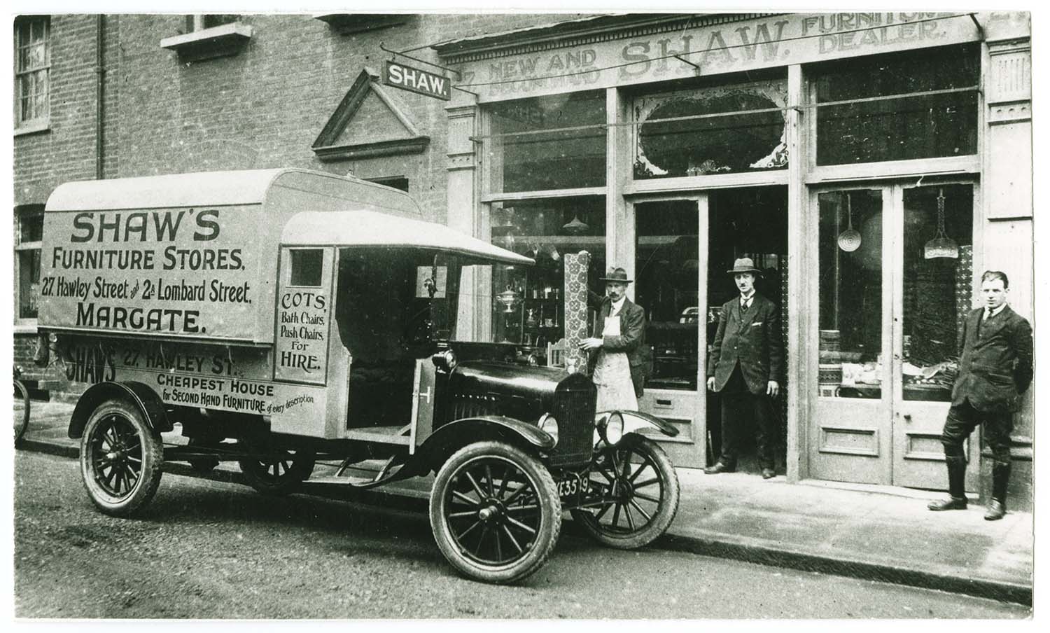
Hawley St/No 27 Shaw's Furniture Stores |
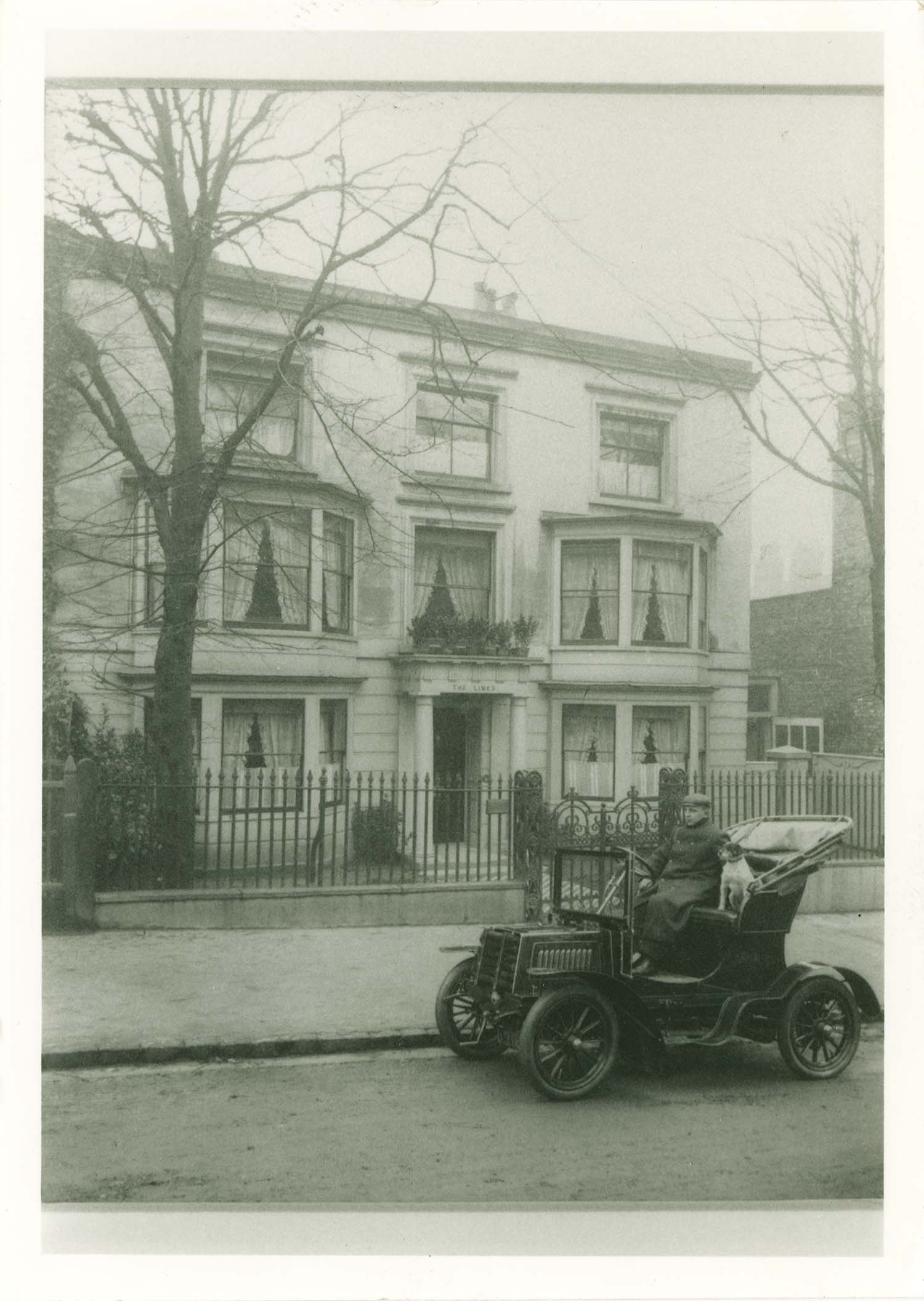
Hawley St/Doctor's car outside The Limes |
Hawley Street/No 16 J Clarks shop 1910 |
 |
 |
 |
 |
|
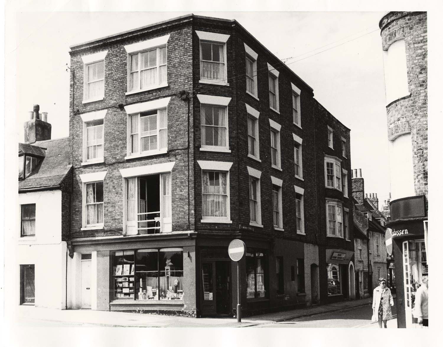
Hawley Street/Lombard Street corner |
Hawley Street/India House |
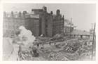
Hawley Street/Margate College bomb damage |
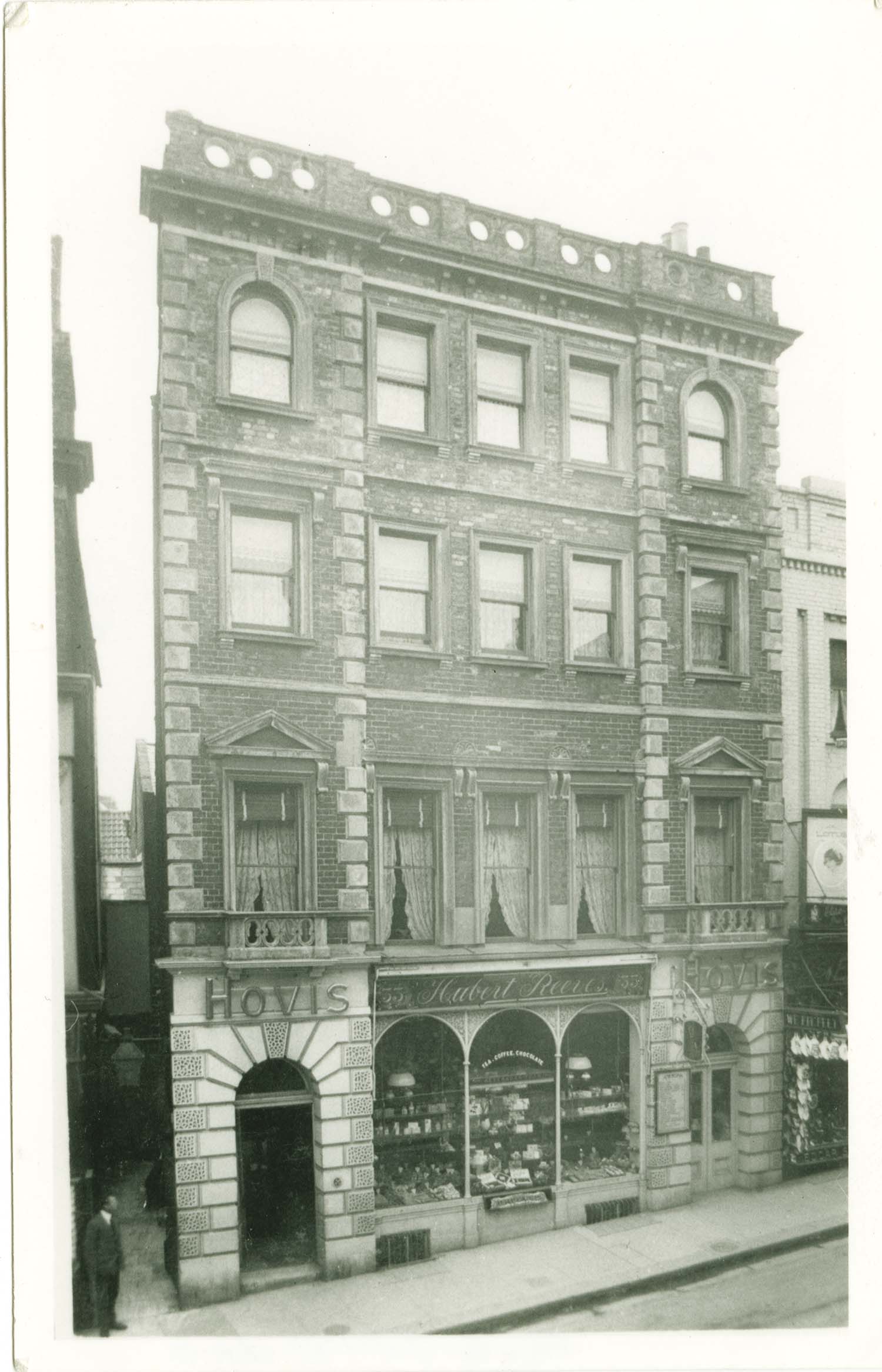
High Stree/No 33 Hubert Reeves baker |
 |
 |
 |
 |
|
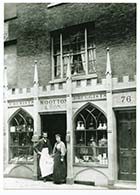
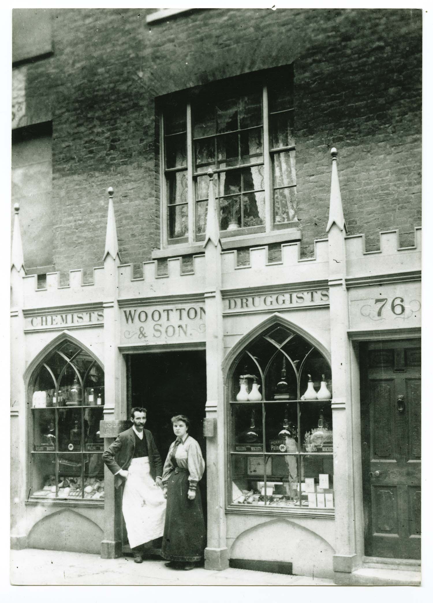
High Street/No 76 Wootton Chemists |
High street/No 106a Nov 1926 Prince of Wales visit |
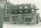
High Street/No 142 corner Grosvenbor Hill demolition |
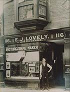
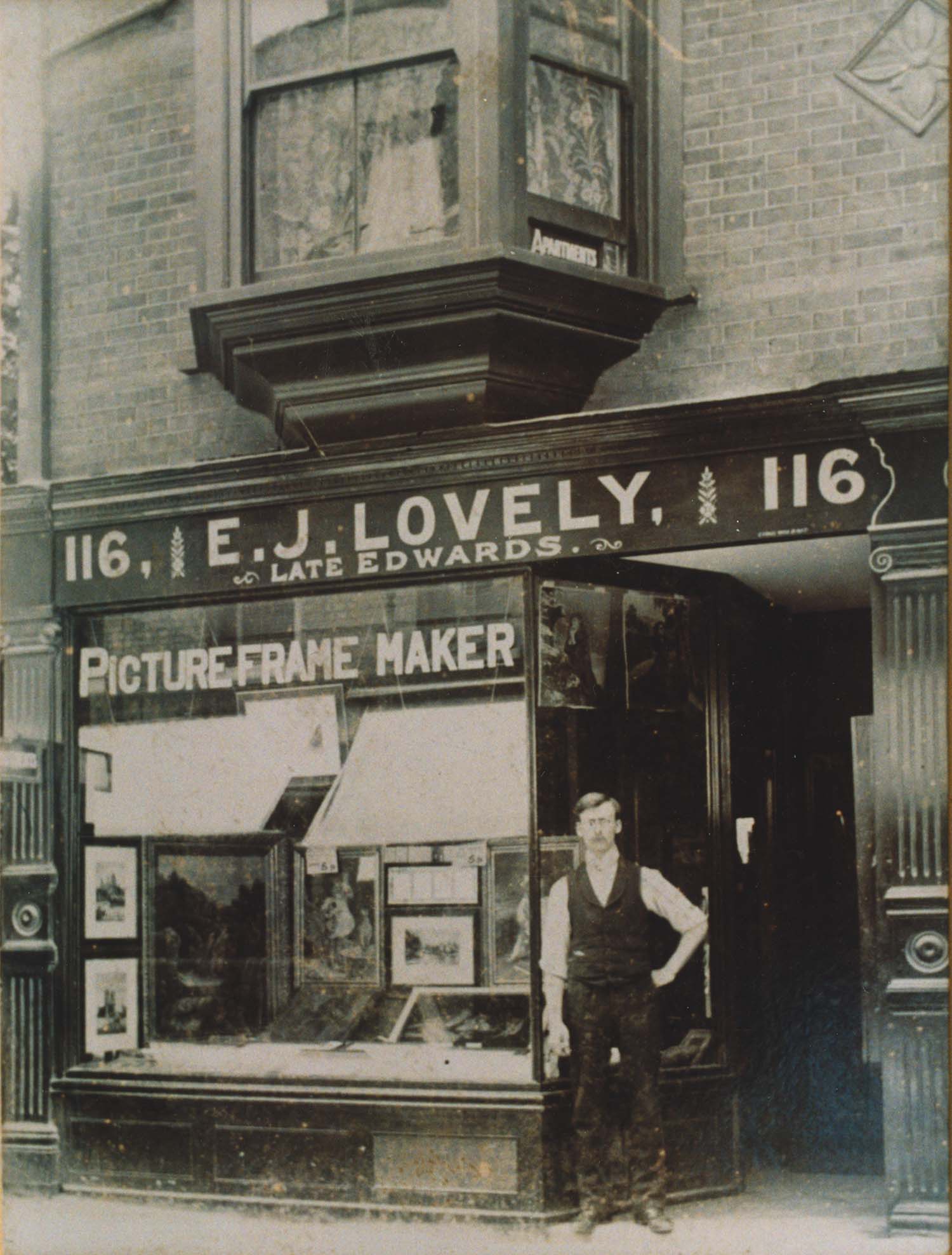
High Street/No 116 E.J. Lovely |
October 25 2012
|
Pictures of Old Margate added to the OS 1907 Map
|
 |
 |
![Byron Road/Mrs Chapman [Twyman collection] | Margate History](../Pictures/Photos/Modern/Old Margate/Byron Road Mrs Chapman-thumb.jpg) |
 |
|
Aerial view Fort Hill/Cobbs Brewery 1937 |
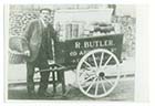
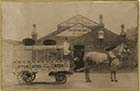
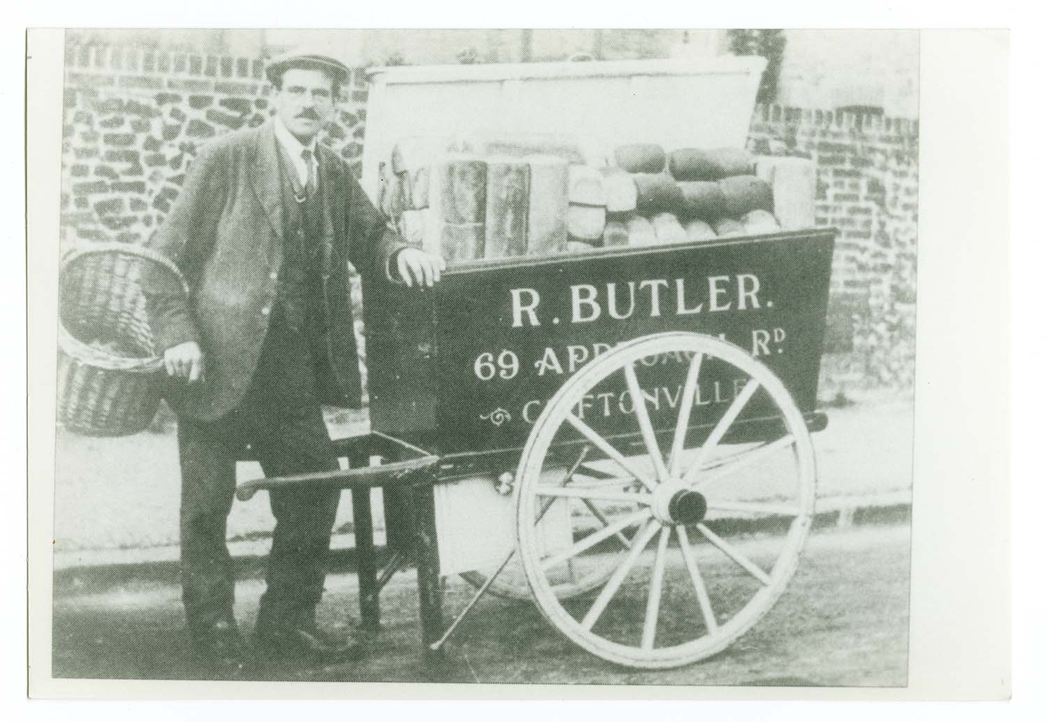
R. Butler 69 Approach Road/ Bakers handcart |
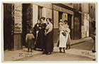
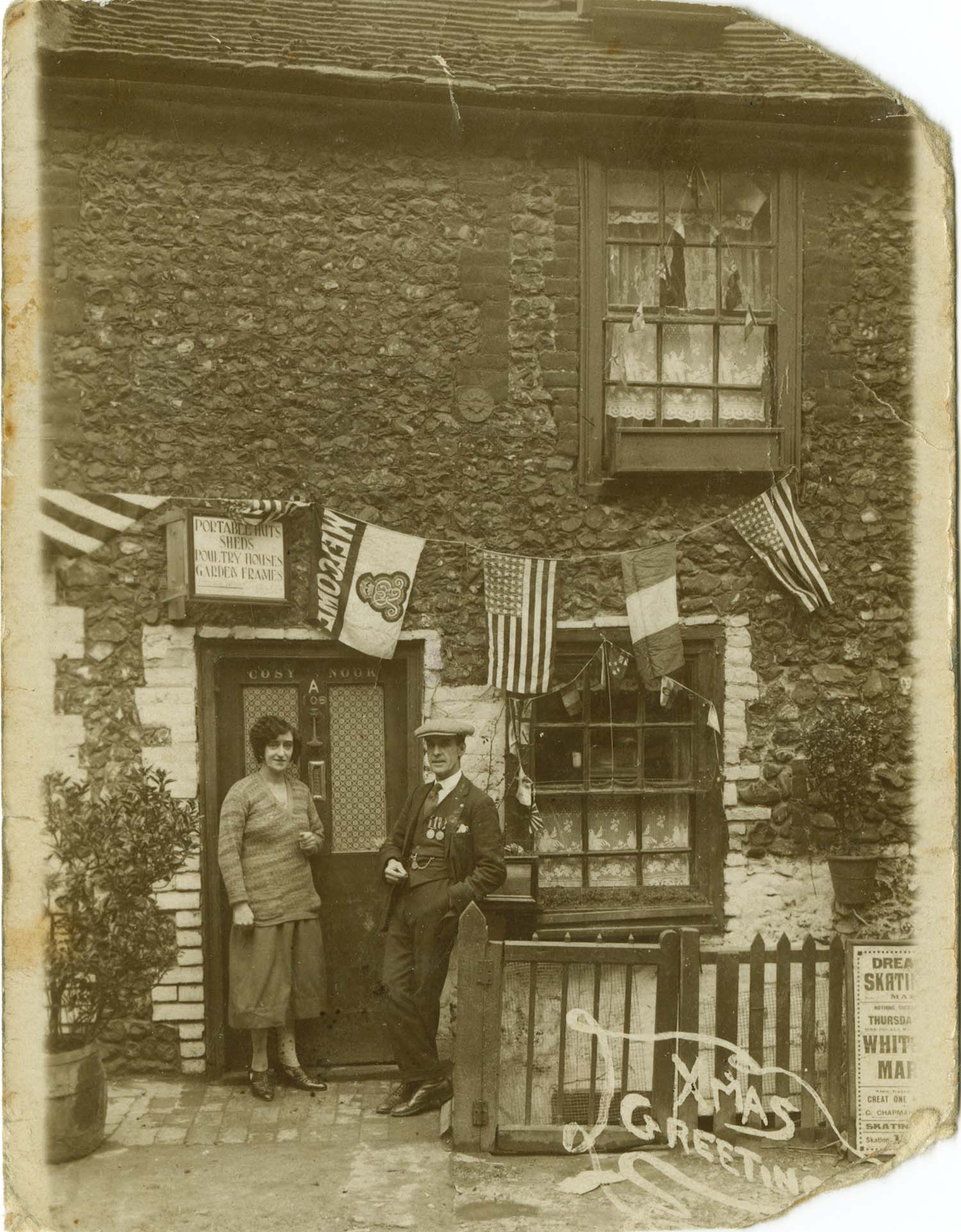
Byron Road/Mrs Chapman [Twyman collection] |
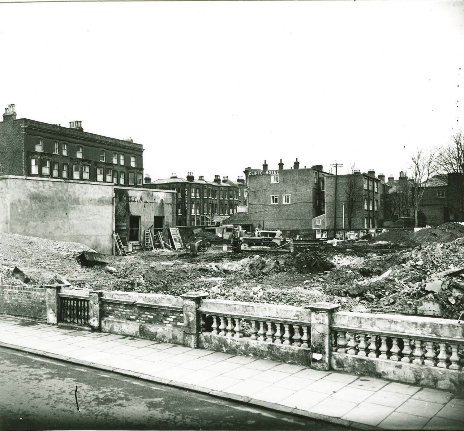
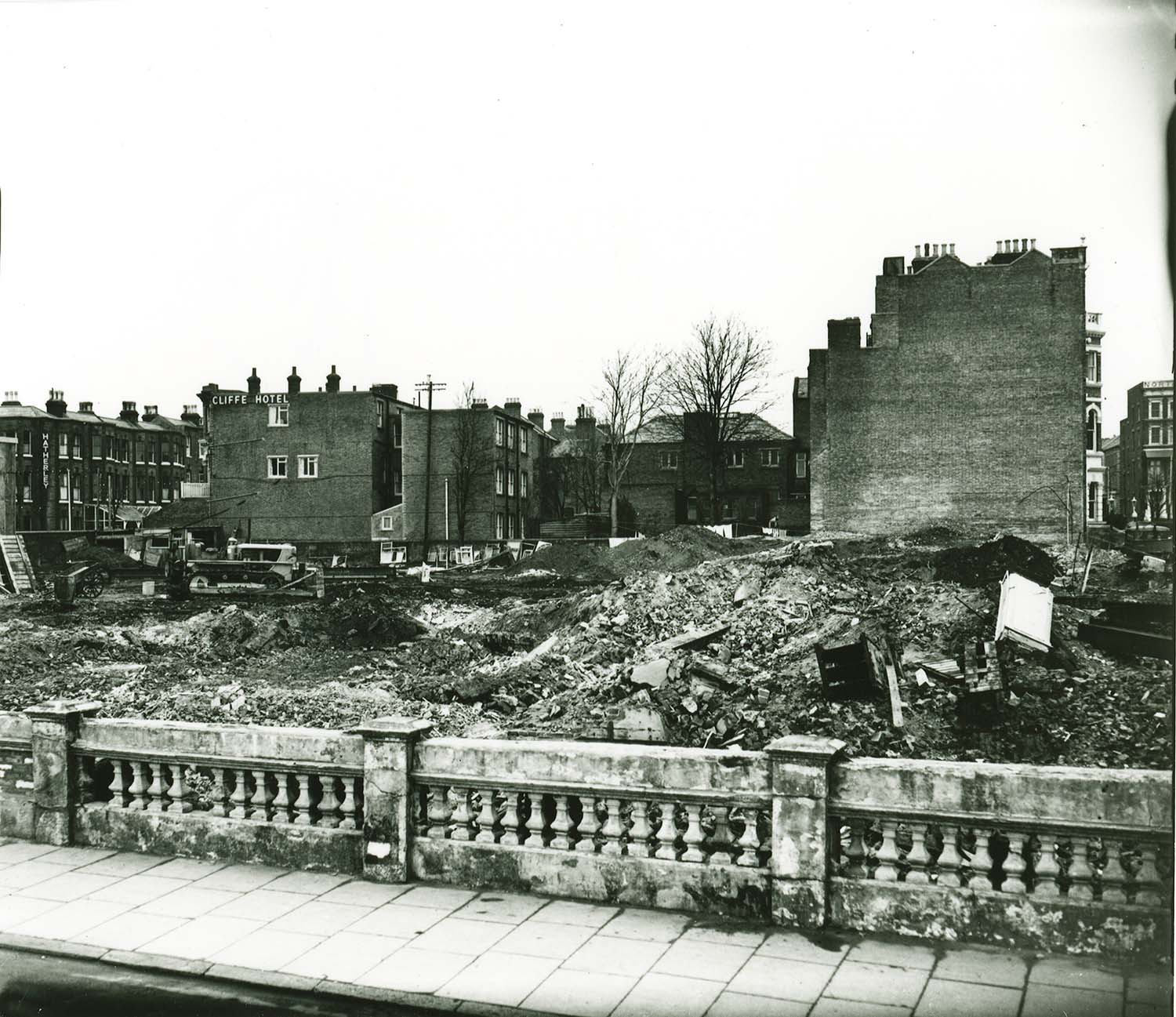
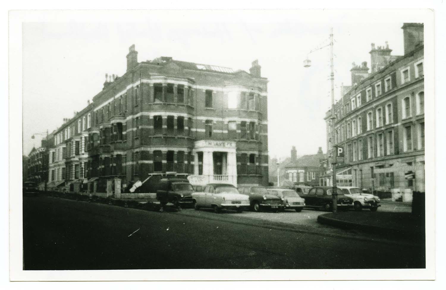
Canterbury Road/demolition of Harveys Hotel 1967 |
 |
 |
 |
 |
|
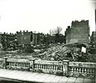
Cecil square/Hippodrome 1964 |
Cecil square after demolition of Hippodrome |
Charlotte Square looking towards Rogers the baker |
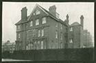
Churchfields/Churchfield House |
 |
 |
 |
 |
|
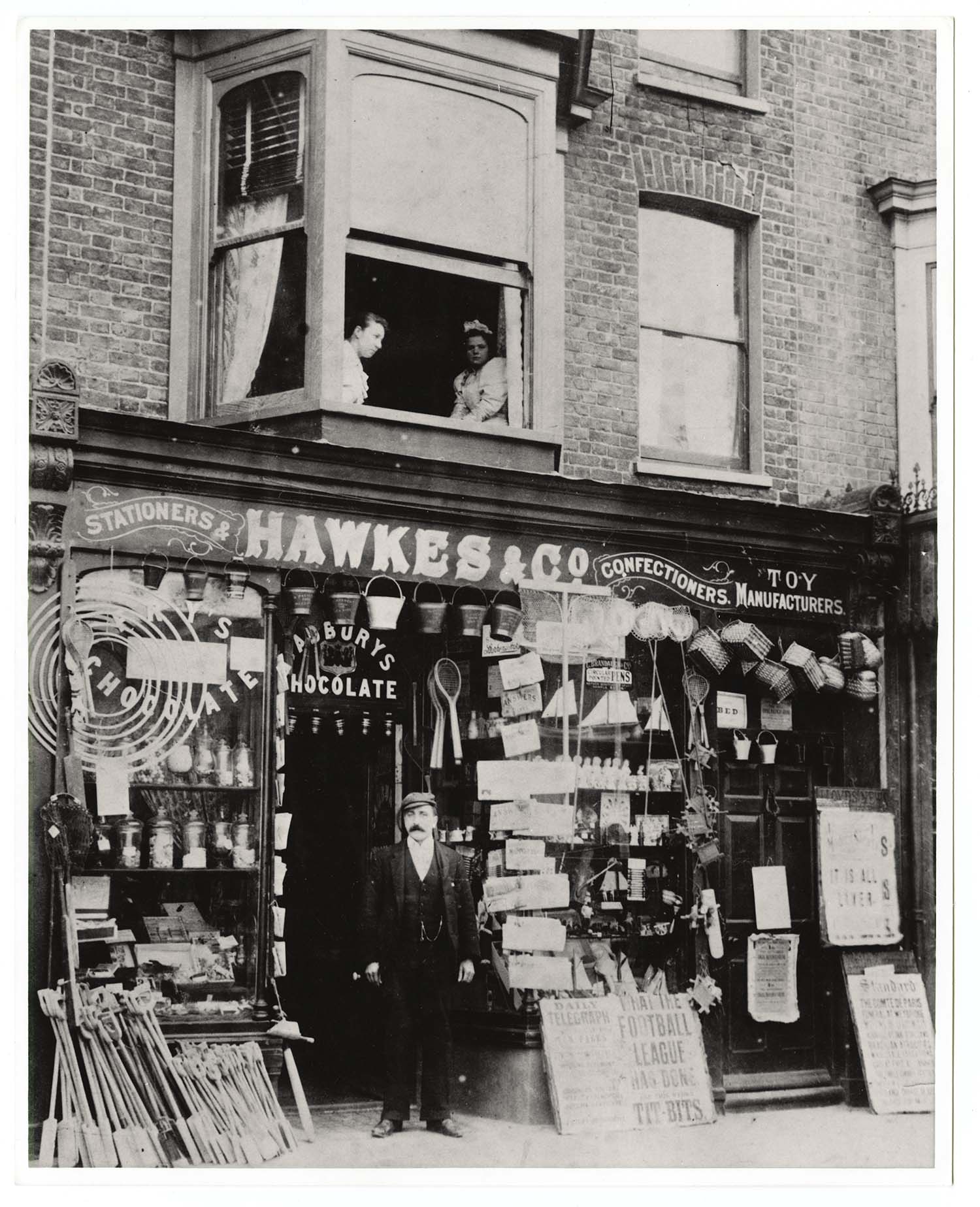
Cliff Terrace/Hawkes & Co. ca 1900 |
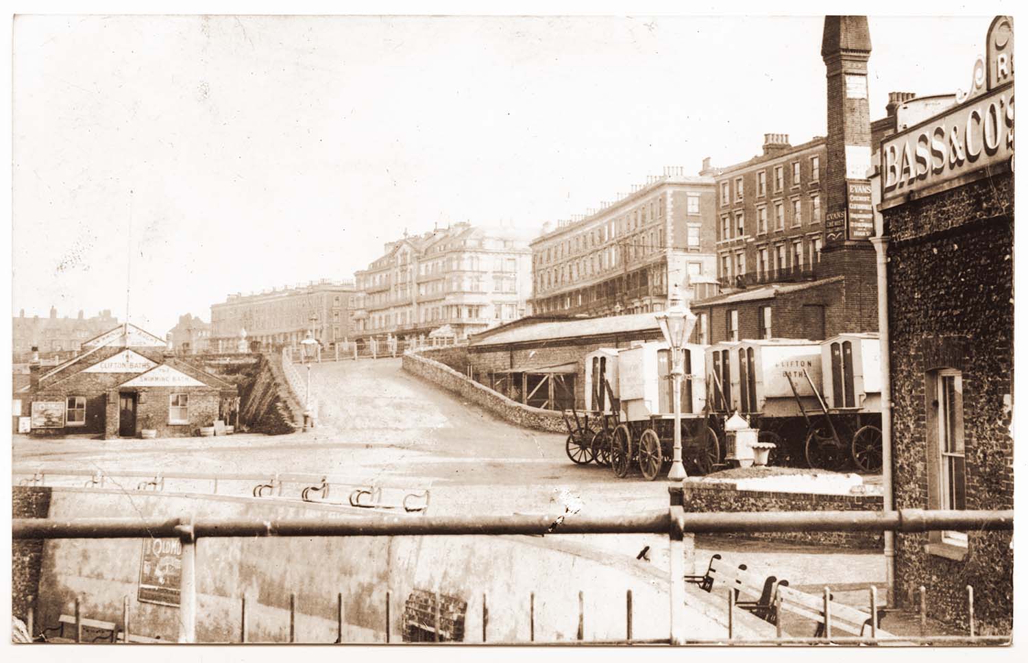
Clifton Baths ca 1895 |
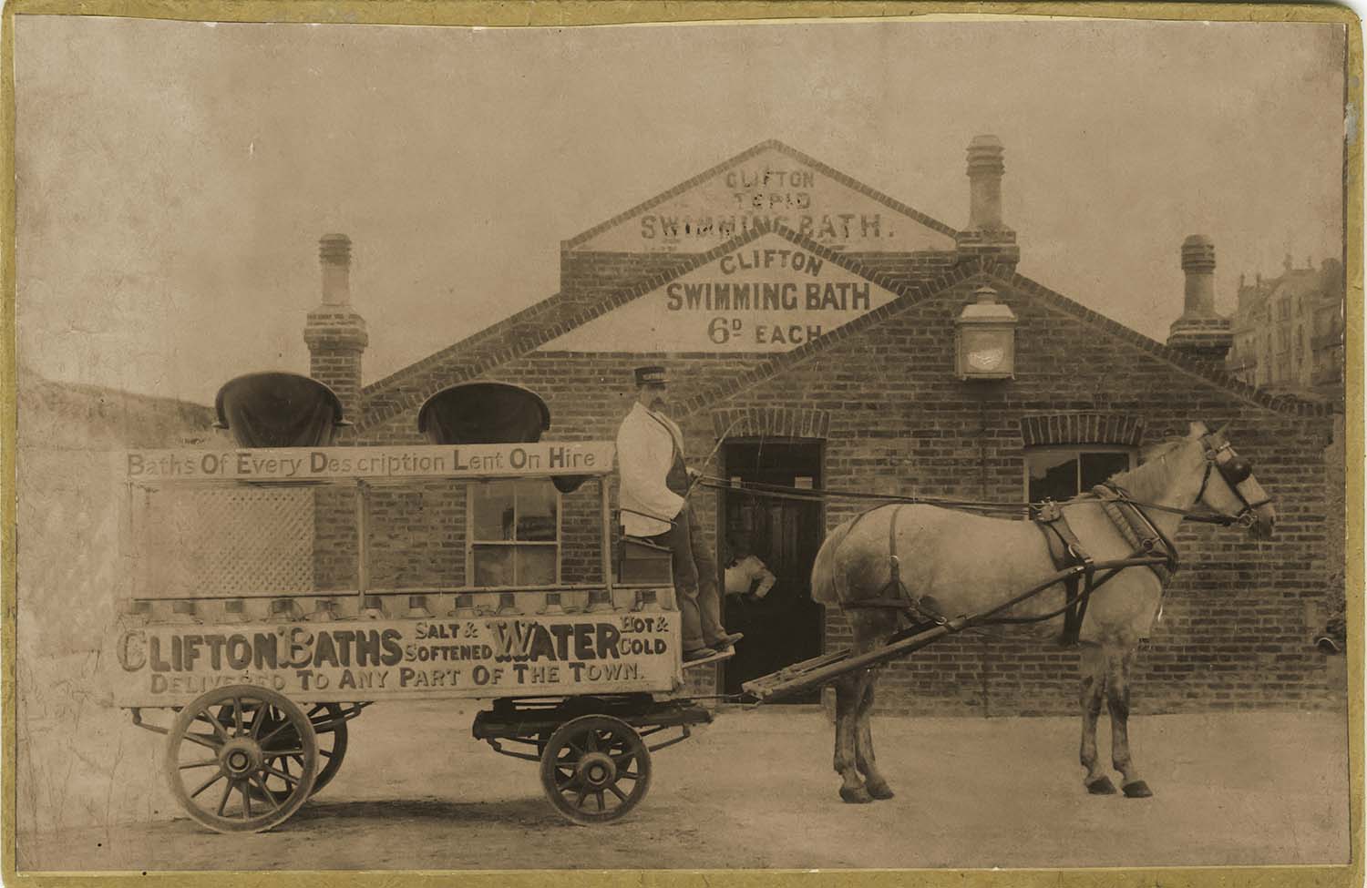
Clifton Swimming Bath ca 1886 |
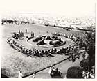
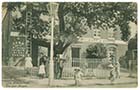
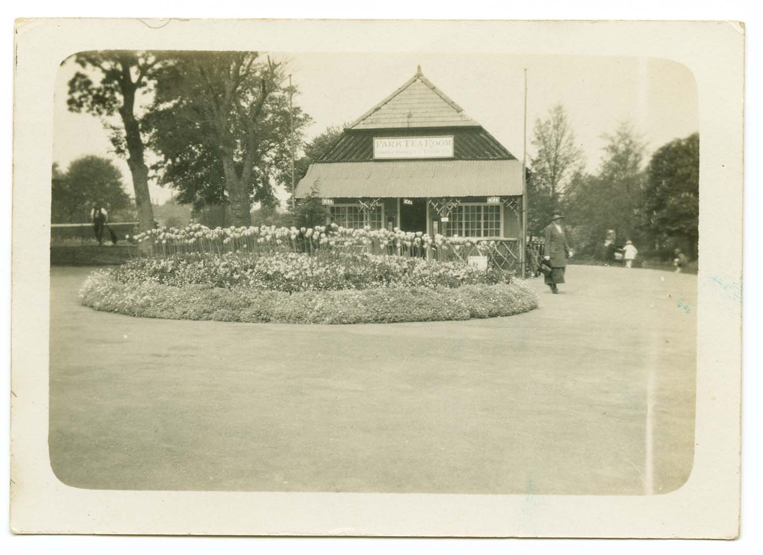
Dane Park Tea Room |
 |
 |
 |
 |
|
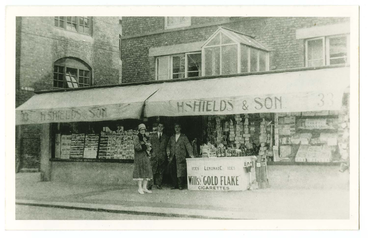
Dane Road/H Shields,No. 33 1930s |
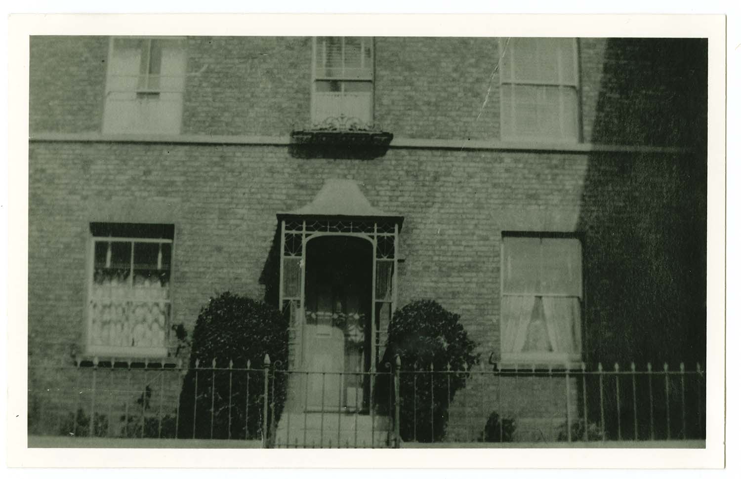
Dane Road/ Shields house No.33, pre 1920s |
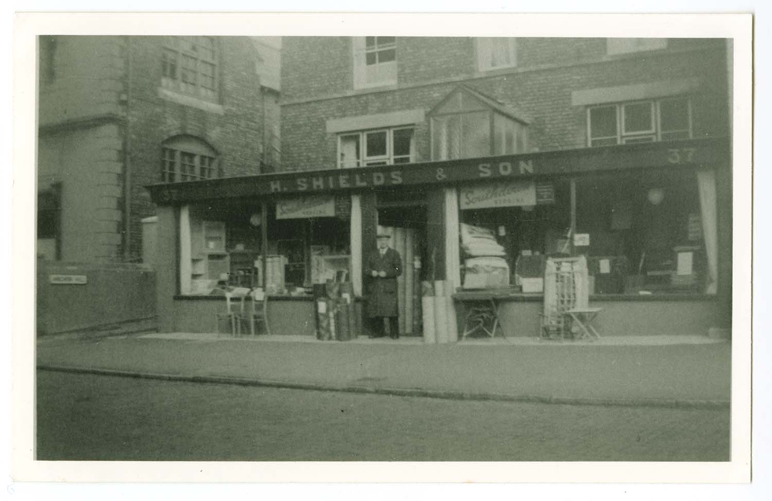
Dane Road/H Shields, No. 37, 1960 |
Dixons Court |
October 7 2012
|
Pictures of Stanley House School (Clarendon Road, Margate) ca 1920 kindly provided by Lyn Offord
|
 |
 |
 |
 |
|
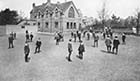
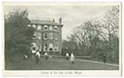
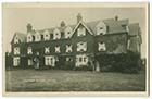
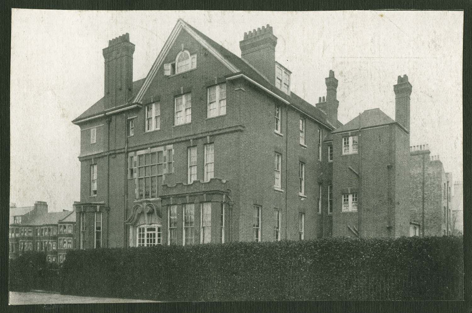
Stanley House School ca 1920s |
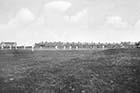
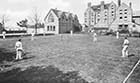
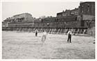
Stanley House School cricket field ca 1920s |
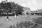
Stanley House School croquet lawn ca 1920s |
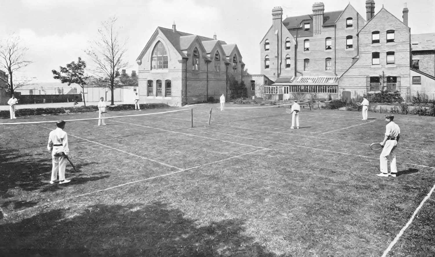
Stanley House School tennis courts ca 1920s |
 |
 |
 |
 |
|
Stanley House School playground ca 1920s |
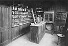
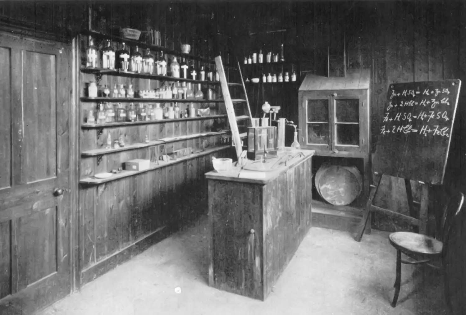
Stanley House School chemistry lab ca 1920s |
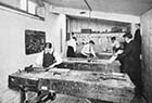
Stanley House School woodwork shop ca 1920s |
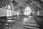
Stanley House School school room ca 1920s |
 |
 |
 |
 |
|
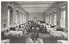
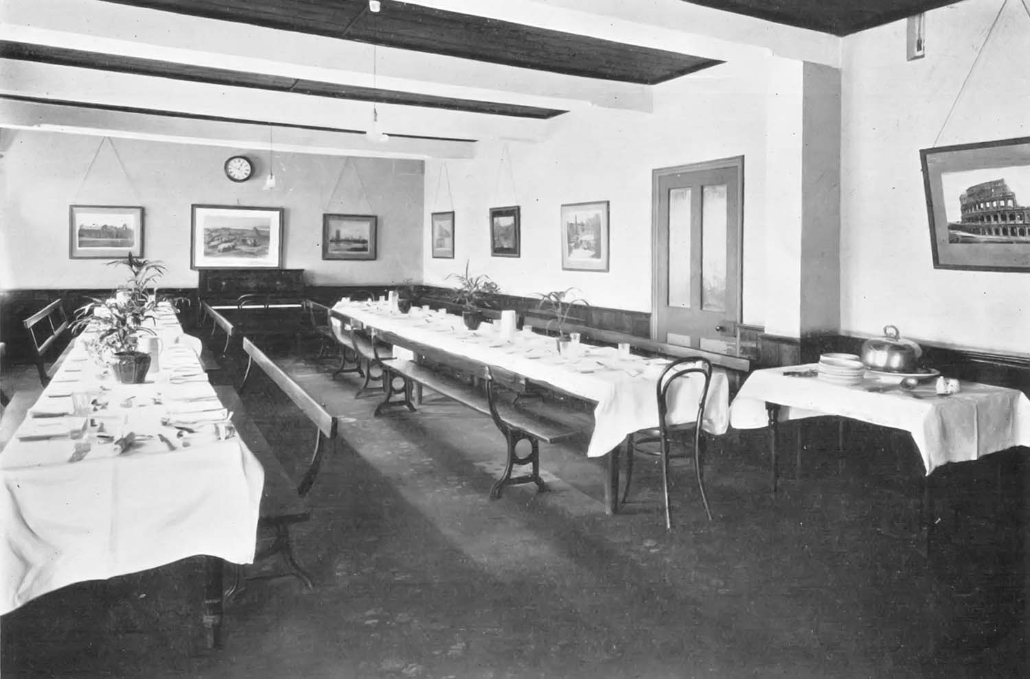
Stanley House School dining room ca 1920s |
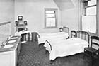
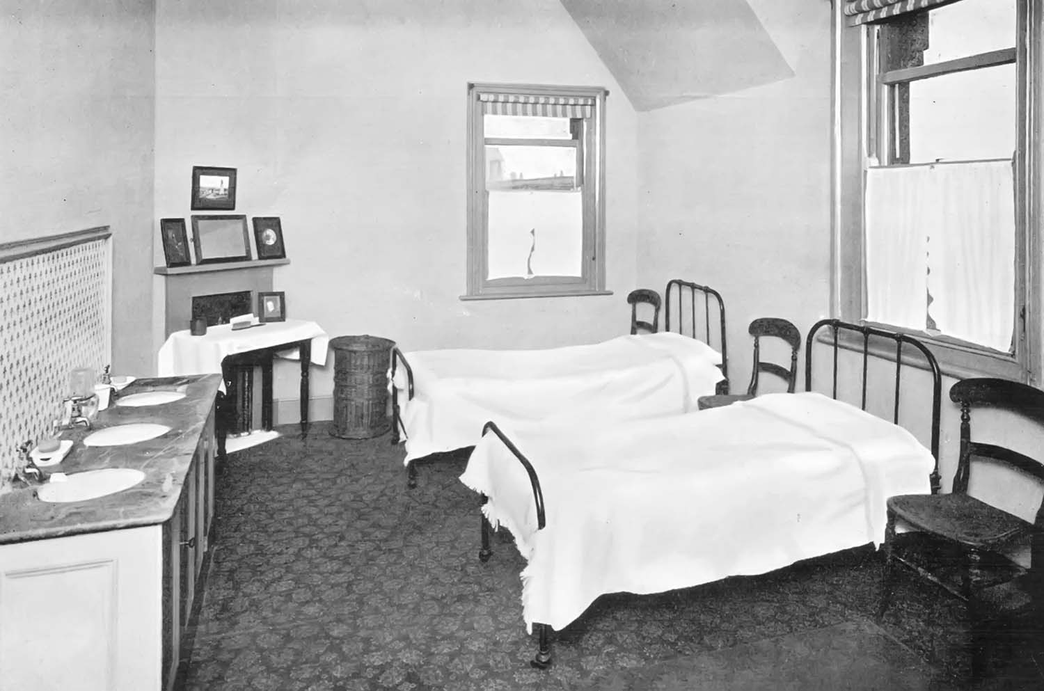
Stanley House School dormitory ca 1920s |
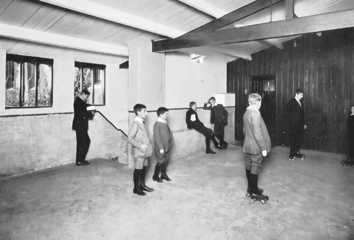
Stanley House School roller skating ca 1920s |
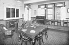
Stanley House School reading room ca 1920s |
 |
|
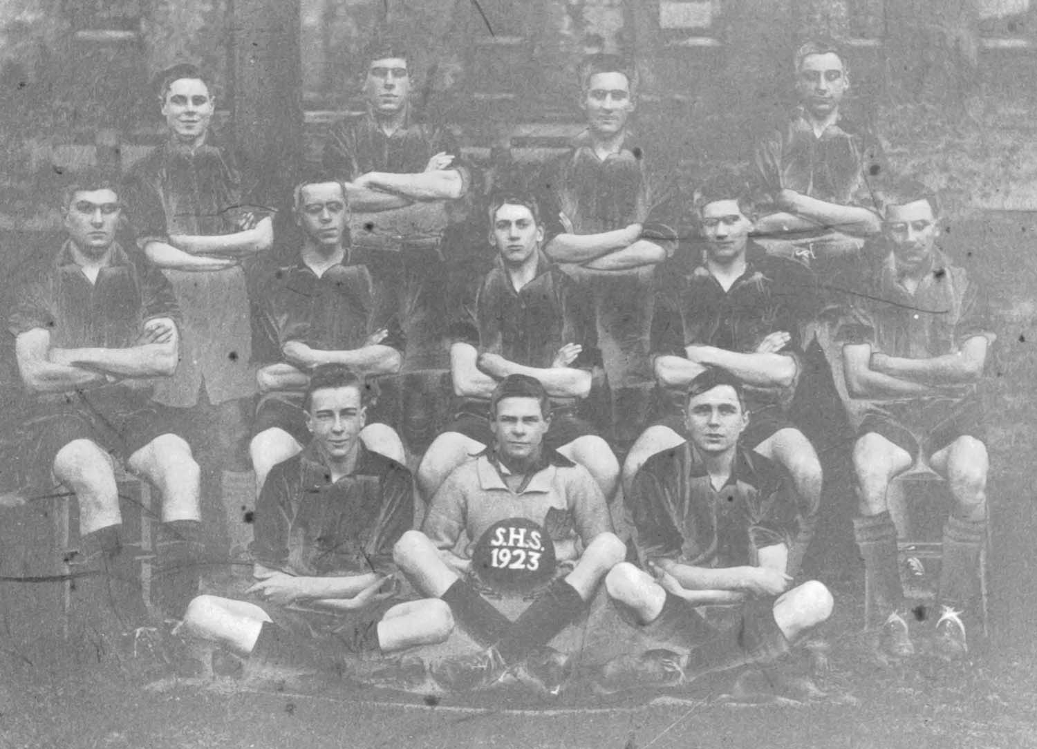
Stanley House School Football team 1923 |
September 6 2012
|
Pictures of the Zion Place/Flint Row area added to the 1907 Ordnance Survey Map of Margate.
|
 |
 |
 |
 |
|
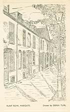
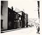
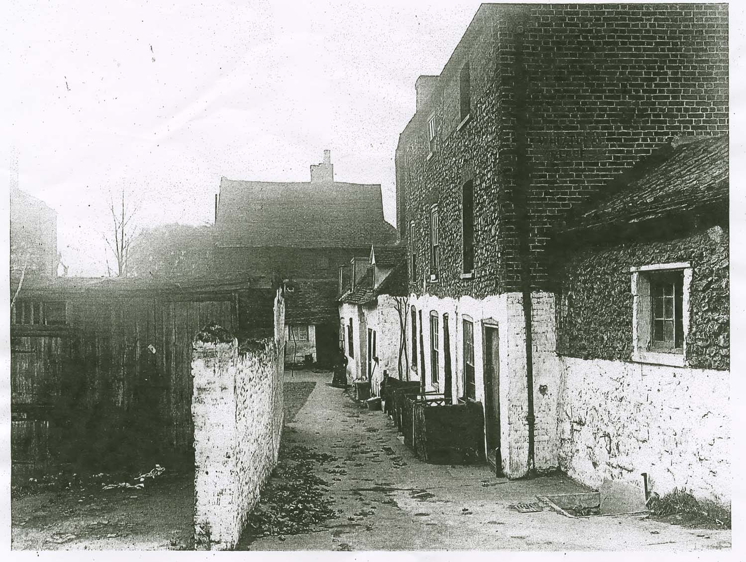
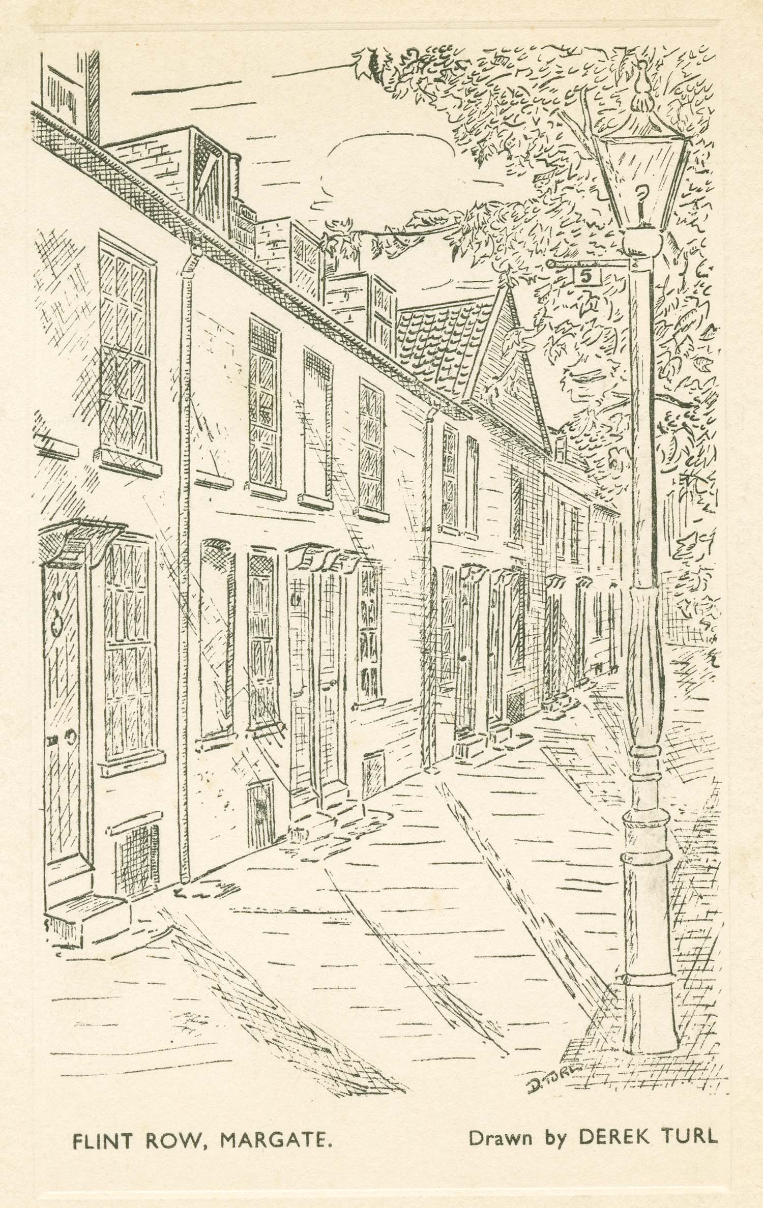
Flint Row |
Flint Row from gardens |
Flint Row junction with Northumberland Road |
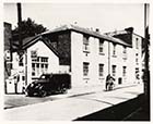
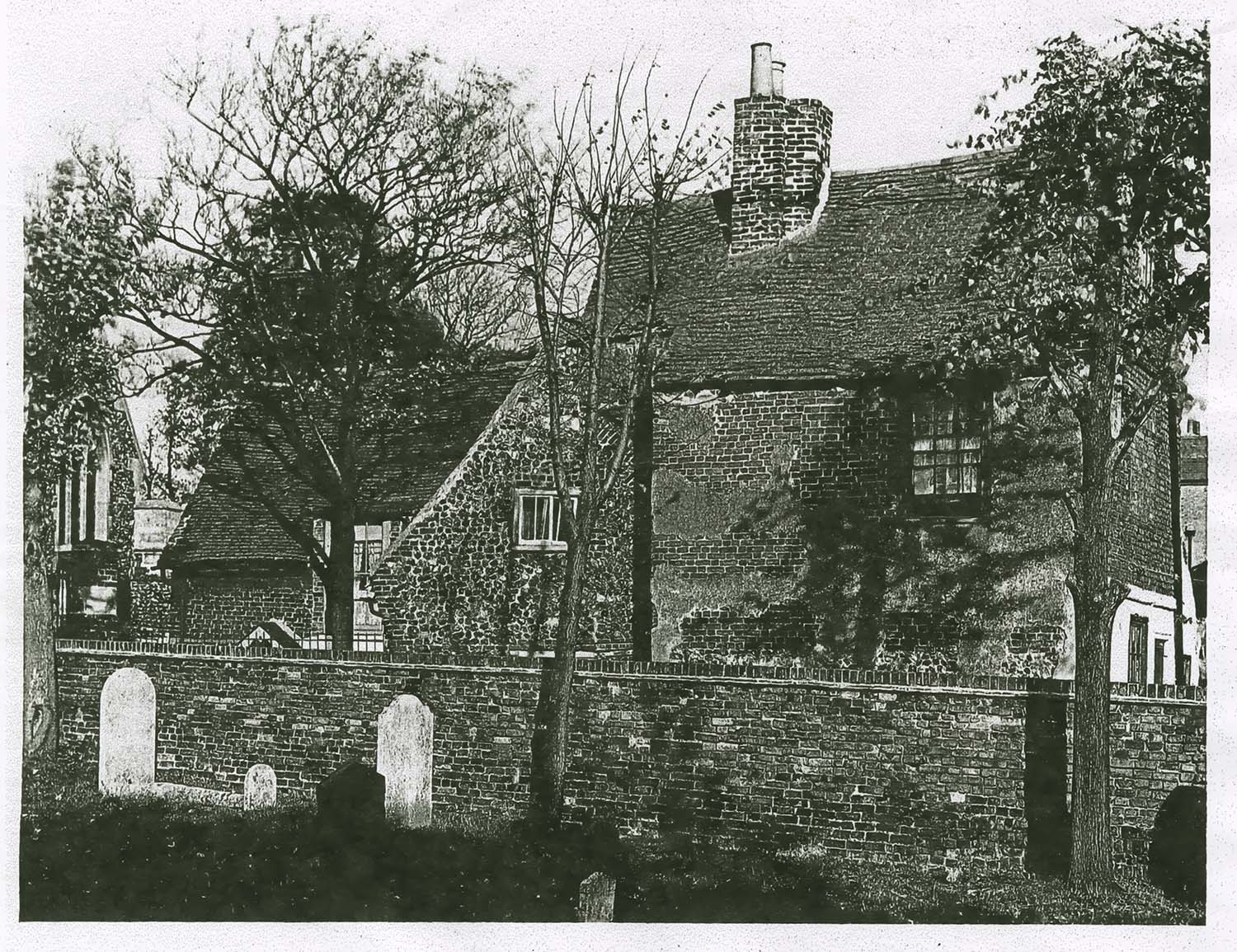
Flint Cottage (Gloucester Lodge) |
 |
 |
 |
 |
|
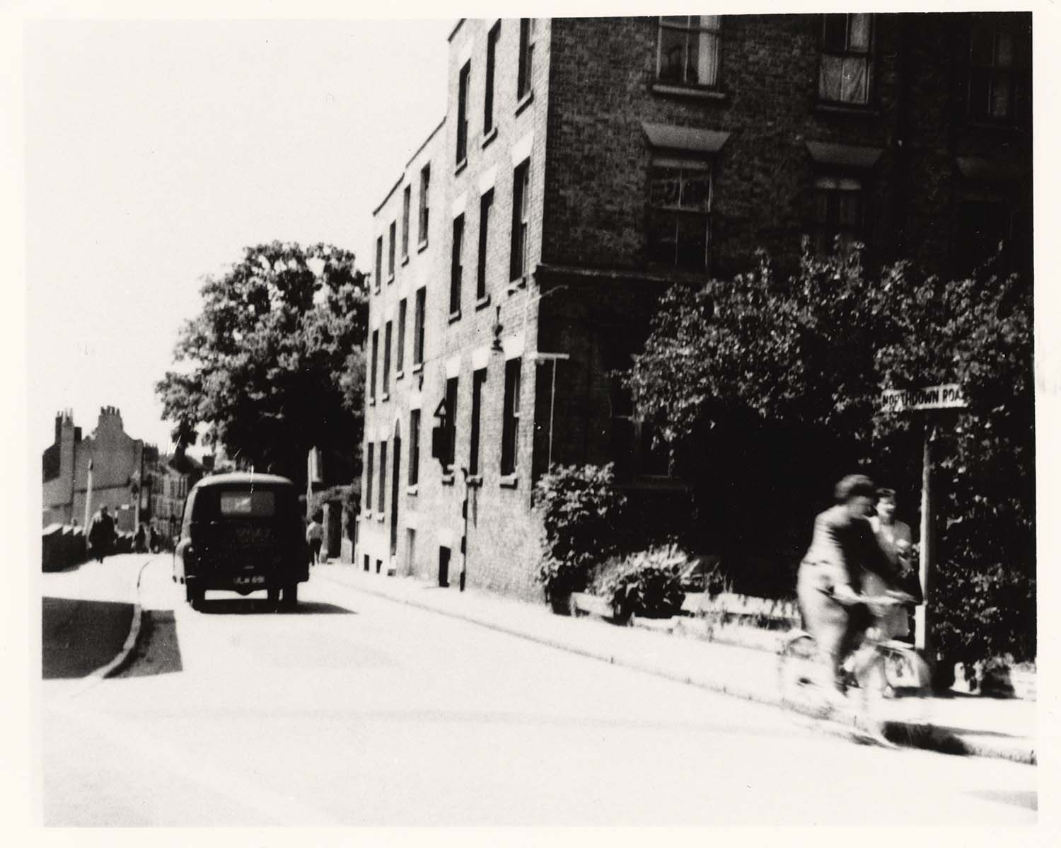
Northumberland (Northdown) Road looking towards Zion Place |
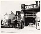
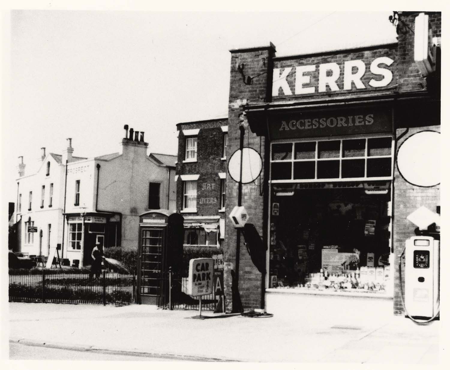
Northumberland (Northdown) Road Kerrs Garage 1960 |
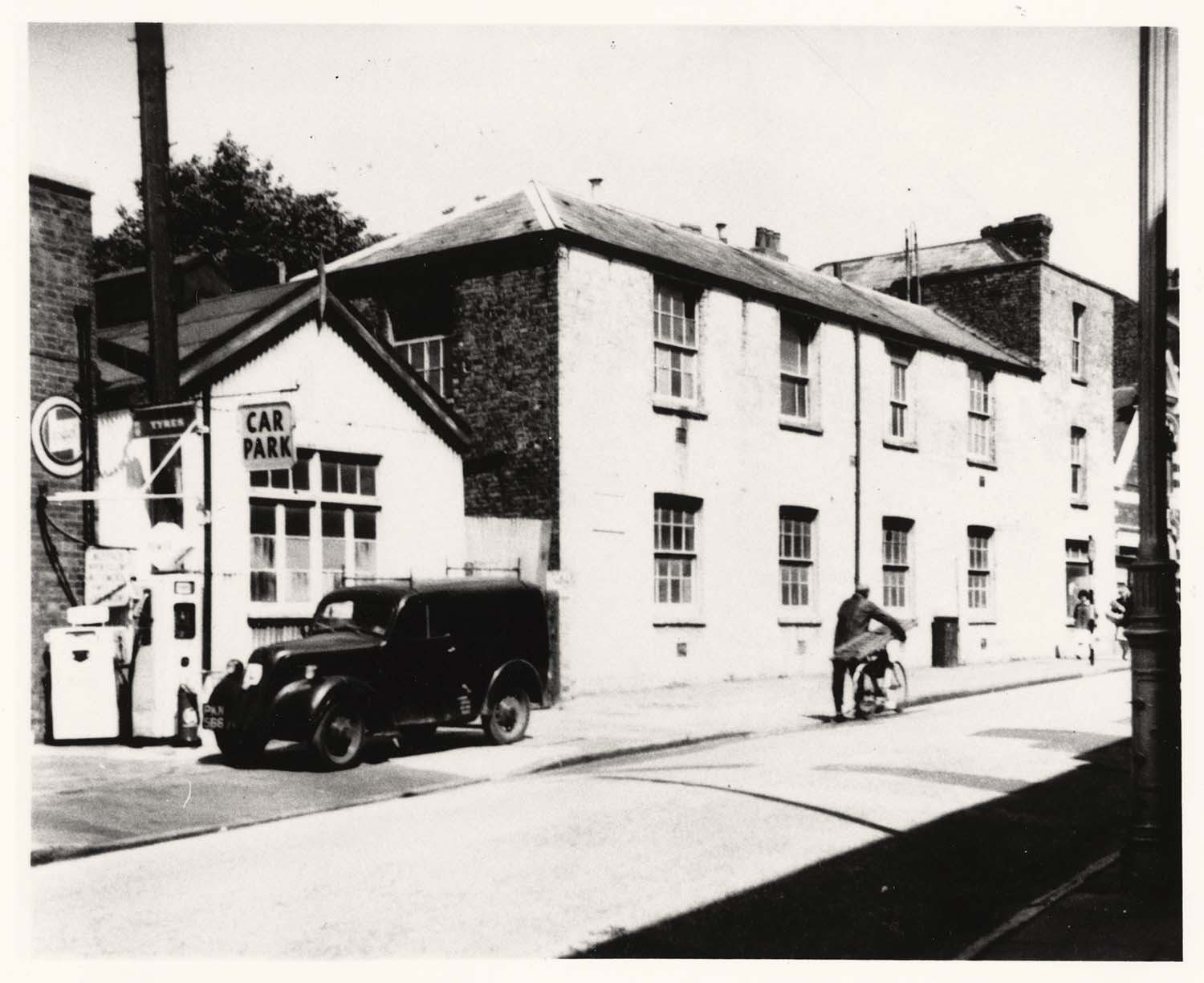
Northumberland (Northdown) Road West Ham Convalescent Home 1960 |
Northumberland (Northdown) Road West Ham Convalescent Home 1960 |
 |
 |
 |
 |
|
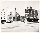
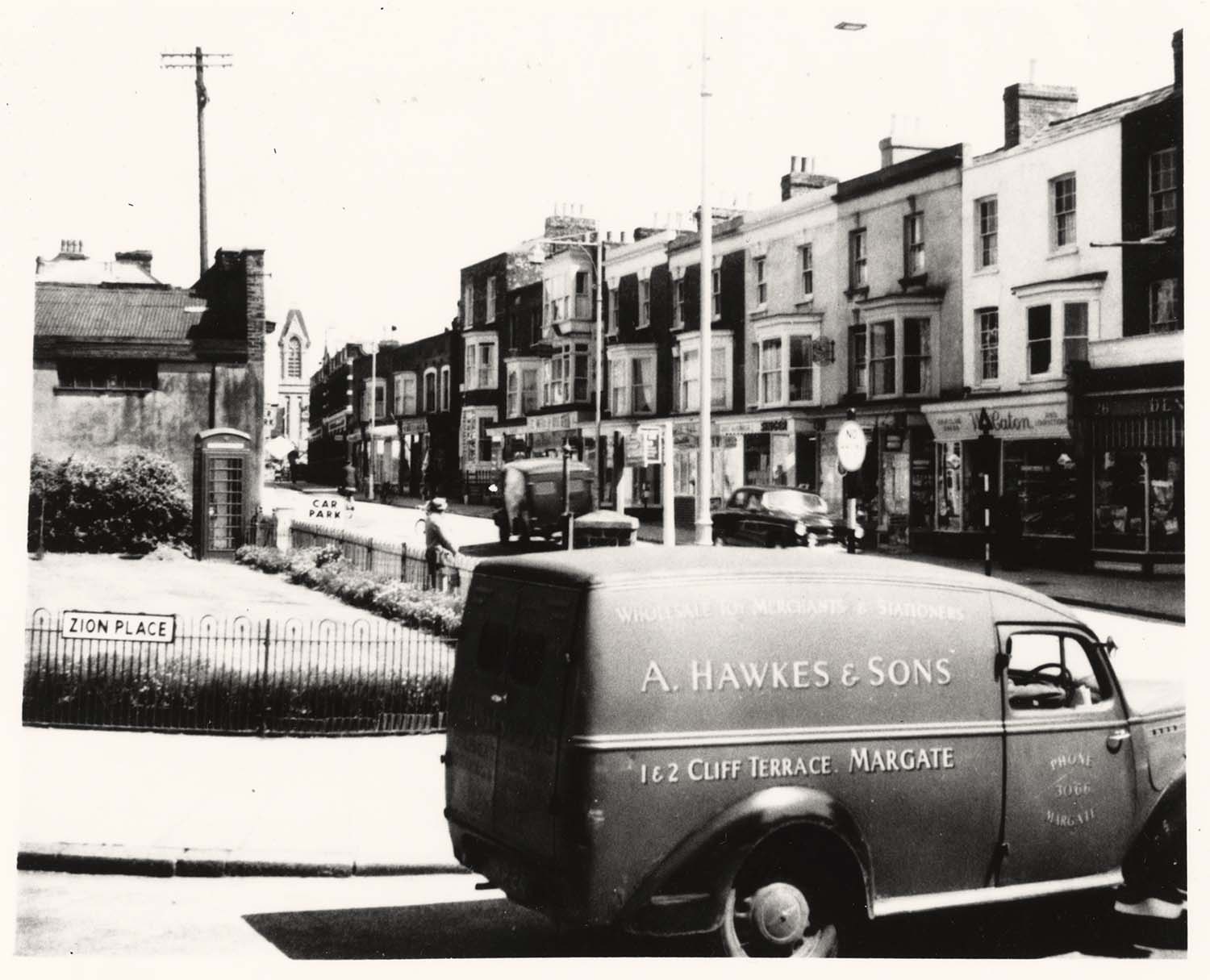
Zion Place/Northdown Road junction 1960 |
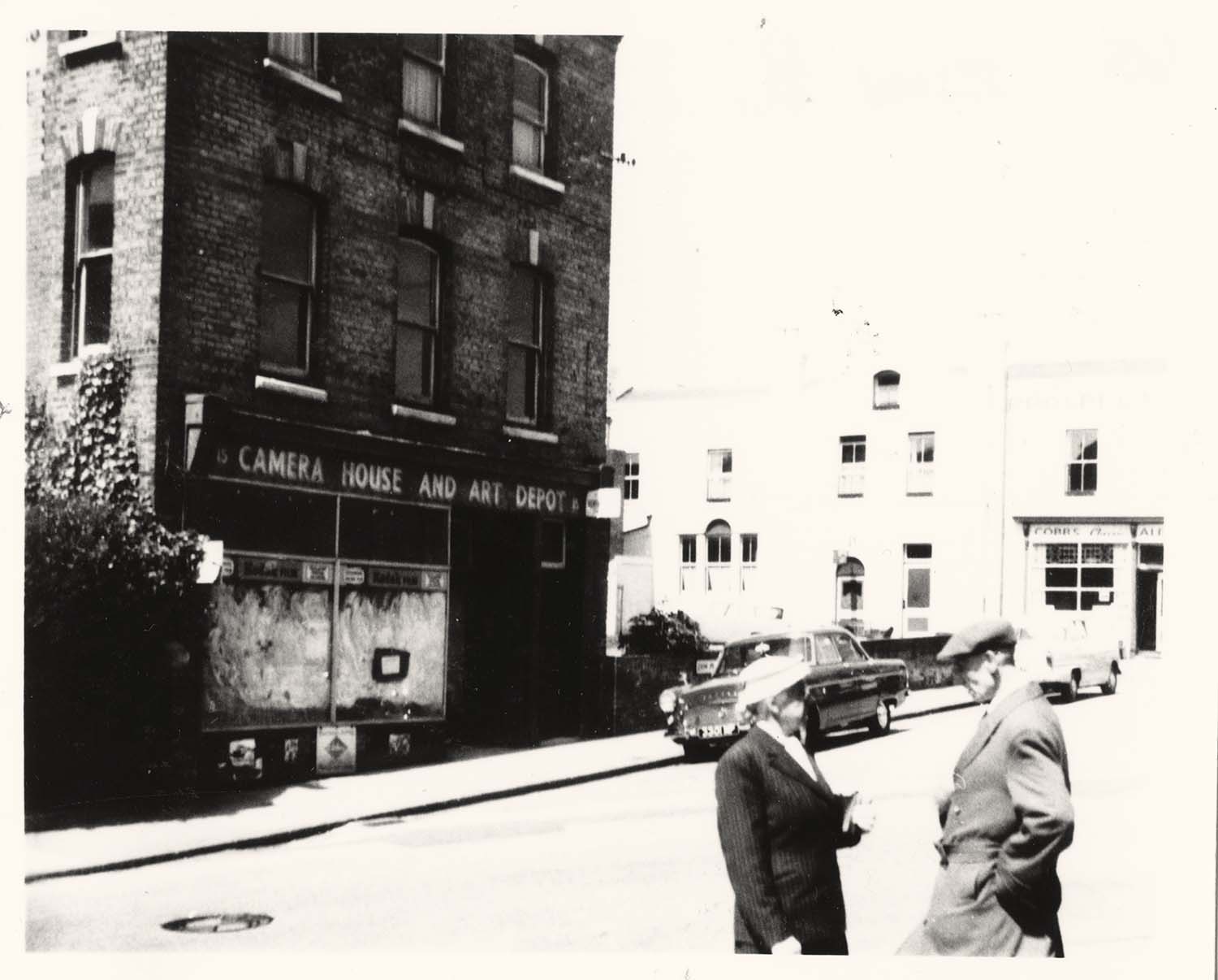
Camera house No 15 Northdown Road/Zion Place junction 1960 |
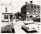
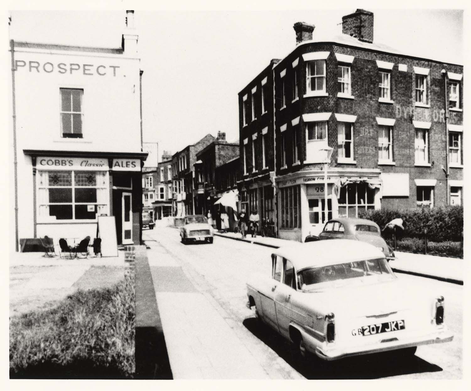
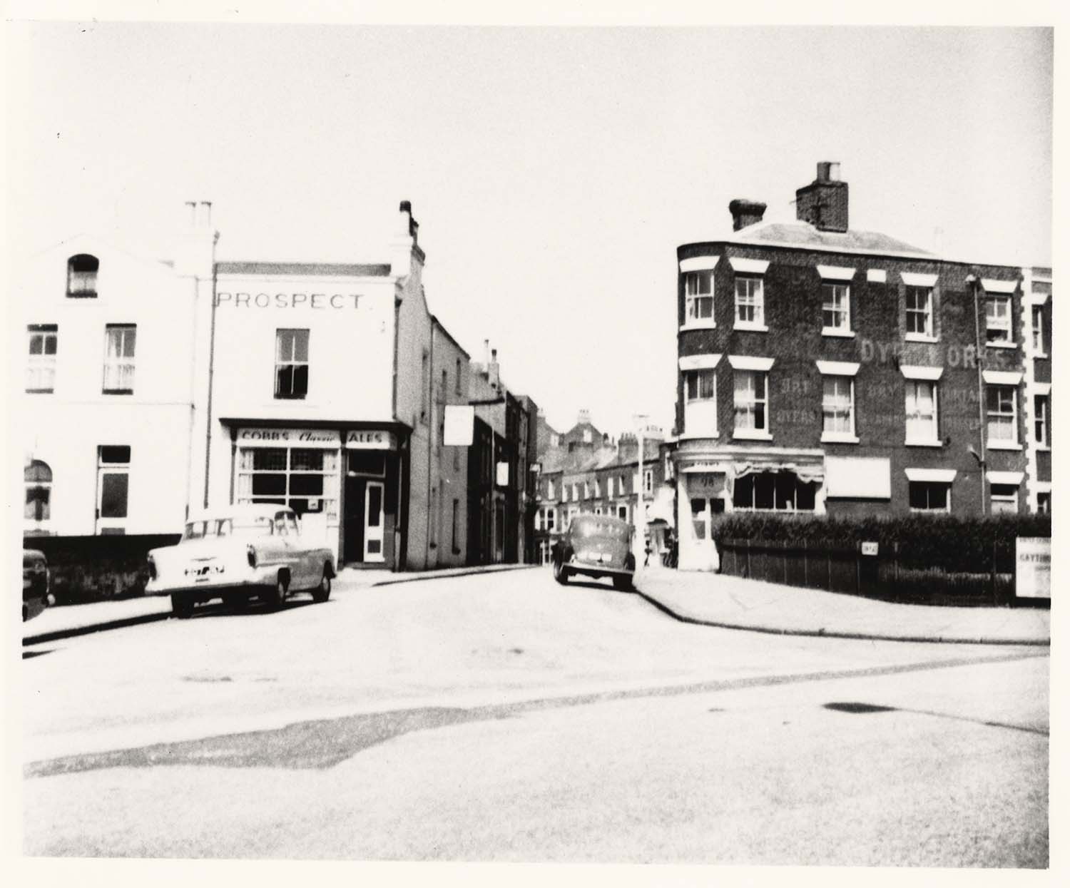
Zion Place/Prospect Inn from Northdown Rd 1960 |
Zion Place/Prospect Inn from Northdown Rd 1960 |
 |
 |
 |
 |
|
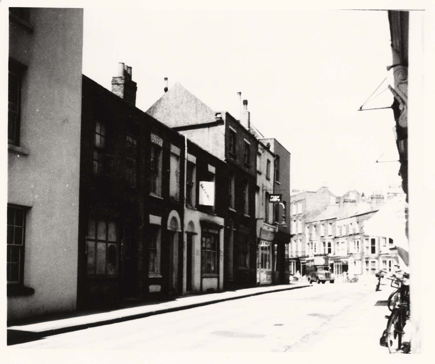
Zion place looking from Northdown Road 1960 |
Zion place looking from Northdown Road 1960 |
Zion Place from sea end 1960 1960 |
Zion Place Randolph Hotel on left 1960 |
 |
|
Pleasant Place 1960 |
September 2 2012
|
Postcards added to the 1907 Ordnance Survey Map of Margate.
|
 |
 |
 |
 |
|
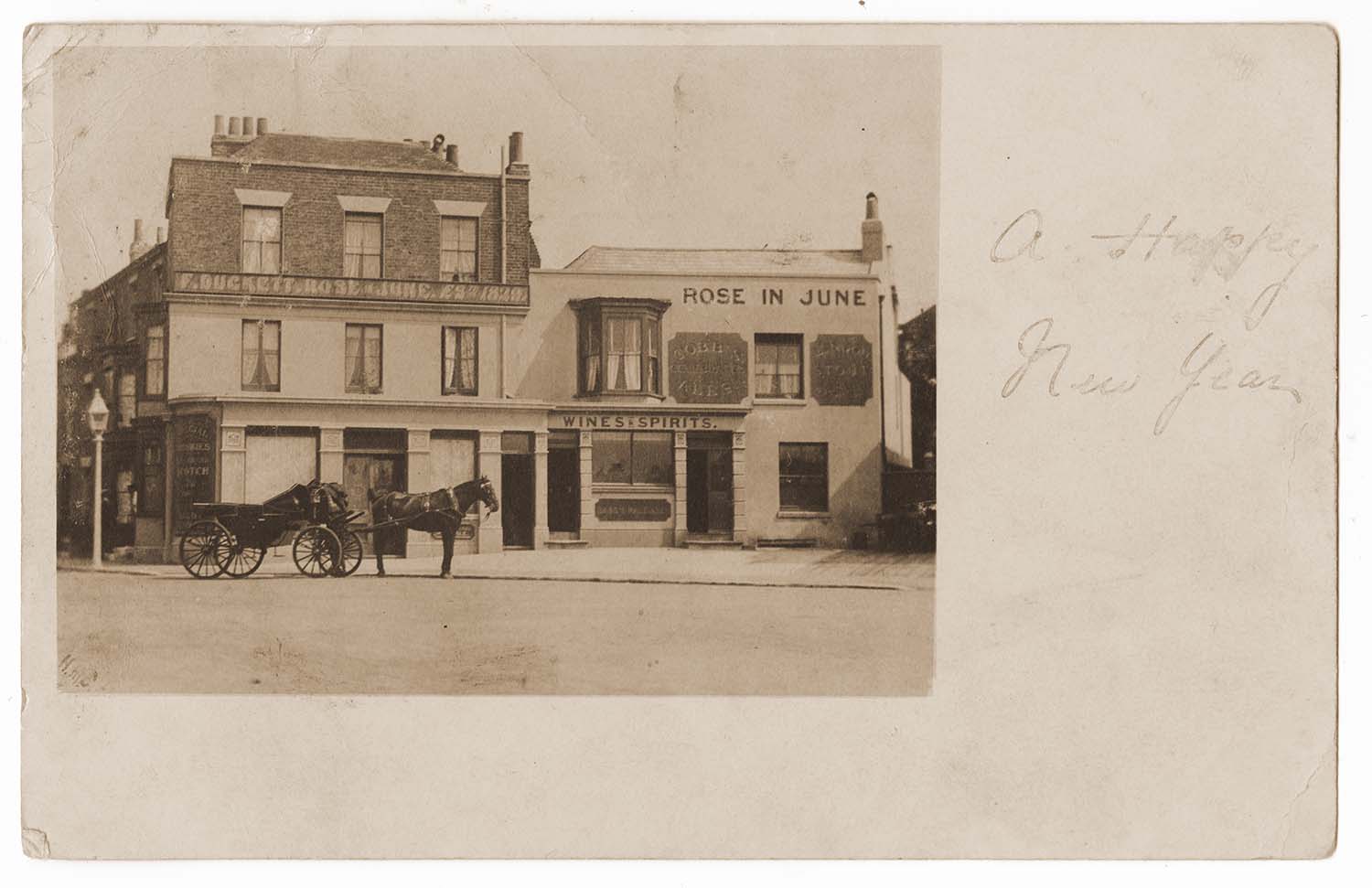
Trinity Square/Rose in June 1904 |
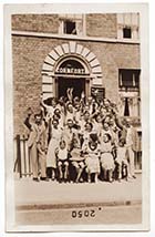
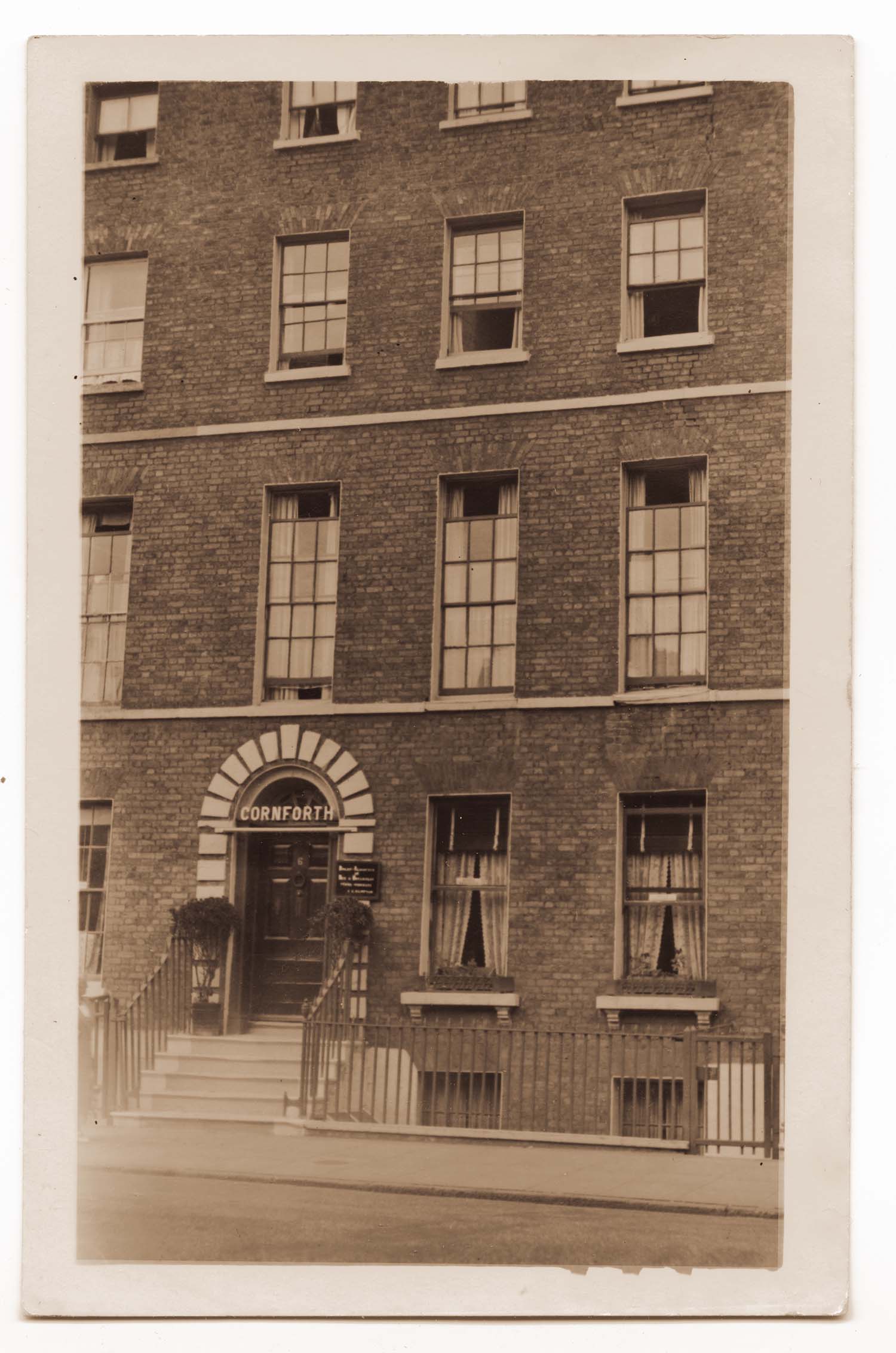
Union Crescent/No 6 Cornforth |
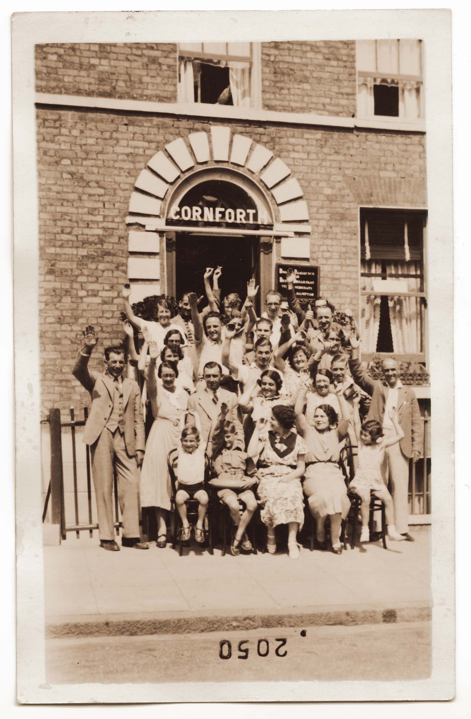
Union Crescent/No 6 Cornforth group |
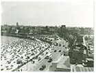
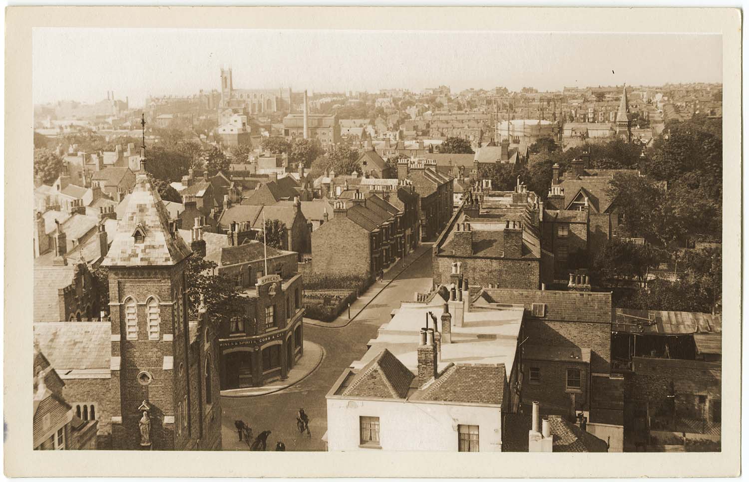
Victoria Road and Spread Eagle aerial view |
 |
 |
 |
 |
|
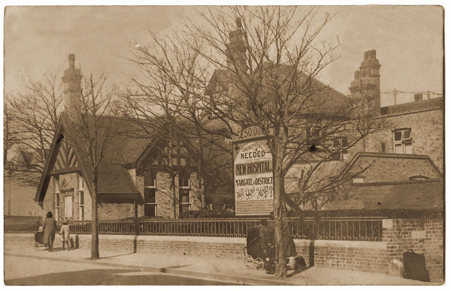
Victoria Road/Cottage Hospital |
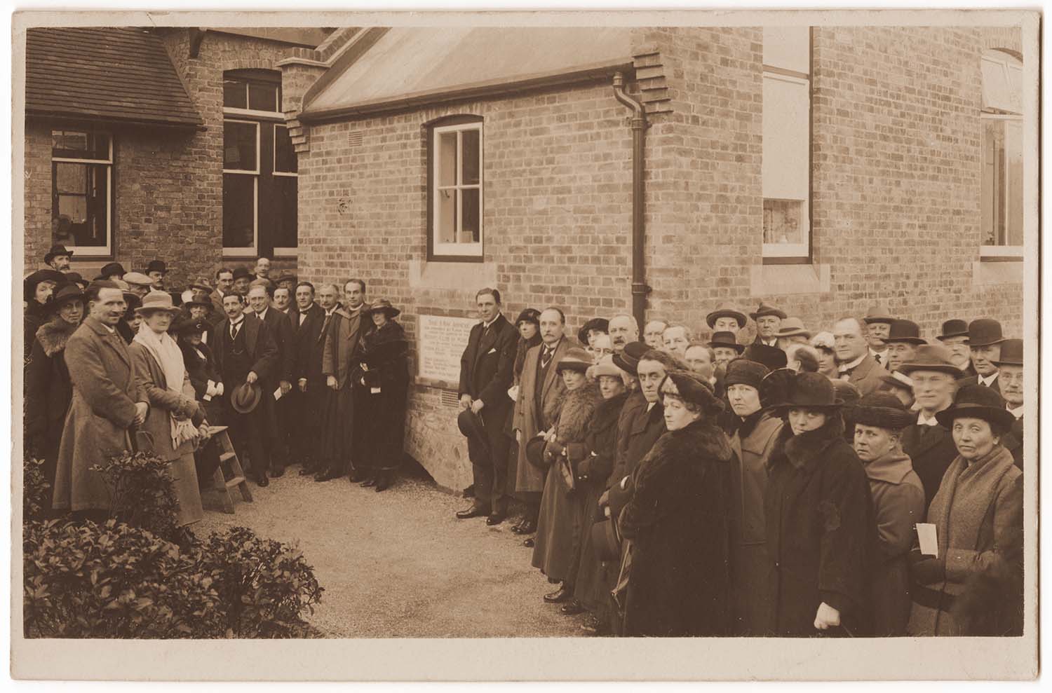
Victoria Road Cottage Hospital/ X-ray annexe stone laying |
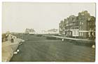
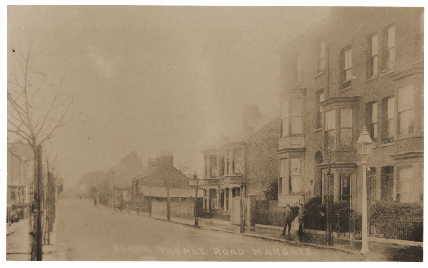
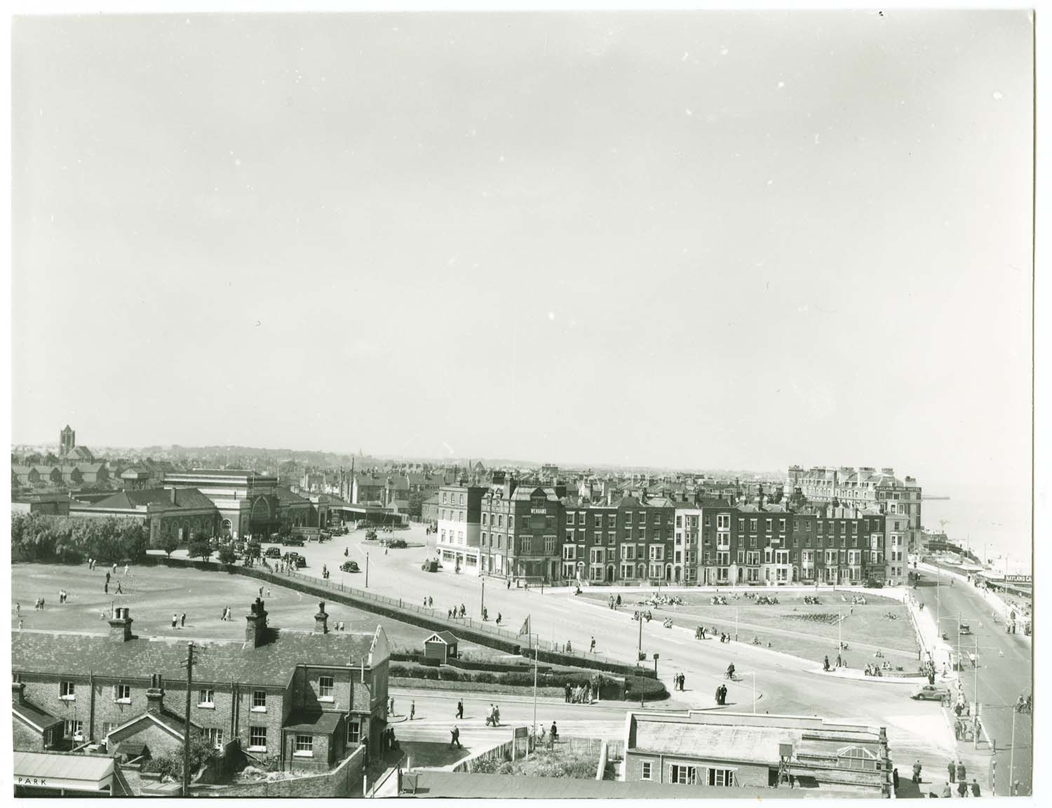
Victoria Road/view to Ramsgate Road |
Westbrook Gardens/corner with Canterbury Road |
 |
 |
 |
 |
|
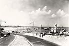
Westbrook Pavilion |
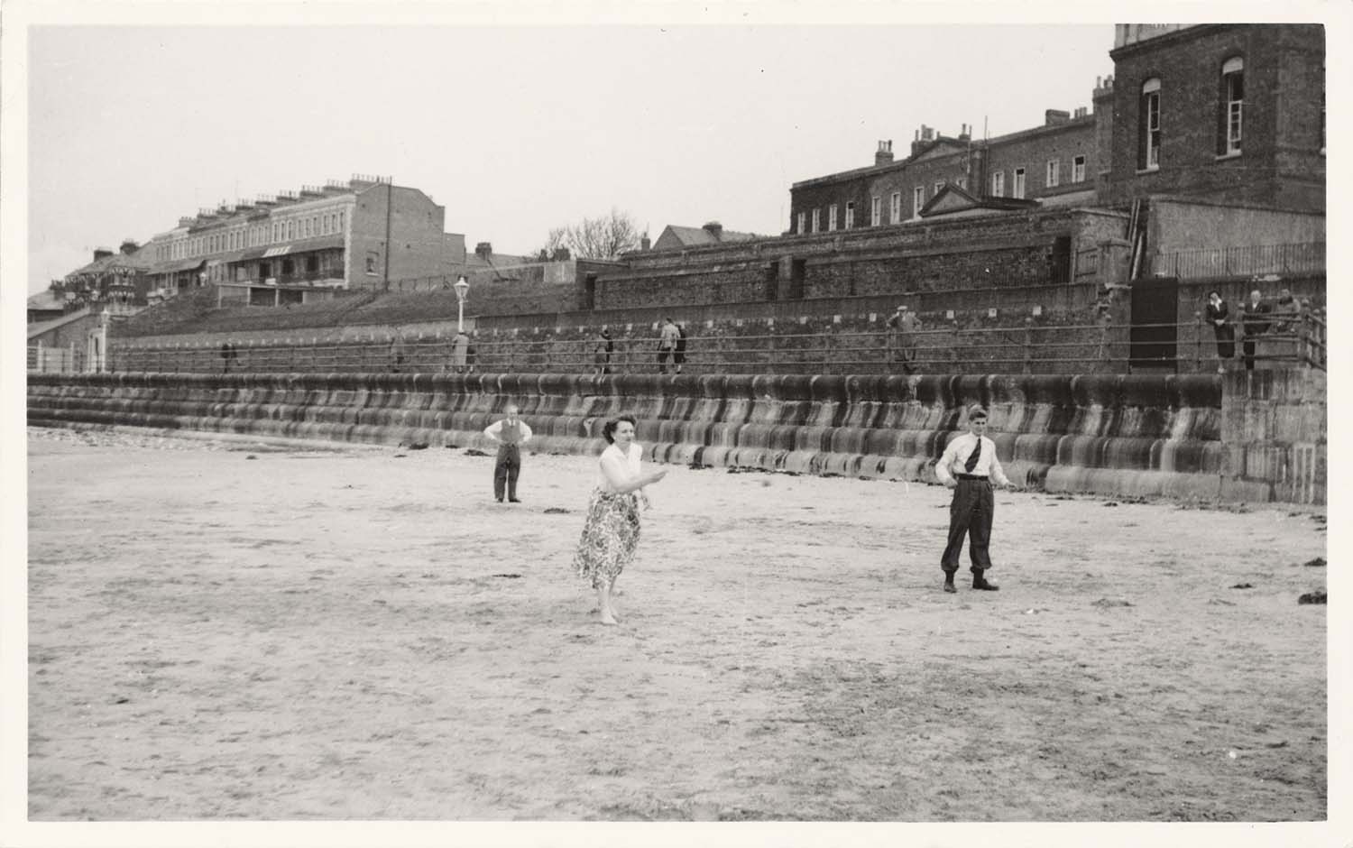
Westbrook Promenade 1955 |
Westbrook Promenade 1955 |
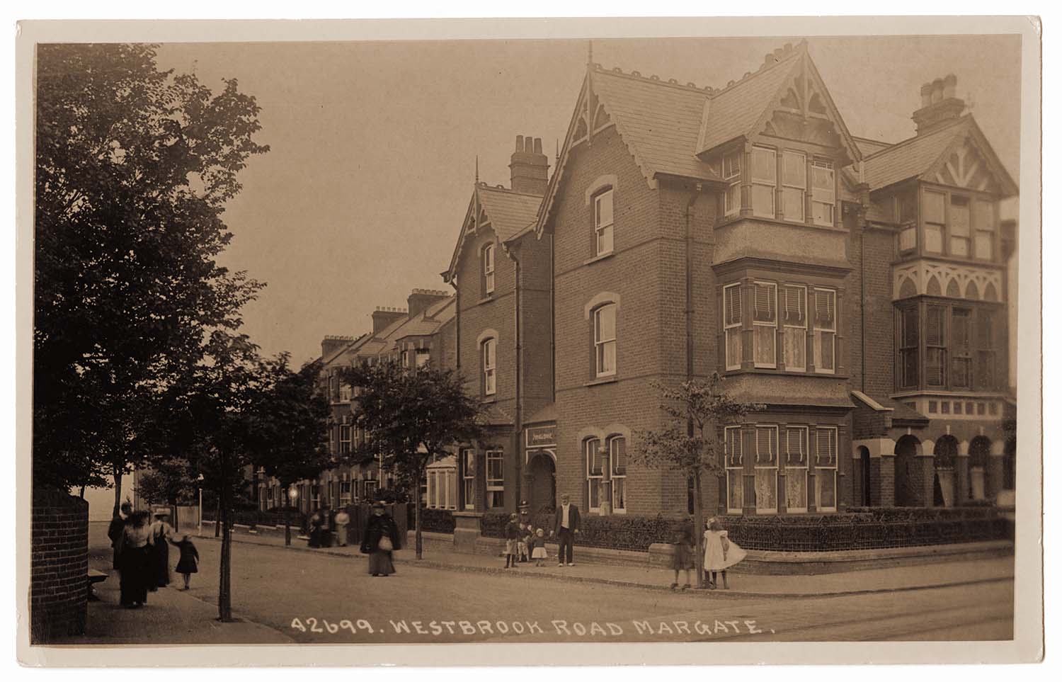
Westbrook Road/junction with Canterbury Road |
 |
 |
 |
 |
|
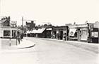
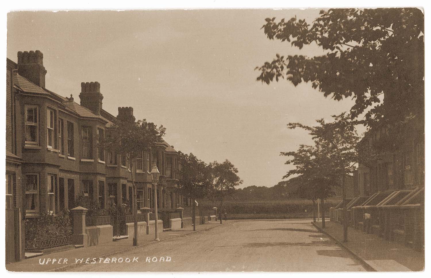
Westbrook Road |
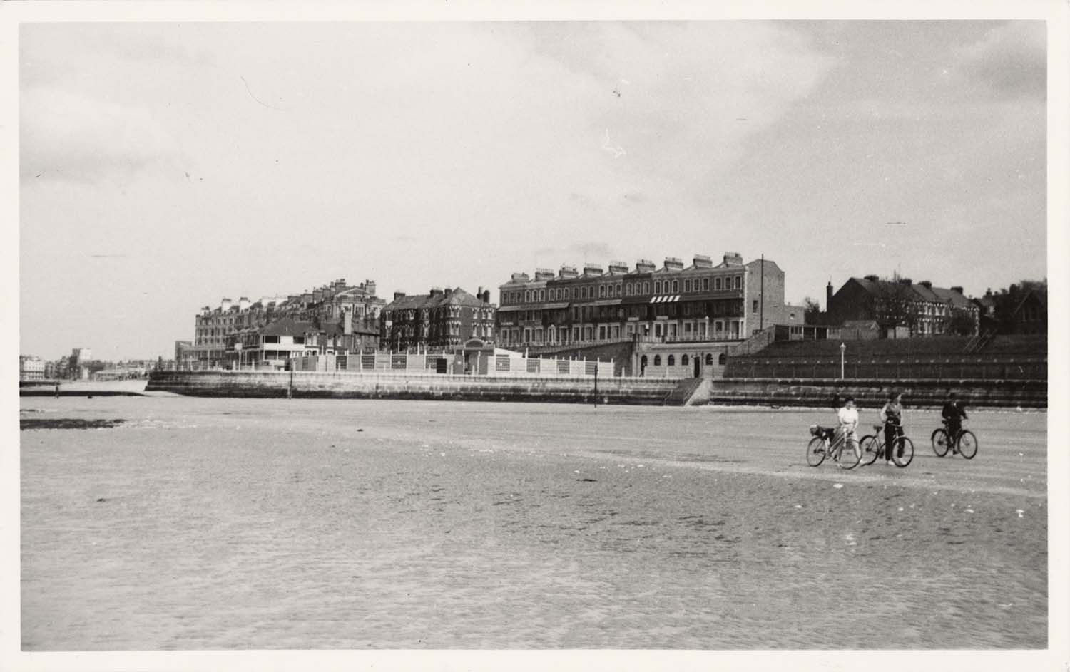
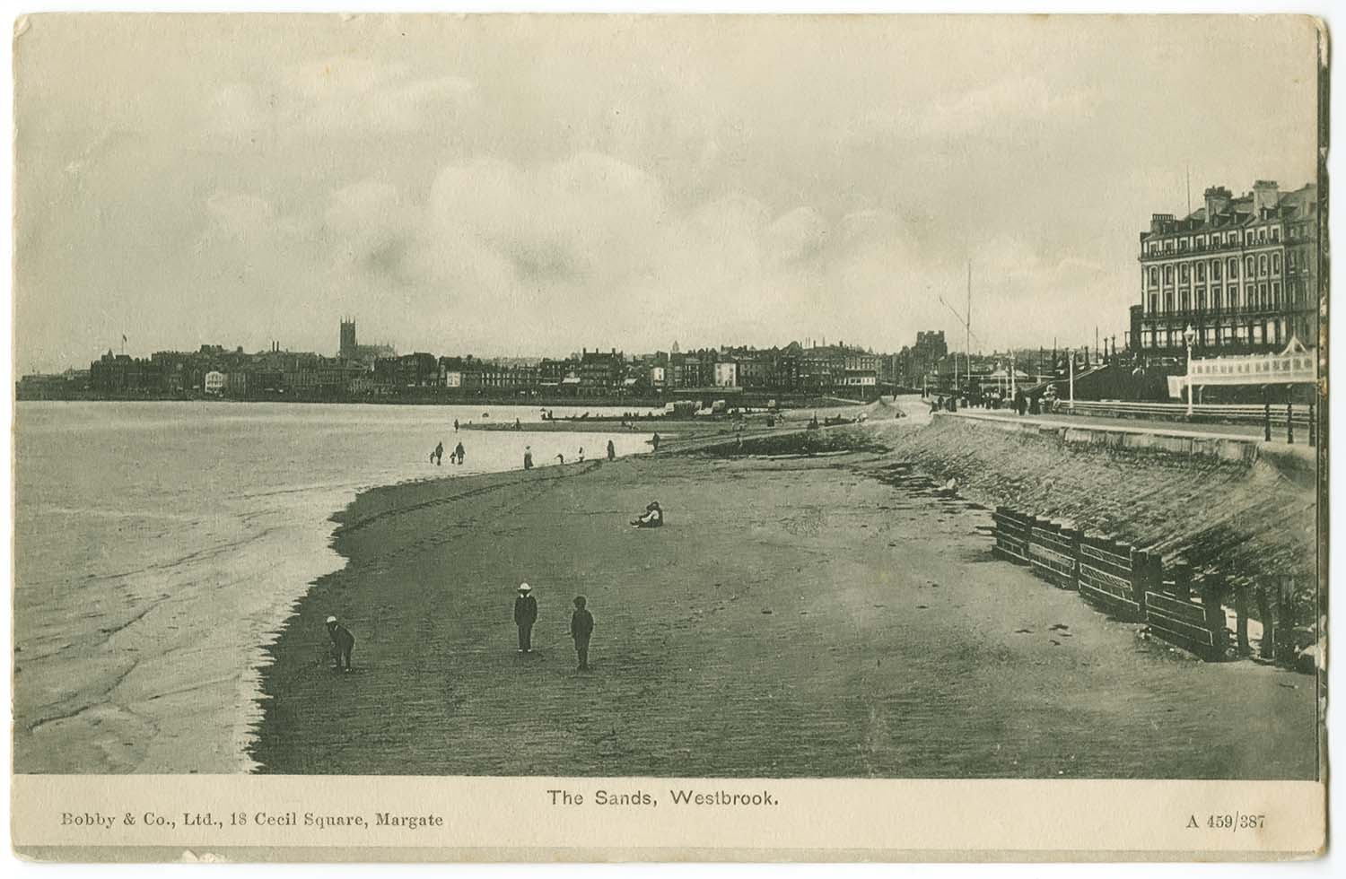
Westbrook sands |
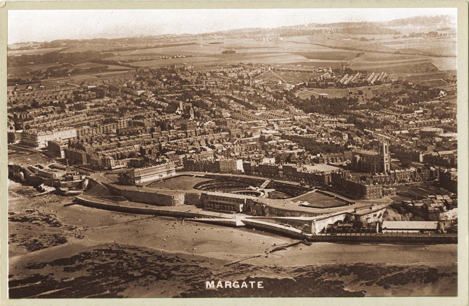
Winter Gardens aerial view |
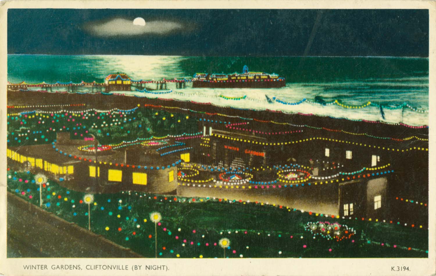
Winter Gardens by night |
 |
 |
 |
 |
|
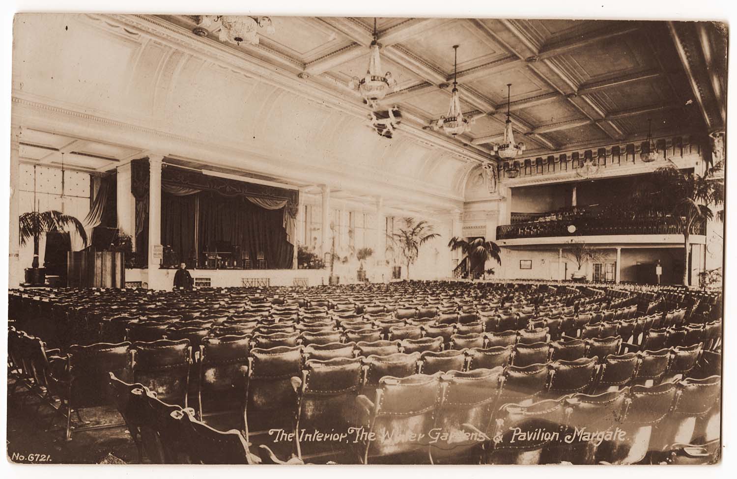
Winter Gardens interior |
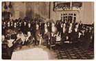
Winter Gardens/meeting |
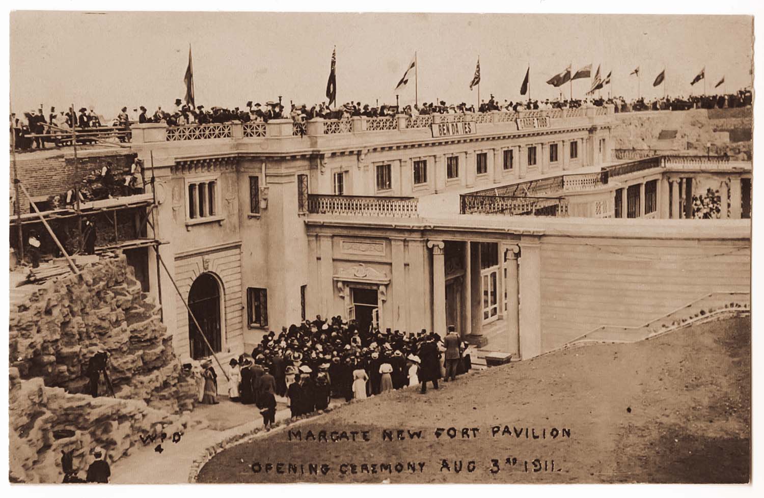
Winter Gardens/opening August 3 1911 |
Winter Gardens/opening August 3 1911 |
 |
|
Zion Place/Prospect Inn |
August 26 2012
|
Photographs of the Fort Hill area, mostly from the Mick Twyman collection, added to the 1907 Ordnance Survey Map of Margate
|
 |
 |
 |
 |
|
Bankside |
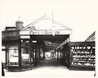
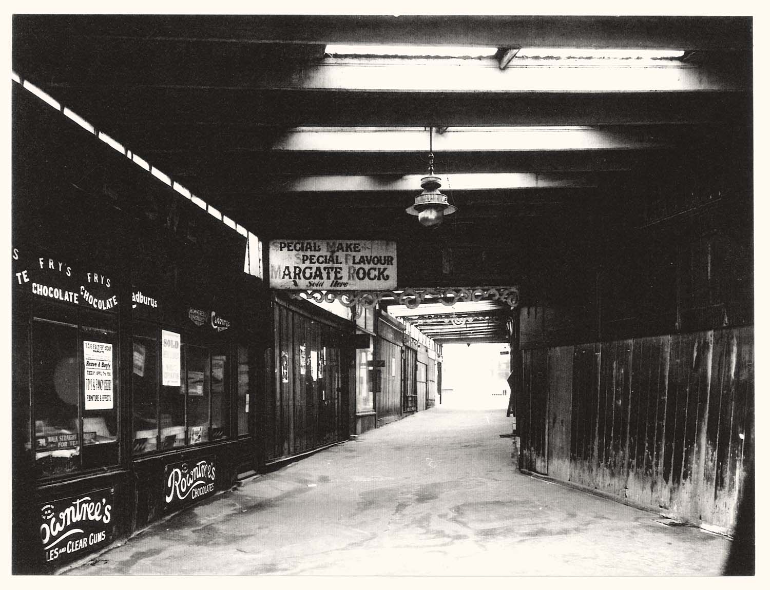
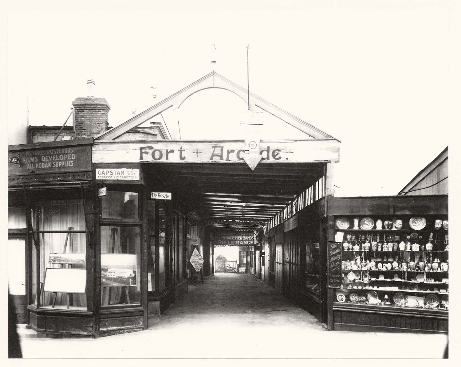
Fort Arcade |
Fort Arcade |
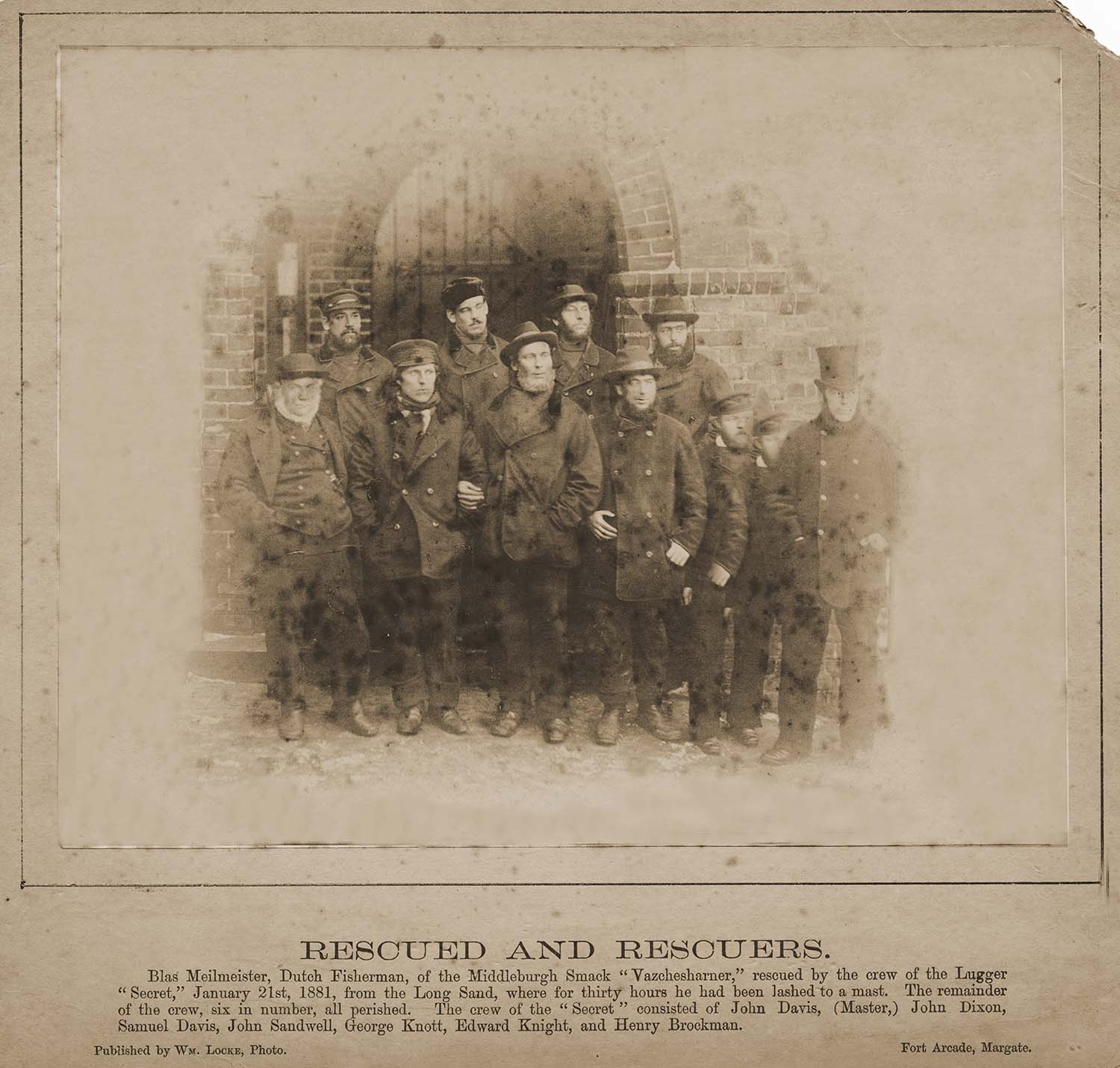
Rescuers outide the Seamens Institute |
 |
 |
 |
 |
|
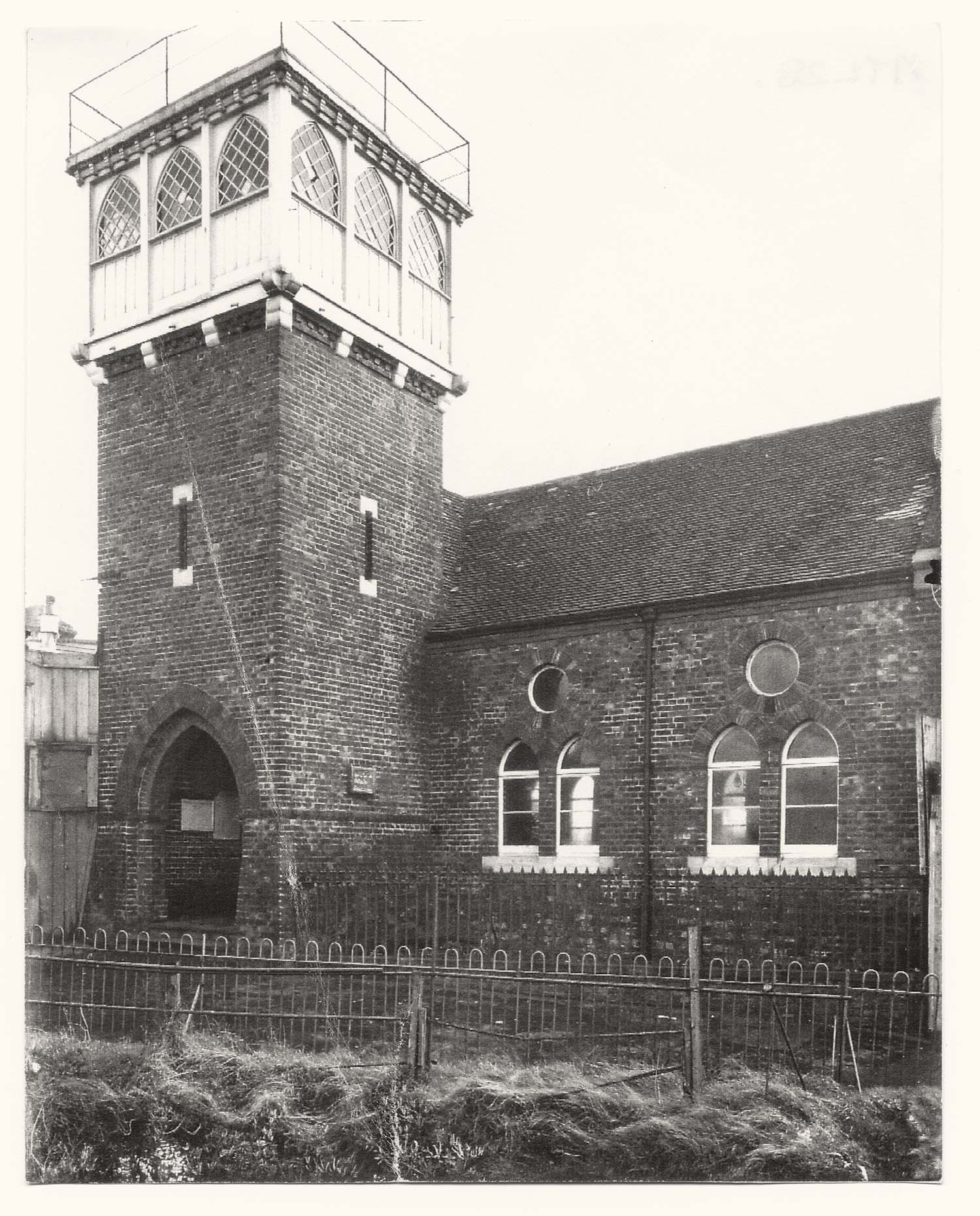
Seamens Institute |
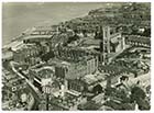
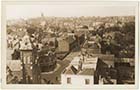
Fort Hill seen from the sea |
Fort Hill looking towards Paradise Street |
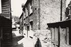
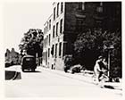
Fort Mount Brockmans Boat yard |
 |
 |
![Neptune square cottages [Geoff Pearce] | Margate History](../Pictures/Photos/Modern/Fort Hill Area/Neptune square cottages Geoff Pearce-thumb.jpg) |
 |
|
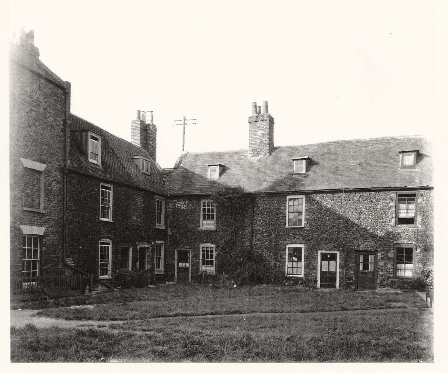
Neptune square |
Neptune square |
Neptune square cottages [Geoff Pearce] |
Neptune Square from Paradise Street |
![Paradise street and tram [Geoff Pearce] | Margate History](../Pictures/Photos/Modern/Fort Hill Area/Paradise street tram Geoff Pearce-thumb.jpg) |
 |
![Paradise Street fire 1930s] | Margate History](../Pictures/Photos/Modern/Fort Hill Area/Paradise Street fire 1930s 3-thumb.jpg) |
 |
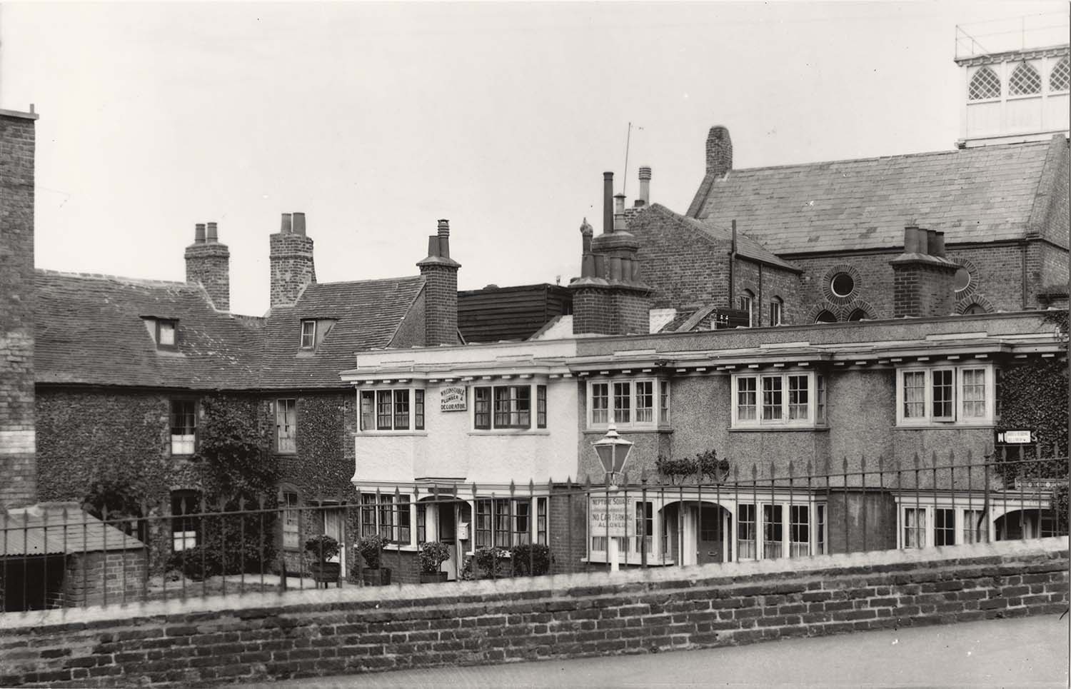
|
Paradise street and tram [Geoff Pearce] |
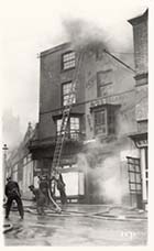
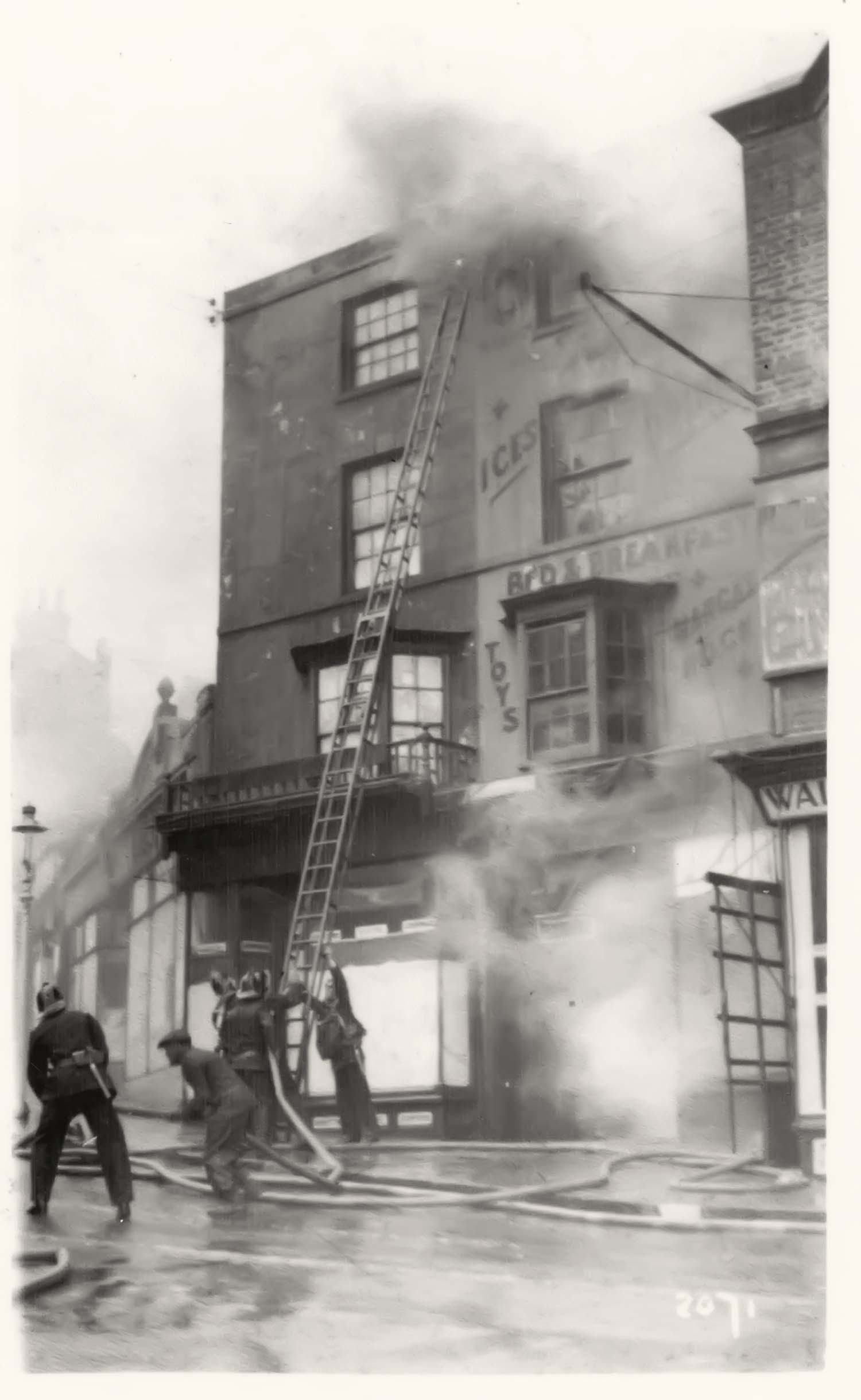
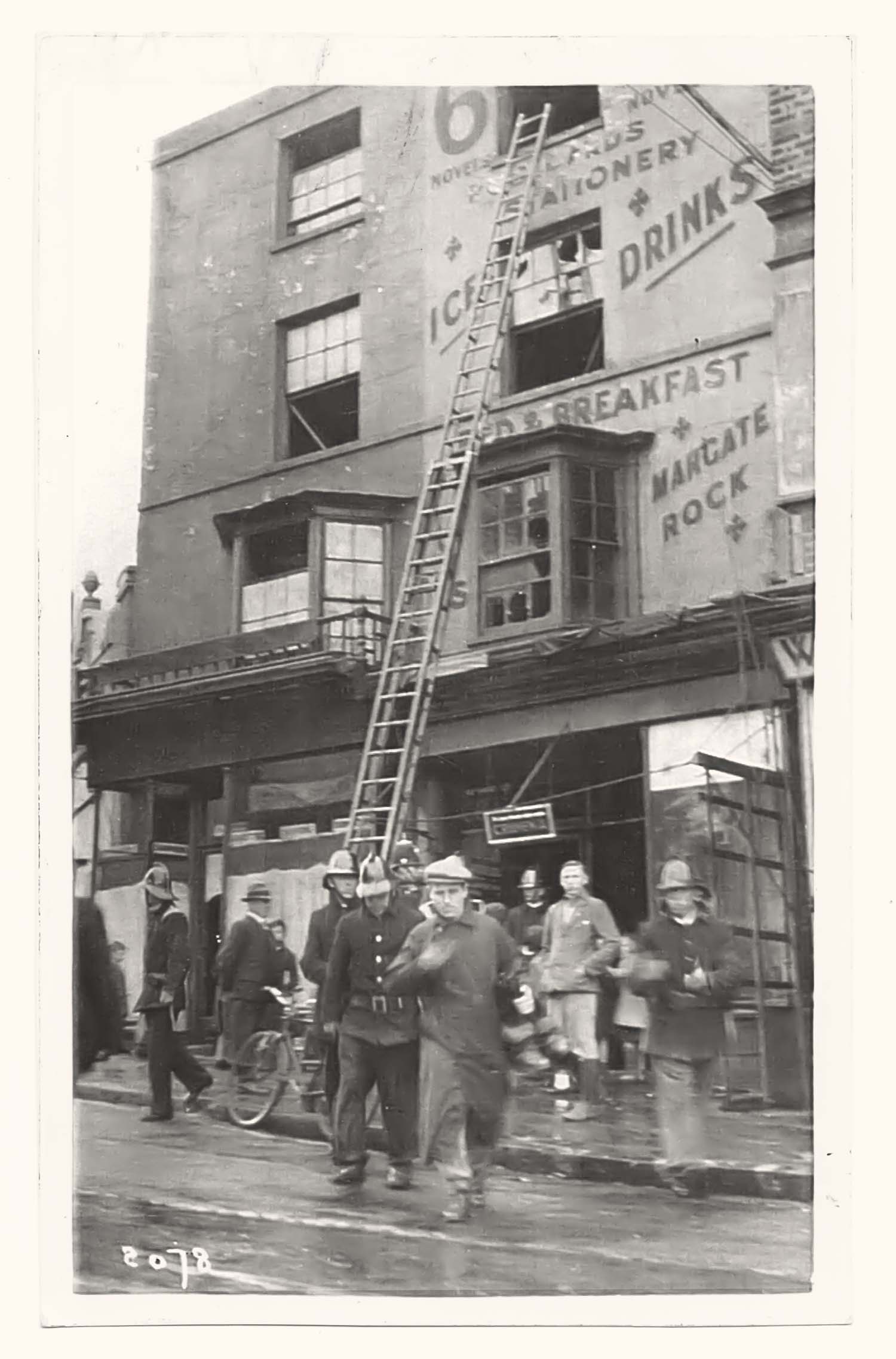
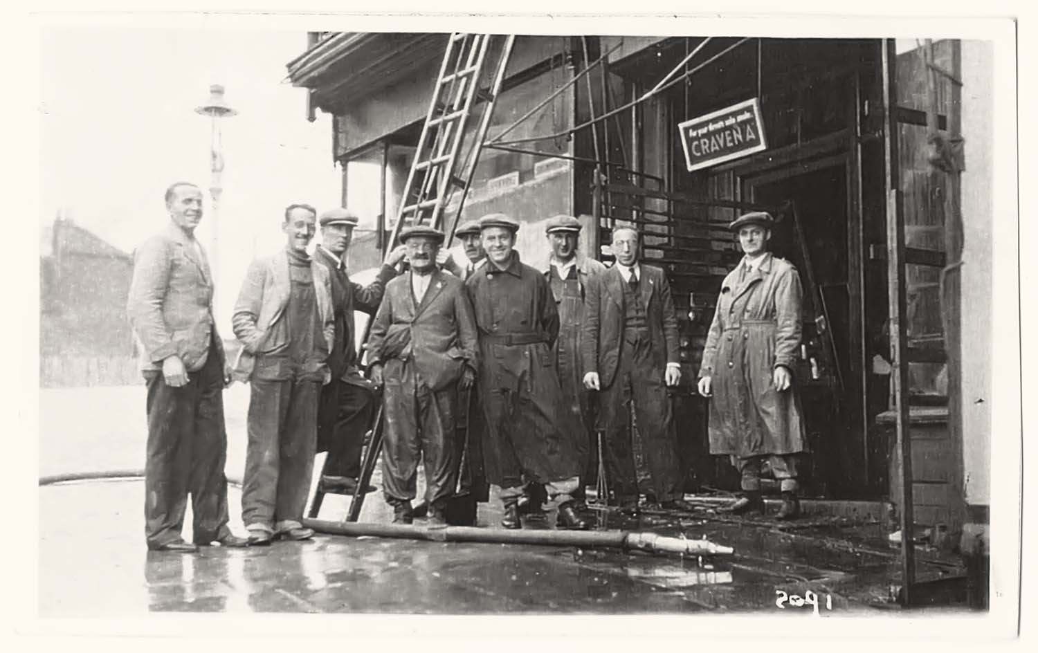
Paradise Street fire 1930s |
Paradise Street fire 1930s |
Paradise Street fire 1930s |
 |
 |
 |
 |
|
Paradise Street No 4 fire 1930s |
Paradise Street Nos 2 and 4 fire 1930s |
Paradise Street Nos 2 and 4 fire 1930s |
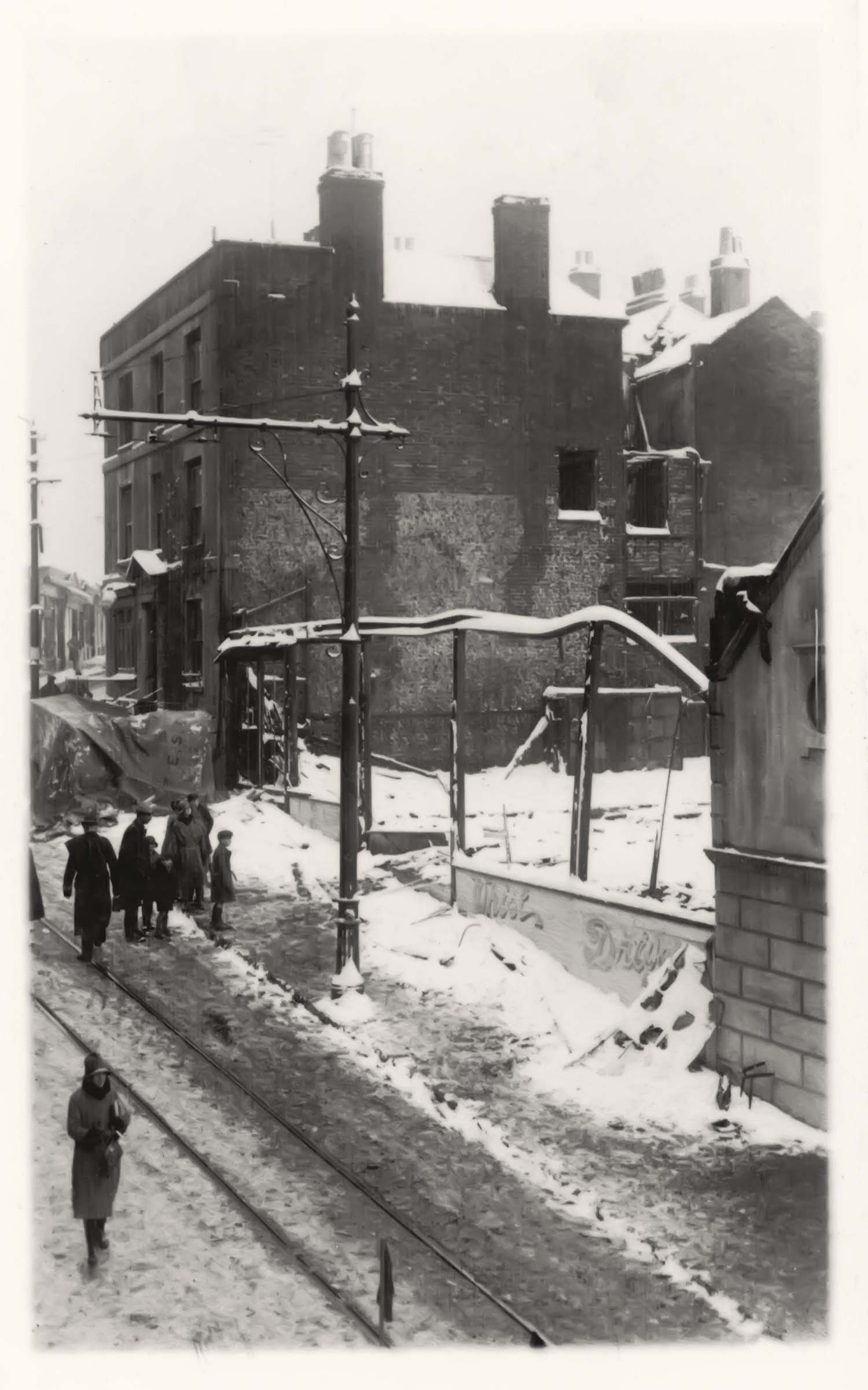
Paradise Street and Neptune Square |
 |
 |
 |
 |
|
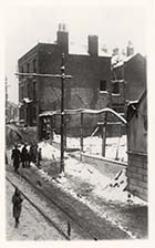
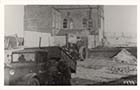
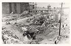
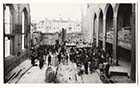
Fort demolition 1939 |
Fort demolition 1939 |
Fort demolition 1939 |
Fort demolition 1939 |
 |
 |
 |
 |
|
Fort demolition 1939 |
Fort demolition 1939 |
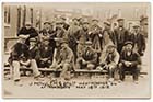
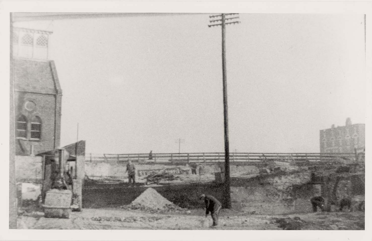
Fort Hill-new steel works for road bridge |
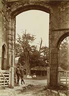
Fort Hill looking towards harbour |
August 24 2012
|
Photographs of Inns and Hotels from the Mick Twyman collection, added to the 1907 Ordnance Survey Map of Margate
|
 |
 |
 |
 |
|
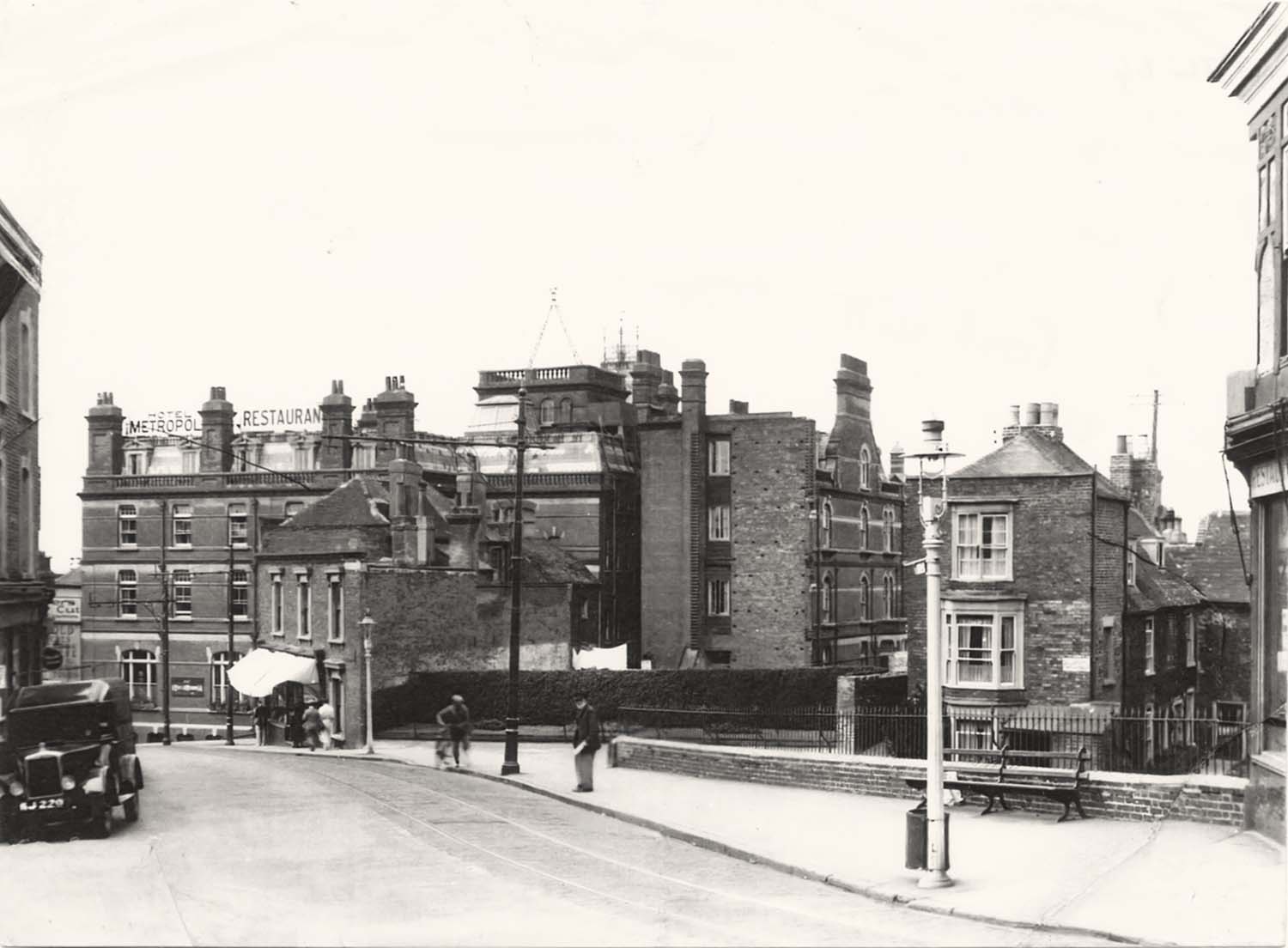
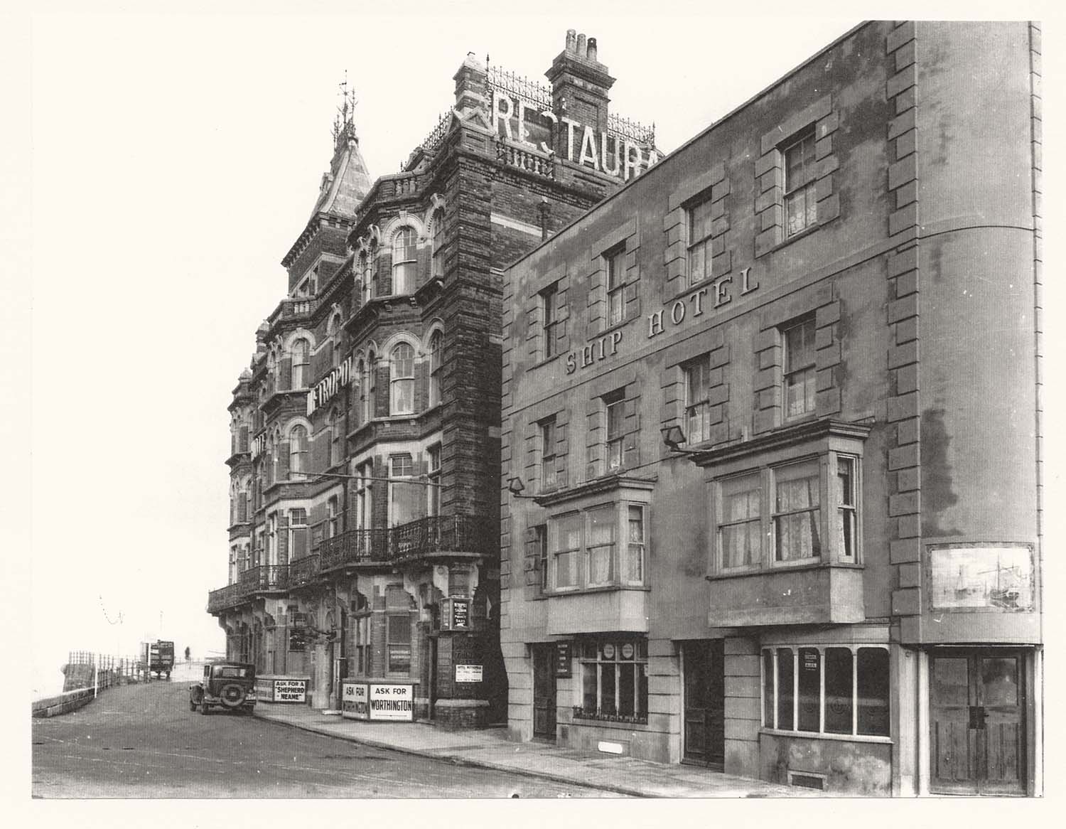
Bankside/Ship Hotel and Hotel Metropole |
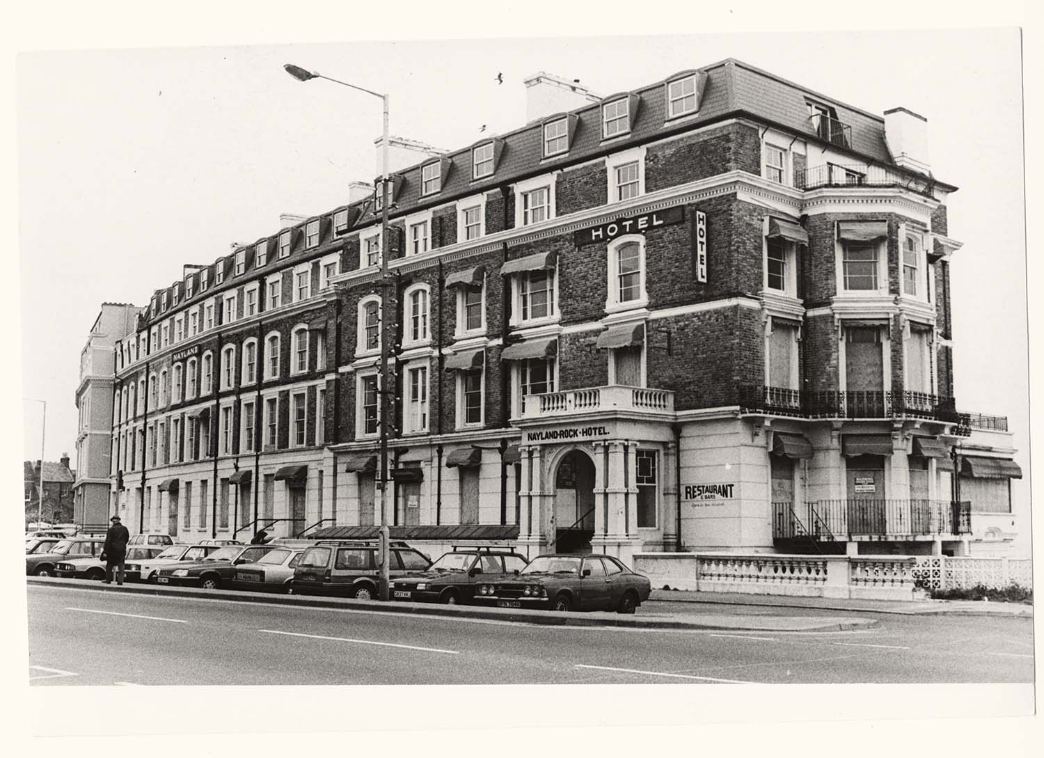
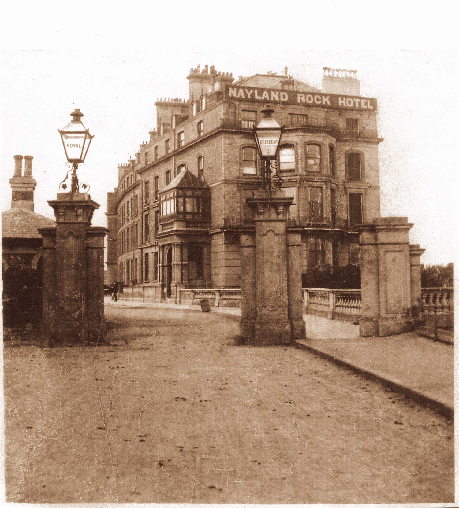
Canterbury Road/Nayland Rock Hotel |
Canterbury Road/Nayland Rock Hotel |
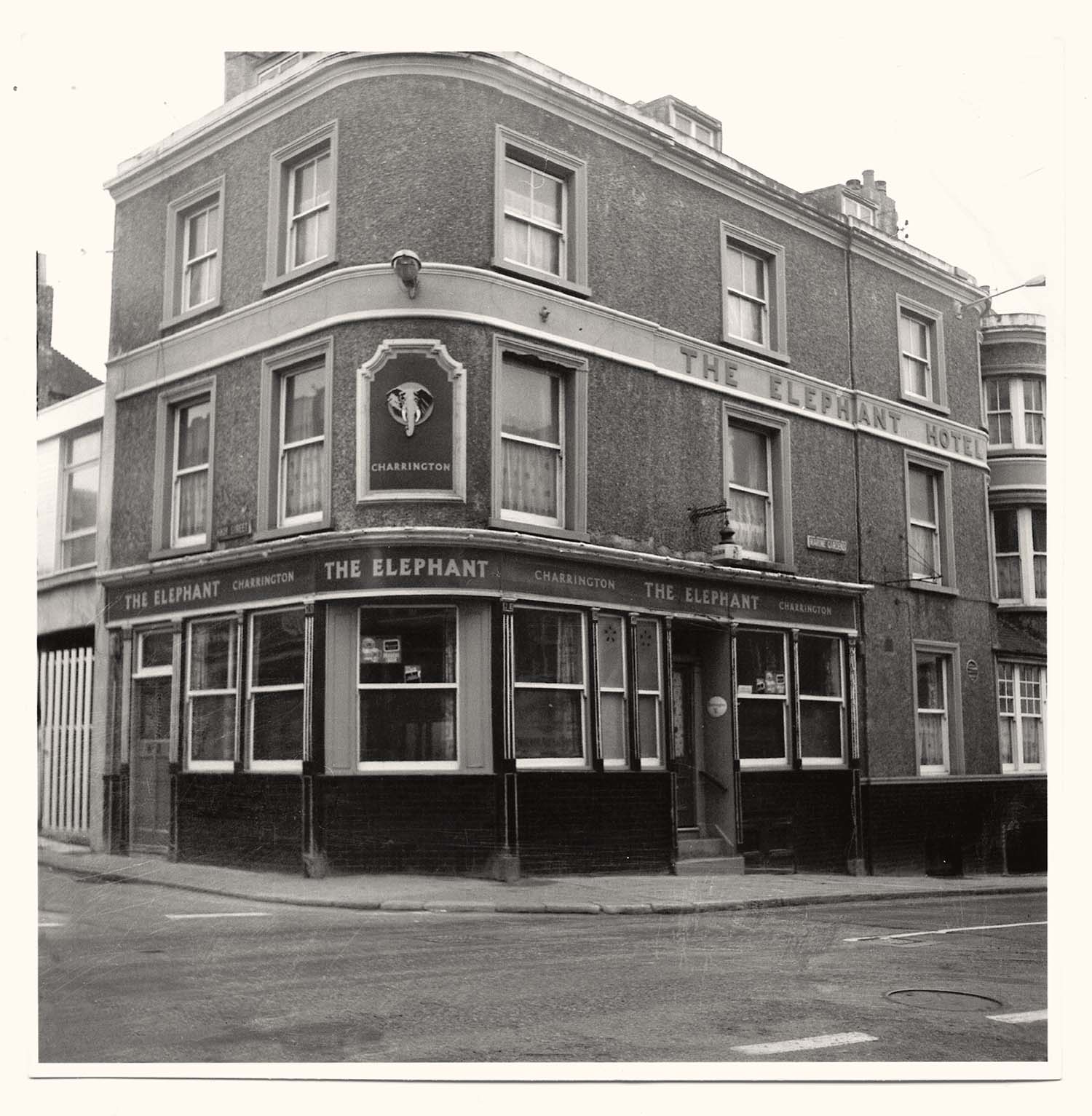
High Street/Elephant Hotel |
 |
 |
 |
![High Street/Six Bells [adjacent houses demolished] | Margate History](../Pictures/Photos/Modern/Twyman Inns and Hotels/High street Six bells adjacent houses demolished 1-thumb.jpg) |
|
High Street/Royal Oak 1967 |
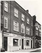
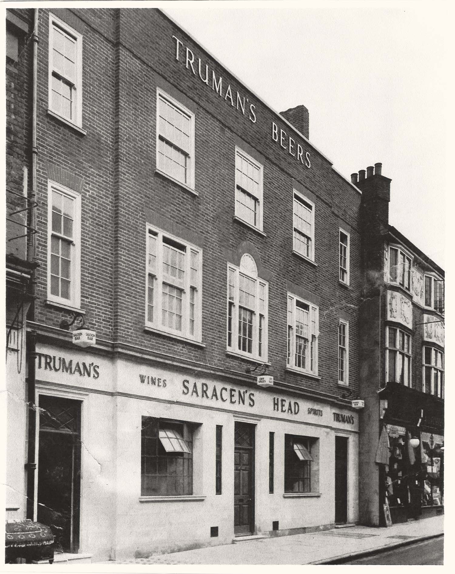
High Street/Saracens Head |
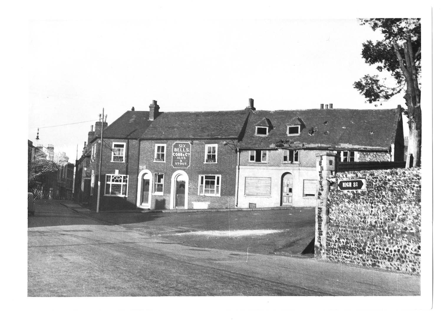
High Street/Six Bells |
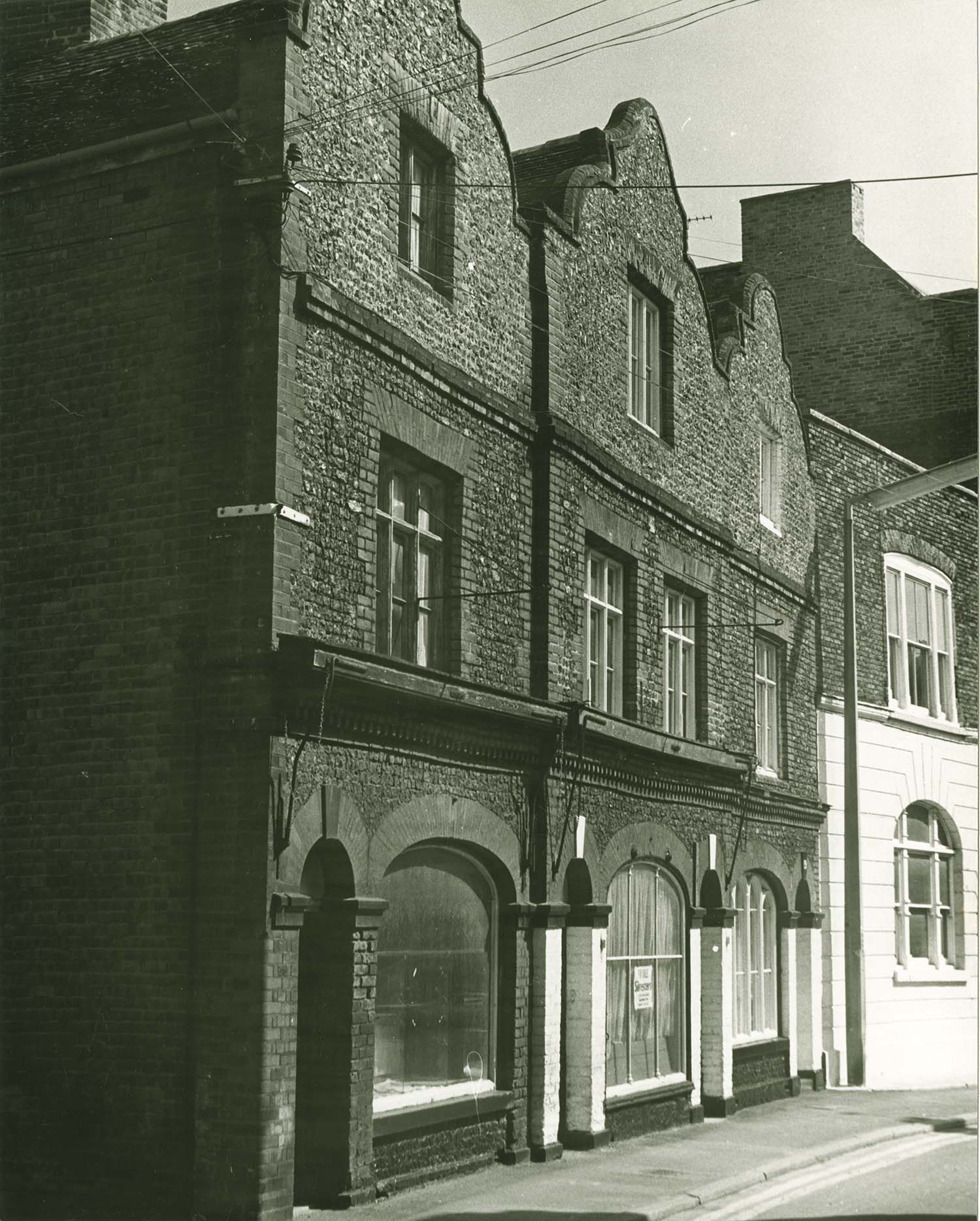
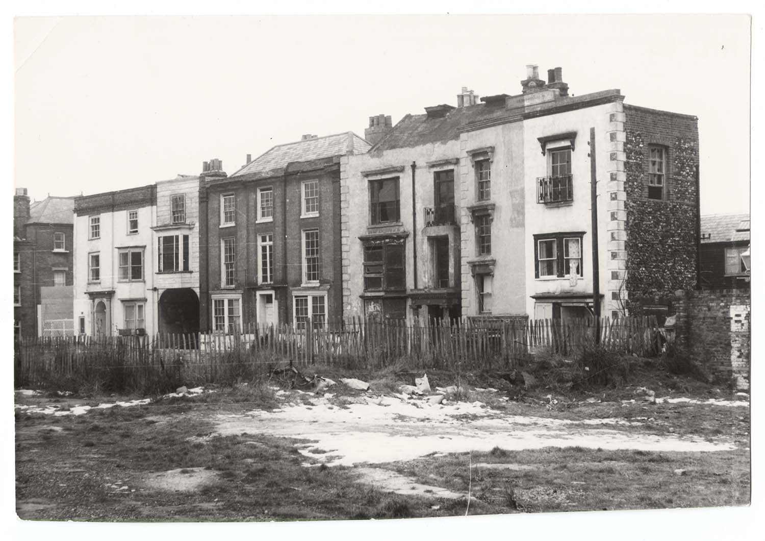
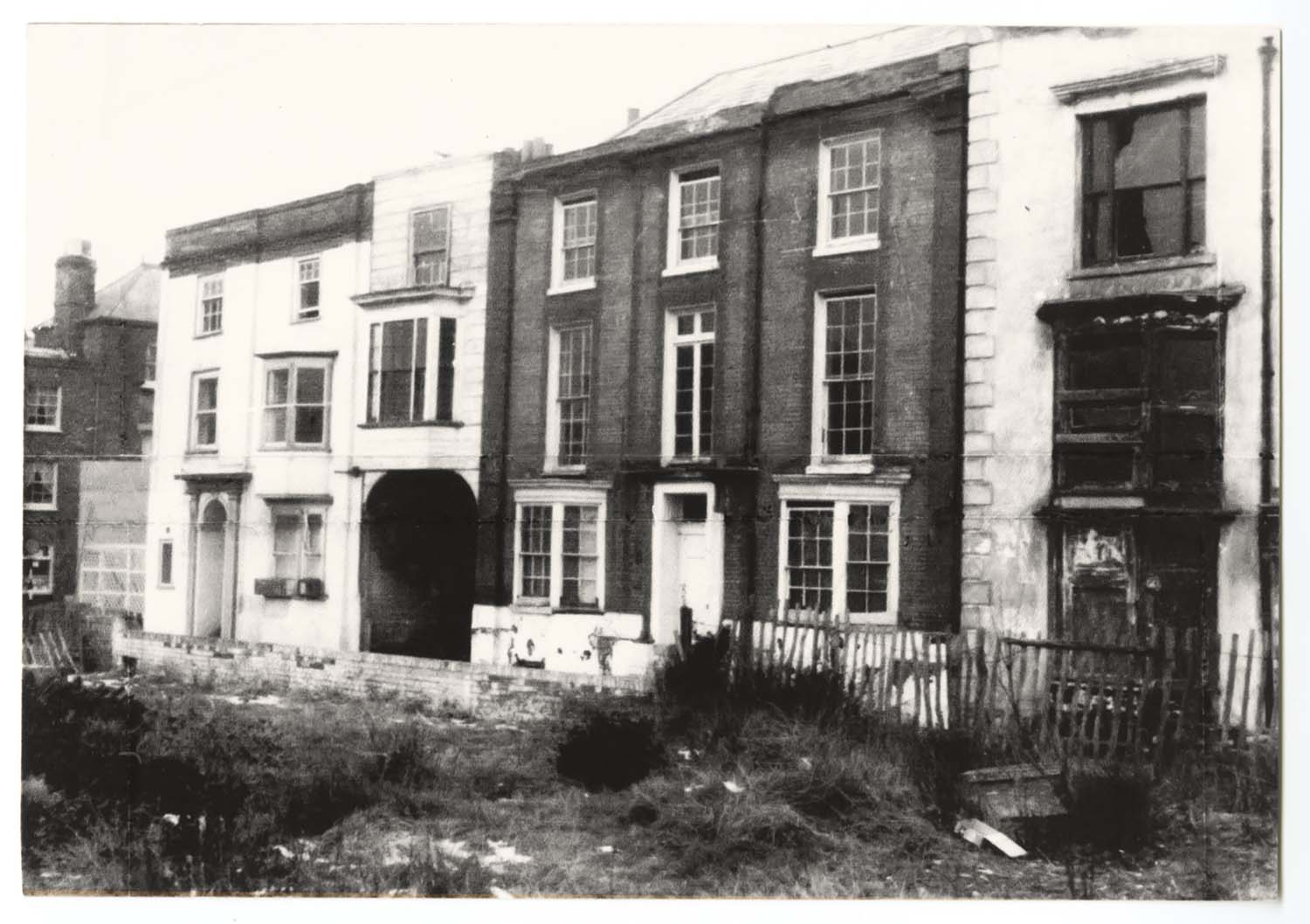
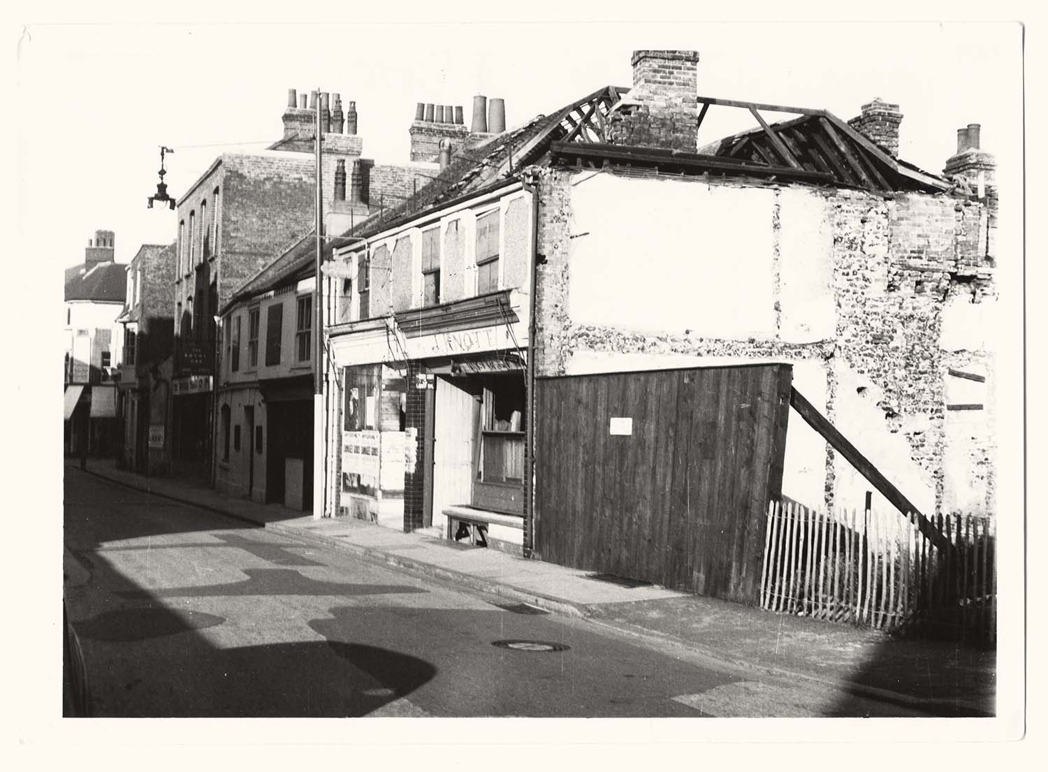
High Street/Six Bells [adjacent houses demolished] |
![High Street/Six Bells [adjacent houses demolished] | Margate History](../Pictures/Photos/Modern/Twyman Inns and Hotels/High street Six bells adjacent houses demolished 2-thumb.jpg) |
 |
 |
 |
|
High Street/Six Bells [adjacent houses demolished] |
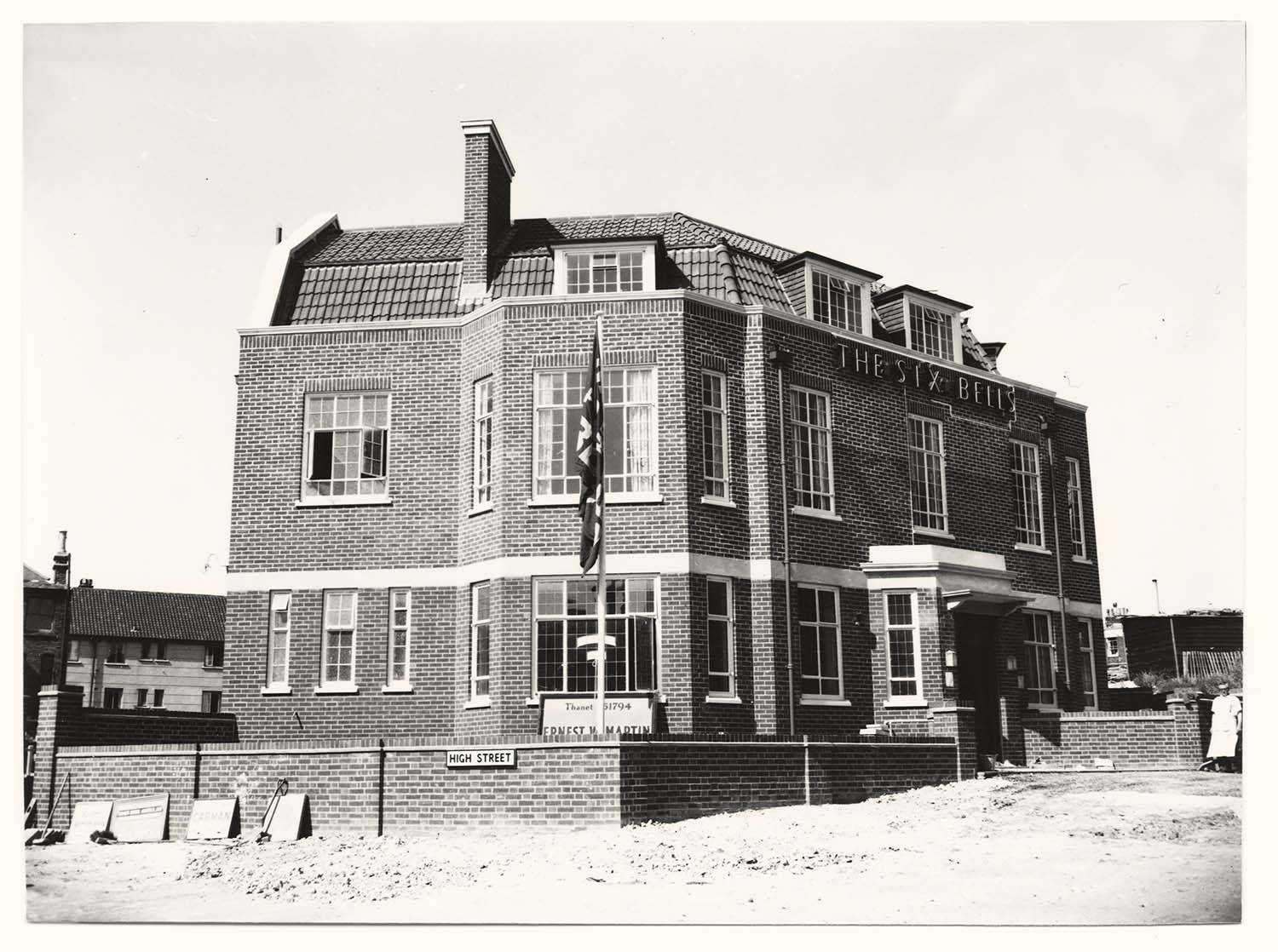
High Street/new Six Bells under construction |
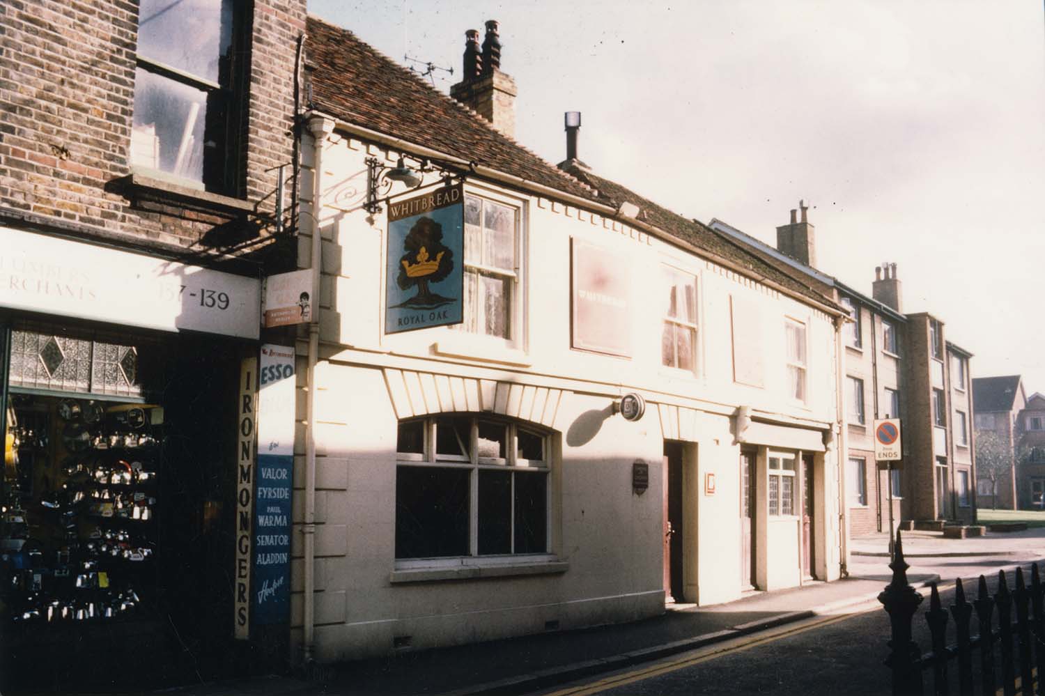
High Street/Royal Oak |
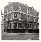
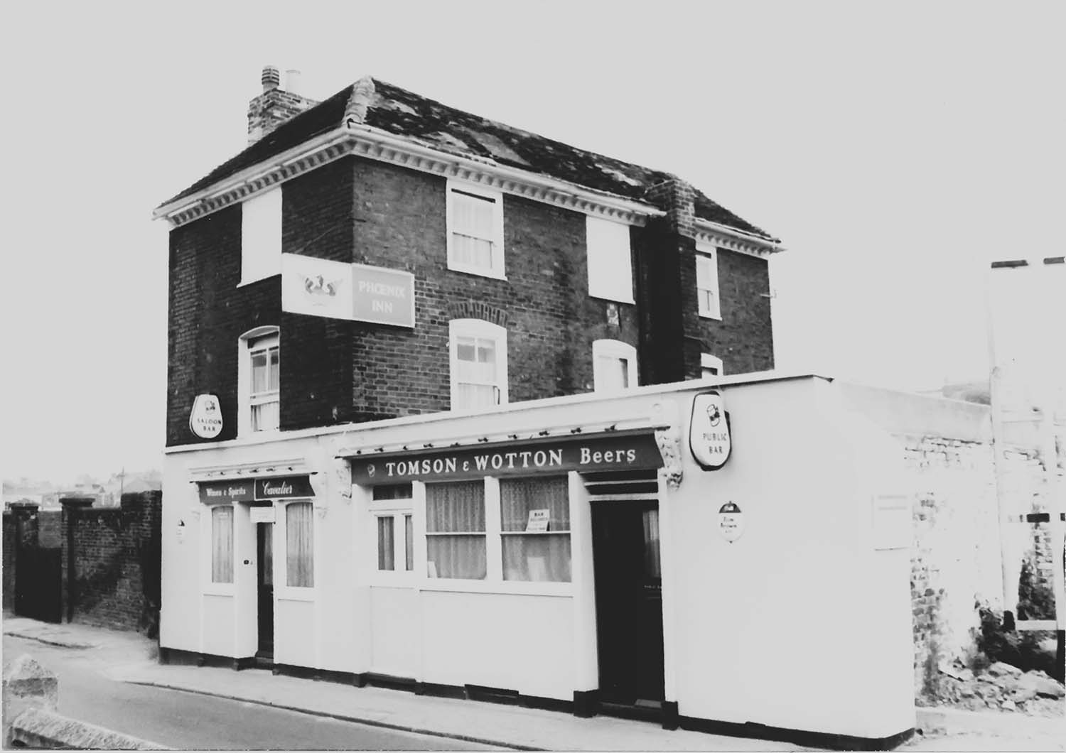
King Street/Phoenix |
 |
 |
 |
|
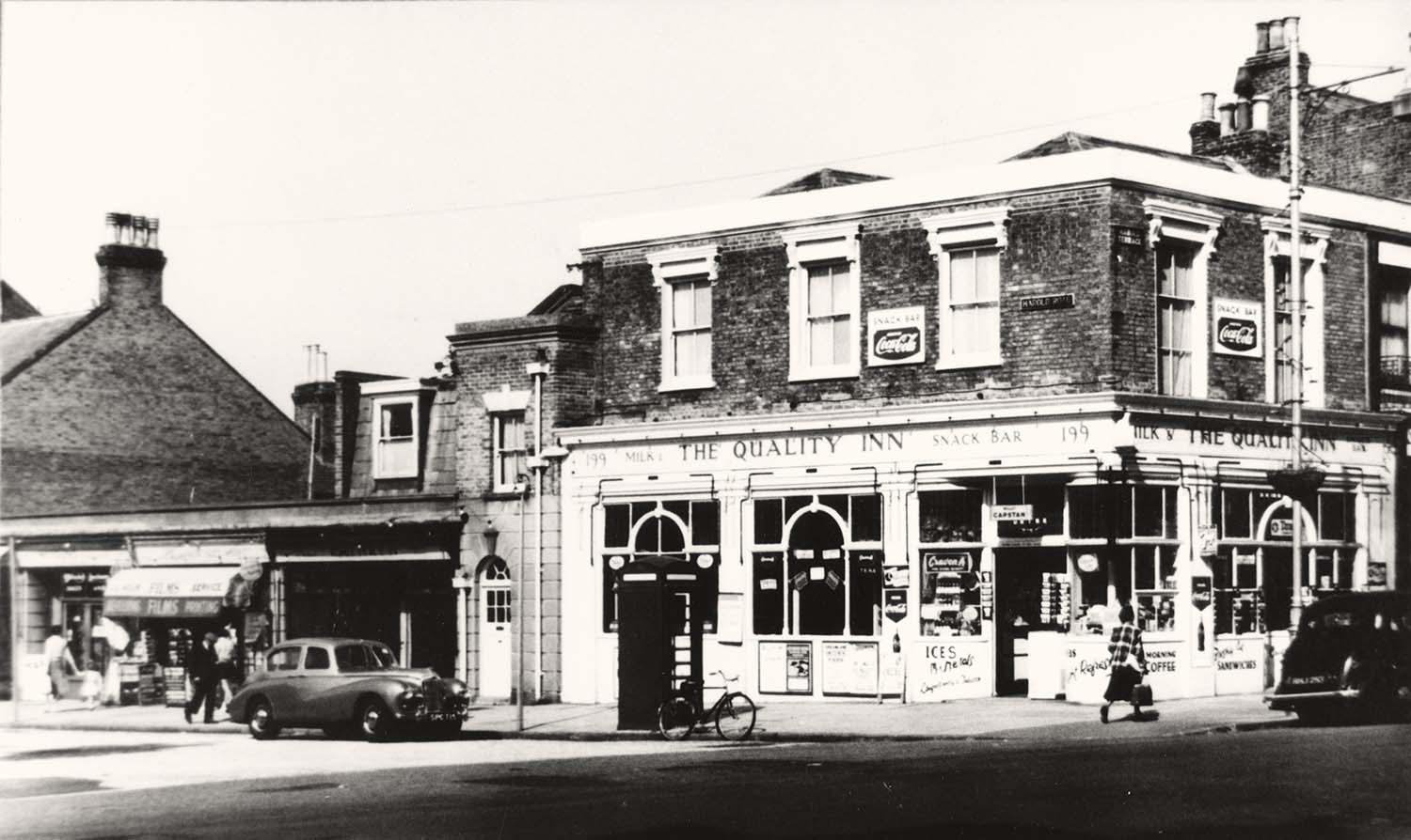
Northdown Road/Quality Inn |
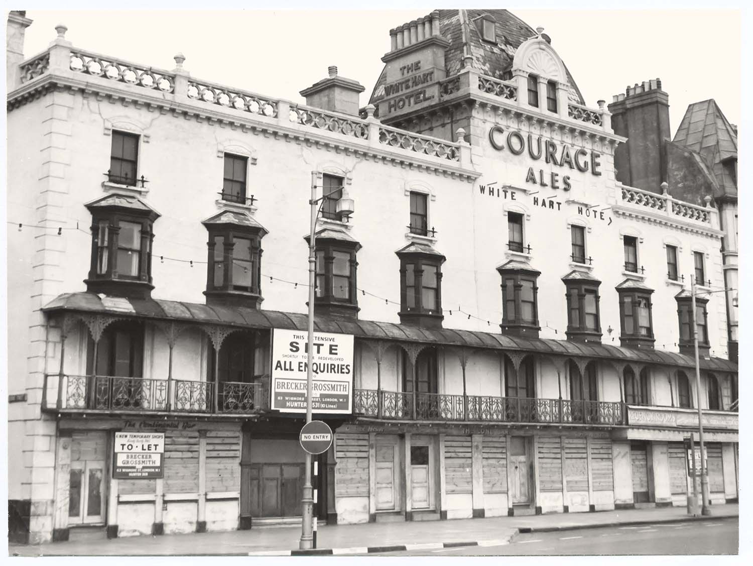
Parade/White Hart Hotel for sale |
High Street/looking toward Hope and Anchor |
August 18 2012
|
Postcards added to the 1907 Ordnance Survey Map of Margate.
|
 |
 |
 |
 |
|
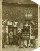
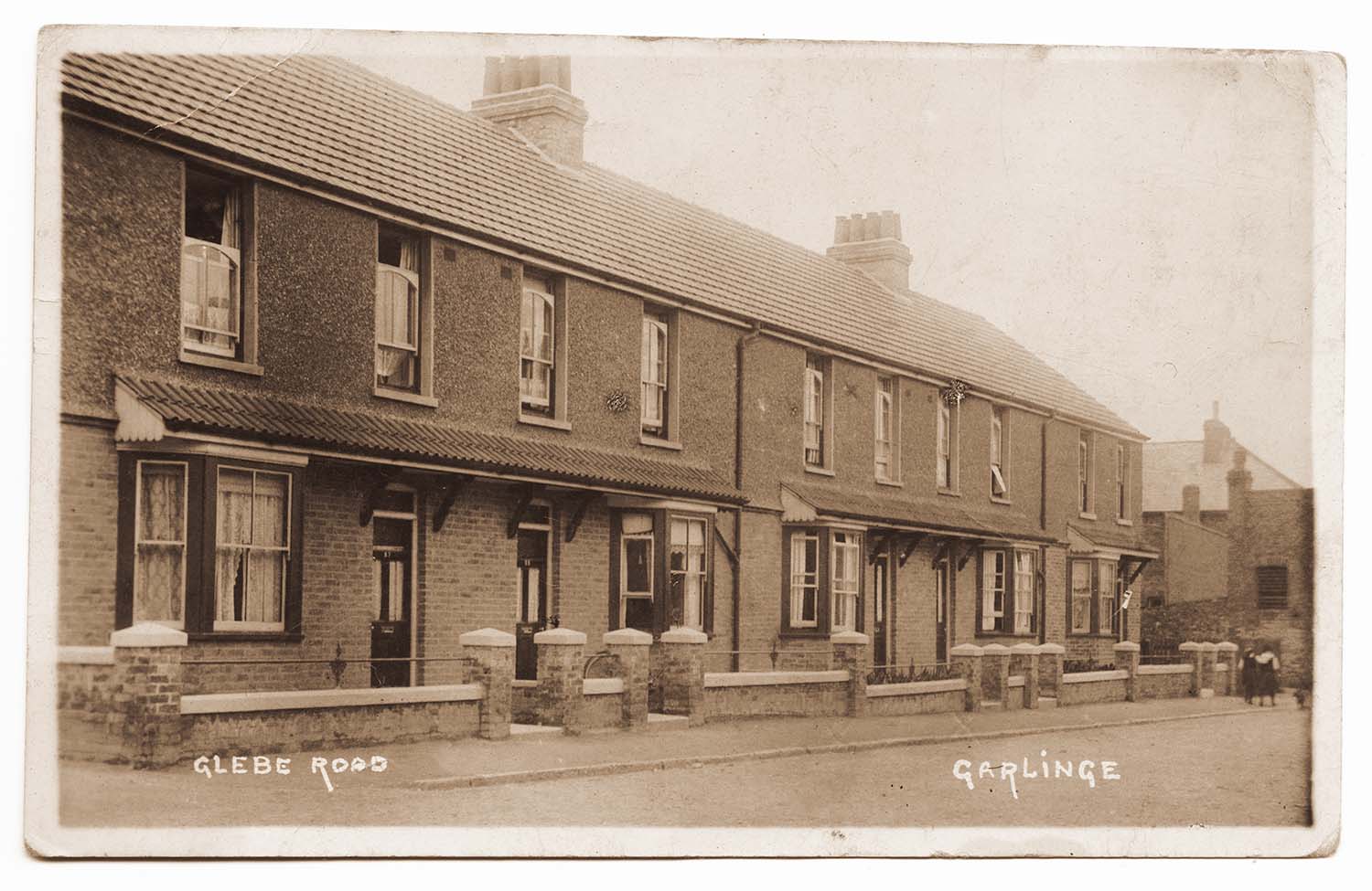
Glebe Road Garlinge |
Hodges Bridge and Bungalow 1955 |
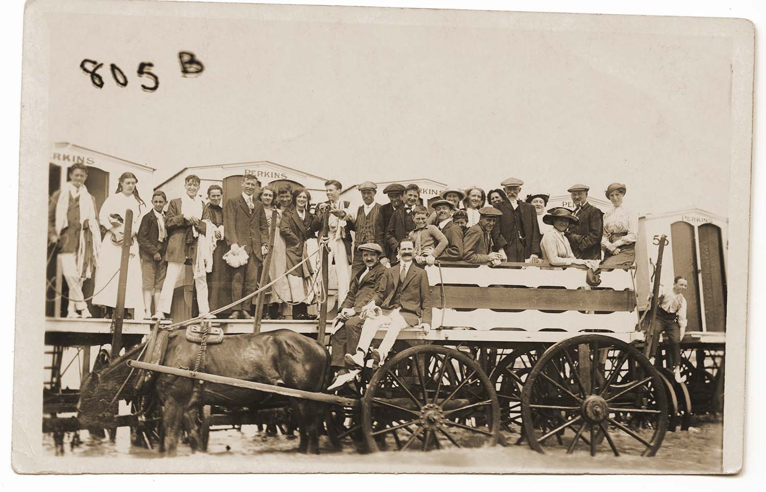
Marine Terrace Sands/Perkins Huts and cart |
St Peters Footpath/Thanet College 1904 |
/Station Lest we forget pre 1925-thumb.jpg) |
 |
 |
 |
|
Margate West (LCDR/War wounded |
Station Road |
Sweyn Road/Corporation container |
Thanet Road |
 |
 |
 |
 |
|
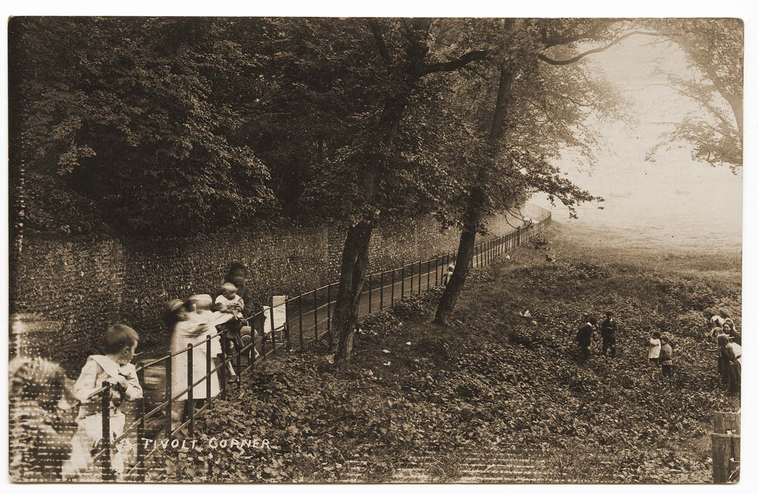
Tivoli Corner 1910 |
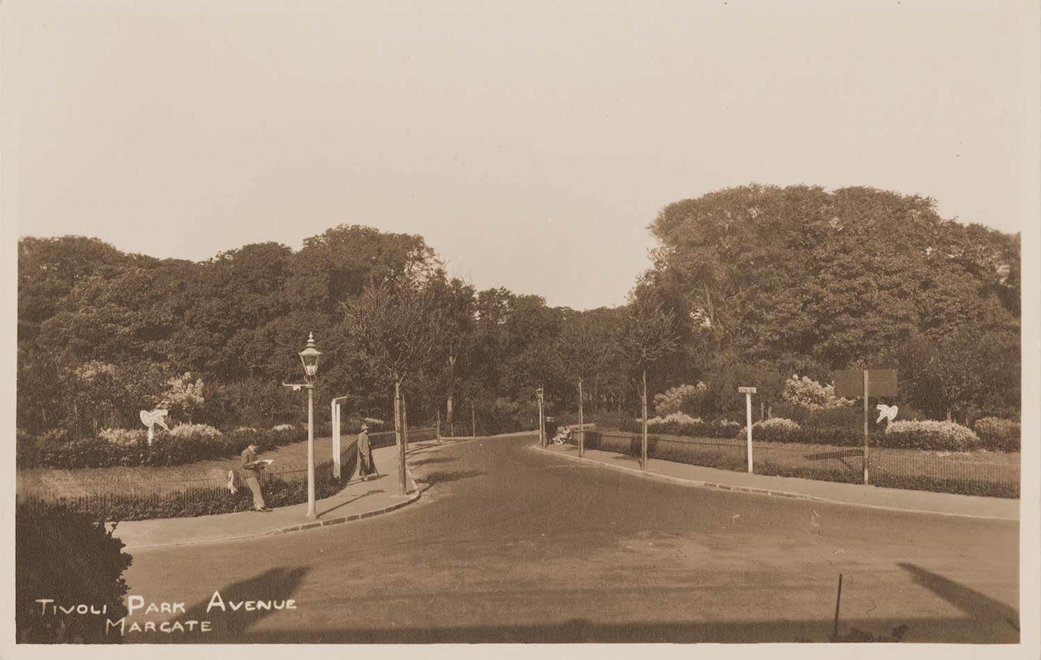
Tivoli Park Avenue |
Tivoli Park Avenue/outing 1926 |
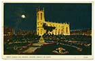
Trinity Church at night |
 |
 |
 |
 |
|
Trinity Church after bomb damage |
Trinity Church/Margate Sea Cadets 1933 |
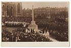
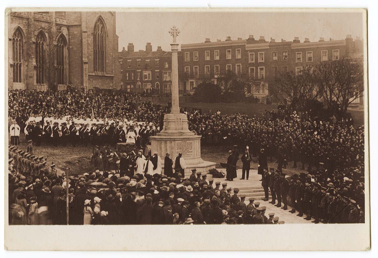
Trinity Church/War Memorial |
Trinity Square |
August 12 2012
|
Postcards added to the 1907 Ordnance Survey Map of Margate.
|
 |
 |
 |
 |
|
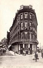
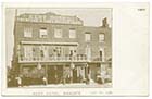
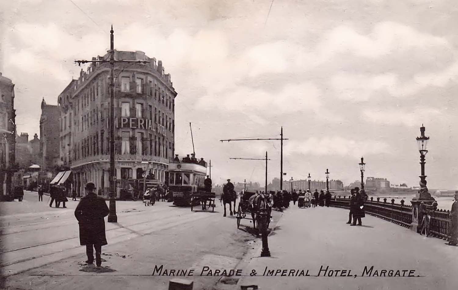
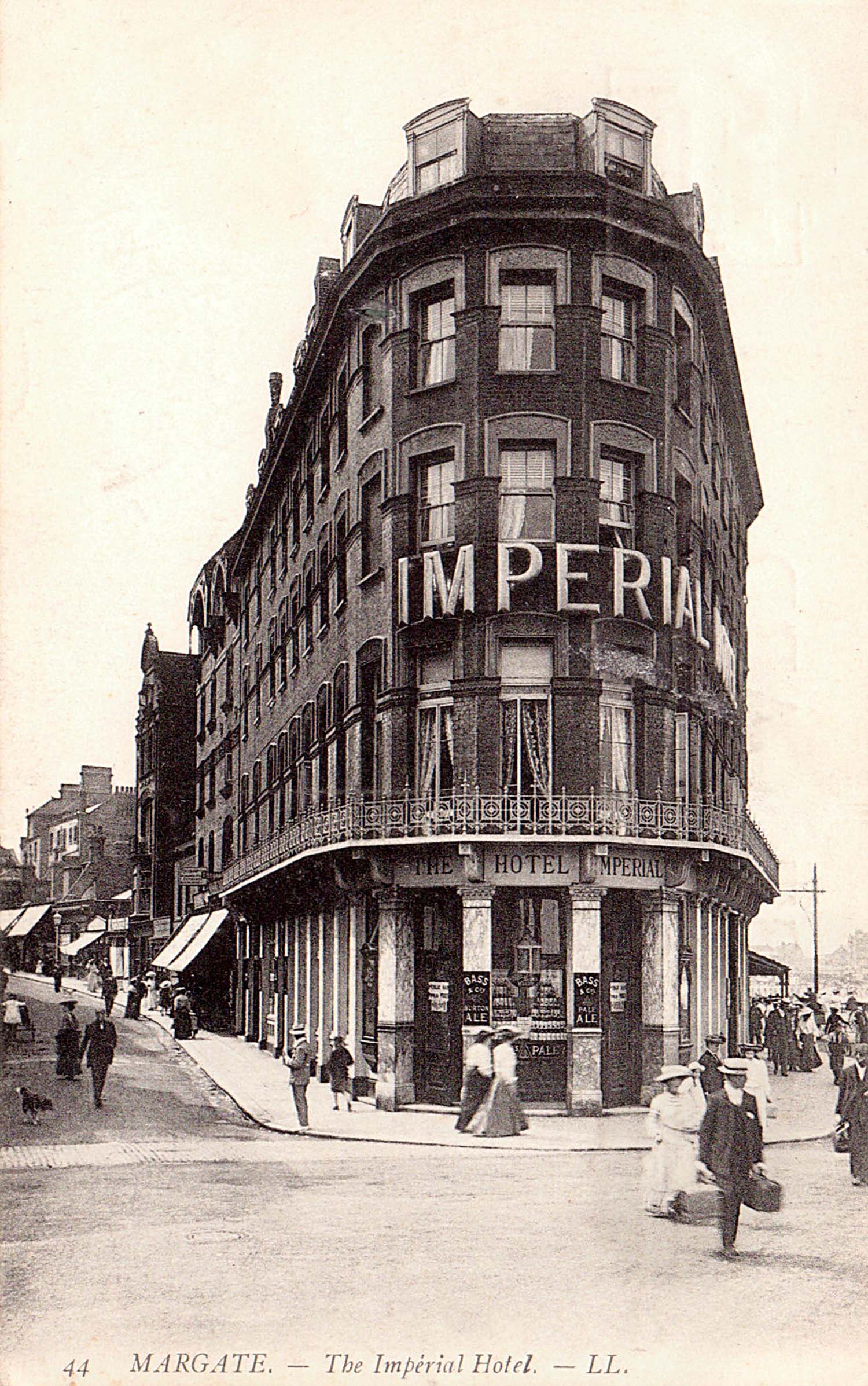
Imperial Hotel 1907 |
Imperial Hotel 1907 |
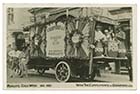
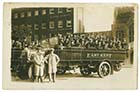
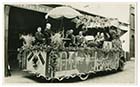
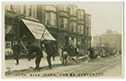
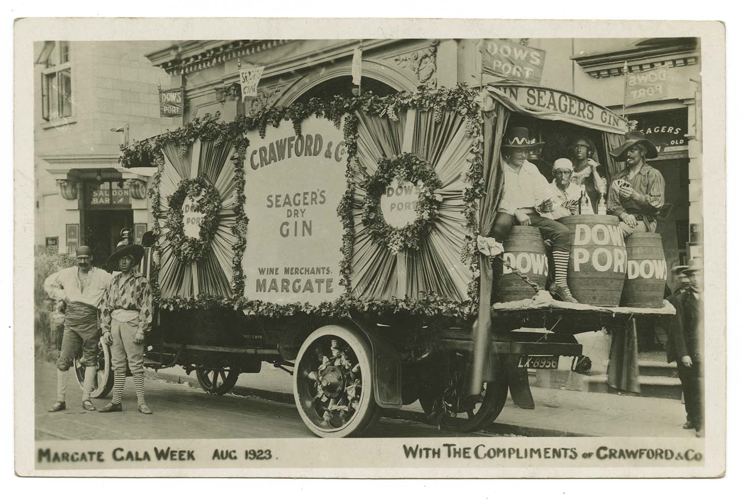
Margate Gala Week 1923/Crawford Lorry |
Hodges Bridge/New promenade |
 |
 |
 |
 |
|
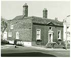
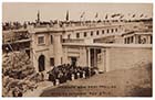
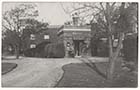
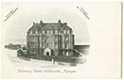
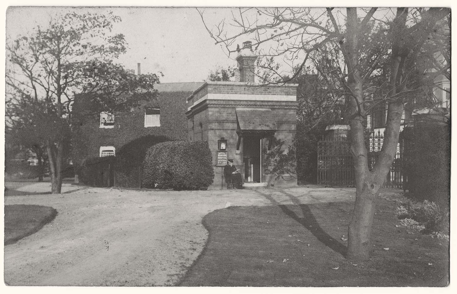
Royal Sea Bathing Infirmary Entrance Lodge |
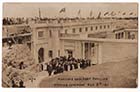
Royal Sea Bathing Infirmary Entrance Lodge 1907 |
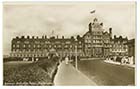
Royal Sea Bathing Infirmary front view |
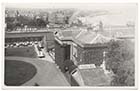
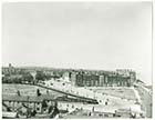
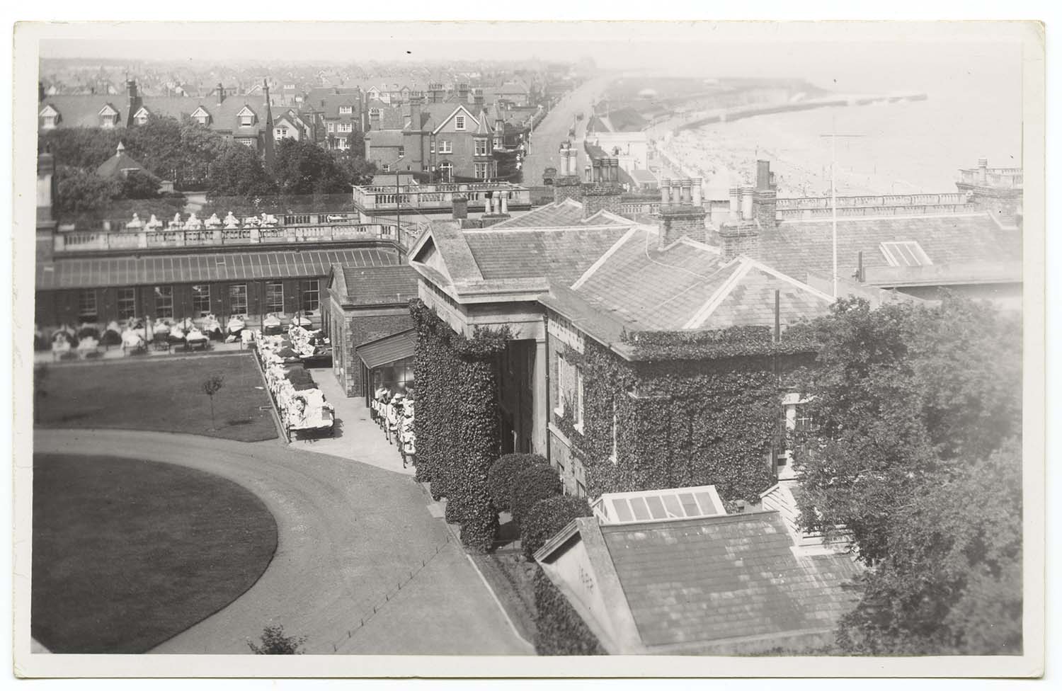
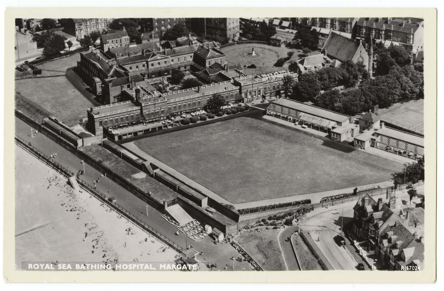
Royal Sea Bathing Infirmary aerial view |
 |
 |
 |
 |
|
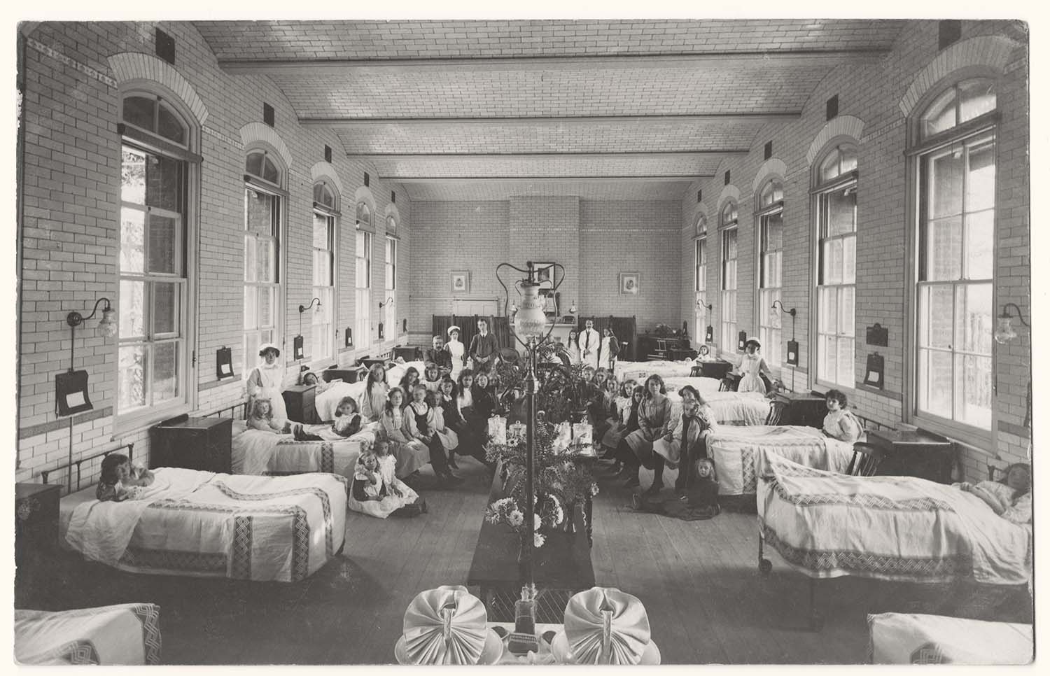
Royal Sea Bathing Infirmary Victoria Ward |
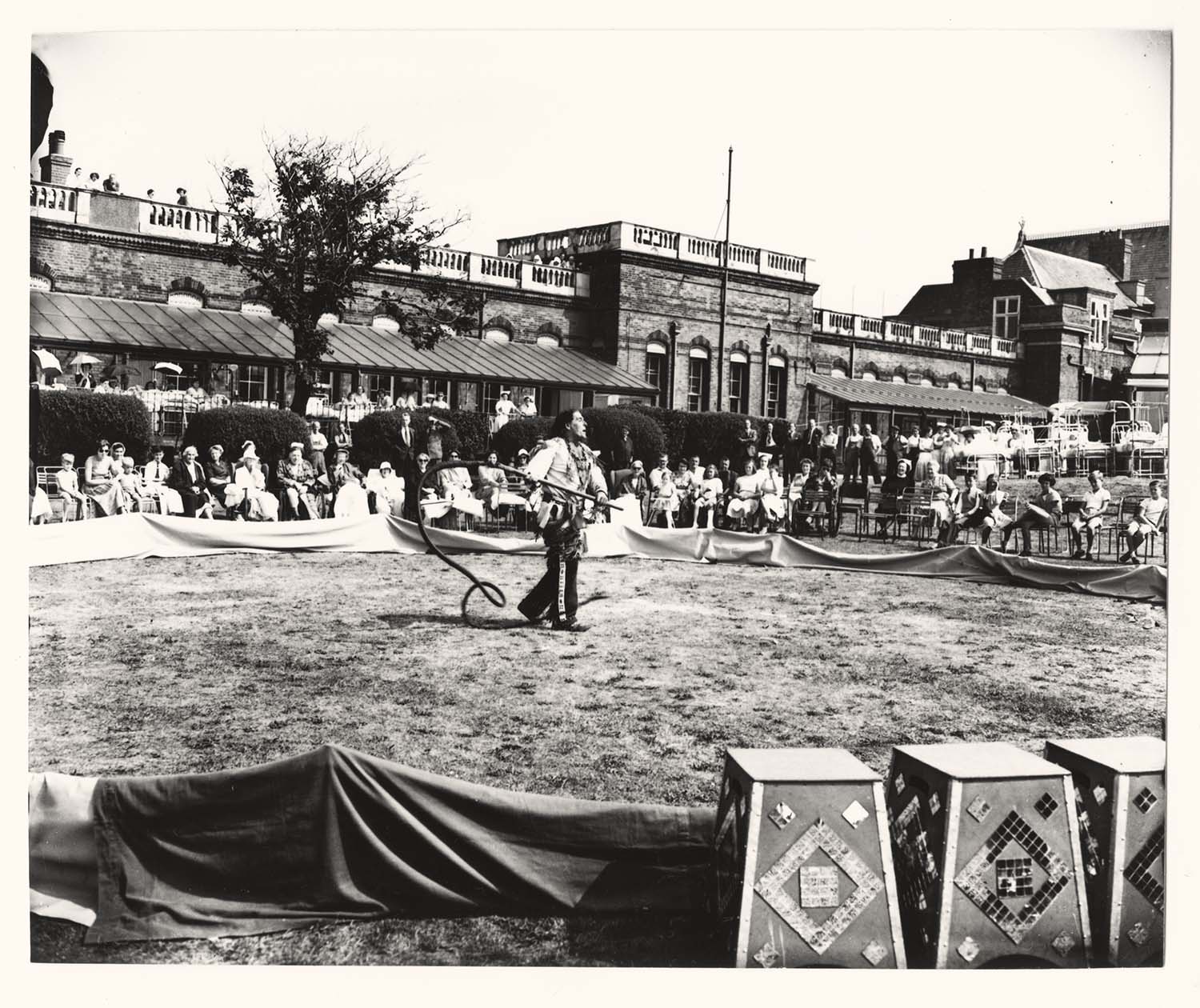
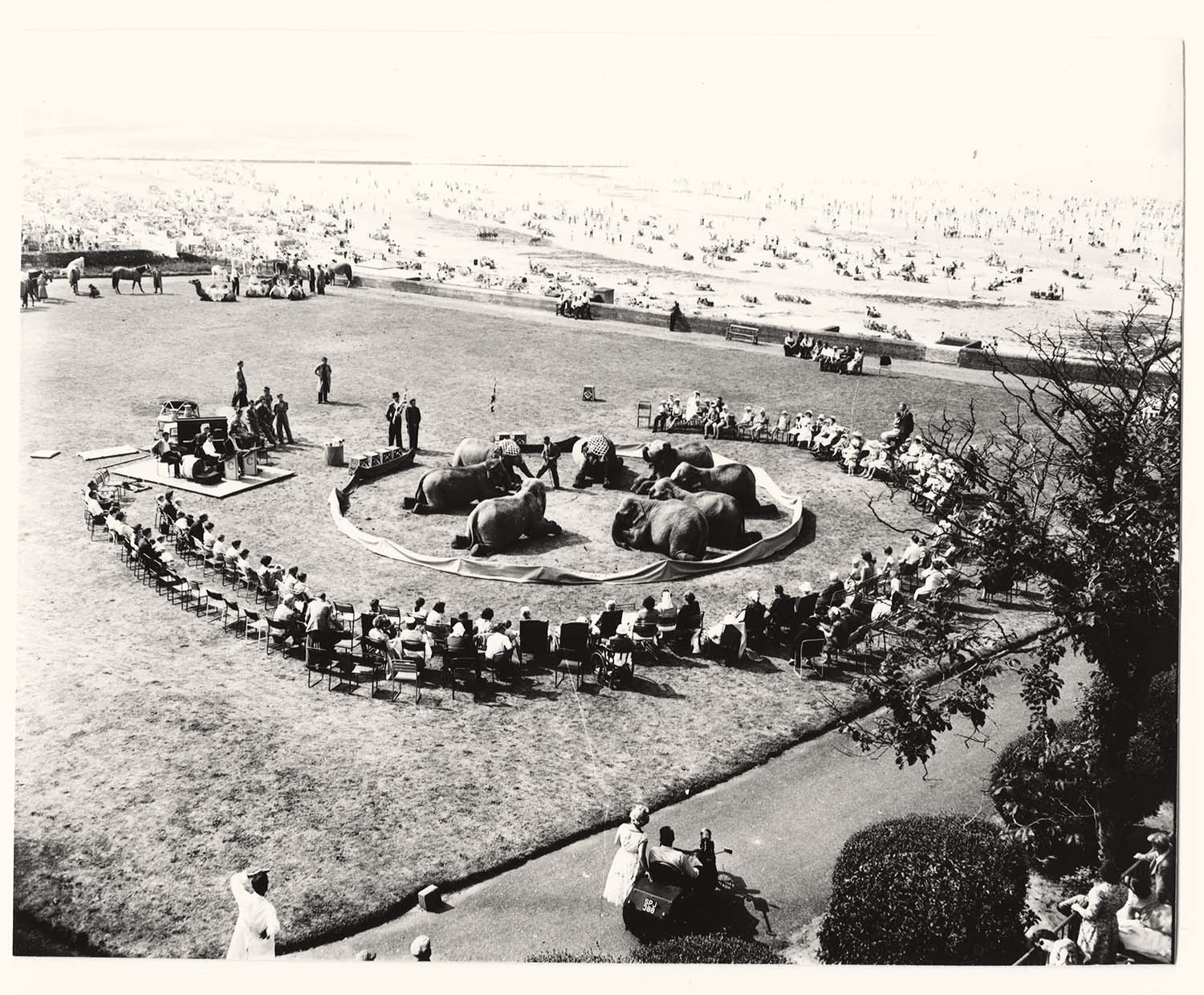
Royal Sea Bathing Infirmary/circus [photo] |
Royal Sea Bathing Infirmary/circus [photo] |
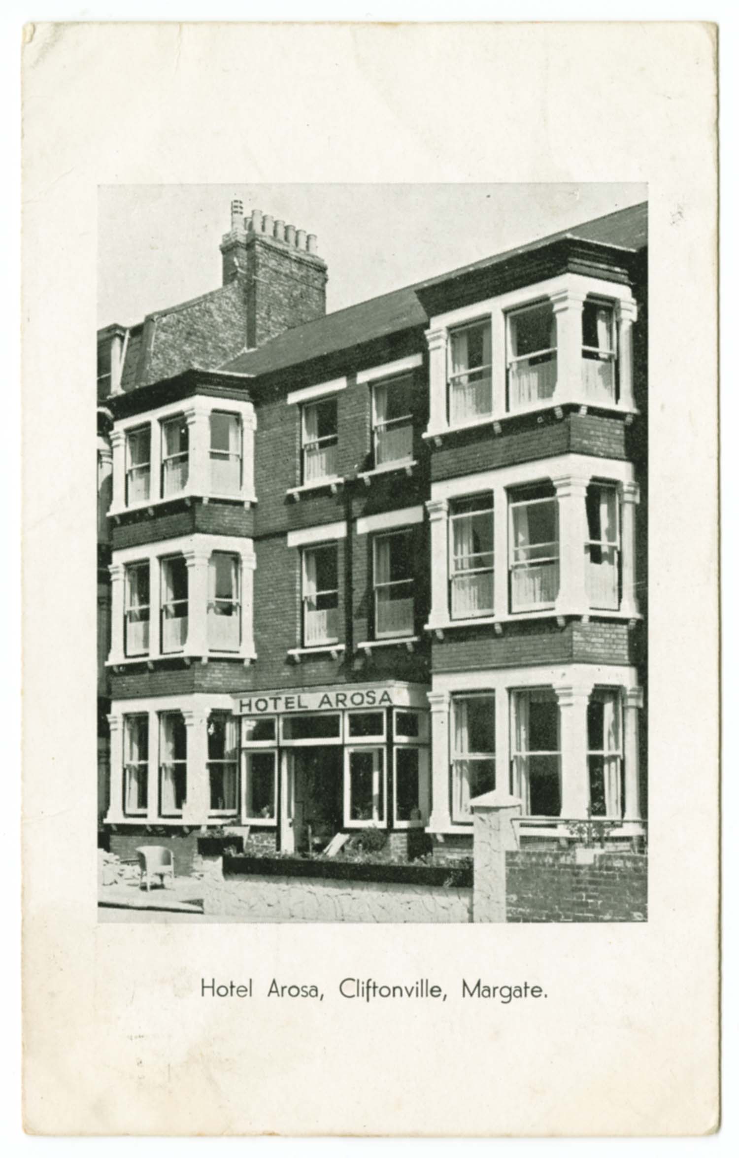
Second Avenue/Arosa Hotel Nos 5 and 7 1938 |
/LCDR Station 1903-thumb.jpg) |
 |
 |
 |
|
Railway Station LCDR (West) 1903 |
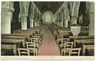
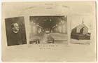
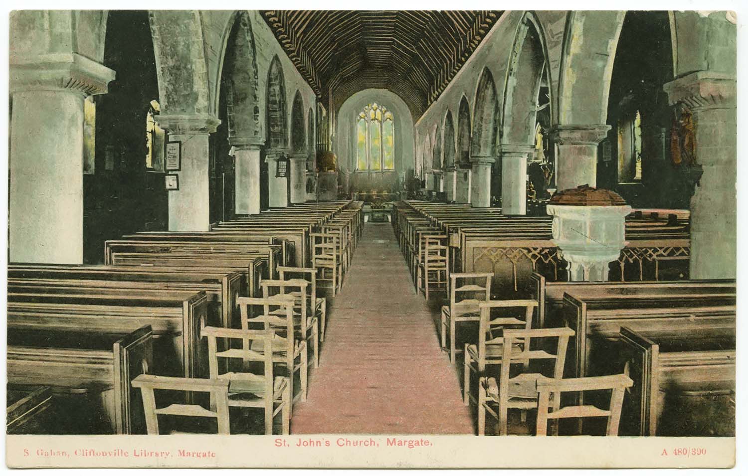
St Johns Church Interior 1906 |
St Johns Church Interior |
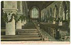
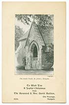
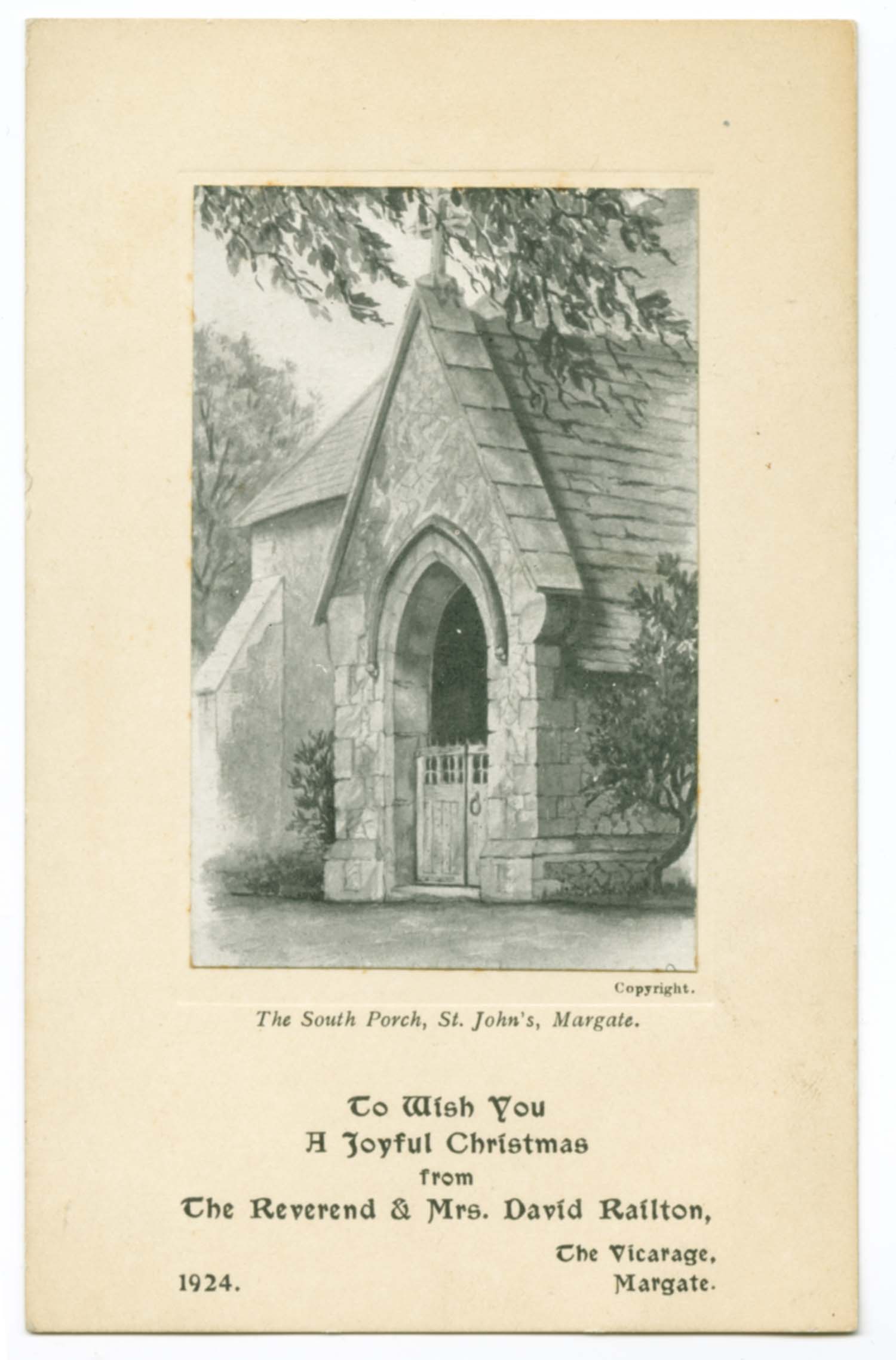
St Johns Church South Porch 1924 |
August 8 2012
|
Some newly added pictures of Margate
|
![Lido Cliff Railway [Jim Greaves] | Margate History](../Pictures/Photos/Others/Lido Cliff Railway JG-thumb.jpg) |
 |
|
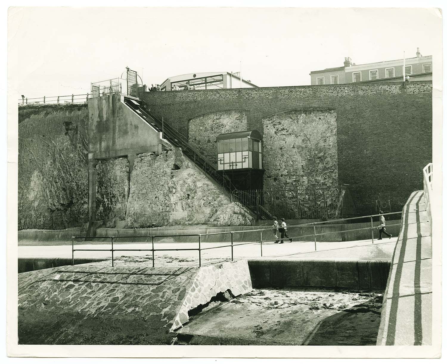
Lido Cliff Railway [Jim Greaves] |
Lido Cliff Railway |
 |
 |
|
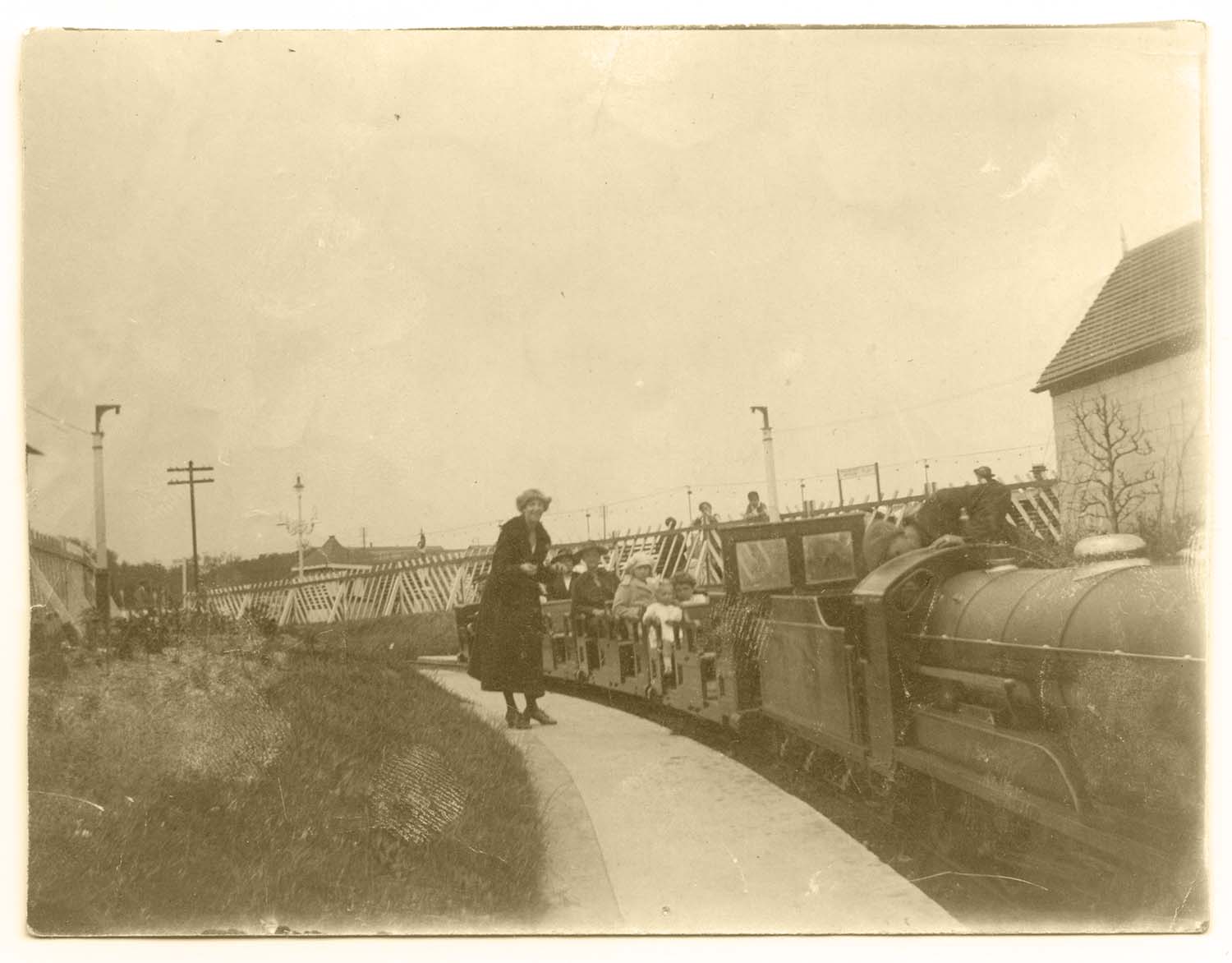
Dreamland Miniature Railway station |
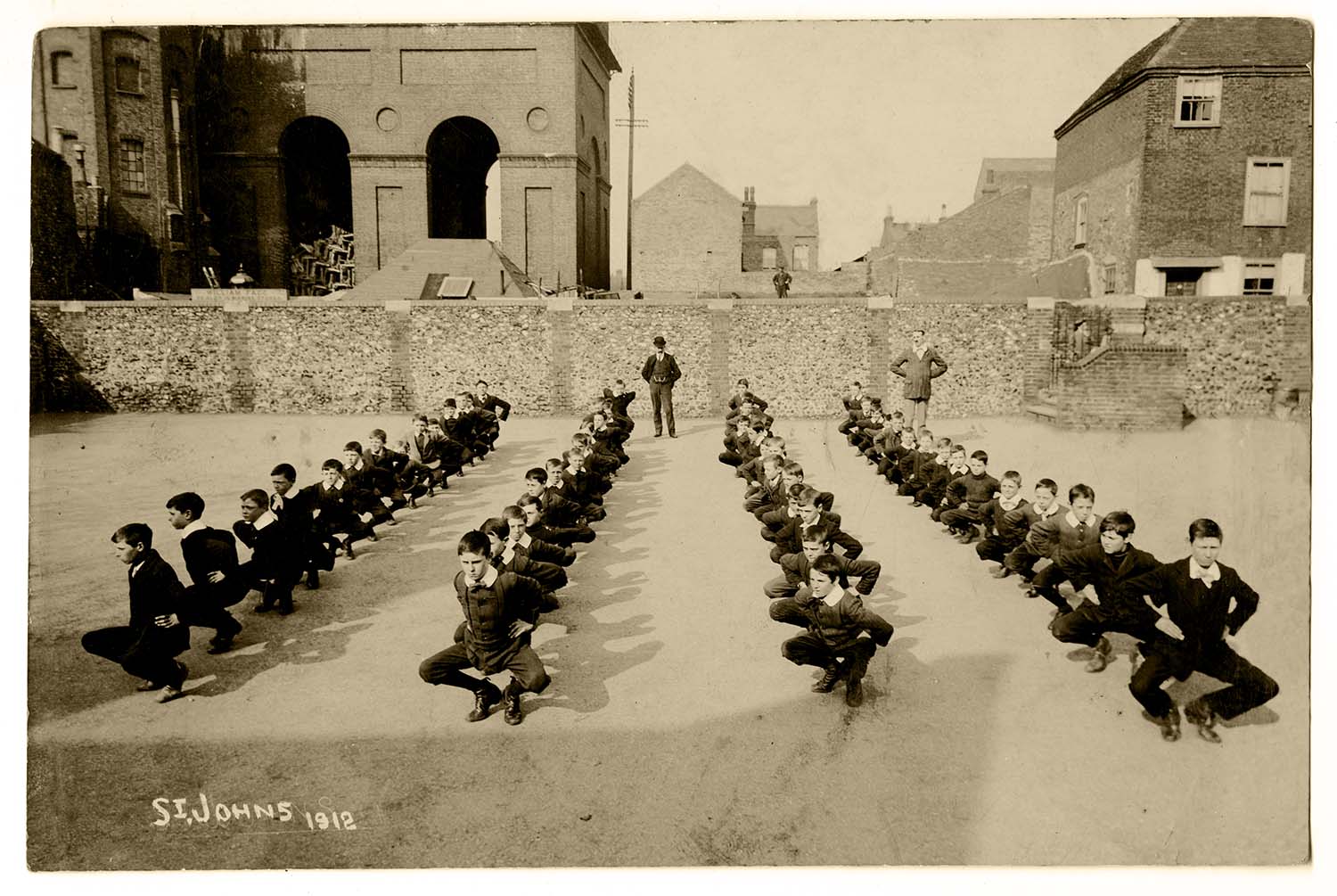
St Johns School 1912 |
 |
|
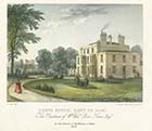
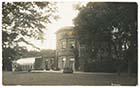
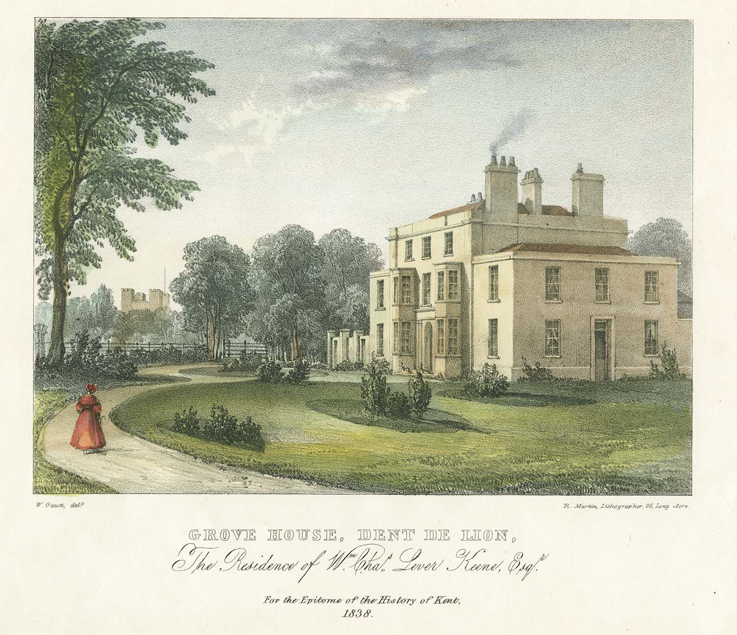
Grove House 1838 |
Information kindly provided by Jim Greaves
|
 |
 |
|
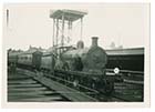
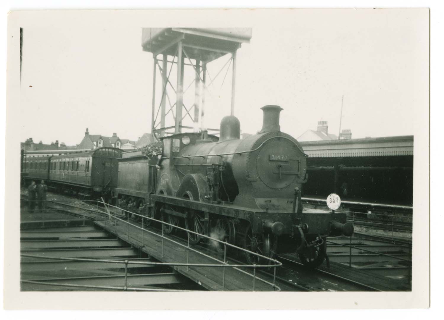
Margate West Station ca 1950 - Engine 31477 scrapped in 1951 |
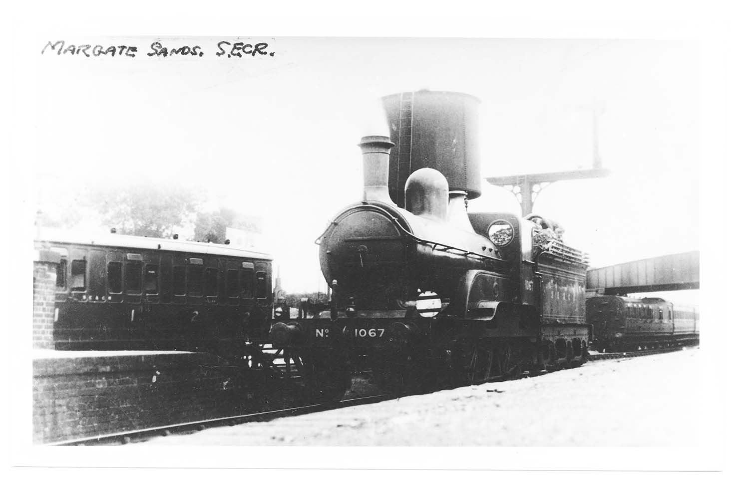
Margate Sands Station - ca 1914 -GNR loco loaned to SECR |
August 5 2012
|
Postcards added to the 1907 Ordnance Survey Map of Margate.
|
 |
 |
 |
 |
|
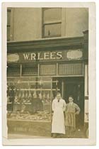
Canterbury Rd/W.R.Lees No. 139, Butcher and Grazier |
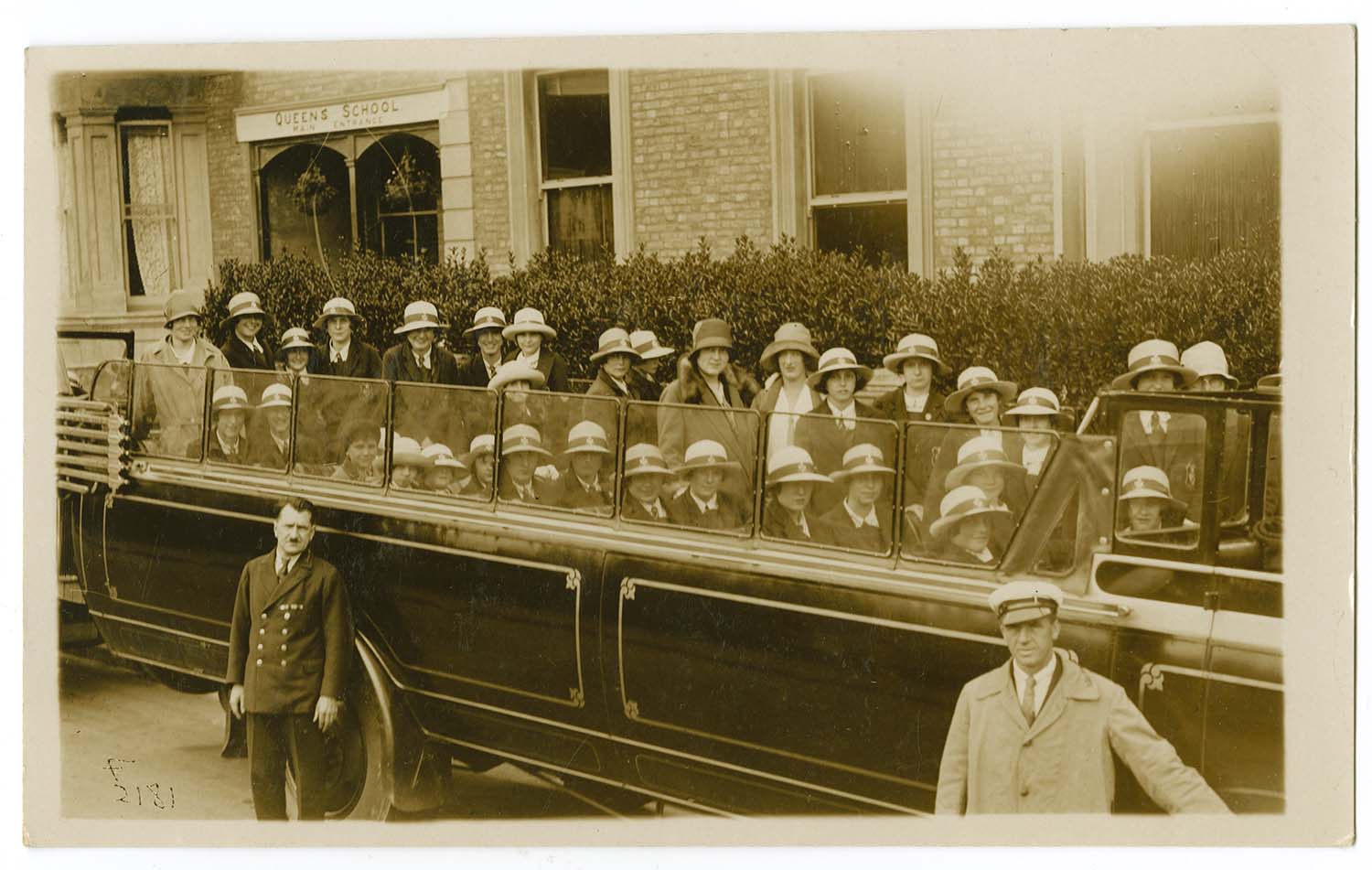
Coach outside Queens School, Dalby Square |
Marine Terrace No 34, 1909 |
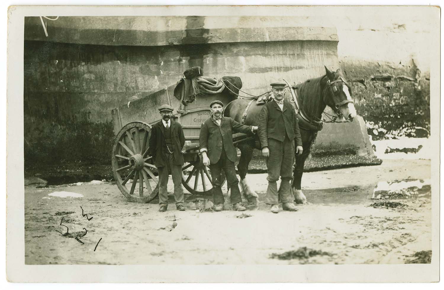
Newgate Gap/Corporation tip cart |
 |
 |
 |
 |
|
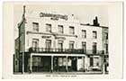
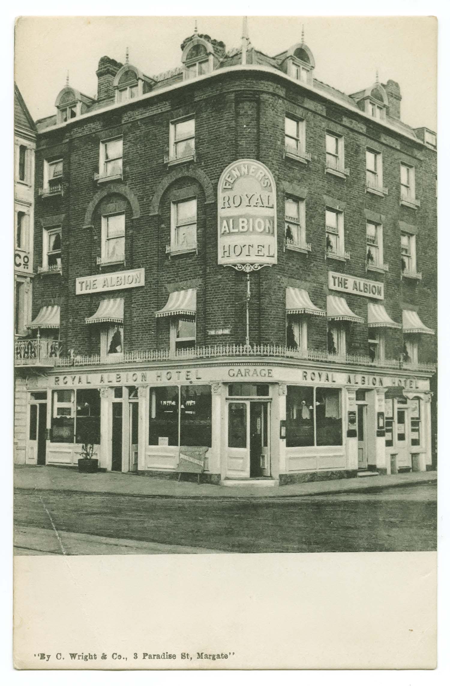
Parade/Royal Albion Hotel |
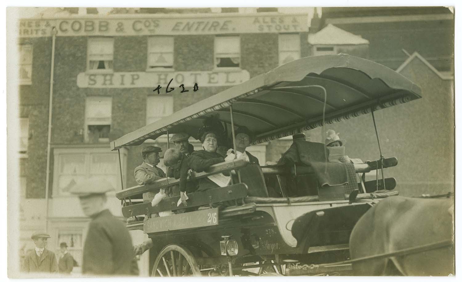
Parade/Ship Hotel |
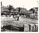
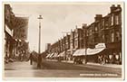
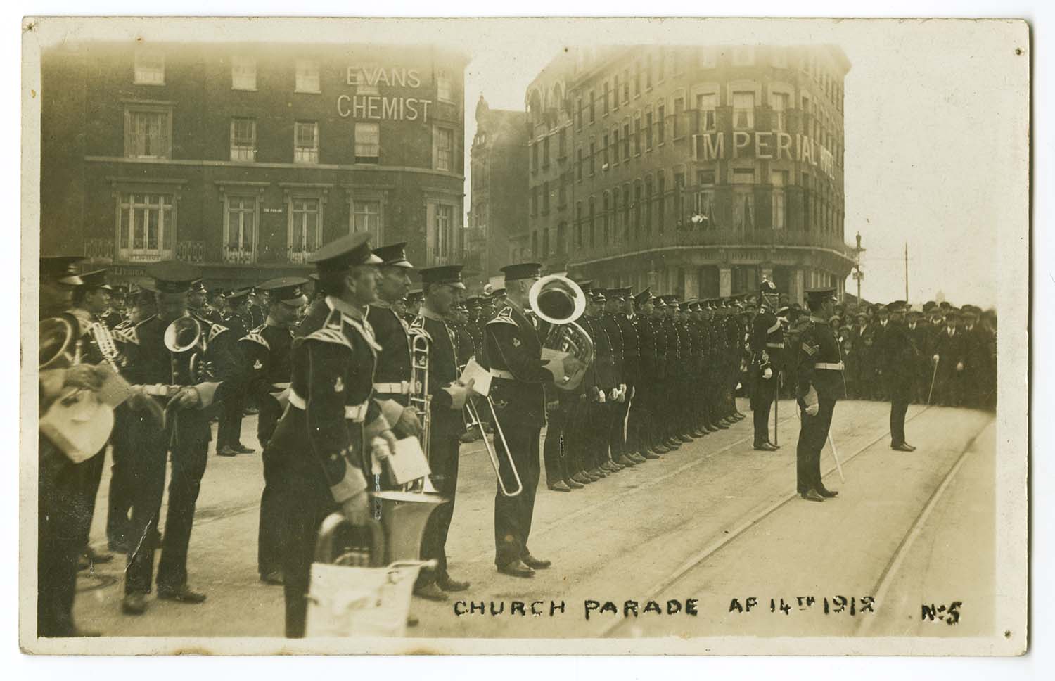
Parade/Church Parade 1912 |
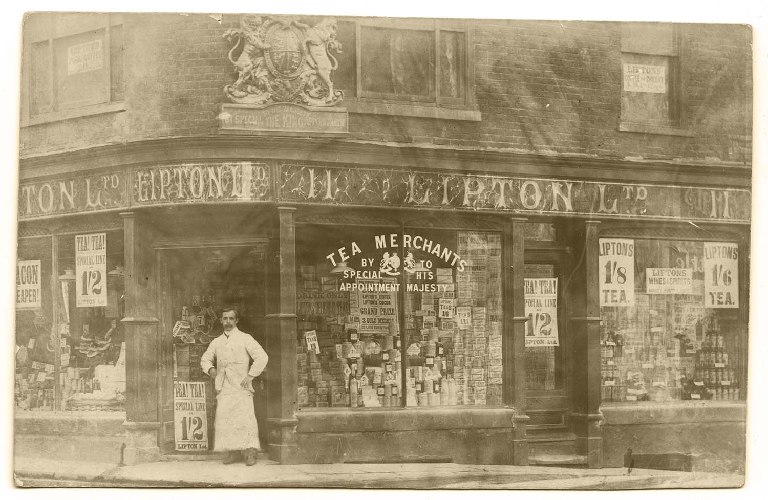
Queen St/Lipton, No 11, 1913 |
 |
 |
 |
 |
|
Queen St/Lipton Ltd, No 11 |
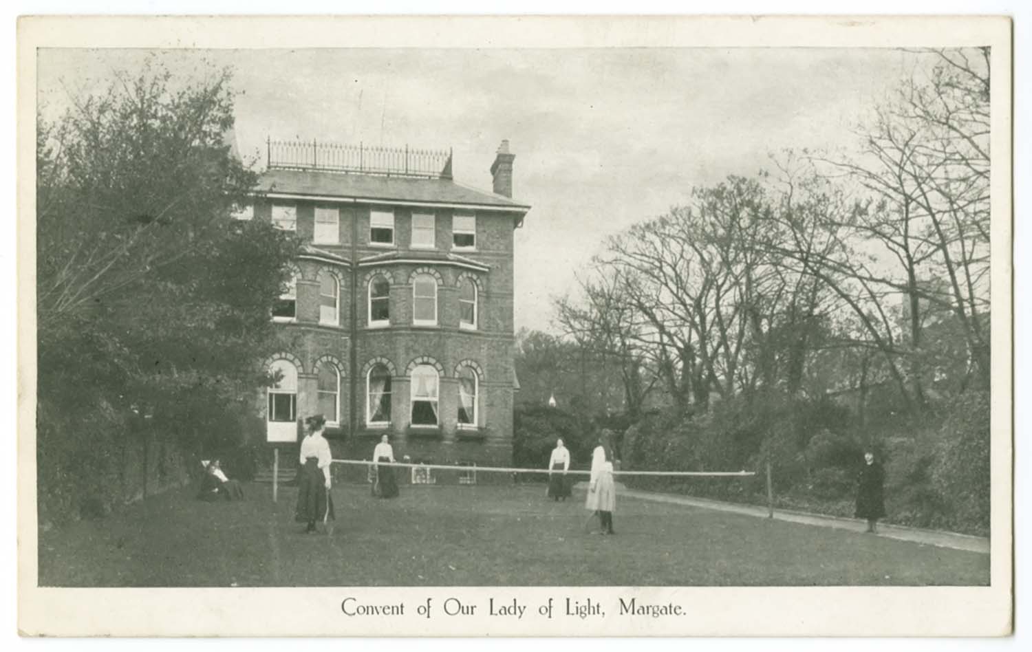
Queens Avenue/Convent Lady of Light, 1919 |
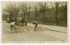
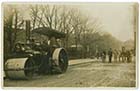
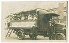
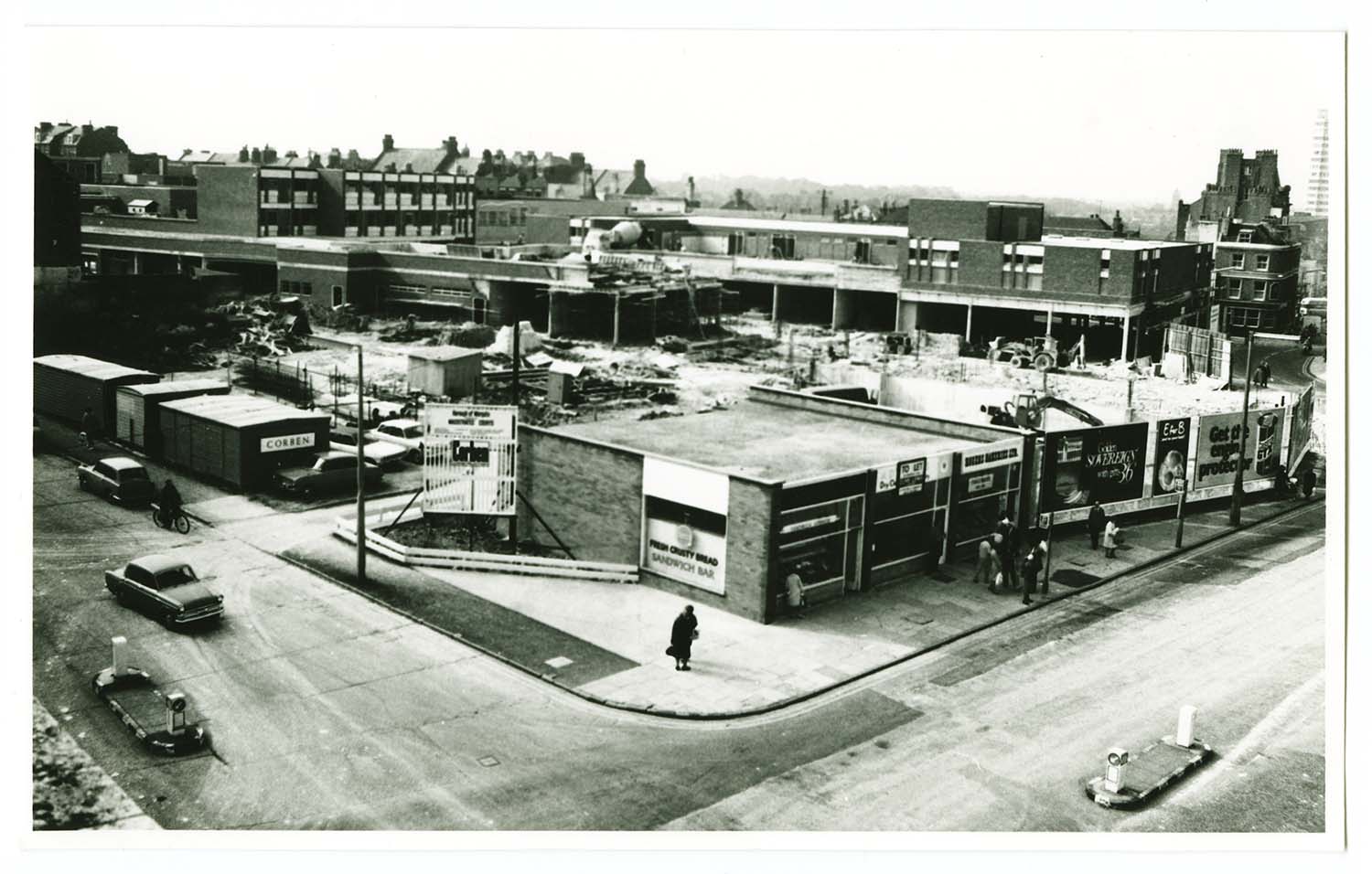
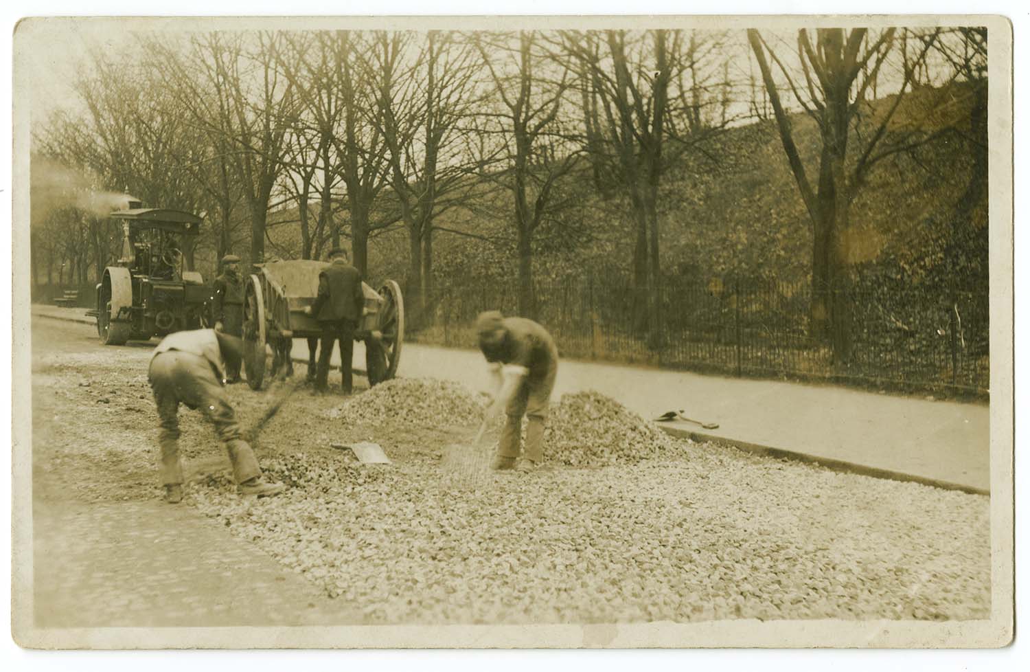
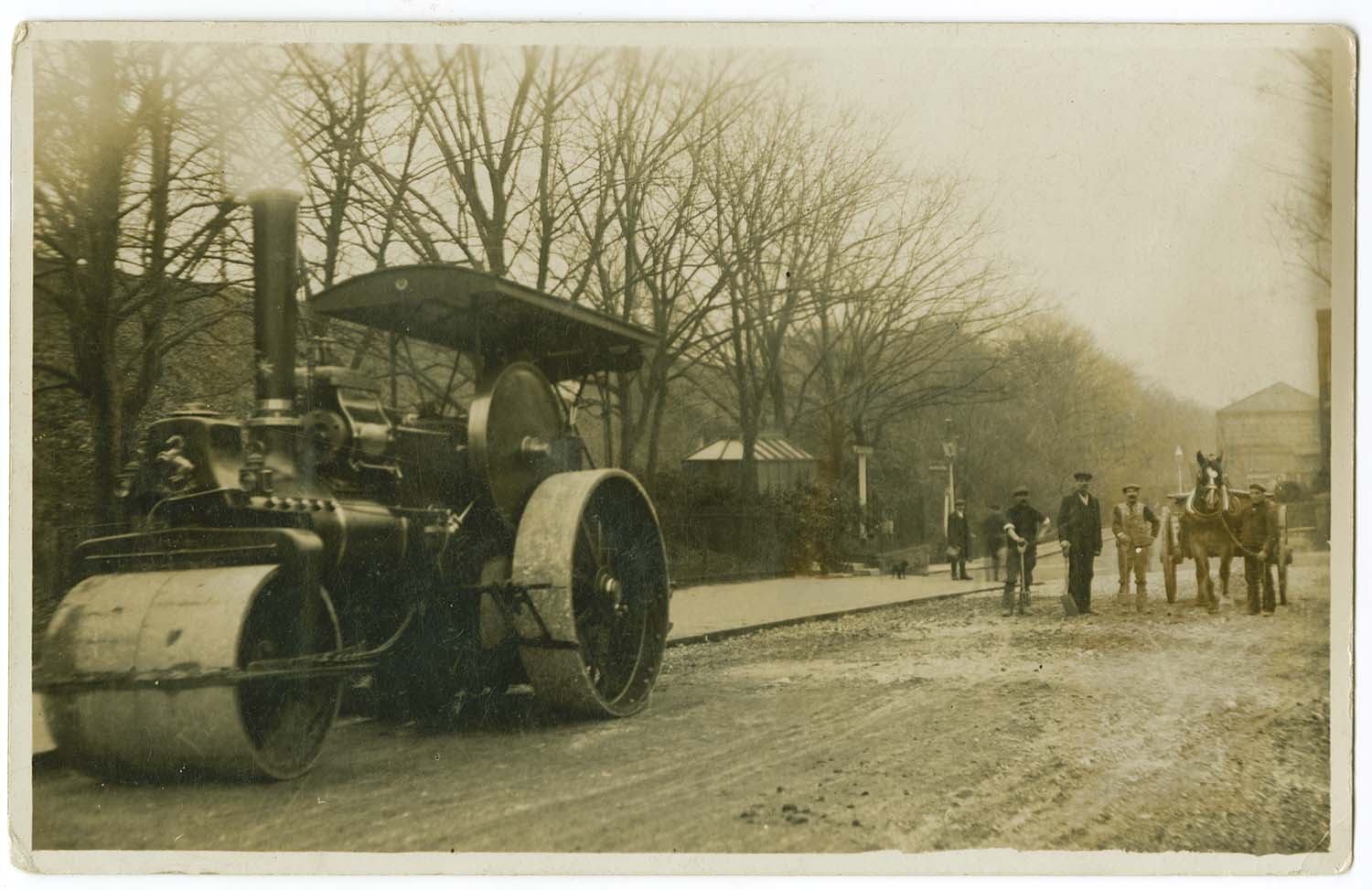
Queens Avenue/Road Building |
Queens Avenue/Road Building |
 |
 |
 |
/Railway Station Sands photo-thumb.jpg) |
|
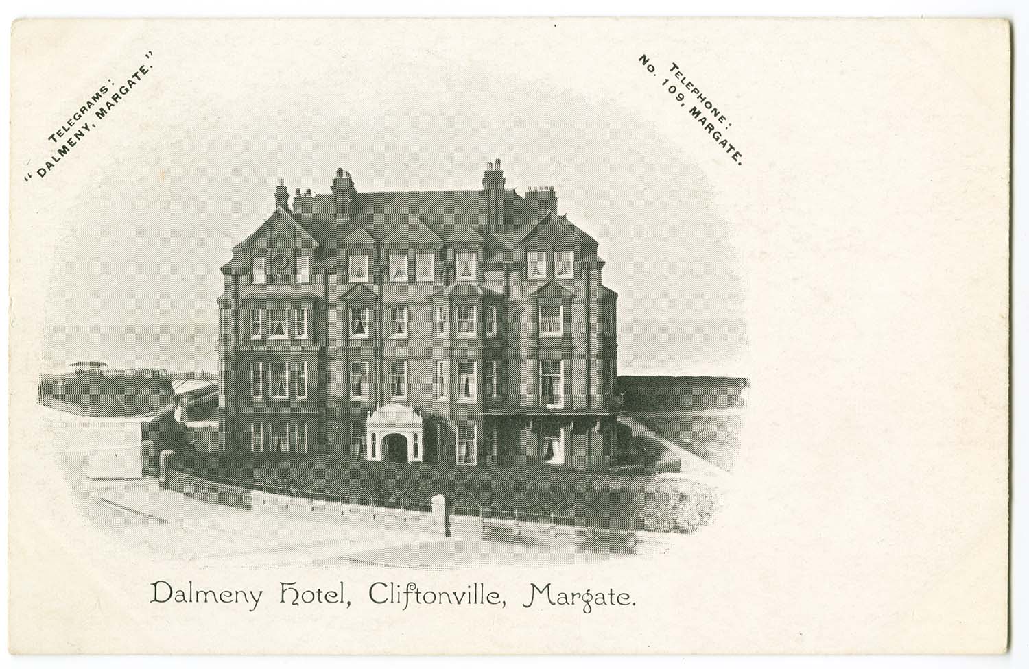
Queens Gardens/Dalmeny Hotel |
Queens Gardens/Queens and High Cliffe Hotels |
Railway station and Buenos Ayres |
SER Sands Railway Station |
July 31 2012
|
Postcards added to the 1907 Ordnance Survey Map of Margate.
|
 |
 |
 |
 |
|
Canterbury Road/Dog and Duck No 44 |
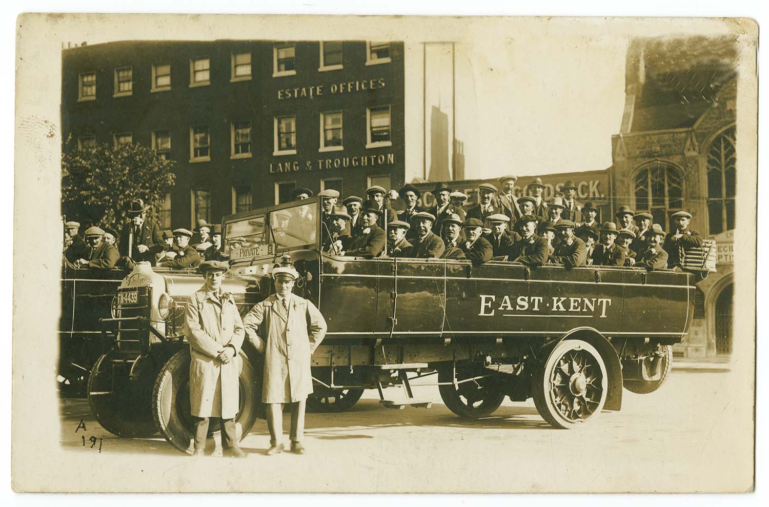
East Kent Coach in Cecil Square |
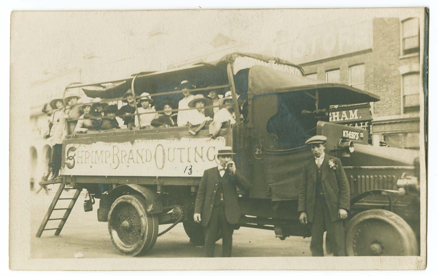
Shrimp Brand coach outside Bangham garage |
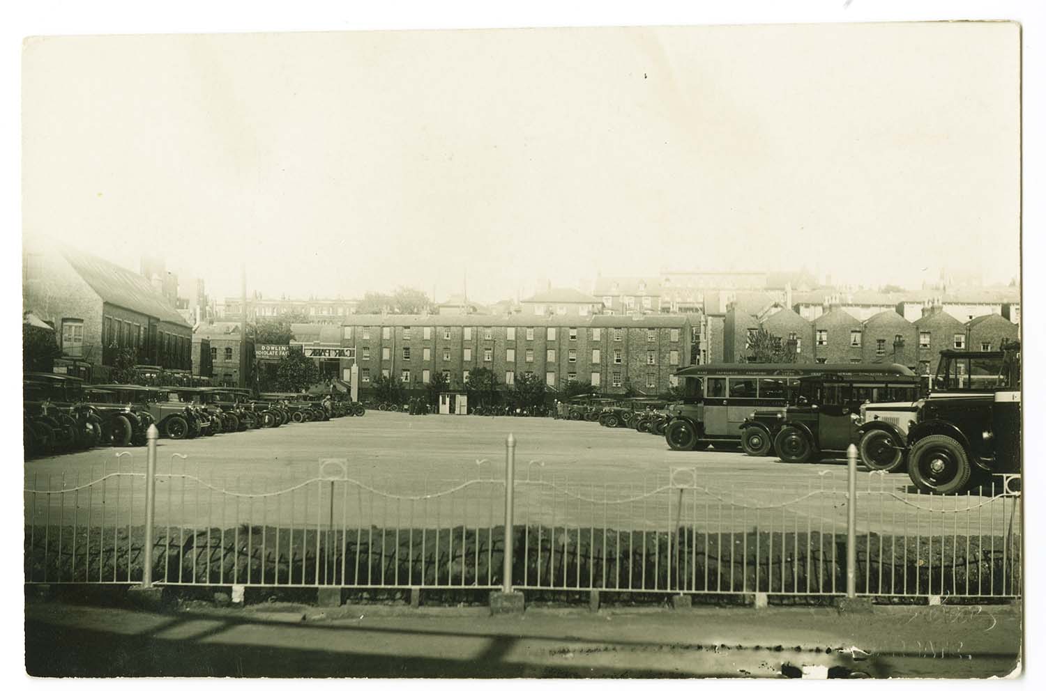
Dreamland Car Park Eaton Road entrance |
 |
 |
 |
 |
|
Eastern Esplanade/St Martins School |
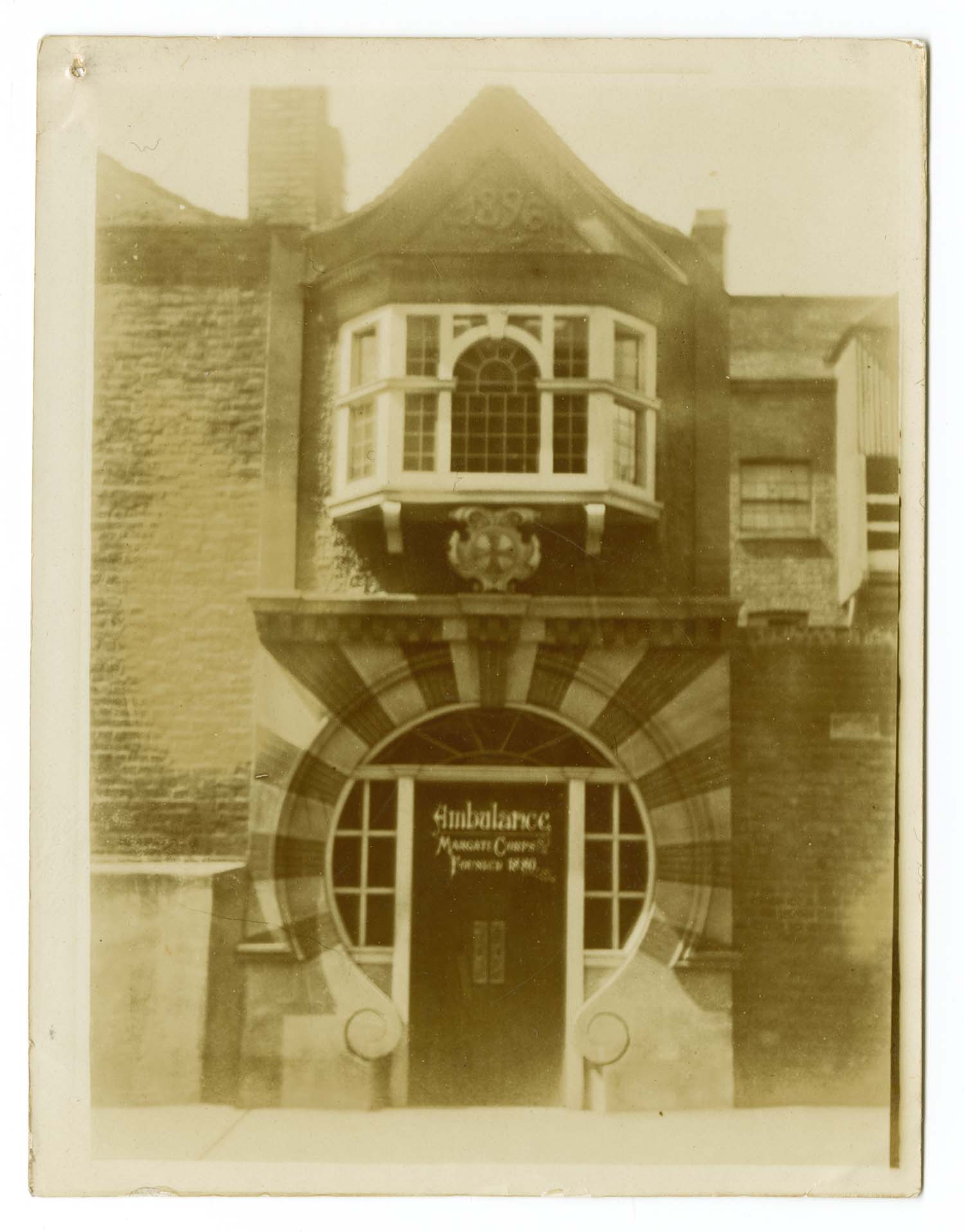
Fort Road Ambulance Station |
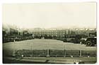
Hall by the Sea Football ground 1914 |
High Street Church Parade 1918 |
 |
 |
 |
 |
|
Mansion Street Regatta 1949 |
Mansion Street Regatta 1949 |
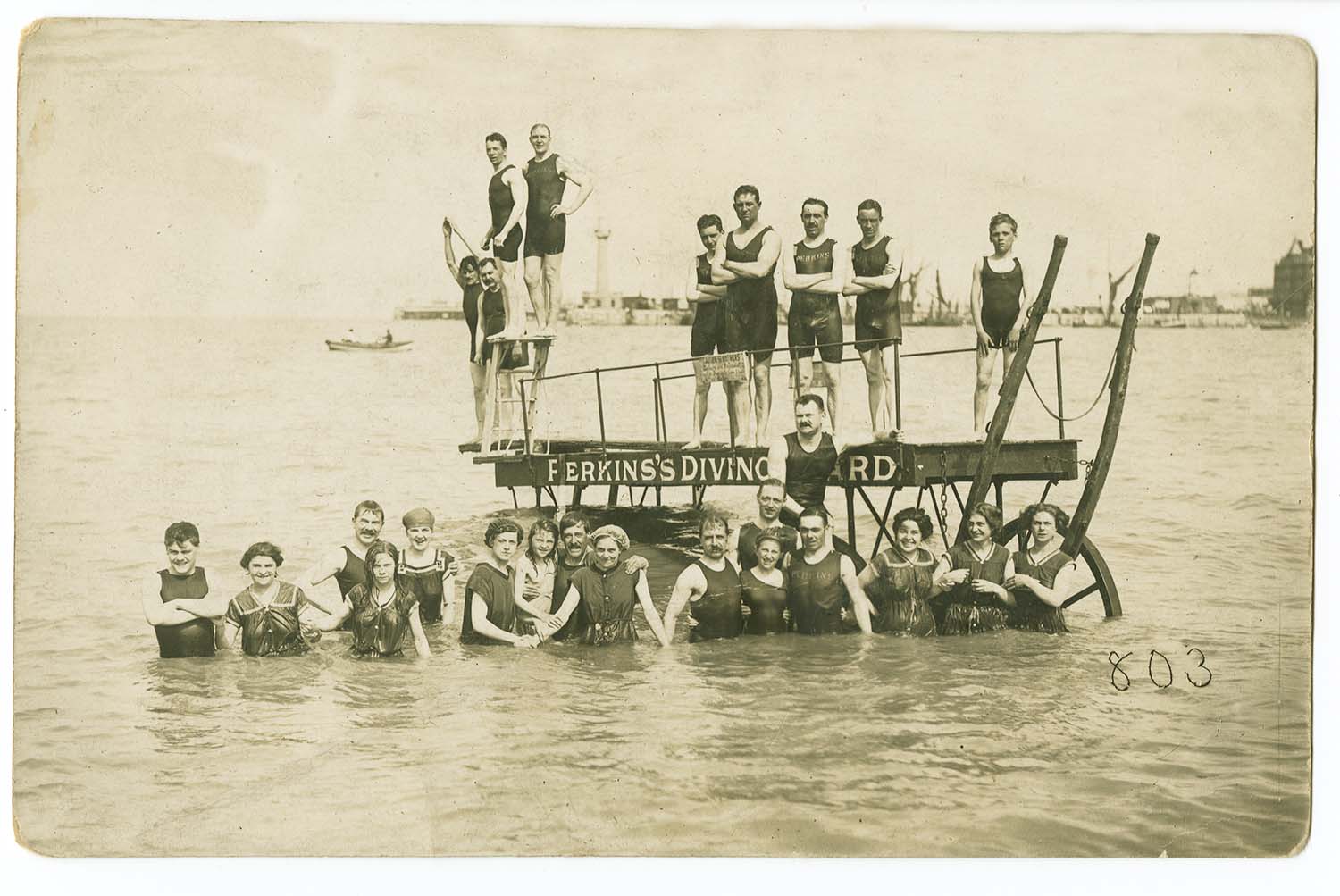
Marine Terrace Sands/Perkins Diving Board 1910 |
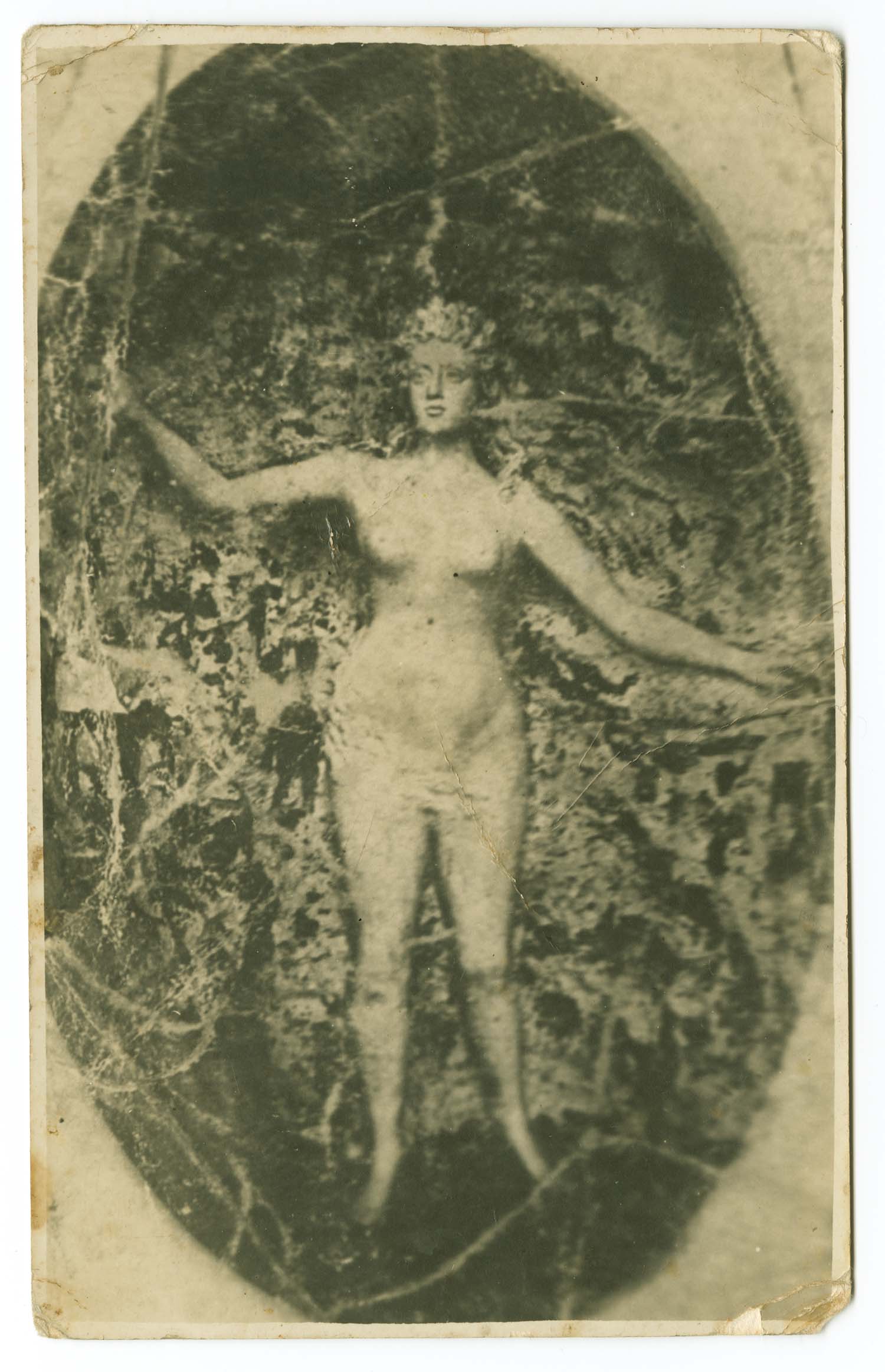
Newgate Gap/Figure carved in chalk |
 |
 |
 |
 |
|
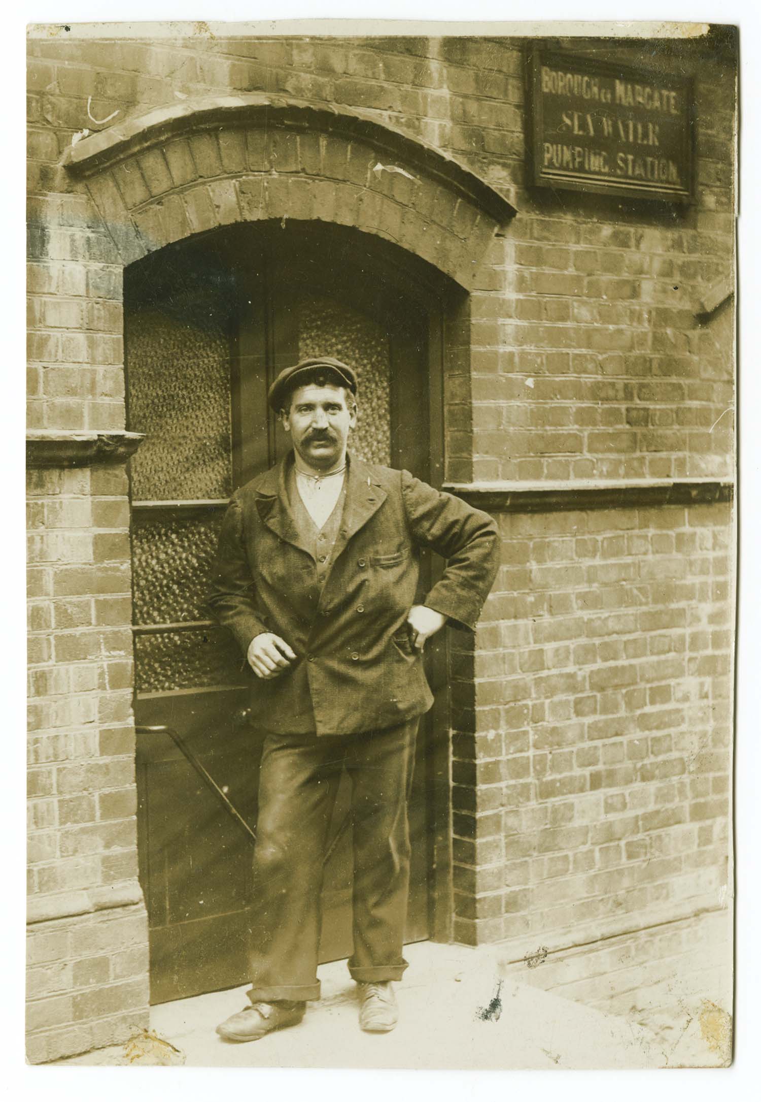
Newgate Gap pumping station c 1912 |
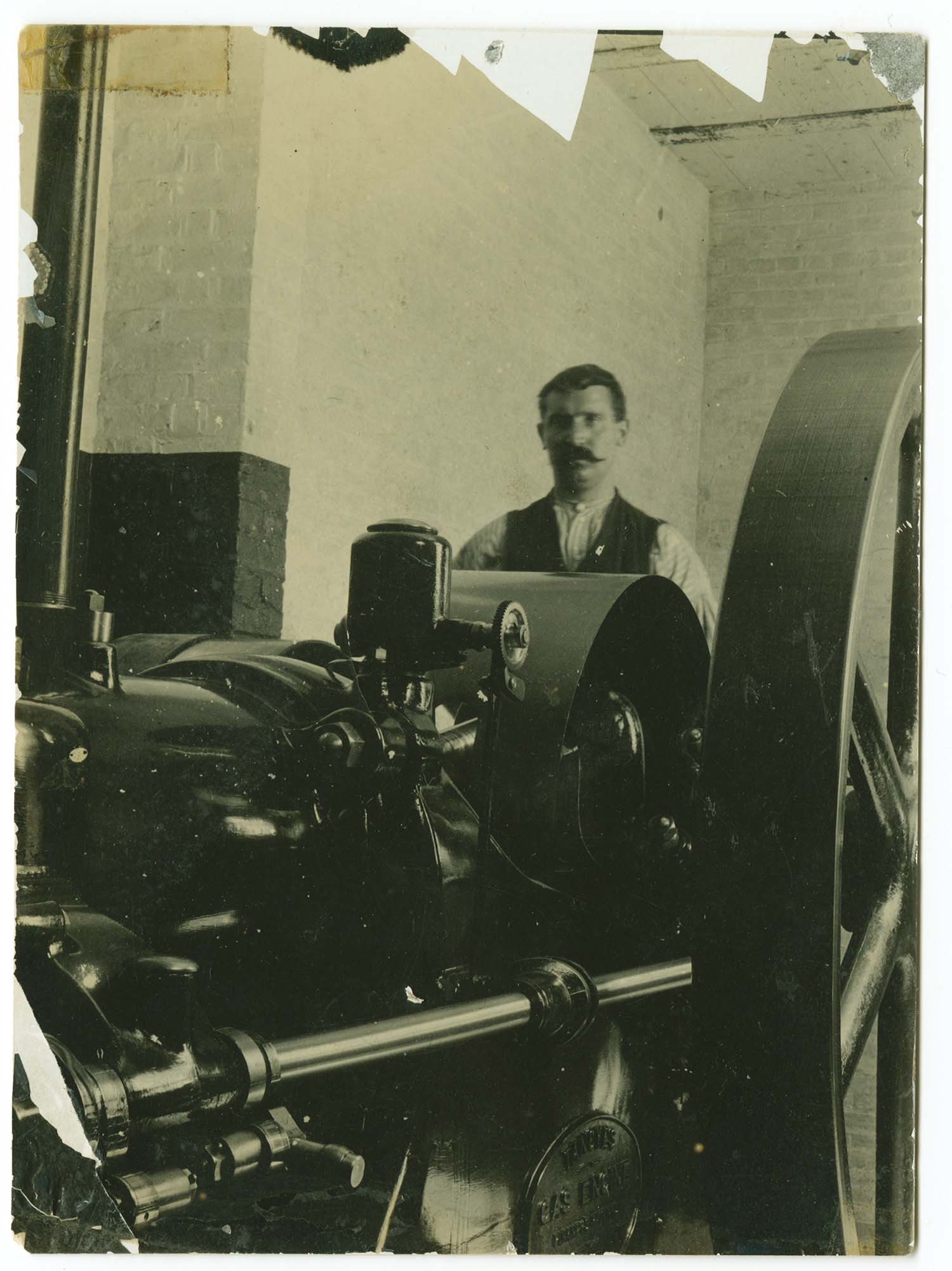
Newgate Gap pumping station Mr Nutter c 1912 |
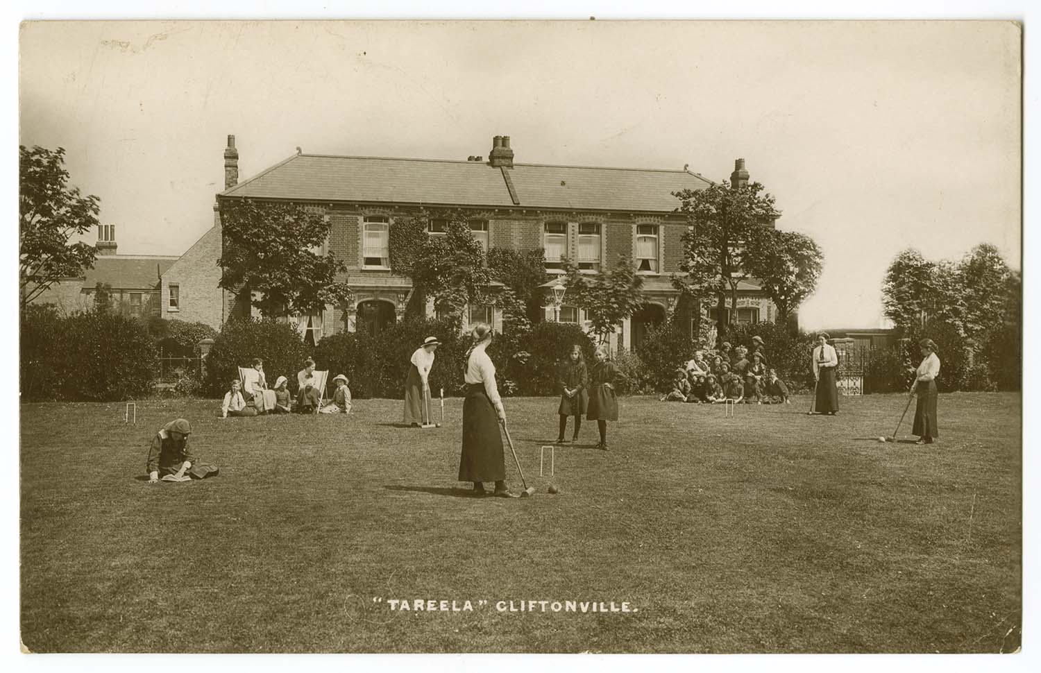
Northdown Avenue/Tareela School |
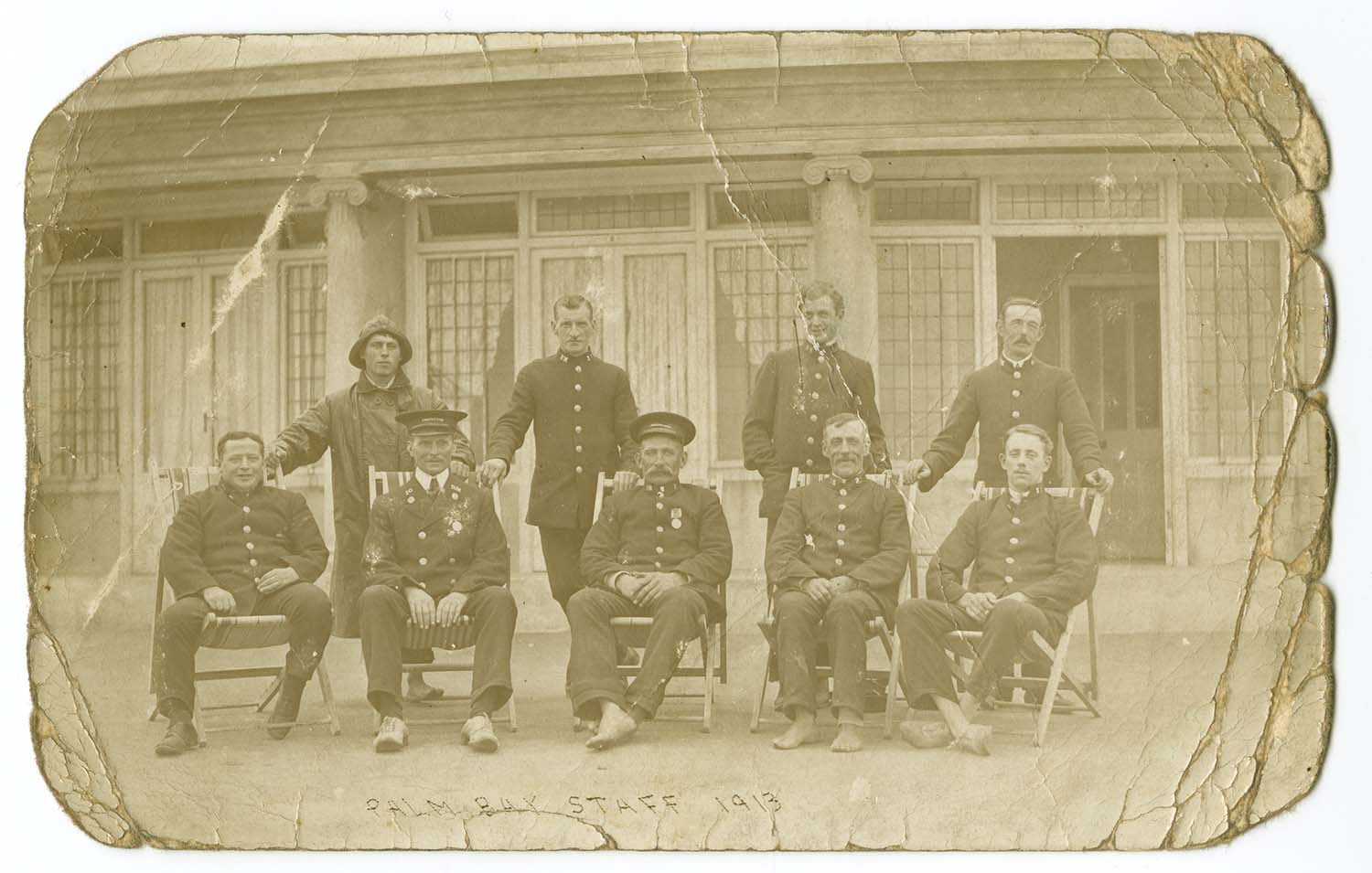
Palm Bay Staff 1913 |
July 7 2012
|
Postcards added to the 1907 Ordnance Survey Map of Margate.
|
/Marine Terrace Margate Sands station LL 1905-thumb.jpg) |
 |
 |
 |
|
Marine Terrace and SER Station 1905 [LL PC] |
Marine Terrace/ painting the prom |
Marine Terrace/ sands service 1913 |
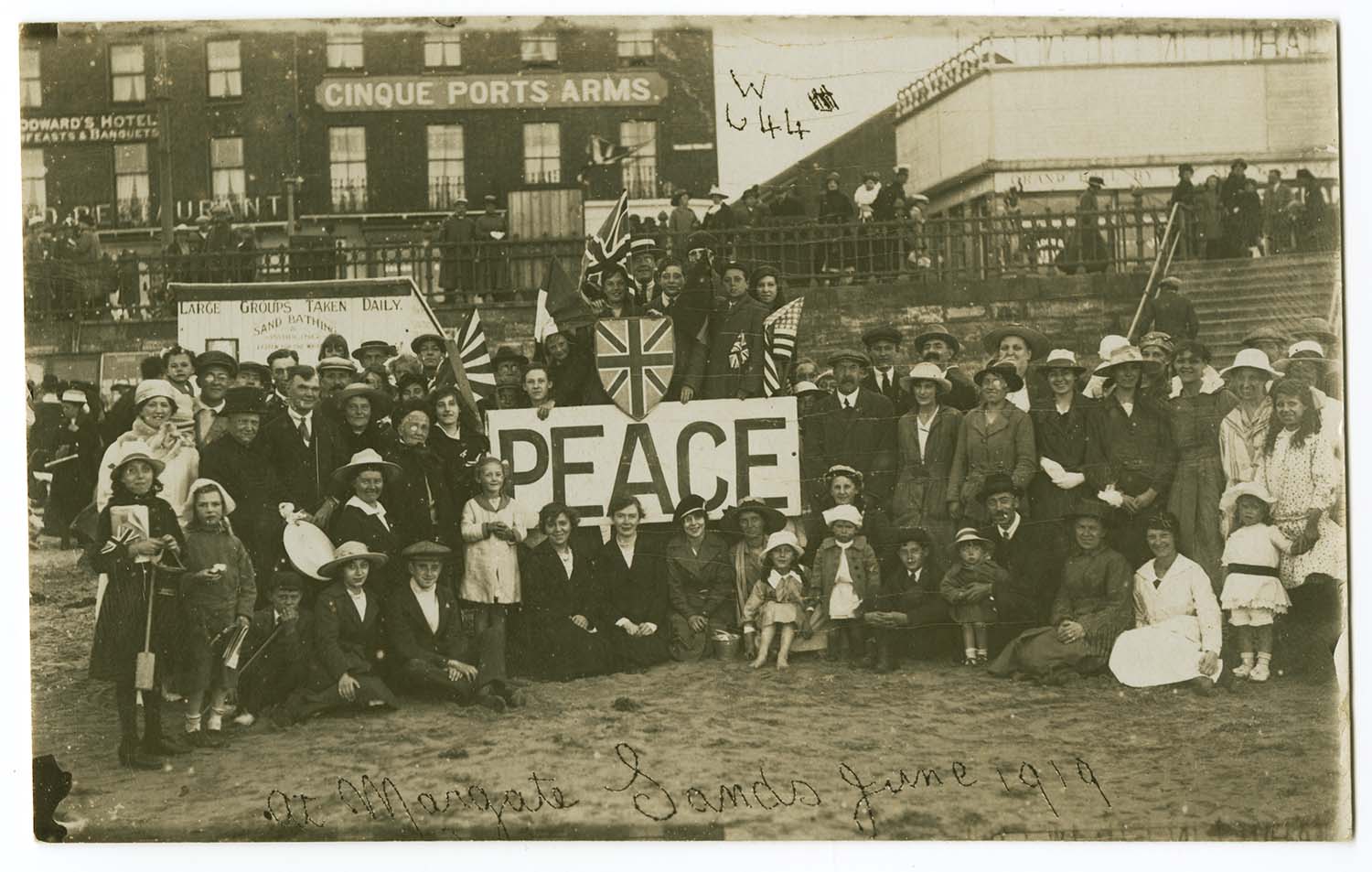
Marine Terrace sands and Cinque Port Arms [1919] |
 |
 |
 |
 |
|
Marlborough Road |
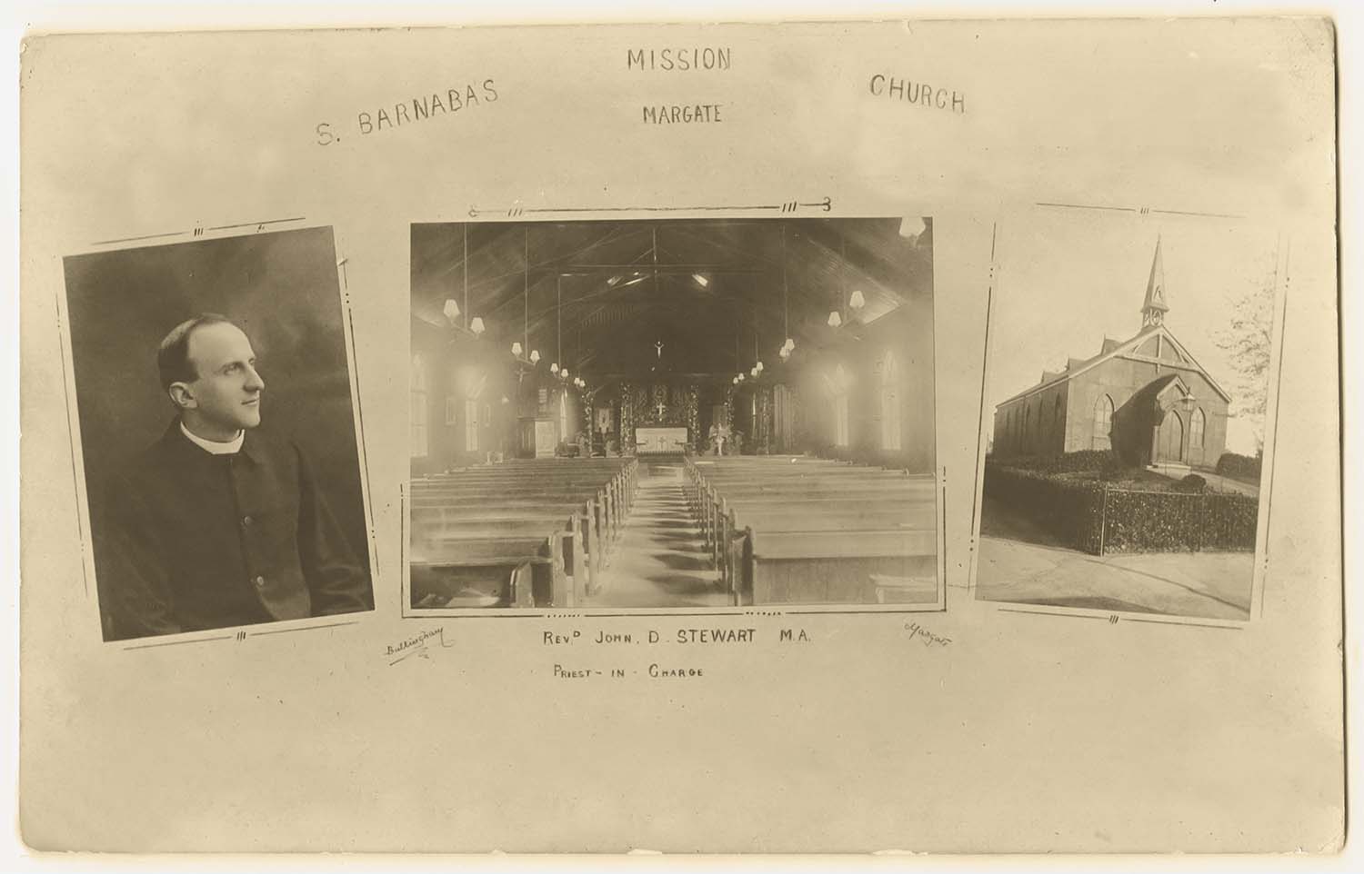
Back of Milton Road/St Barnabas 1912 |
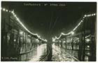
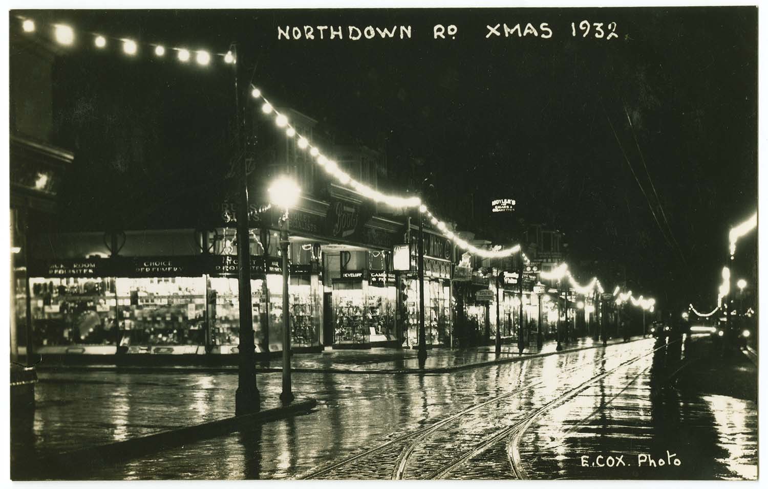
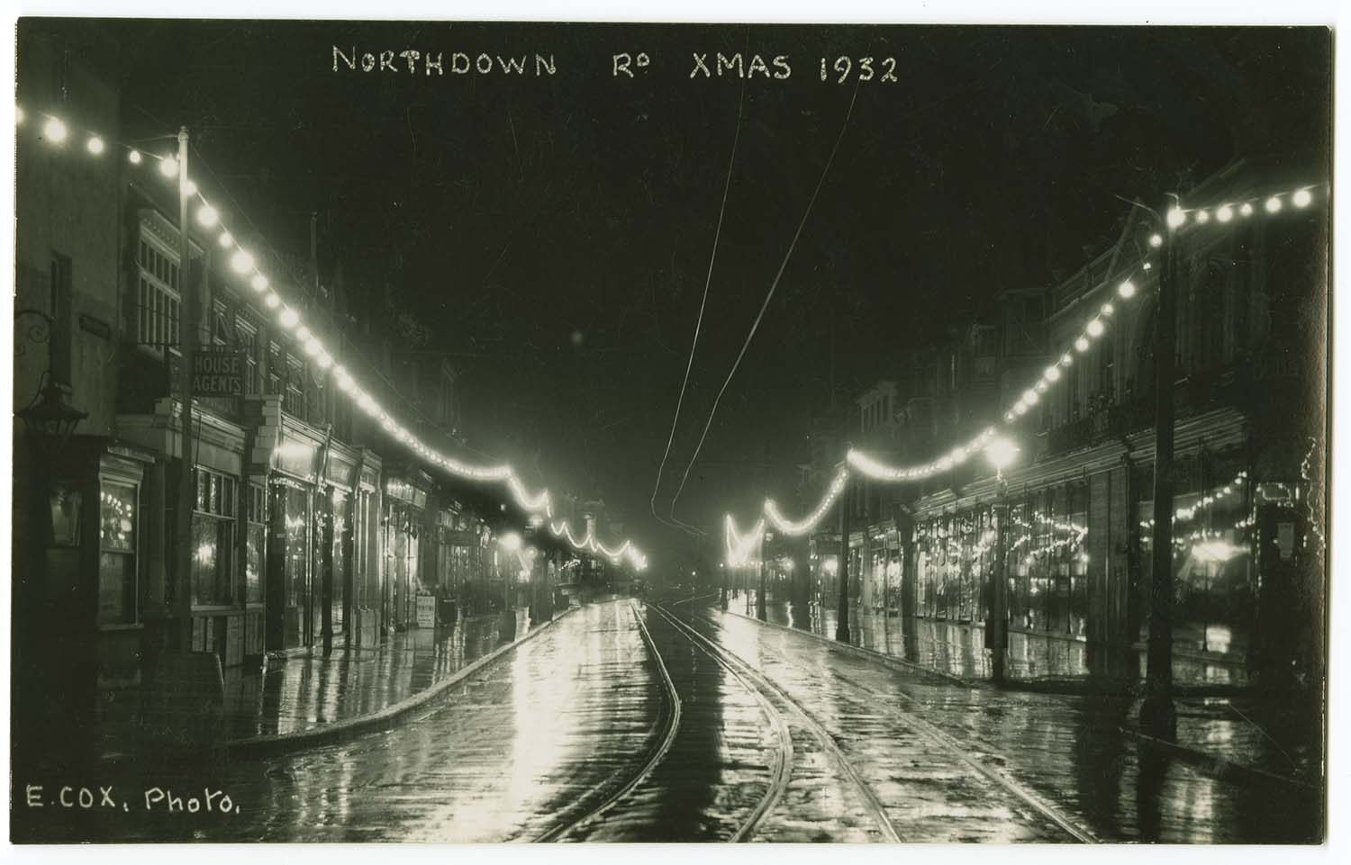
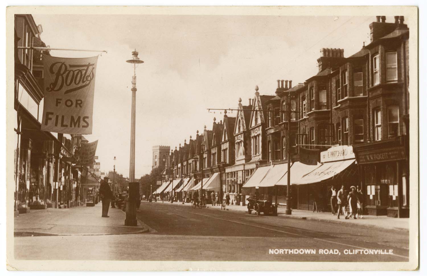
Northdown Road Xmas 1932 |
Northdown Road Xmas 1932 |
 |
 |
 |
 |
|
Northdown Road/Gas Workers |
Northdown Road 1936 |
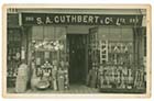
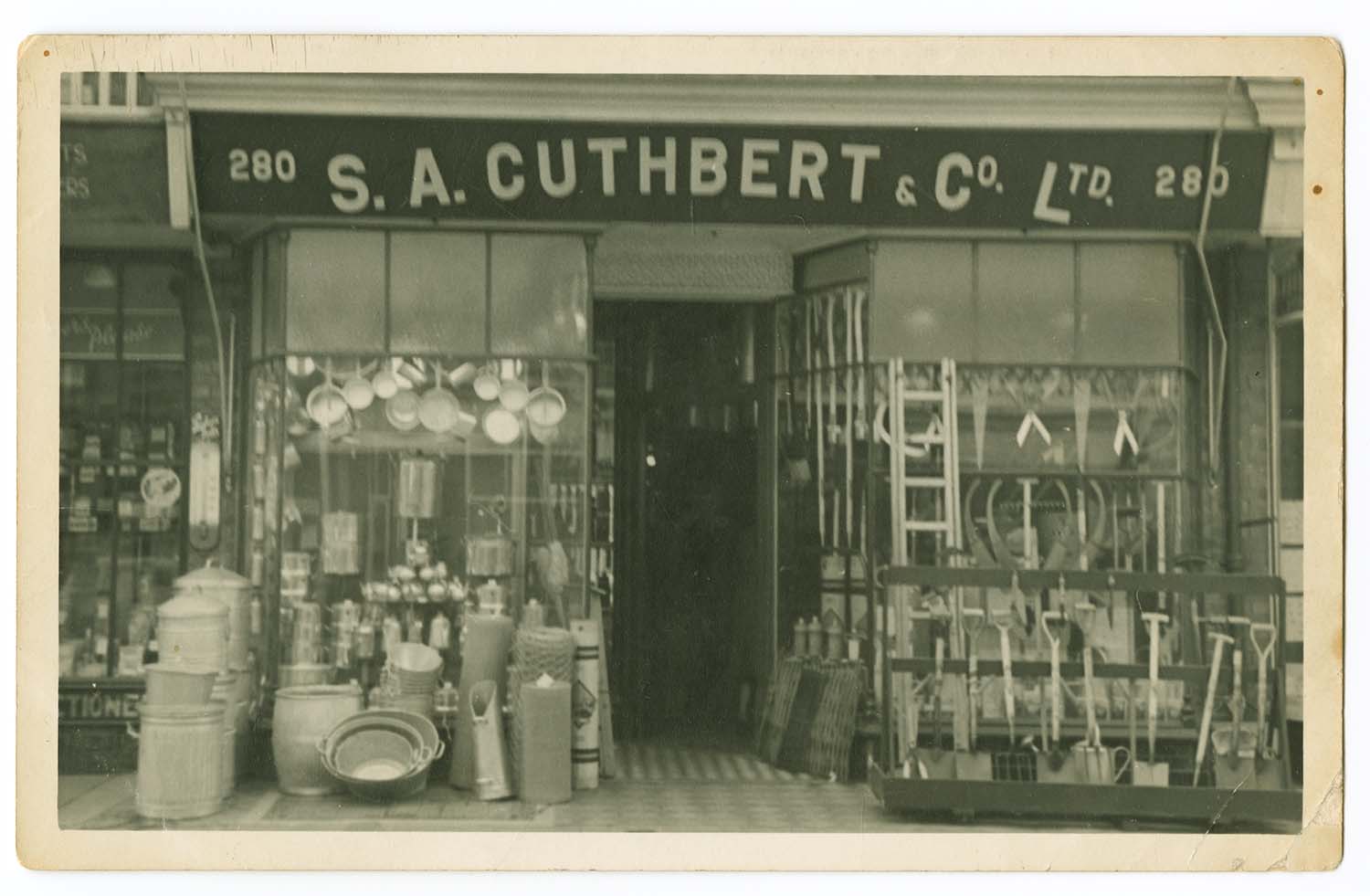
Northdown Road/SA Cuthbert No 280 |
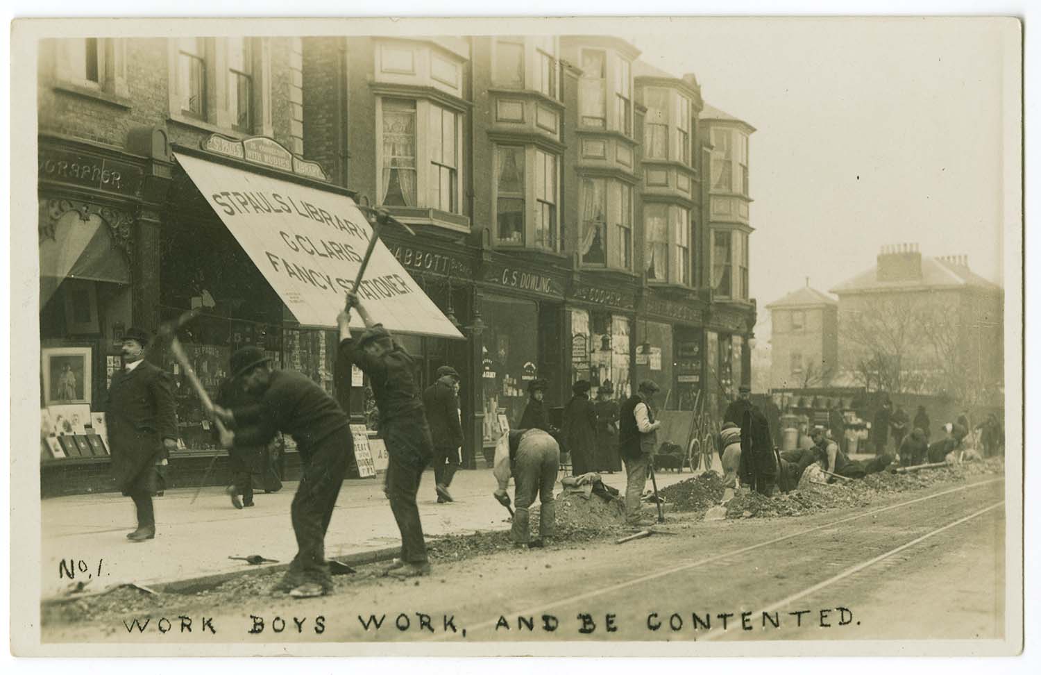
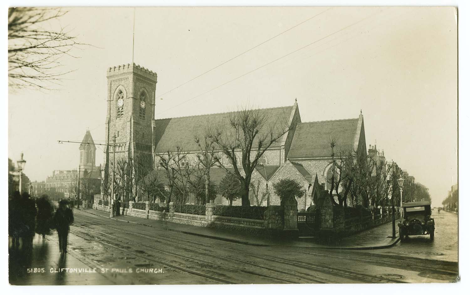
Alexandra Road/St Pauls |
Postcards added to the 1936 Trams Cliftonville to Northdown Ordnance Survey Map.
|
 |
 |
 |
|
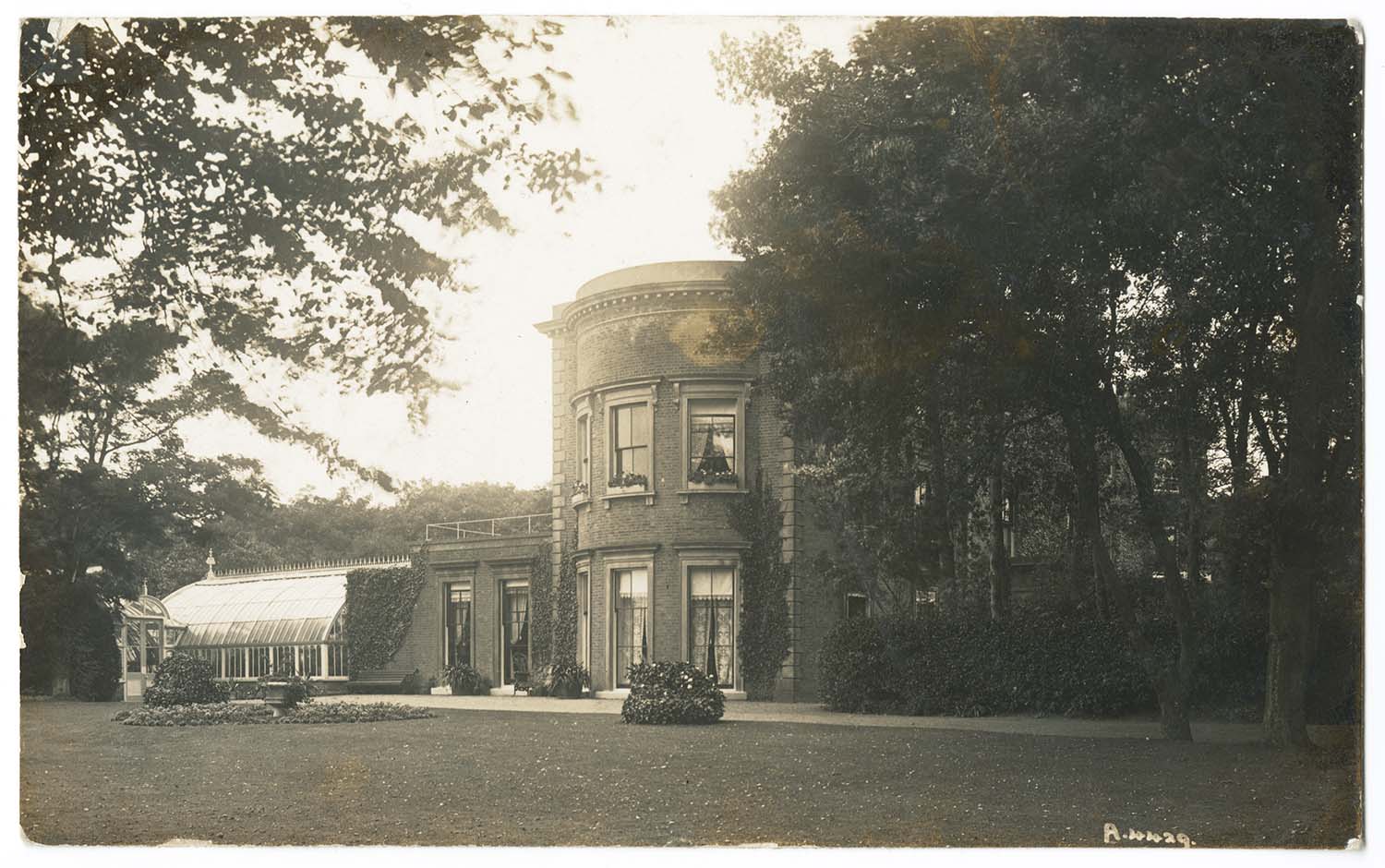
Northdown House 1913 |
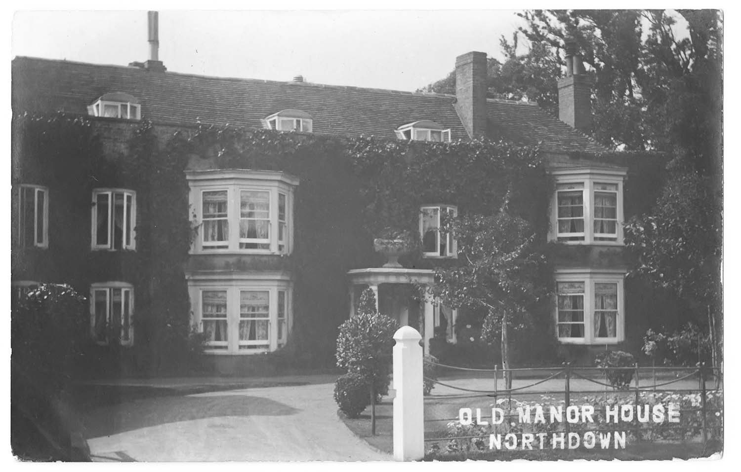
Northdown Old Manor House |
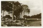
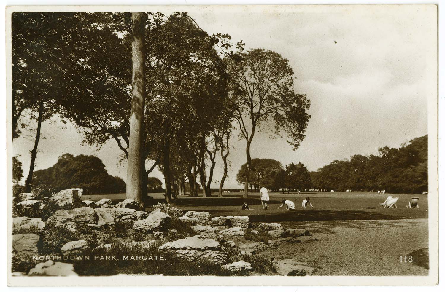
Northdown Park |
Picture added to Margate Storms
|
 |
|
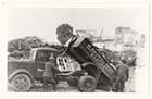
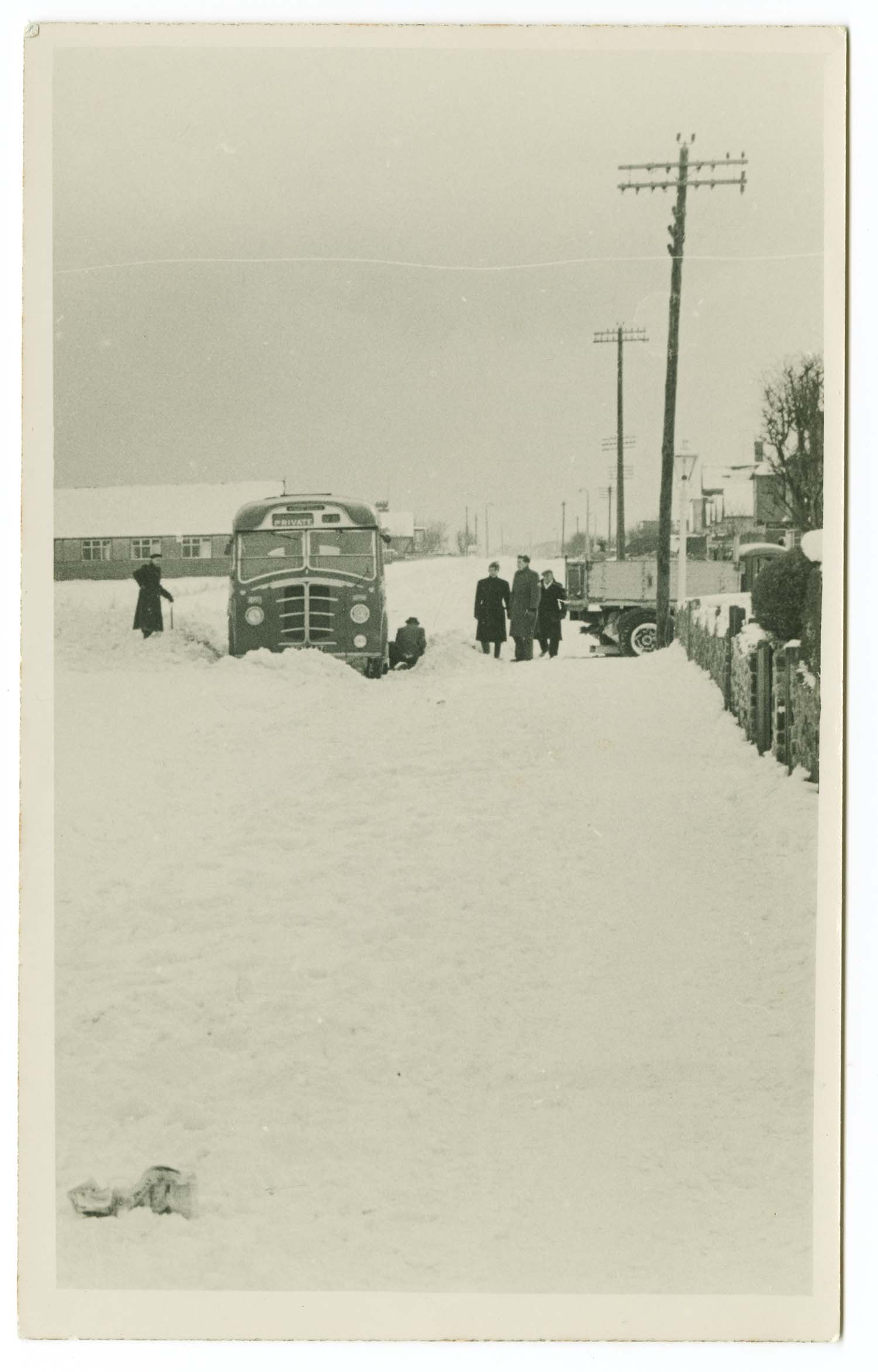
Millmead Road/Coach stuck in snow 1956 |
July 2 2012
|
Postcards added to the 1907 Ordnance Survey Map of Margate.
|
 |
 |
 |
 |
|
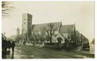
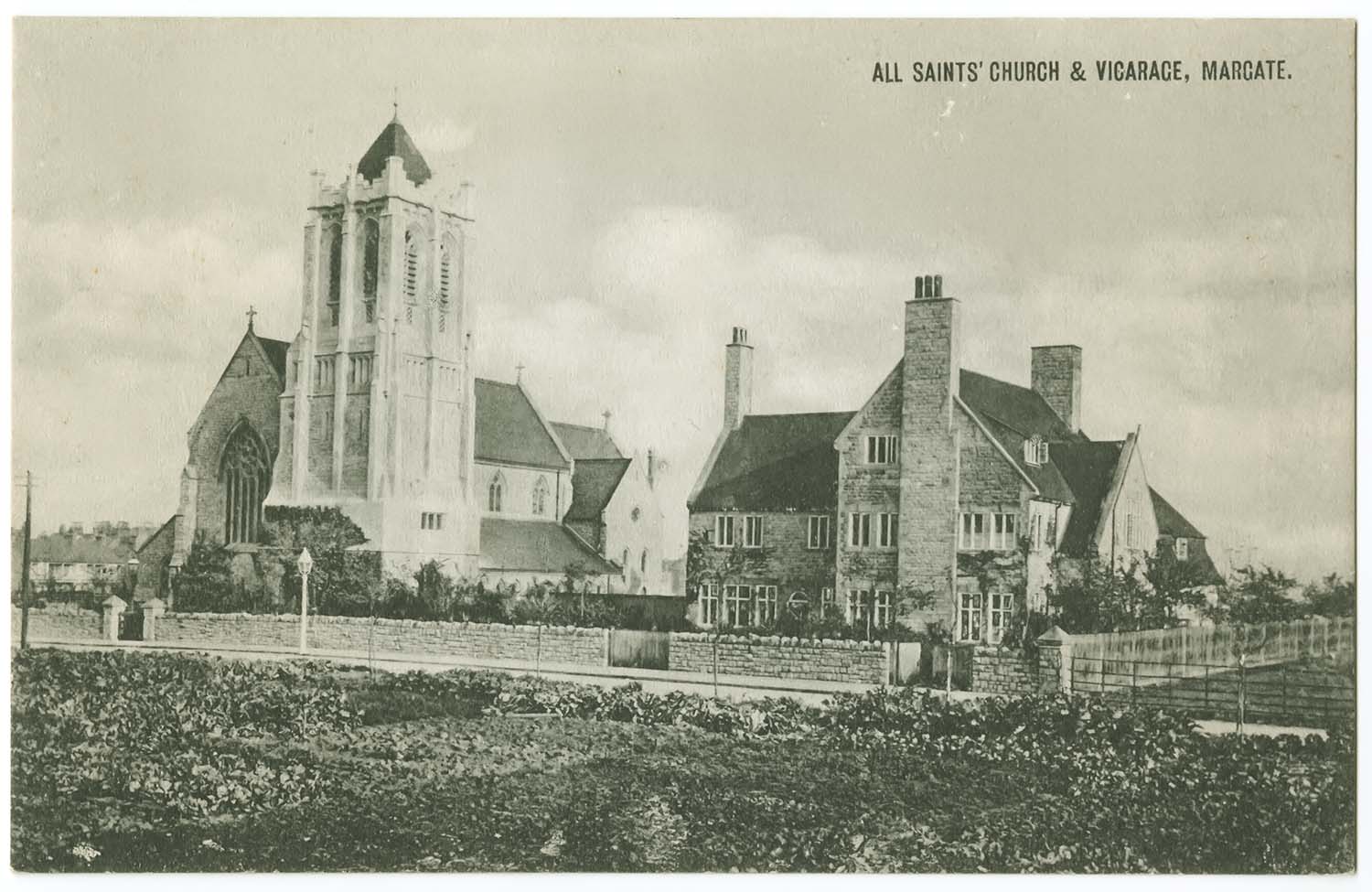
All Saints Church and Vicarage |
Jetty/Steam boat opening ceremony 1922 |
Jetty Ships and Lifeboat |
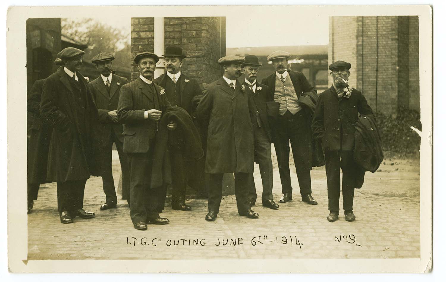
Gas Works outing 1914 |
 |
 |
 |
 |
|
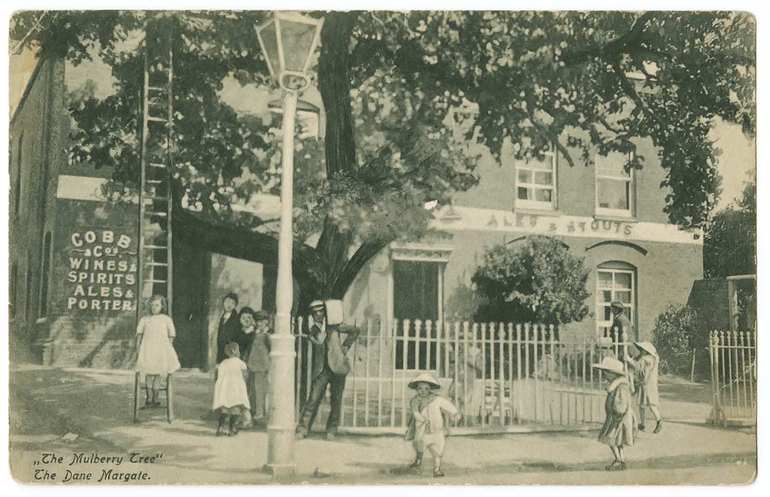
Dane Road/Mulberry Tree |
Lewis Avenue/St Georges Hotel 1912 |
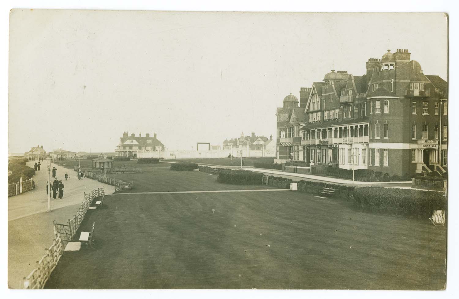
Lewis Crescent/Garfield House 1912 |
Lewis Crescent and lawns |
 |
 |
 |
/Margate Sands SER carriage cleaners ca 1912-thumb.jpg) |
|
Love Lane |
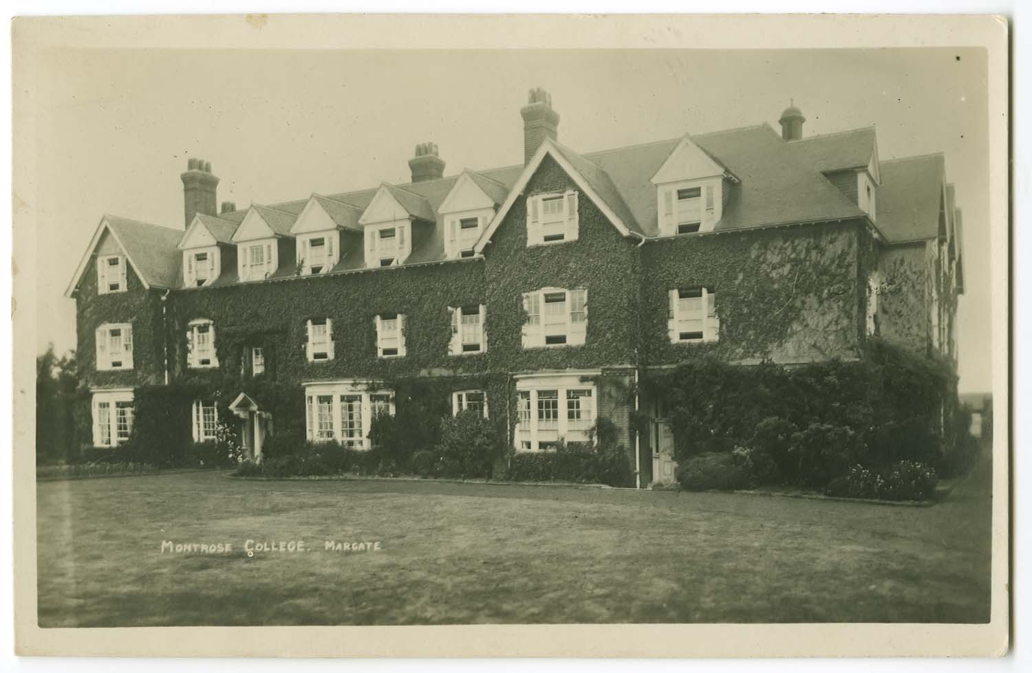
Lower Northdown Road/Montrose School [Houghton] |
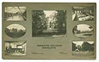
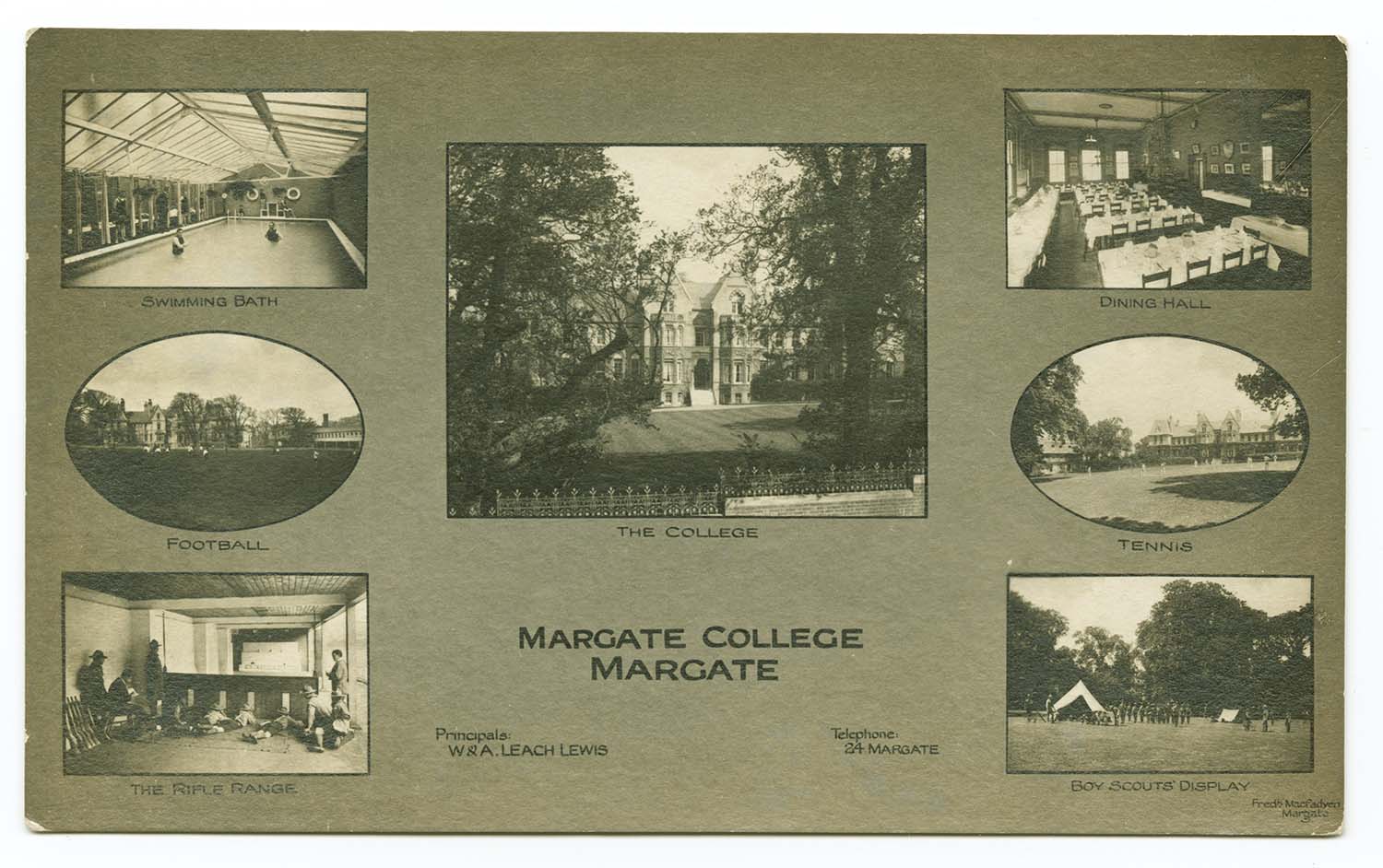
Margate College multiview |
Margate Sands SER/carriage cleaners |
 |
 |
 |
 |
|
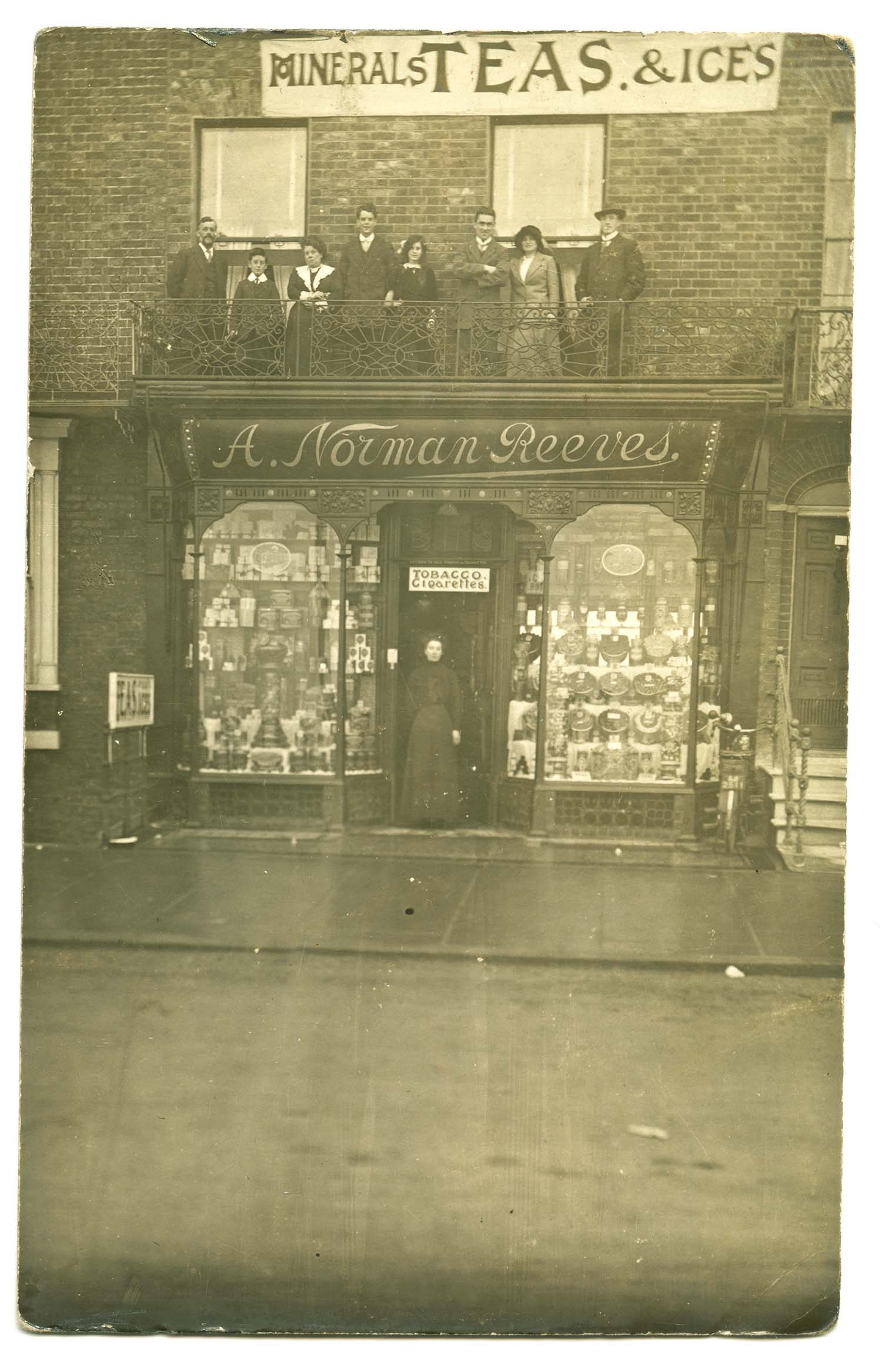
Marine Terrace/No 26 A Norman Reeves |
Marine Terrace [photo Twyman] |
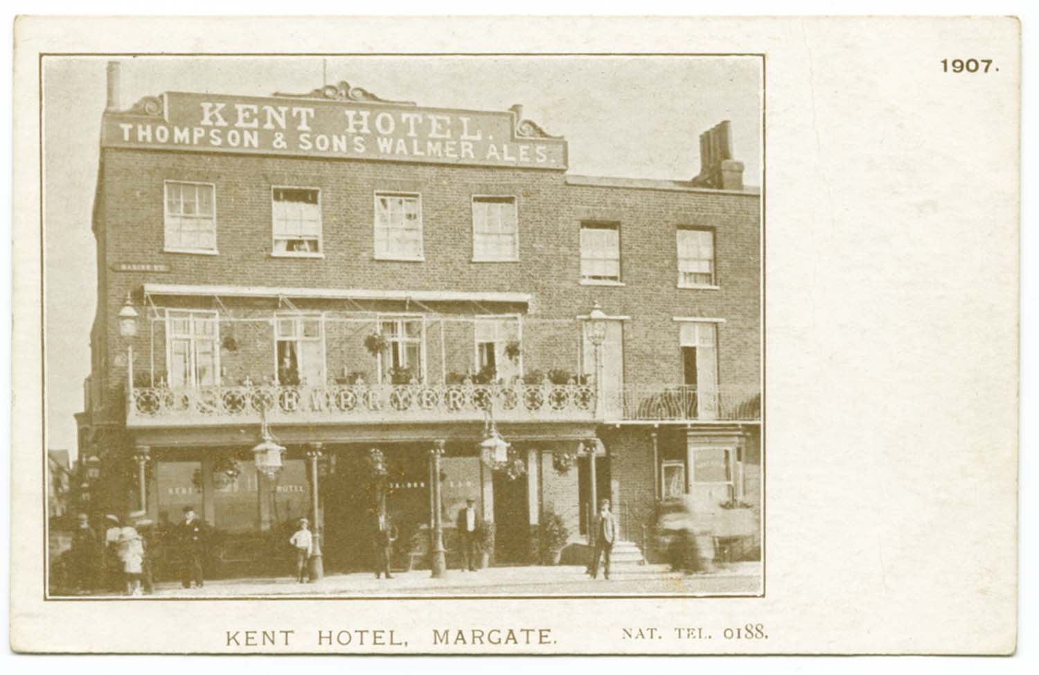
Marine Terrace/Kent Hotel 1907 |
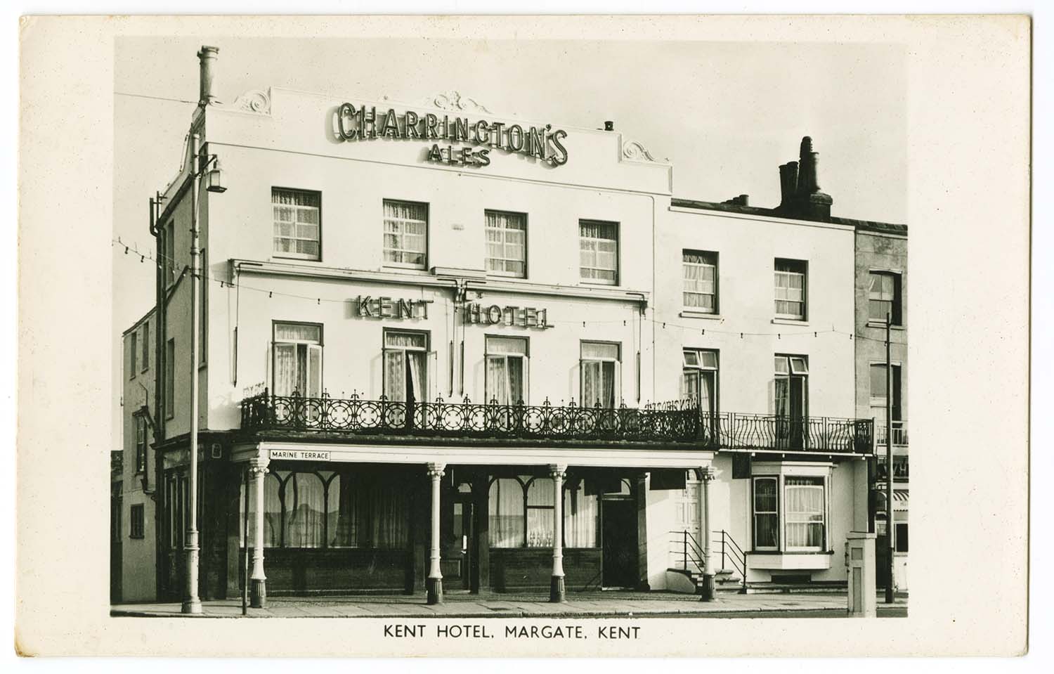
Marine Terrace/Kent Hotel |
![Alexandra [Northdown] Road jnc with Bath Road | Margate History](../Pictures/Photos/Modern/Old Margate/Alexandra Road jnc with Bath Road.jpg)
![Northumberland [Northdown] Road/Herbert Hills | Margate History](../Pictures/Photos/Modern/Old Margate/Northumberland Road Herbert Hills.jpg)
![Northumberland [Northdown] Road/Herbert Hills | Margate History](../Pictures/Photos/Modern/Old Margate/Northumberland Road Herbert Hills 2.jpg)


![Northdown [Northumberland] Road/No 32 and 32a Singer | Margate History](../Pictures/Photos/Modern/Old Margate/Northdown Road 32 and 32a Singer.jpg)
![Northdown [Northumberland] Road/No 44 Whitehead | Margate History](../Pictures/Photos/Modern/Old Margate/Northdown Road 44 Whitehead.jpg)
![Northdown [Alexandra] Road/No 88 Twyman shop | Margate History](../Pictures/Photos/Modern/Old Margate/Northdown Road 88 Twyman shop 1.jpg)
![Northdown [Alexandra] Road/No 88 Twyman shop | Margate History](../Pictures/Photos/Modern/Old Margate/Northdown Road 88 Twyman shop 2.jpg)
![Northdown [Alexandra] Road/No 88 Twyman van | Margate History](../Pictures/Photos/Modern/Old Margate/Northdown Road 88 Twyman van.jpg)

![King Street Floods [Payne Collection] | Margate History](../Pictures/Storms/Floods 1953/Payne 52 King Street.jpg)
![Love Lane Floods [Payne Collection] | Margate History](../Pictures/Storms/Floods 1953/Payne 55 Storm Love Lane.jpg)
![Hawley Street Floods [Payne Collection] | Margate History](../Pictures/Storms/Floods 1953/Payne 56 Hawley ST.jpg)
![Marine Drive [Payne Collection] | Margate History](../Pictures/Storms/Floods 1953/Payne 54 Marine Drive Storm.jpg)
![Rendezvous [Payne Collection] | Margate History](../Pictures/Storms/Floods 1953/Payne 53 Storm.jpg)
![Bathing Stage [Payne Collection] | Margate History](../Pictures/Storms/Floods 1953/Payne 51 Bathing Stage.jpg)
![Harbour after the storm [Payne Collection] | Margate History](../Pictures/Storms/Floods 1953/Payne 14.jpg)
![Pier and Lighthouse [Payne Collection] | Margate History](../Pictures/Storms/Floods 1953/Payne 15.jpg)
![Damaged Lighthouse [Payne Collection] | Margate History](../Pictures/Storms/Floods 1953/Payne 17.jpg)
![Damaged Lighthouse [Payne Collection] | Margate History](../Pictures/Storms/Floods 1953/Payne 18.jpg)
![Damaged Lighthouse [Payne Collection] | Margate History](../Pictures/Storms/Floods 1953/Payne 19.jpg)
![Lighthouse [Payne Collection] | Margate History](../Pictures/Storms/Floods 1953/Payne 16.jpg)
![Damaged Pier [Payne Collection] | Margate History](../Pictures/Storms/Floods 1953/Payne 21.jpg)
![Damaged Pier [Payne Collection] | Margate History](../Pictures/Storms/Floods 1953/Payne 22.jpg)
![Damaged Pier [Payne Collection] | Margate History](../Pictures/Storms/Floods 1953/Payne 23.jpg)
![Damaged Pier [Payne Collection] | Margate History](../Pictures/Storms/Floods 1953/Payne 24.jpg)
![Damaged Pier [Payne Collection] | Margate History](../Pictures/Storms/Floods 1953/Payne 27.jpg)
![Damaged Pier [Payne Collection] | Margate History](../Pictures/Storms/Floods 1953/Payne 28.jpg)
![Damaged Pier [Payne Collection] | Margate History](../Pictures/Storms/Floods 1953/Payne 29.jpg)
![Damaged Marine Drive [Payne Collection] | Margate History](../Pictures/Storms/Floods 1953/Payne 30.jpg)
![Damaged Jetty [Payne Collection] | Margate History](../Pictures/Storms/Floods 1953/Payne 31.jpg)
![Damaged Jetty [Payne Collection] | Margate History](../Pictures/Storms/Floods 1953/Payne 32.jpg)
![Damaged Jetty [Payne Collection] | Margate History](../Pictures/Storms/Floods 1953/Payne 33.jpg)
![Damaged Jetty [Payne Collection] | Margate History](../Pictures/Storms/Floods 1953/Payne 34.jpg)
![Damaged Jetty [Payne Collection] | Margate History](../Pictures/Storms/Floods 1953/Payne 35.jpg)
![Damaged Jetty [Payne Collection] | Margate History](../Pictures/Storms/Floods 1953/Payne 36.jpg)
![Damaged Jetty [Payne Collection] | Margate History](../Pictures/Storms/Floods 1953/Payne 37.jpg)
![Damaged Jetty [Payne Collection] | Margate History](../Pictures/Storms/Floods 1953/Payne 38.jpg)
![Damaged Jetty [Payne Collection] | Margate History](../Pictures/Storms/Floods 1953/Payne 39.jpg)
![Damaged Jetty [Payne Collection] | Margate History](../Pictures/Storms/Floods 1953/Payne 40.jpg)
![Damaged Jetty [Payne Collection] | Margate History](../Pictures/Storms/Floods 1953/Payne 41.jpg)
![Damaged Jetty [Payne Collection] | Margate History](../Pictures/Storms/Floods 1953/Payne 42.jpg)
![Damaged Jetty [Payne Collection] | Margate History](../Pictures/Storms/Floods 1953/Payne 43.jpg)
![Damaged Jetty [Payne Collection] | Margate History](../Pictures/Storms/Floods 1953/Payne 44.jpg)
![Damaged Jetty [Payne Collection] | Margate History](../Pictures/Storms/Floods 1953/Payne 45.jpg)
![Damaged Jetty [Payne Collection] | Margate History](../Pictures/Storms/Floods 1953/Payne 46.jpg)
![Damaged Jetty [Payne Collection] | Margate History](../Pictures/Storms/Floods 1953/Payne 47.jpg)
![Damaged Jetty [Payne Collection] | Margate History](../Pictures/Storms/Floods 1953/Payne 48.jpg)
![Damaged Jetty [Payne Collection] | Margate History](../Pictures/Storms/Floods 1953/Payne 49.jpg)
![Damaged Jetty [Payne Collection] | Margate History](../Pictures/Storms/Floods 1953/Payne 50.jpg)
![Frozen Sea [Payne Collection] | Margate History](../Pictures/Storms/Frozen Sea 1963/Payne 57.jpg)
![Frozen Sea [Payne Collection] | Margate History](../Pictures/Storms/Frozen Sea 1963/Payne 58.jpg)
![Frozen Sea [Payne Collection] | Margate History](../Pictures/Storms/Frozen Sea 1963/Payne 59.jpg)
![Jetty [Payne Collection] | Margate History](../Pictures/Storms/Frozen Sea 1963/Payne 60.jpg)
![Jetty [Payne Collection] | Margate History](../Pictures/Storms/Frozen Sea 1963/Payne 61.jpg)
![Harbour [Payne Collection] | Margate History](../Pictures/Storms/Frozen Sea 1963/Payne 63.jpg)
![Swimming Pool [Payne Collection] | Margate History](../Pictures/Storms/Frozen Sea 1963/Payne 64.jpg)
![Frozen Sea [Payne Collection] | Margate History](../Pictures/Storms/Frozen Sea 1963/Payne 65.jpg)
![Frozen Sea [Payne Collection] | Margate History](../Pictures/Storms/Frozen Sea 1963/Payne 730.jpg)
![Frozen Sea [Payne Collection] | Margate History](../Pictures/Storms/Frozen Sea 1963/Payne 731.jpg)
![Frozen Sea [Payne Collection] | Margate History](../Pictures/Storms/Frozen Sea 1963/Payne 734.jpg)
![Frozen Sea [Payne Collection] | Margate History](../Pictures/Storms/Frozen Sea 1963/Payne 736.jpg)
![Frozen Sea [Payne Collection] | Margate History](../Pictures/Storms/Frozen Sea 1963/Payne 738.jpg)
![Frozen Sea [Payne Collection] | Margate History](../Pictures/Storms/Frozen Sea 1963/Payne 739.jpg)
![Frozen Sea [Payne Collection] | Margate History](../Pictures/Storms/Frozen Sea 1963/Payne 742.jpg)
![Harbour [Payne Collection] | Margate History](../Pictures/Storms/Storm 1978/Payne 66.jpg)
![Harbour [Payne Collection] | Margate History](../Pictures/Storms/Storm 1978/Payne 67.jpg)
![Marine Terrace [Payne Collection] | Margate History](../Pictures/Storms/Storm 1978/Payne 68.jpg)
![Jetty [Payne Collection] | Margate History](../Pictures/Storms/Storm 1978/Payne 69.jpg)
![Jetty [Payne Collection] | Margate History](../Pictures/Storms/Storm 1978/Payne 74.jpg)
![Jetty [Payne Collection] | Margate History](../Pictures/Storms/Storm 1978/Payne 75.jpg)
![Jetty [Payne Collection] | Margate History](../Pictures/Storms/Storm 1978/Payne 76.jpg)
![Jetty [Payne Collection] | Margate History](../Pictures/Storms/Storm 1978/Payne 77.jpg)
![Jetty [Payne Collection] | Margate History](../Pictures/Storms/Storm 1978/Payne 78.jpg)
![Jetty [Payne Collection] | Margate History](../Pictures/Storms/Storm 1978/Payne 79.jpg)
![Jetty [Payne Collection] | Margate History](../Pictures/Storms/Storm 1978/Payne 80.jpg)
![Jetty demolition [Payne Collection] | Margate History](../Pictures/Storms/End of Jetty 1998/Payne81.jpg)
![Jetty demolition [Payne Collection] | Margate History](../Pictures/Storms/End of Jetty 1998/Payne82.jpg)
![Jetty demolition [Payne Collection] | Margate History](../Pictures/Storms/End of Jetty 1998/Payne83.jpg)


![Byron Road/Mrs Chapman [Twyman collection] | Margate History](../Pictures/Photos/Modern/Old Margate/Byron Road Mrs Chapman.jpg)


![Neptune square cottages [Geoff Pearce] | Margate History](../Pictures/Photos/Modern/Fort Hill Area/Neptune square cottages Geoff Pearce.jpg)
![Paradise street and tram [Geoff Pearce] | Margate History](../Pictures/Photos/Modern/Fort Hill Area/Paradise street tram Geoff Pearce.jpg)
![Paradise Street fire 1930s] | Margate History](../Pictures/Photos/Modern/Fort Hill Area/Paradise Street fire 1930s 3.jpg)

![High Street/Six Bells [adjacent houses demolished] | Margate History](../Pictures/Photos/Modern/Twyman Inns and Hotels/High street Six bells adjacent houses demolished 1.jpg)
![High Street/Six Bells [adjacent houses demolished] | Margate History](../Pictures/Photos/Modern/Twyman Inns and Hotels/High street Six bells adjacent houses demolished 2.jpg)

/Station Lest we forget pre 1925.jpg)


/LCDR Station 1903.jpg)
![Lido Cliff Railway [Jim Greaves] | Margate History](../Pictures/Photos/Others/Lido Cliff Railway JG.jpg)


/Railway Station Sands photo.jpg)
/Marine Terrace Margate Sands station LL 1905.jpg)


/Margate Sands SER carriage cleaners ca 1912.jpg)