Understanding Ordnance Survey Maps
Anthony Lee
Ordnance Survey Map Symbols
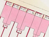 |
Carmine colour = brick or stone building |
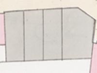 |
Grey colour = iron or wood building |
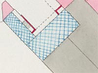 |
Blue and/or cross-hatched = glass |
 |
Dotted crossed lines: Roofed archway/alleyway/passageway |
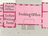 |
Interior layout in a public building |
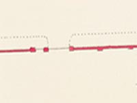 |
Brick or stone wall |
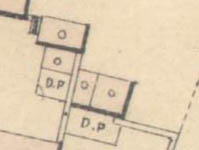 |
Small circle in building = Privy or WC [next to Dung Pit (D.P.), Spellers Court, 1852 map] |
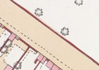 |
Sienna colour = road (dotted line shows pavement on left-hand side) |
Ordnance Survey Map Abbreviations
A fuller list of abbreviations is published in Richard Oliver’s Ordnance Survey Maps. A concise guide for historians.
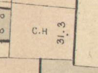 |
C.H. = Coach House |
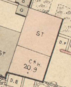 |
CR.H. = Carriage House [next to stables, 1852 map] |
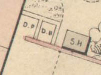 |
D.B. = Dust Bin [1852 map] |
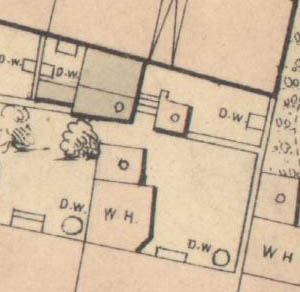 |
D.W. = Draw Well - a deep well from which water is drawn by a bucket on a rope [A cluster of draw wells behind the houses in Union Crescent is shown on the 1852 map] |
|
D.P. = Dung Pit [1852 map] |
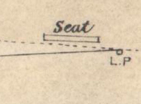 |
L.P. = Lamp Post [and Seat on Marine Terrace, 1852 map] |
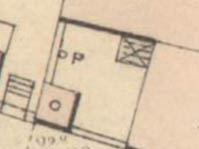 |
P = Pump [in yard, 1852 map] |
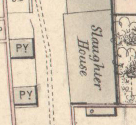 |
PY = Piggery [opposite Slaughter House, 1852 map] |
|
S.H. = Summer House [1852 map] |
|
ST. = Stable [next to Carriage House, 1852 map] |
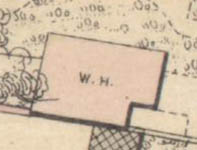 |
W.H. = Wash House [1852 map] |
